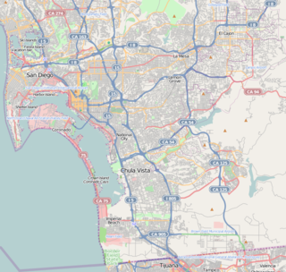
San Ysidro is a district of the City of San Diego, immediately north of the U.S.-Mexico border. It neighbors Otay Mesa West to the north, Otay Mesa to the east, and Nestor and the Tijuana River Valley to the west; together these communities form South San Diego, a pene-exclave of the City of San Diego, thus making it possible to travel between central San Diego and South San Diego without ever leaving the city limits. Major thoroughfares include Beyer Boulevard and San Ysidro Boulevard.

Tijuana Municipality is a municipality in the Mexican state of Baja California. Its municipal seat is located in the city of Tijuana. According to the 2010 census, the municipality had a population of 1,559,683 inhabitants, of whom 1,300,983, or 83.4%, lived in the city of Tijuana. The municipality maintained its position as 3rd most populated nationally as of 2015 census, only behind Ecatepec de Morelos and Iztapalapa. Carlos Bustamante Anchondo of the PRI is the current municipal president. The municipality comprises the largest part of the Tijuana metropolitan area.

Carmel Valley is an affluent suburban planned community in the north-western corner of San Diego, California, United States. The community is composed of commercial offices, residential units, hotels, and retail stores and restaurants. This is not to be confused with Carmel Valley Village, an unincorporated community in Monterey County, California.
Otay Mesa is a community in the southern section of the city of San Diego, just north of the U.S.–Mexico border.

Paradise Hills is a neighborhood in the southeastern area of the city of San Diego, California. It is an outlying neighborhood adjacent to the independent city of National City and the unincorporated communities of Lincoln Acres and certain portions of Bonita.
Navajo is a hilly community in the eastern part of San Diego, California. It is a designated planning area for the city of San Diego. It includes the neighborhoods of Del Cerro, Grantville, San Carlos, and Allied Gardens.

Clairemont is a community within the city of San Diego, California, United States. It has a population of about 81,600 residents and an area of roughly 13.3 square miles (34 km2). Clairemont Mesa is bordered by Interstate 805 on the east, Interstate 5 to the west, State Route 52 to the north, and the community of Linda Vista to the south. The community of Clairemont Mesa can be subdivided into the neighborhoods of North Clairemont, Bay Ho, Clairemont Mesa East, Clairemont Mesa West, and Bay Park.

Kearny Mesa is a community in the central part of San Diego, California. It is located in the area of the city that is bounded by State Route 52 to the north, Interstate 805 to the west, Aero Drive to the South, and Interstate 15 to the east. Adjacent communities include Serra Mesa, Clairemont and Tierrasanta.

Torrey Pines is a primarily residential community of 2,600 acres (1,100 ha) in the northern coastal area of San Diego, California.
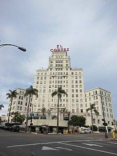
Cortez Hill is a neighborhood located in north-east Downtown San Diego, California.
Nestor is a residential neighborhood in the southern section of San Diego, and part of the Otay Mesa-Nestor community planning area. It neighbors Palm City and Otay Mesa West to the east, Egger Highlands to the north, San Ysidro to the southeast and the Tijuana River Valley to the south. Major thoroughfares include Coronado Avenue, Saturn Boulevard, Hollister Street, and Tocayo Avenue.
Palm City is a neighborhood in the southern section of San Diego. It neighbors Otay Mesa West to the south and east, Egger Highlands and Nestor to the west, and Chula Vista to the north. It also serves as a gateway to the beach cities of Imperial Beach, and Coronado, by way of the Silver Strand isthmus, due to it being where California State Route 75 meets Interstate 5. Major thoroughfares include Coronado Avenue, Hollister Street, Beyer Boulevard, and Palm Avenue.
Otay Mesa West is a residential neighborhood in the southern section of San Diego. It borders Interstate 805 to the east, Interstate 5 to the west, and California State Route 905 to the south. It neighbors Ocean View Hills to the east, Nestor and Palm City to the west and Chula Vista to the north. The northern boundary of Otay Mesa West roughly coincides with the Otay River. Just north of the Otay River the community of Otay resides within the city of Chula Vista. Major thoroughfares include Palm Avenue, Coronado Avenue, Picador Boulevard, Del Sol Boulevard, Beyer Boulevard, and Beyer Way.

Mountain View is a community in the southeastern section of the city of San Diego. It is bordered by Mount Hope and Greenwood Memorial Park on the north, Interstate 15 and the neighborhoods of Stockton and Logan Heights on the west, Interstate 805 and Lincoln Park on the east, and Southcrest and National City on the south. Major thoroughfares include Imperial Avenue and Ocean View Boulevard.

Emerald Hills is a community in the southeastern section of the city of San Diego, California, United States. It is bordered by Oak Park and California State Route 94 on the north, Chollas View and Euclid Avenue on the west, Encanto on the east, and Valencia Park and Market Street on the south. Major thoroughfares include Kelton Road and Roswell Street.

The 2010 San Diego City Council election occurred on November 2, 2010. The primary election was held on June 8, 2010. Four of the eight seats of the San Diego City Council were contested. This was the last election to use eight council districts. Two incumbents ran for reelection in their council district.
The 2002 San Diego City Council election occurred on November 5, 2002. The primary election was held on March 5, 2002. Four of the eight seats of the San Diego City Council were contested. Two incumbent council members stood for reelection after having previously been elected to partial terms.
Rancho Melijo, or Milijo, named after a local Kumeyaay village. It was later called Rancho La Punta for the location of the Arguello family ranch house, on a point of hills overlooking the south end of San Diego Bay, north of the Otay River and east of where the river entered the south bend of the bay. It was a Mexican land grant rancho, granted by Governor José Figueroa in 1833 to Santiago E. Argüello.
Vivian Moreno is an American politician in San Diego, California. She currently serves as a San Diego City Councilmember representing City Council District 8. She is a Democrat, although city council positions are officially nonpartisan per California state law.

