College Area, San Diego

Last updated
College Area, San Diego
College Area
Campanile Drive.jpg
Campanile Drive
Location map Southern San Diego.png
Red pog.svg
College Area, San Diego
Location within San Diego
Coordinates: 32°46′19″N117°04′08″W / 32.771831°N 117.068939°W / 32.771831; -117.068939
Country Flag of the United States.svg  United States of America
State Flag of California.svg  California
County Flag of San Diego County, California.png San Diego
City Flag of San Diego, California.svg San Diego

The College Area is a residential community in the Mid-City region of San Diego, California, United States. The College Area is dominated by San Diego State University (SDSU; once known as San Diego State College), after which the area is named. Several neighborhoods in the College Area were developed in the 1930s, with others becoming established in the post-war period. [1] The College Area is bordered on the west by Kensington and Talmadge and on the east by the city of La Mesa. El Cajon Boulevard is a busy shopping district; additional retail, entertainment and dining establishments are located in a new housing and commercial complex known as South Campus Plaza on College Avenue at Aztec Center. The College Area includes the neighborhoods of the Catoctin Area, Dennstedt Point, East Falls View Drive, Saranac-Mohawk, and an Orthodox Jewish neighborhood in the area near Congregation Beth Jacob Orthodox Synagogue on College Avenue. The region includes Alvarado Hospital, a 306-bed acute care facility, and the College-Rolando branch of the San Diego Public Library.

Contents

History

On August 18, 1948, the "Campus Drive-In" movie theater with a capacity for 900 cars was built at the intersection of College Avenue and El Cajon Boulevard. The opening night films were Give My Regards to Broadway and The Kansan. The final two features in 1983 were The Dark Crystal and Dragonslayer. [2]

In 1961, snack-bar employee Tom O'Leary was convicted of manslaughter for stabbing a patron named Dennis O'Connor to death at the drive-in. The O'Connor family sued the company for wrongful death but did not prevail. The dead man's family became active in city politics and eventually his sister Maureen O'Connor was elected mayor of San Diego in 1986. [2]

Three neon drum majorettes wearing Indian headdresses from the Drive-In are preserved in the Vons shopping center at this location and one large one is preserved in the College Grove Shopping Center in Rolando Park. [3] [4]

Geography

The College Area lies on a plateau known as Montezuma Mesa which overlooks Interstate 8. The neighborhood's borders are defined by Montezuma Road/Collwood Boulevard to the southwest, Interstate 8 to the north, 73rd Street to the east, and El Cajon Boulevard to the south. A large canyon opens up in the center of the SDSU campus known as Aztec Bowl and descends toward Alvarado Creek in Mission Valley. Canyon Crest Drive snakes down through the canyon from 55th Street to College Avenue.

Transportation

MTS (Metropolitan Transit System) operates the San Diego Trolley [5] to SDSU Transit Center and the Alvarado Medical Center trolley station, both of which are in the College Area. The trolley station at SDSU, as well as a bus plaza, make up the SDSU Transit Center. Bus routes 11, 11A, 14, 936, and Rapid Bus 215 go to the Transit Center, to name a few. Transfers are made from the SDSU trolley subway station located at the Transit Center, underneath the bus plaza. Riders can go up to the bus plaza via elevator or stairs.

As of October 12, 2014, the SDSU Transit Station serves as the starting point for MTS Rapid Bus Route 215. A high-frequency, limited-stop service runs between San Diego State University and Downtown San Diego via El Cajon Boulevard and Park Boulevard. This route provides a convenient transit option for visitors and nearby neighbors from downtown San Diego, North Park and Hillcrest to shop and dine in the busy commercial corridor.

Traffic

The College Area is accessible from Interstate 8, State Route 94. Surface streets entering into the College Area include 70th Street (accessible from I-8), College Avenue (accessible from I-8 and SR94),54th Street and Montezuma Road (accessible from I-8). Built in July 2005 there is also a mass transit connection by MTS San Diego Trolley accessing the SDSU on-campus underground station. Traffic can be high during the day, however local residents and City officials work together to increase pedestrian and bicycle routes and modify the street infrastructure to alleviate any congestion in the area as the population grows in the neighborhoods.

Education

The College Area is home to one traditional elementary school, one private K-8 school, two alternative K-8 schools, and SDSU.

Elementary schools

K through 8

K through 12

Colleges and universities

Related Research Articles

<span class="mw-page-title-main">San Diego Trolley</span> Light rail system serving San Diego, California

The San Diego Trolley is a light rail system operating in the metropolitan area of San Diego. The Trolley's operator, San Diego Trolley, Inc., is a subsidiary of the San Diego Metropolitan Transit System (MTS). The trolley operates as a critical component of the MTS, with connections to and integrated travel tickets with the local bus systems.

<span class="mw-page-title-main">North Park, San Diego</span> Neighborhood in California, US

North Park is a neighborhood in San Diego, California, United States, as well as a larger "community" as defined by the City of San Diego for planning purposes. The neighborhood is bounded:

City Heights is a dense urban community in central San Diego, California, known for its ethnic diversity. The area was previously known as East San Diego. City Heights is located south of Mission Valley and northeast of Balboa Park.

<span class="mw-page-title-main">University Heights, San Diego</span> Community in California

University Heights is a neighborhood in Central San Diego, California centered on Park Boulevard and Adams Avenue. University Heights is bounded on the west and north by the edge of the mesa, the southern boundary is Lincoln Avenue, and the eastern boundary is Texas Street. The area is filled with a number of restaurants, coffee shops, boutiques, and artist studios primarily on Park Boulevard and Adams Avenue. Live entertainment can be found most nights. Adjacent to Hillcrest, Normal Heights and North Park, additional restaurants, bars, coffee shops, and night clubs are within easy reach.

<span class="mw-page-title-main">Old Town Transit Center</span> Passenger train, light rail, and bus station in San Diego, California, United States

Old Town Transit Center, also known as San Diego–Old Town station, Old Town San Diego station, or UC San Diego Health South station, is an intermodal transportation station located in the Old Town neighborhood of San Diego, California. It is served by Amtrak's Pacific Surfliner, the COASTER commuter rail service, and the San Diego Trolley, as well as numerous San Diego Metropolitan Transit System bus lines.

<span class="mw-page-title-main">San Diego Metropolitan Transit System</span> Public transportation agency in Southern San Diego County, California

The San Diego Metropolitan Transit System is a public transit service provider for central, southern, northeast, and southeast San Diego County, California, as well as for the city of San Diego. The agency directly operates a large transit system that includes the MTS Bus, San Diego Trolley light rail, and Rapid bus rapid transit services. The MTS also controls the San Diego and Arizona Eastern (SD&AE) freight railway and regulates taxicabs, jitneys, and other private for-hire passenger transportation services.

<span class="mw-page-title-main">Rolando, San Diego</span>

Rolando is a neighborhood of the Mid-City region of San Diego, California. Rolando is mostly residential with the exception of El Cajon Boulevard, which features the Campus Plaza shopping center. Rolando is divided by University Avenue into two sections: Rolando Village to the north, and Rolando Park to the south.

<span class="mw-page-title-main">El Cajon Boulevard</span> Major thoroughfare through San Diego, La Mesa and El Cajon, California and called "The Boulevard"

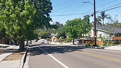
El Cajon Boulevard is a major east–west thoroughfare through San Diego, La Mesa and El Cajon, California. Before the creation of Interstate 8 it was the principal automobile route from San Diego to El Cajon, the Imperial Valley, and points east as U.S. Route 80; it is now signed as a business loop of Interstate 8.

<span class="mw-page-title-main">San Diego State University Transit Center</span> San Diego Trolley and bus station

San Diego State University Transit Center is a station on San Diego Trolley's Green Line. The station is underground and has side platforms. The station is located in the Aztec Green on the south portion of the campus of San Diego State University. The station entrances are between College Avenue and Campanile Drive. The station is very popular with students and staff who commute to the university because of the high cost and low availability of parking around campus.

<span class="mw-page-title-main">Alvarado station</span> San Diego Trolley station

Alvarado Station is a station on San Diego Trolley's Green Line in the College Area. It is one of the San Diego Trolley network's newer stations, having opened in 2005.

<span class="mw-page-title-main">El Cajon Transit Center</span> San Diego Trolley and bus station

El Cajon Transit Center is a San Diego Trolley station served by the Orange and the Green lines in the San Diego suburb of El Cajon, California. The station is a major commuter center for the large suburb, and is the convergence of multiple local and regional bus routes operated by the Metropolitan Transit System and Greyhound Lines.

<span class="mw-page-title-main">Blue Line (San Diego Trolley)</span> San Diego Trolley light rail line

The Blue Line is a 26.3-mile (42.3 km) light rail line in the San Diego Trolley system, operated by San Diego Trolley, Inc., an operating division of the San Diego Metropolitan Transit System (MTS). With an end-to-end travel time of one hour and twenty-three minutes, it operates between the UTC Transit Center and the San Ysidro Transit Center, the latter of which is at the border with Mexico directly adjacent to the San Ysidro Port of Entry, facilitating easy connections across the border. The line serves La Jolla, Downtown San Diego, National City, Chula Vista, and San Ysidro.

<span class="mw-page-title-main">Orange Line (San Diego Trolley)</span> San Diego Trolley light rail line

The Orange Line is an 18.0-mile (29.0 km) light rail line in the San Diego Trolley system, operated by San Diego Trolley, Inc. an operating division of the San Diego Metropolitan Transit System. The route connects Downtown San Diego with the cities of Lemon Grove, La Mesa, and El Cajon. The Orange Line has the lowest ridership of the San Diego Trolley's three regular lines, transporting 10,896,289 riders during FY 2014 according to the MTS.

<span class="mw-page-title-main">Green Line (San Diego Trolley)</span> San Diego Trolley light rail line

The Green Line is a 23.6-mile (38.0 km) light rail line in the San Diego Trolley system, operated by San Diego Trolley, Inc. an operating division of the San Diego Metropolitan Transit System (MTS). The route serves Downtown San Diego, Mission Valley, and the cities of La Mesa, El Cajon, and Santee. The Green Line has the second highest ridership of the San Diego Trolley's three regular lines, transporting 13,673,926 riders during FY 2014 according to the MTS.

<span class="mw-page-title-main">Gillespie Field station</span> San Diego Trolley station

Gillespie Field station is a Green Line station of the San Diego Trolley in the San Diego suburb of Santee, California. It is located across Marshall Avenue from Gillespie Field, a county airport which also contains an annex of the San Diego Air & Space Museum.

<span class="mw-page-title-main">12th & Imperial Transit Center</span> San Diego Trolley and bus station

12th & Imperial Transit Center is a San Diego Trolley station in Downtown San Diego, California. It is located in the East Village neighborhood of the city and serves the high-density residential developments that surround the stop. It is one of two stations from which Petco Park can be reached. The station has historically been used as a major transfer point between the various Trolley lines and is the only station that is directly served by all four Trolley lines.

<span class="mw-page-title-main">Rapid (San Diego)</span> Bus Rapid Transit System

Rapid is the brand name given to the bus rapid transit system in San Diego County, California. The system serves nearly half the county, operating mainly on the HOV lanes on Interstates 15 and 805, with most of the stops also served by other routes. In addition, there are stations, dubbed as CenterLine in the medians of Interstate 15, Park Boulevard in San Diego and on East Palomar Street in Chula Vista, that are designed in a similar manner to the light rail stations. The system operates with a dedicated fleet, although buses from the Mainline fleet are regularly substituted. The system is administered, built and managed by San Diego Association of Governments (SANDAG) and is operated as part of the San Diego Metropolitan Transit System (MTS).

References

  1. “Historical Neighborhoods.” College Neighborhoods, 2013. http://collegeneighborhoods.com/history/baja.html.
  2. 1 2 Sanford, Jay Allen (July 6, 2006). "Field of Screens: Drive-in theaters in San Diego". www.sandiegoreader.com. Retrieved 2020-02-17.
  3. "Campus Drive-In in San Diego, CA - Cinema Treasures". cinematreasures.org. Retrieved 2020-02-17.
  4. "Campus Drive-In Theater, closer view with neon, El Cajon Boulevard, San Diego, California". Library of Congress. Retrieved 2020-02-17.
  5. "Transit.511sd.com". Archived from the original on 2011-02-21. Retrieved 2006-01-21.

32°46′18.59″N117°4′8.18″W / 32.7718306°N 117.0689389°W / 32.7718306; -117.0689389