Harrisburg is the capital city of the Commonwealth of Pennsylvania, United States, and the seat of Dauphin County. With a population of 50,135 as of 2021, Harrisburg is the ninth-largest city and 15th-largest municipality in Pennsylvania. Harrisburg is situated on the east bank of the Susquehanna River. It is the larger principal city of the Harrisburg–Carlisle metropolitan statistical area, also known as the Susquehanna Valley, which had a population of 591,712 as of 2020, making it the fourth-most populous metropolitan area in Pennsylvania after the Philadelphia, Pittsburgh, and Lehigh Valley metropolitan areas.

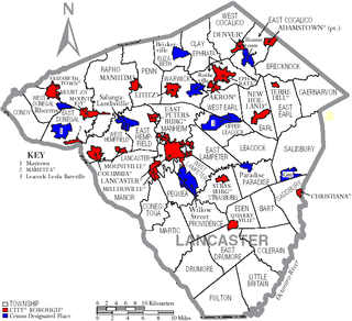
Lancaster County, sometimes nicknamed the Garden Spot of America or Pennsylvania Dutch Country, is a county in the Commonwealth of Pennsylvania. It is located in the south central part of Pennsylvania. As of the 2020 census, the population was 552,984. Its county seat is Lancaster. Lancaster County comprises the Lancaster, Pennsylvania metropolitan statistical area.

Columbia, formerly Wright's Ferry, is a borough (town) in Lancaster County, Pennsylvania, United States. As of the 2020 census, it had a population of 10,222. It is 28 miles (45 km) southeast of Harrisburg, on the east (left) bank of the Susquehanna River, across from Wrightsville and York County and just south of U.S. Route 30.

Gap is a census-designated place (CDP) and unincorporated community in Salisbury Township, Lancaster County, Pennsylvania, United States, with a ZIP code of 17527. The population was 1,931 at the 2010 census. U.S. Route 30 passes through the town, which is also the terminus for four Pennsylvania highways: 772, 741, 897, and the heavily used 41, which leads toward Wilmington, Delaware.

Plains Township is a township in Luzerne County, Pennsylvania, United States. The population was 9,816 at the 2020 census. The municipality is the birthplace of Chicago White Sox hall of famer Ed Walsh and John J. Yeosock, a United States Army general who commanded the 3rd U.S. Army during Operation Desert Shield and Operation Desert Storm. Mohegan Pennsylvania is a casino in Plains Township.

Williamsport is a city in, and the county seat of, Lycoming County, Pennsylvania, United States. As of the 2020 census, it had a population of 27,754. It is the principal city of the Williamsport Metropolitan Statistical Area, which has a population of about 114,000. Williamsport is the larger principal city of the Williamsport-Lock Haven Combined Statistical Area, which includes Lycoming and Clinton counties.

Mount Pocono is a borough in Monroe County, Pennsylvania. It is located nearly centered in the southernmost county of five in the northeastern corner that are part of the Pocono Mountains. The borough serves as a local highway nexus, and sees a lot of tourist traffic making use of resources in the region. As of the 2020 census, the borough population was 3,083 residents.

Newberry Township is a township in York County, Pennsylvania, United States. The population was 15,657 at the 2020 census.
Leola is a census-designated place (CDP) in Lancaster County, Pennsylvania, United States. It includes the unincorporated communities of Leola, Leacock, and Bareville, and prior to 2010 was known as the Leacock-Leola-Bareville census-designated place. Originally named "Mechanicsburg", its present name is a portmanteau of "Leacock" and the "Glenola" train station that once served the town. As of the 2010 census, the population of the CDP was 7,214.
Gordonville is an unincorporated community and census-designated place (CDP) in Leacock Township, Lancaster County, Pennsylvania, United States. The population was 508 as of the 2010 census. Though the village is little known outside its immediate area, the surrounding countryside has been portrayed in many books and magazine articles. The Old Order Amish constitute a significant cultural presence in the area of the village. Wendell Berry mentioned the town in one of his collections of essays.

Pequea Creek is a tributary of the Susquehanna River that runs for 49.2 miles (79.2 km) from the eastern border of Lancaster County and Chester County, Pennsylvania to the village of Pequea, about 5 miles (8 km) above the hydroelectric dam at Holtwood along the Susquehanna River in Lancaster County.
Pequea is a variation of the Shawnee Pekowi.

Peach Bottom is an unincorporated village in Fulton Township, Lancaster County, in the state of Pennsylvania, United States. It lies on the east bank of the Susquehanna River.

Transportation in Lancaster County, Pennsylvania has a long and variegated history. An early-settled part of the United States, and lying on the route between Philadelphia and Harrisburg, it has been the site of early experiments in canals, railroads, and highways. Before all these, at least ten Native American paths crossed parts of the county, many connecting with the Susquehannock village of Conestoga.

Pennsylvania Route 124 is a 12.8-mile-long (20.6 km) state route in York County in south central Pennsylvania. The western terminus of the route is at the eastern border of York, where the road continues west as East Prospect Street towards PA 74. Its eastern terminus is at PA 425 and PA 624 in the Lower Windsor Township community of Craley, where PA 124 continues south as PA 425. PA 124 heads east from its beginning through suburban areas to the east of York, intersecting Interstate 83 (I-83) and PA 24. Farther east, the route heads through rural land in eastern York County to East Prospect, where it turns south and comes to its terminus.

Pennsylvania Route 324 is a 13.3-mile-long (21.4 km) state highway located in the western part of Lancaster County, Pennsylvania. The southern terminus is at State Route 3038 in the community of Pequea along the east bank of the Susquehanna River in Martic Township. The northern terminus is at U.S. Route 222 /PA 272 in Lancaster. PA 324 heads northeast from Pequea parallel to the Pequea Creek. The route continues north to New Danville, where it has a concurrency with PA 741. From here, PA 324 runs parallel to the Conestoga River to its northern terminus in the southern part of Lancaster. The northern portion of PA 324 follows the Lancaster and New Danville Turnpike, a 19th-century turnpike. PA 324 was designated in 1928 to run from PA 124 at Penn Grant Road north to PA 124 in New Danville, while PA 124 was designated on the remainder of the road between Lancaster and Pequea, where it crossed the Susquehanna River on a bridge towards York. By 1930, PA 324 was paved and the PA 124 bridge over the river was removed. PA 324 was extended to its current length in the 1930s.

Refton is an unincorporated community and census-designated place (CDP) in Strasburg Township, Lancaster County, Pennsylvania, United States, with a ZIP code of 17560. The community is located along U.S. Route 222. As of the 2010 census, the population was 298.

Lampeter is an unincorporated community and census-designated place (CDP) in West Lampeter Township, Lancaster County, Pennsylvania, United States. As of the 2010 census, it had a population of 1,669. It is a suburb of Lancaster and has a ZIP code of 17537. The community was named after Lampeter, in Wales.

The Atglen and Susquehanna Branch is an abandoned branch line of the Pennsylvania Railroad that ran between Lemoyne and Atglen, Pennsylvania. A portion of the line is now the Enola Low Grade Trail.
Soudersburg is an unincorporated community and census-designated place (CDP) in East Lampeter and Leacock townships in Lancaster County, Pennsylvania, United States. As of the 2010 census, the population was 540.


