Willow Street, Pennsylvania

Last updated

Willow Street, Pennsylvania
Hans Herr House cropped.jpg
Willow Street, Lancaster County Highlighted.png
Location in Lancaster County
USA Pennsylvania location map.svg
Red pog.svg
Willow Street
Location in Pennsylvania
Usa edcp location map.svg
Red pog.svg
Willow Street
Location in the United States
Coordinates: 39°58′45″N76°16′35″W / 39.97917°N 76.27639°W / 39.97917; -76.27639
Country United States
State Pennsylvania
County Lancaster
Townships West Lampeter
Pequea
Area
[1]
  Total5.46 sq mi (14.14 km2)
  Land5.43 sq mi (14.07 km2)
  Water0.03 sq mi (0.07 km2)
Elevation
482 ft (147 m)
Population
 (2010) [2]
  Total7,578
  Density1,395/sq mi (538.5/km2)
Time zone UTC-5 (Eastern (EST))
  Summer (DST) UTC-4 (EDT)
ZIP code
17584
Area code 717
GNIS feature ID1191509 [3]
FIPS code 42-85464

Willow Street is an unincorporated community and census-designated place (CDP) in Lancaster County, Pennsylvania, United States. The population was 7,578 at the 2010 census. [2] In the early part of the 20th century, the main thoroughfare in town was lined with willow trees on both sides for the length of the town, hence the community's name. As time passed and the town grew, the road was widened and sidewalks were installed, which required the trees be removed. Only a few of the original trees remain to this day.

Contents

It is the location of the Hans Herr House, the oldest homestead in Lancaster County, and also the Martin Meylin Gunshop, where the long rifle was first made.

Geography

Willow Street is located in central Lancaster County at 39°58′41″N76°16′28″W / 39.977932°N 76.274395°W / 39.977932; -76.274395 . [4] It is primarily in West Lampeter Township, with a portion extending west into Pequea Township. It is bordered to the east by the village of Lampeter.

Pennsylvania Route 272 (Willow Street Pike) is the main highway through the community. It is split into two one-way streets, with the northbound lanes following the original main street through the town, and the southbound lanes running four blocks to the west. PA 272 leads north 4 miles (6 km) to the center of Lancaster, the county seat, and south 15 miles (24 km) to Wakefield. U.S. Route 222 joins PA 272 in the north part of the CDP (shown as "Mylin Corners" on USGS topographic maps) and leads north into Lancaster but southeast 10 miles (16 km) to Quarryville.

According to the United States Census Bureau, the CDP has a total area of 5.4 square miles (14.1 km2), of which 0.03 square miles (0.07 km2), or 0.47%, are water. [1] The community primarily drains north to Mill Creek, a tributary of the Conestoga River, but the southern part of the community drains south to Pequea Creek. The Conestoga and Pequea are both southwest-flowing tributaries of the Susquehanna River.

Demographics

As of the census [5] of 2000, there were 7,258 people, 3,203 households, and 2,091 families living in the CDP. The population density was 1,340.9 people per square mile (517.7 people/km2). There were 3,323 housing units at an average density of 613.9 per square mile (237.0/km2). The racial makeup of the CDP was 98.26% White, 0.37% African American, 0.04% Native American, 0.51% Asian, 0.36% from other races, and 0.45% from two or more races. Hispanic or Latino of any race were 1.18% of the population.

There were 3,203 households, out of which 19.2% had children under the age of 18 living with them, 58.7% were married couples living together, 4.9% had a female householder with no husband present, and 34.7% were non-families. 32.2% of all households were made up of individuals, and 25.7% had someone living alone who was 65 years of age or older. The average household size was 2.15 and the average family size was 2.69.

In the CDP, the population was spread out, with 17.1% under the age of 18, 4.6% from 18 to 24, 18.9% from 25 to 44, 17.1% from 45 to 64, and 42.4% who were 65 years of age or older. The median age was 54 years. For every 100 females, there were 80.0 males. For every 100 females age 18 and over, there were 76.4 males.

The median income for a household in the CDP was $45,103, and the median income for a family was $58,611. Males had a median income of $43,580 versus $25,523 for females. The per capita income for the CDP was $25,292. About 1.2% of families and 2.8% of the population were below the poverty line, including 2.6% of those under age 18 and 3.8% of those age 65 or over.

Related Research Articles

<span class="mw-page-title-main">Millersville, Pennsylvania</span> Borough in Pennsylvania, United States

Millersville is a borough in Lancaster County, Pennsylvania. At the 2020 census, the population was 7,629 and in 2021 it was estimated at 7,593.

<span class="mw-page-title-main">Paradise, Pennsylvania</span> Census-designated place in Pennsylvania, United States

Paradise is an unincorporated community and census-designated place (CDP) in Lancaster County, Pennsylvania, United States, with a ZIP code of 17562. The population was 1,129 at the 2010 census.

<span class="mw-page-title-main">Strasburg, Pennsylvania</span> Borough in Pennsylvania, United States

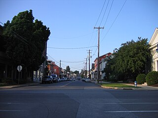
Strasburg is a borough in Lancaster County, Pennsylvania, United States. It developed as a linear village stretching approximately 2 miles (3 km) along the Great Conestoga Road, later known as the Strasburg Road. The population was 3,117 at the 2020 census.

<span class="mw-page-title-main">Brickerville, Pennsylvania</span> Census-designated place in Pennsylvania, United States

Brickerville is an unincorporated community and census-designated place (CDP) in Elizabeth Township, Lancaster County, Pennsylvania, United States, with a ZIP code of 17543. The population was 1,309 at the 2010 census.

<span class="mw-page-title-main">Conestoga Township, Lancaster County, Pennsylvania</span> Township in Pennsylvania, United States

Conestoga Township is a township in west central Lancaster County, Pennsylvania, United States. At the 2020 census the population was 3,922.

<span class="mw-page-title-main">East Lampeter Township, Lancaster County, Pennsylvania</span> Township in Pennsylvania, United States

East Lampeter Township is a township in central Lancaster County, Pennsylvania, United States. At the 2020 census, the population was 17,834.

<span class="mw-page-title-main">Gap, Pennsylvania</span> Census-designated place in Pennsylvania, United States

Gap is a census-designated place (CDP) and unincorporated community in Salisbury Township, Lancaster County, Pennsylvania, United States, with a ZIP code of 17527. The population was 1,931 at the 2010 census. U.S. Route 30 passes through the town, which is also the terminus for four Pennsylvania highways: 772, 741, 897, and the heavily used 41, which leads toward Wilmington, Delaware.

<span class="mw-page-title-main">Martic Township, Lancaster County, Pennsylvania</span> Township in Pennsylvania, United States

Martic Township is a township in southwestern Lancaster County, Pennsylvania, United States. At the 2020 census, the population was 5,237. Martic Township was organized in 1729. It borders Conestoga, Providence, Pequea and Drumore townships.

<span class="mw-page-title-main">Lancaster Township, Lancaster County, Pennsylvania</span> Township in Pennsylvania, United States

Lancaster Township is a civil township of Lancaster County, Pennsylvania, United States. It is in the central area of the county, and it immediately surrounds Lancaster City. As of the 2020 census, the township population was 18,591.

<span class="mw-page-title-main">Manor Township, Lancaster County, Pennsylvania</span> Township in Pennsylvania, United States

Manor Township is a second-class township in west-central Lancaster County, Pennsylvania, United States. As of the 2020 census, it had a population of 21,920.

<span class="mw-page-title-main">Mountville, Pennsylvania</span> Borough in Pennsylvania, United States

Mountville is a borough in Lancaster County, Pennsylvania, United States. The population was 3,022 at the 2020 census, an increase over the figure of 2,802 tabulated in 2010. The original Charles Chips potato chip factory was located here.

<span class="mw-page-title-main">Pequea Township, Lancaster County, Pennsylvania</span> Township in Pennsylvania, United States

Pequea Township is a township that is located in central Lancaster County, Pennsylvania, United States. The population was 5,493 at the time of the 2020 census.

<span class="mw-page-title-main">Quarryville, Pennsylvania</span> Borough in Pennsylvania, United States

Quarryville is a borough in Lancaster County, Pennsylvania, United States. The population was 2,852 at the 2020 census, an increase over the figure of 2,576 tabulated in 2010.

<span class="mw-page-title-main">Reamstown, Pennsylvania</span> Census-designated place in Pennsylvania, United States

Reamstown is an unincorporated community and census-designated place (CDP) in Lancaster County, Pennsylvania, United States. The population was 3,361 at the 2010 census.

<span class="mw-page-title-main">Rothsville, Pennsylvania</span> Census-designated place in Pennsylvania, United States

Rothsville is an unincorporated community and census-designated place (CDP) in Warwick Township, Lancaster County, Pennsylvania, United States. The population was 3,044 at the 2010 census. Lititz is the town for residents' mailing addresses.

<span class="mw-page-title-main">Terre Hill, Pennsylvania</span> Borough in Pennsylvania, United States

Terre Hill is a borough in Lancaster County, Pennsylvania, United States. The population was 1,363 at the 2020 census.

<span class="mw-page-title-main">West Lampeter Township, Lancaster County, Pennsylvania</span> Township in Pennsylvania, United States

West Lampeter Township is a township in central Lancaster County, Pennsylvania, United States. The population was 17,365 at the 2020 census.

<span class="mw-page-title-main">Smoketown, Pennsylvania</span> Census-designated place in Pennsylvania, United States

Smoketown is an unincorporated village and census-designated place (CDP) in East Lampeter Township, Lancaster County, Pennsylvania, United States. Also known as Smoke Town, it is served by the Smoketown Airport. As of the 2010 census, it had a population of 357.

<span class="mw-page-title-main">Reinholds, Pennsylvania</span> Census-designated place in Pennsylvania, United States

Reinholds is an unincorporated community and census-designated place (CDP) in West Cocalico Township, Lancaster County, Pennsylvania, United States. As of the 2010 census the population was 1,803.

<span class="mw-page-title-main">Lampeter, Pennsylvania</span> Census-designated place in Pennsylvania, United States

Lampeter is an unincorporated community and census-designated place (CDP) in West Lampeter Township, Lancaster County, Pennsylvania, United States. As of the 2010 census, it had a population of 1,669. It is a suburb of Lancaster and has a ZIP code of 17537. The community was named after Lampeter, in Wales.

References

  1. 1 2 "2019 U.S. Gazetteer Files: Places: Pennsylvania". United States Census Bureau. Retrieved October 5, 2020.
  2. 1 2 "Total Population: 2010 Census DEC Summary File 1 (P1), Willow Street CDP, Pennsylvania". data.census.gov. U.S. Census Bureau. Retrieved October 5, 2020.
  3. "Willow Street". Geographic Names Information System . United States Geological Survey, United States Department of the Interior.
  4. "US Gazetteer files: 2010, 2000, and 1990". United States Census Bureau. February 12, 2011. Retrieved April 23, 2011.
  5. "U.S. Census website". United States Census Bureau . Retrieved January 31, 2008.