Quarryville, Pennsylvania

Last updated
Quarryville, Pennsylvania
Quarryville LanCo PA Library.JPG
Quarryville Library
Lancaster County Pennsylvania Incorporated and Unincorporated areas Quarryville Highlighted.svg
Location in Lancaster County, Pennsylvania
USA Pennsylvania location map.svg
Red pog.svg
Quarryville
Location in Pennsylvania
Usa edcp location map.svg
Red pog.svg
Quarryville
Location in the United States
Coordinates: 39°53′43″N76°09′44″W / 39.89528°N 76.16222°W / 39.89528; -76.16222
CountryUnited States
StatePennsylvania
County Lancaster
Founded1791
Incorporated1892
Area
[1]
  Total1.31 sq mi (3.40 km2)
  Land1.29 sq mi (3.34 km2)
  Water0.02 sq mi (0.05 km2)
Elevation
545 ft (166 m)
Population
 (2020) [2]
  Total2,843
  Density2,202.17/sq mi (850.10/km2)
Time zone UTC-5 (EST)
  Summer (DST) UTC-4 (EDT)
ZIP code
17566
Area codes 717
FIPS code 42-63064
Website quarryvilleborough.com

Quarryville is a borough in Lancaster County, Pennsylvania, United States. The population was 2,852 at the 2020 census, [3] an increase over the figure of 2,576 tabulated in 2010. [4]

Contents

Geography

Quarryville is located in southern Lancaster County at 39°53′43″N76°9′44″W / 39.89528°N 76.16222°W / 39.89528; -76.16222 (39.895402, -76.162175). [5] U.S. Route 222 passes through the borough, leading northwest 14 miles (23 km) to Lancaster, the county seat, and south 17 miles (27 km) to U.S. Route 1 in Conowingo, Maryland. Pennsylvania Route 372 (State Street) also passes through Quarryville, leading east 16 miles (26 km) to Parkesburg and west 11 miles (18 km) to its crossing of the Susquehanna River near Holtwood. Pennsylvania Route 472 (South Lime Street) leads southeast from Quarryville 13 miles (21 km) to Oxford.

According to the United States Census Bureau, the borough of Quarryville has a total area of 1.3 square miles (3.4 km2), of which 0.02 square miles (0.05 km2), or 1.53%, are water. [6] The borough is drained by the headwaters of the South Fork of Big Beaver Creek, a northwestward-flowing tributary of Pequea Creek, itself a tributary of the Susquehanna River.

Demographics

Historical population
CensusPop.Note
1880 346
1900 565
1910 73930.8%
1920 82311.4%
1930 1,02824.9%
1940 1,1208.9%
1950 1,1876.0%
1960 1,42720.2%
1970 1,57110.1%
1980 1,558−0.8%
1990 1,6425.4%
2000 1,99421.4%
2010 2,57629.2%
2020 2,85210.7%
2021 (est.)2,861 [3] 0.3%
Sources: [7] [8] [9]

As of the census [8] of 2000, there were 1,994 people, 838 households, and 578 families residing in the borough. The population density was 1,520.9 inhabitants per square mile (587.2/km2). There were 864 housing units at an average density of 659.0 per square mile (254.4/km2). The racial makeup of the borough was 96.69% White, 0.45% African American, 0.10% Native American, 0.25% Asian, 1.50% from other races, and 1.00% from two or more races. Hispanic or Latino of any race were 2.26% of the population.

There were 838 households, out of which 34.0% had children under the age of 18 living with them, 53.6% were married couples living together, 12.3% had a female householder with no husband present, and 31.0% were non-families. 28.4% of all households were made up of individuals, and 13.6% had someone living alone who was 65 years of age or older. The average household size was 2.38 and the average family size was 2.92.

In the borough the population was spread out, with 27.0% under the age of 18, 7.6% from 18 to 24, 27.4% from 25 to 44, 20.0% from 45 to 64, and 18.1% who were 65 years of age or older. The median age was 37 years. For every 100 females there were 90.4 males. For every 100 females age 18 and over, there were 82.2 males.

The median income for a household in the borough was $35,798, and the median income for a family was $44,000. Males had a median income of $38,550 versus $23,989 for females. The per capita income for the borough was $19,105. About 5.9% of families and 7.1% of the population were below the poverty line, including 10.6% of those under age 18 and 5.7% of those age 65 or over.

History

The land which became Quarryville Borough was originally located within Providence Township and was the property of a John ("Swamp John") Groff. There was a stone quarry adjacent to the village where many of the workers lived. This village became larger as the work force grew, hence the town acquired the name "Quarryville". Locals say that one day the men went to lunch and returned to find the quarry half-full of water. The quarry site remains, now full of water.

Every September, the community is home to the Solanco Fair, which began in 1950 and takes place on the Solanco Fairgrounds. [10]

Education

Quarryville is part of the Solanco School District.

Quarryville Elementary School, Smith Middle School, and Solanco High School serve Quarryville.

Local services

The Quarryville Library is part of the Lancaster County Library System. The Quarryville Fire Company is a volunteer unit.

Notable people

Related Research Articles

<span class="mw-page-title-main">Denver, Pennsylvania</span> Borough in Pennsylvania, United States

Denver is a borough in Lancaster County, Pennsylvania, United States. The population was 3,794 at the 2020 census, a decline from the figure of 3,861 tabulated in 2010.

<span class="mw-page-title-main">East Petersburg, Pennsylvania</span> Borough in Pennsylvania, United States

East Petersburg is a borough in Lancaster County, Pennsylvania, United States. The population was 4,591 at the 2020 census.

<span class="mw-page-title-main">Marietta, Pennsylvania</span> Borough in Pennsylvania, United States

Marietta is a borough in Lancaster County, Pennsylvania, United States. The population was 2,633 at the 2020 census. It is located on the east bank of the Susquehanna River, northwest of Columbia.

<span class="mw-page-title-main">Millersville, Pennsylvania</span> Borough in Pennsylvania, United States

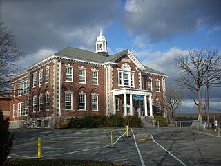
Millersville is a borough in Lancaster County, Pennsylvania. At the 2020 census, the population was 7,629 and in 2021 it was estimated at 7,593.

Rheems is an unincorporated community and census-designated place (CDP) in Lancaster County, Pennsylvania, United States, between the boroughs of Elizabethtown and Mount Joy. The population was 1,598 during the 2010 census.

<span class="mw-page-title-main">Willow Street, Pennsylvania</span> Census-designated place in Pennsylvania, United States

Willow Street is an unincorporated community and census-designated place (CDP) in Lancaster County, Pennsylvania, United States. The population was 7,578 at the 2010 census. In the early part of the 20th century, the main thoroughfare in town was lined with willow trees on both sides for the length of the town, hence the community's name. As time passed and the town grew, the road was widened and sidewalks were installed, which required the trees be removed. Only a few of the original trees remain to this day.

<span class="mw-page-title-main">Strasburg, Pennsylvania</span> Borough in Pennsylvania, United States

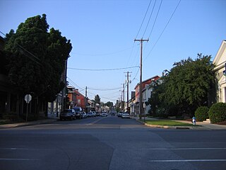
Strasburg is a borough in Lancaster County, Pennsylvania, United States. It developed as a linear village stretching approximately 2 miles (3 km) along the Great Conestoga Road, later known as the Strasburg Road. The population was 3,117 at the 2020 census.

<span class="mw-page-title-main">Christiana, Pennsylvania</span> Borough in Pennsylvania, United States

Christiana is a borough in Lancaster County, Pennsylvania, United States. The population was 1,100 at the time of the 2020 census.

<span class="mw-page-title-main">Drumore Township, Lancaster County, Pennsylvania</span> Township in Pennsylvania, United States

Drumore Township is a township in southwestern Lancaster County, Pennsylvania, United States. At the 2020 census, the population was 2,568.

<span class="mw-page-title-main">East Drumore Township, Lancaster County, Pennsylvania</span> Township in Pennsylvania, United States

East Drumore Township is a township in south central Lancaster County, Pennsylvania, United States. At the 2020 census, the population was 3,903. It is part of the Solanco School District.

<span class="mw-page-title-main">Eden Township, Lancaster County, Pennsylvania</span> Township in Pennsylvania, United States

Eden Township is a township in southeastern Lancaster County, Pennsylvania, United States. At the 2020 census, the population was 2,248. It is part of the Solanco School District.

<span class="mw-page-title-main">Fulton Township, Lancaster County, Pennsylvania</span> Township in Pennsylvania, United States

Fulton Township is a township in southern Lancaster County, Pennsylvania, United States, and it is the only municipality in the county to touch the Maryland border. At the 2020 census the population was 3,227. It is part of the Solanco School District.

<span class="mw-page-title-main">Kenhorst, Pennsylvania</span> Borough in Pennsylvania, United States

Kenhorst is a borough in Berks County, Pennsylvania, United States. The population was 2,877 at the 2010 census.

<span class="mw-page-title-main">Mountville, Pennsylvania</span> Borough in Pennsylvania, United States

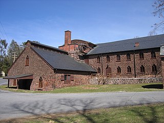
Mountville is a borough in Lancaster County, Pennsylvania, United States. The population was 3,022 at the 2020 census, an increase over the figure of 2,802 tabulated in 2010. The original Charles Chips potato chip factory was located here.

<span class="mw-page-title-main">Providence Township, Lancaster County, Pennsylvania</span> Township in Pennsylvania, United States

Providence Township is a township that is located in south central Lancaster County, Pennsylvania, United States. The population was 7,025 at the time of the 2020 census.

<span class="mw-page-title-main">Reamstown, Pennsylvania</span> Census-designated place in Pennsylvania, United States

Reamstown is an unincorporated community and census-designated place (CDP) in Lancaster County, Pennsylvania, United States. The population was 3,361 at the 2010 census.

<span class="mw-page-title-main">Terre Hill, Pennsylvania</span> Borough in Pennsylvania, United States

Terre Hill is a borough in Lancaster County, Pennsylvania, United States. The population was 1,363 at the 2020 census.

<span class="mw-page-title-main">Cornwall, Pennsylvania</span> Borough in Pennsylvania, United States

Cornwall is a borough in Lebanon County, Pennsylvania, United States. It is part of the Lebanon, PA Metropolitan Statistical Area. The population was 4,604 at the 2020 census.

<span class="mw-page-title-main">Quentin, Pennsylvania</span> Census-designated place in Pennsylvania, United States

Quentin is an unincorporated community and census-designated place (CDP) in Lebanon County, Pennsylvania, United States. It was named after Quentin Roosevelt, youngest son of President Theodore Roosevelt. The population was 594 at the 2010 census, up from 529 at the 2000 census.

<span class="mw-page-title-main">Solanco School District</span> Rural public school district in the southern Lancaster County, Pennsylvania

Solanco School District is a large, rural public school district located in the southern end of Lancaster County, Pennsylvania. Solanco School District encompasses approximately 180 square miles (470 km2). Solanco School District serves: Providence Township, Eden Township, Quarryville Borough, Little Britain Township, Bart Township, Colerain Township, Drumore Township, East Drumore Township and Fulton Township. According to 2008 local census data, it served a resident population of 30,566. By 2010, the district's population increased to 31,871 people. In 2009, the district residents’ per capita income was $17,040, while the median family income was $49,432. In the Commonwealth, the median family income was $49,501 and the United States median family income was $49,445, in 2010.

References

  1. "ArcGIS REST Services Directory". United States Census Bureau. Retrieved October 16, 2022.
  2. "Census Population API". United States Census Bureau. Retrieved Oct 12, 2022.
  3. 1 2 Bureau, US Census. "City and Town Population Totals: 2020-2021". Census.gov. US Census Bureau. Retrieved 9 July 2022.
  4. "Total Population: 2010 Census DEC Summary File 1 (P1), Quarryville borough, Pennsylvania". data.census.gov. U.S. Census Bureau. Retrieved September 9, 2020.
  5. "US Gazetteer files: 2010, 2000, and 1990". United States Census Bureau. 2011-02-12. Retrieved 2011-04-23.
  6. "2019 U.S. Gazetteer Files". United States Census Bureau. Retrieved July 28, 2020.
  7. "Census of Population and Housing". U.S. Census Bureau. Retrieved 11 December 2013.
  8. 1 2 "U.S. Census website". United States Census Bureau . Retrieved 2008-01-31.
  9. "Incorporated Places and Minor Civil Divisions Datasets: Subcounty Resident Population Estimates: April 1, 2010 to July 1, 2012". Population Estimates. U.S. Census Bureau. Archived from the original on June 11, 2013. Retrieved 11 December 2013.
  10. "Solanco Fairgrounds - a Community Venue in Southern Lancaster PA". Solanco Fair Association. Retrieved 2022-01-26.