Sadsbury Township, Lancaster County, Pennsylvania

Last updated

Salisbury Township,
Lancaster County, Pennsylvania
Mercer's Mill Covered Bridge 2600px.jpg
Mercer's Mill Covered Bridge on the Chester County border in Salisbury Township.
Salisbury Township, Lancaster County Highlighted.png
Map of Lancaster County highlighting Sadsbury Township
Country United States
State Pennsylvania
County Lancaster
Settled1691
Incorporated1729
Government
  TypeBoard of Supervisors
Area
[1]
  Total19.66 sq mi (50.92 km2)
  Land19.56 sq mi (50.66 km2)
  Water0.10 sq mi (0.26 km2)
Population
 (2020) [2]
  Total3,547 Increase2.svg
  Estimate 
(2021) [2]
3,529
  Density178.43/sq mi (68.89/km2)
Time zone UTC-5 (Eastern (EST))
  Summer (DST) UTC-4 (EDT)
Area code(s) 610, 717
FIPS code 42-071-67096
Website www.sadsburytownshiplancaster.org

Sadsbury Township is a township in east central Lancaster County, Pennsylvania, United States. The population was 3,547 at the 2020 census. [2]

Contents

History

In 1744, Sadsbury Township was split into two; the western part was organized as Bart Township and the eastern part remained Sadsbury Township. [3]

The Mercer's Mill Covered Bridge was listed on the National Register of Historic Places in 1980. [4]

Politics

Sadsbury township vote
by party in presidential elections
Year Democratic Republican Third Parties
2020 [5] 24.45% 30074.25%9111.30% 16
2016 [5] 25.58% 25370.58%6983.84% 38
2012 [5] 29.69% 28868.56%6651.75% 17
2008 [5] 36.19% 35061.74%5972.07% 20
2004 [5] 29.39% 29370.21%7000.40% 4
2000 [5] 30.41% 24364.46%5155.13% 41
1996 [6] 29.97% 21159.80%42110.23% 72
1992 [7] 30.42% 20951.82%35617.76% 122
1988 [8] 29.35% 16270.65%3900.00% 0
1984 [9] 25.04% 14474.61%4290.35% 2
1980 [10] 27.78% 13564.81%3157.41% 36
1976 [11] 34.27% 14764.57%2771.17% 5
1972 [12] 15.32% 6828.60% 12756.08%249
1968 [13] 25.43% 8962.28%21812.29% 43
1964 [14] 50.29%17249.71% 1700.00% 0
1960 [15] 31.10% 10768.90%2370.00% 0
1956 [16] 32.99% 9767.01%1970.00% 0
1952 [17] 26.92% 7073.08%1900.00% 0
1948 [18] 31.58% 6067.37%1281.05% 2
1944 [19] 32.16% 7367.84%1540.00% 0
1940 [20] 44.89% 12355.11%1510.00% 0
1936 [21] 52.75%18246.96% 1620.29% 1
1932 [22] 39.36% 9860.64%1510.00% 0
1928 [23] 15.35% 3584.65%1930.00% 0
1924 [24] 19.71% 5480.29%2200.00% 0
1920 [25] 17.22% 2675.50%1147.28% 11
1916 [26] 37.10% 4661.29%761.61% 2
1912 [27] 28.13% 4534.38%5537.50% 60 [28]
1908 [29] 28.04% 6069.63%1492.34% 5
1904 [30] 27.41% 5470.05%1380.25% 5

Media

WNUZ-LP 92.9 FM - Community Radio Station, Based in the Gap area of Sadsbury Township, which is located in the northeastern corner of the Township. Station Website

Geography

According to the United States Census Bureau, the township has a total area of 19.7 square miles (51.1 km2), all land. Unincorporated communities in the township include Simmonstown, Smyrna, and Coopersville.

Demographics

Historical population
CensusPop.Note
2000 3,025
2010 3,39512.2%
2020 3,5474.5%
2021 (est.)3,529 [2] −0.5%
U.S. Decennial Census [31]

As of the census [32] of 2000, there were 3,025 people, 880 households, and 760 families living in the township. The population density was 153.4 inhabitants per square mile (59.2/km2). There were 899 housing units at an average density of 45.6 per square mile (17.6/km2). The racial makeup of the township was 99.01% White, 0.26% African American, 0.07% Native American, 0.33% Asian, and 0.33% from two or more races. Hispanic or Latino of any race were 0.40% of the population.

There were 880 households, out of which 44.1% had children under the age of 18 living with them, 78.5% were married couples living together, 4.4% had a female householder with no husband present, and 13.6% were non-families. 11.6% of all households were made up of individuals, and 5.0% had someone living alone who was 65 years of age or older. The average household size was 3.44 and the average family size was 3.75.

In the township the population was spread out, with 35.5% under the age of 18, 9.1% from 18 to 24, 24.5% from 25 to 44, 21.4% from 45 to 64, and 9.6% who were 65 years of age or older. The median age was 30 years. For every 100 females, there were 100.1 males. For every 100 females age 18 and over, there were 102.8 males.

The median income for a household in the township was $53,750, and the median income for a family was $56,034. Males had a median income of $35,779 versus $29,545 for females. The per capita income for the township was $17,956. About 8.0% of families and 12.7% of the population were below the poverty line, including 21.0% of those under age 18 and 8.5% of those age 65 or over.

Related Research Articles

<span class="mw-page-title-main">Bart Township, Pennsylvania</span> Township in Pennsylvania, United States

Bart Township is a township in southeastern Lancaster County, Pennsylvania, United States. At the 2020 census, the population was 3,181, up from 3,094 at the 2010 census.

<span class="mw-page-title-main">Christiana, Pennsylvania</span> Borough in Pennsylvania, United States

Christiana is a borough in Lancaster County, Pennsylvania, United States. The population was 1,100 at the time of the 2020 census.

<span class="mw-page-title-main">Eden Township, Pennsylvania</span> Township in Pennsylvania, United States

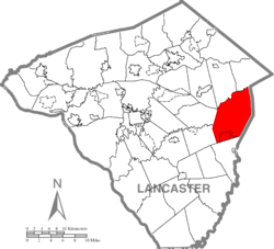
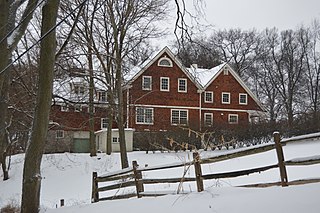
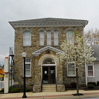
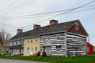
Eden Township is a township in southeastern Lancaster County, Pennsylvania, United States. At the 2020 census, the population was 2,248. It is part of the Solanco School District.

<span class="mw-page-title-main">Woodbury, Connecticut</span> Town in Connecticut, United States

Woodbury is a town in Litchfield County, Connecticut, United States. The town is part of the Naugatuck Valley Planning Region. The population was 9,723 at the 2020 census. The town center, comprising the adjacent villages of Woodbury and North Woodbury, is designated by the U.S. Census Bureau as the Woodbury Center census-designated place (CDP). Woodbury was founded in 1673.

<span class="mw-page-title-main">Granville, Massachusetts</span> Town in Massachusetts, United States

Granville is a town in Hampden County, Massachusetts, United States. The population was 1,538 at the 2020 census. It is part of the Springfield, Massachusetts Metropolitan Statistical Area. The town is named for John Carteret, 2nd Earl Granville.

<span class="mw-page-title-main">Buena Vista Township, New Jersey</span> Township in Atlantic County, New Jersey, US

Buena Vista Township is a township located in Atlantic County, in the U.S. state of New Jersey. The township, and all of Atlantic County, is part of the Atlantic City-Hammonton metropolitan statistical area, which in turn is included in the Philadelphia-Reading-Camden combined statistical area and the Delaware Valley.

<span class="mw-page-title-main">Sewickley Heights, Pennsylvania</span> Borough in Pennsylvania, United States

Sewickley Heights is a borough in Allegheny County, Pennsylvania, United States. The population was 857 at the 2020 census. It is a residential suburb of the Pittsburgh metropolitan area. Sewickley Heights is one of the wealthiest municipalities in Pennsylvania and in the United States.

<span class="mw-page-title-main">Sheshequin Township, Pennsylvania</span> Township in Pennsylvania, United States

Sheshequin Township is a township in Bradford County, Pennsylvania, United States. It is part of Northeastern Pennsylvania. The population was 1,348 at the 2010 census.

<span class="mw-page-title-main">Brady Township, Butler County, Pennsylvania</span> Township in Pennsylvania, United States

Brady Township is a township in Butler County, Pennsylvania, United States. The population was 1,216 at the 2020 census.

<span class="mw-page-title-main">Atglen, Pennsylvania</span> Borough in Pennsylvania, United States

Atglen is a borough in Chester County, Pennsylvania, United States. According to the 2020 census, its population is 1,311.

<span class="mw-page-title-main">Sadsbury Township, Chester County, Pennsylvania</span> Township in Pennsylvania, United States

Sadsbury Township is a township in Chester County, Pennsylvania, United States. The population was 3,570 at the 2010 census.

<span class="mw-page-title-main">West Sadsbury Township, Pennsylvania</span> Township in Pennsylvania, United States

West Sadsbury Township is a township in Chester County, Pennsylvania, United States. The population was 2,444 at the 2010 census.

<span class="mw-page-title-main">Beaver Township, Crawford County, Pennsylvania</span> Township in Pennsylvania, United States

Beaver Township is a township in Crawford County, Pennsylvania, United States. The population was 795 at the 2020 census.

<span class="mw-page-title-main">Sadsbury Township, Crawford County, Pennsylvania</span> Township in Pennsylvania, United States

Sadsbury Township is a township in Crawford County, Pennsylvania, United States. The population was 2,752 at the 2020 census, down from 2,933 at the 2010 census.

<span class="mw-page-title-main">North East, Pennsylvania</span> Borough in Pennsylvania, United States

North East is a borough in Erie County, Pennsylvania, United States, 14 miles (23 km) northeast of Erie. Located in the county's northeastern corner, the name comes from the geographical location. The population was 4,114 at the 2020 census, down from 4,294 in 2010. Fruit growing was an early economic endeavor, and is still to this day, as this is a popular area especially for cherries and grapes. There is an annual Cherry Festival in the summer and an annual Wine Country Harvest Festival in autumn. It is part of the Erie Metropolitan Statistical Area. It is the northernmost town in Pennsylvania.

<span class="mw-page-title-main">Greene Township, Greene County, Pennsylvania</span> Township in Pennsylvania, United States

Greene Township is a township in Greene County, Pennsylvania, United States. The population was 398 at the 2020 census.

<span class="mw-page-title-main">Little Britain Township, Pennsylvania</span> Township in Pennsylvania, United States

Little Britain Township is a township in southeastern Lancaster County, Pennsylvania, United States. The population was 4,134 at the 2020 census. It is part of the Solanco School District.

<span class="mw-page-title-main">Snydertown, Northumberland County, Pennsylvania</span> Borough in Pennsylvania, United States

Snydertown is a borough in Northumberland County, Pennsylvania, United States. As of the 2010 census, the borough population was 339.

<span class="mw-page-title-main">Grace Mann Brown</span>

Grace Mann Brown was an American writer and spiritual leader. Her work was related to the New Thought Movement, Divine Science and Christian Science. Much of her work focused on spirituality, metaphysics, mysticism, esoteric and occult sciences.

<span class="mw-page-title-main">James Henry Nixon</span> British illustrator and painter

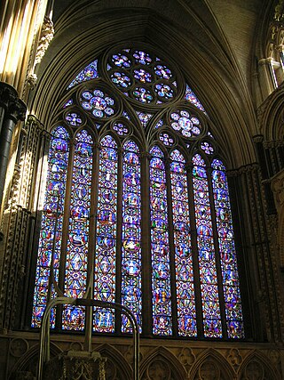
James Henry Nixon (1802–1857) was an illustrator and painter during the Victorian period, who worked in the firm Ward and Nixon painting stained glass windows. James Henry Nixon was a protégé of Charles Winston, who praised Nixon's work at Westminster Abbey and Church of Christ the King, Bloomsbury. The company Ward and Nixon was followed by Ward and Hughes.

References

  1. "2016 U.S. Gazetteer Files". United States Census Bureau. Retrieved August 14, 2017.
  2. 1 2 3 4 Bureau, US Census. "City and Town Population Totals: 2020-2021". Census.gov. US Census Bureau. Retrieved July 9, 2022.
  3. Everets & Stewart, Historical Atlas of Lancaster Co. Pennsylvania Illustrated, 1875, p. XVI. Archived March 13, 2007, at the Wayback Machine
  4. "National Register Information System". National Register of Historic Places . National Park Service. July 9, 2010.
  5. 1 2 3 4 5 6 "Dave Leip's Atlas of U.S. Presidential Elections".
  6. "6 Nov 1996, 11 - Intelligencer Journal at". Newspapers.com. November 6, 1996. Retrieved June 5, 2022.
  7. "4 Nov 1992, 8 - Intelligencer Journal at". Newspapers.com. November 4, 1992. Retrieved June 5, 2022.
  8. "9 Nov 1988, 8 - Intelligencer Journal at". Newspapers.com. November 9, 1988. Retrieved June 5, 2022.
  9. "7 Nov 1984, 16 - Intelligencer Journal at". Newspapers.com. November 7, 1984. Retrieved June 5, 2022.
  10. "5 Nov 1980, 17 - Intelligencer Journal at". Newspapers.com. November 5, 1980. Retrieved June 5, 2022.
  11. "3 Nov 1976, 9 - Intelligencer Journal at". Newspapers.com. November 3, 1976. Retrieved June 5, 2022.
  12. "8 Nov 1972, 13 - Intelligencer Journal at". Newspapers.com. November 8, 1972. Retrieved June 5, 2022.
  13. "6 Nov 1968, 11 - Intelligencer Journal at". Newspapers.com. November 6, 1968. Retrieved June 5, 2022.
  14. "4 Nov 1964, 7 - Intelligencer Journal at". Newspapers.com. November 4, 1964. Retrieved June 5, 2022.
  15. "9 Nov 1960, 18 - Intelligencer Journal at". Newspapers.com. November 9, 1960. Retrieved June 5, 2022.
  16. "7 Nov 1956, 10 - Intelligencer Journal at". Newspapers.com. November 7, 1956. Retrieved June 5, 2022.
  17. "5 Nov 1952, 17 - Intelligencer Journal at". Newspapers.com. November 5, 1952. Retrieved June 5, 2022.
  18. "3 Nov 1948, 12 - Intelligencer Journal at". Newspapers.com. November 3, 1948. Retrieved June 5, 2022.
  19. "8 Nov 1944, 7 - Intelligencer Journal at". Newspapers.com. November 8, 1944. Retrieved June 5, 2022.
  20. "6 Nov 1940, 6 - Intelligencer Journal at". Newspapers.com. November 6, 1940. Retrieved June 5, 2022.
  21. "4 Nov 1936, 7 - Intelligencer Journal at". Newspapers.com. November 4, 1936. Retrieved June 5, 2022.
  22. "9 Nov 1932, 6 - Intelligencer Journal at". Newspapers.com. November 9, 1932. Retrieved June 5, 2022.
  23. "7 Nov 1928, 10 - Intelligencer Journal at". Newspapers.com. November 7, 1928. Retrieved June 5, 2022.
  24. "5 Nov 1924, 5 - Intelligencer Journal at". Newspapers.com. November 5, 1924. Retrieved June 5, 2022.
  25. "Smull's legislative hand book and manual of the ... 1921/22. - Full View | HathiTrust Digital Library". Babel.hathitrust.org. December 11, 2019. Retrieved June 5, 2022.
  26. "Smull's legislative hand book and manual of the ... 1917. - Full View | HathiTrust Digital Library". Babel.hathitrust.org. December 11, 2019. Retrieved June 5, 2022.
  27. "Smull's legislative hand book and manual of the ... 1913. - Full View | HathiTrust Digital Library". Babel.hathitrust.org. December 11, 2019. Retrieved June 5, 2022.
  28. The largest third party in 1912 for Sadsbury was the Bull Moose Party with 44 votes.
  29. "Smull's legislative hand book and manual of the ... 1909. - Full View | HathiTrust Digital Library". Babel.hathitrust.org. December 11, 2019. Retrieved June 5, 2022.
  30. "Smull's legislative hand book and manual of the ... 1905. - Full View | HathiTrust Digital Library". Babel.hathitrust.org. December 11, 2019. Retrieved June 5, 2022.
  31. "Census of Population and Housing". Census.gov. Retrieved June 4, 2016.
  32. "U.S. Census website". United States Census Bureau . Retrieved January 31, 2008.

39°52′24″N75°59′29″W / 39.87333°N 75.99139°W / 39.87333; -75.99139