
Yakima County is a county in the U.S. state of Washington. As of the 2020 census, its population was 256,728. The county seat and largest city is Yakima. The county was formed out of Ferguson County in January 1865 and is named for the Yakama tribe of Native Americans.
Tieton is a city in Yakima County, Washington, United States. The population was 1,389 at the 2020 census.

Rimrock is the sheer rock wall at the upper edge of a plateau, canyon, or geological uplift. It may refer to either the rock formation or to the rock itself. Rimrock may be composed of almost any stone—basalt, gneiss, granite, sandstone, etc.—and is frequently layered. Many times it overlays a softer stone which erodes away underneath. American Indians in the West often used cavities found below rimrock to construct dwellings and granaries.
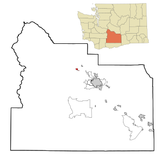
Cowiche is a census-designated place and unincorporated community northwest of Yakima, Washington, near the eastern foothills of the Cascade Mountain range, in central Washington State (US). Cowiche, sometimes spelled Cowychee, is said to mean "footbridge between the valley and the mountains." According to the 2010 census, the town had a population of 428.

The Naches River is a tributary of the Yakima River in central Washington in the United States. Beginning as the Little Naches River, it is about 75 miles (121 km) long. After the confluence of the Little Naches and Bumping River the name becomes simply the Naches River. The Naches and its tributaries drain a portion of the eastern side of the Cascade Range, east of Mount Rainier and northeast of Mount Adams. In terms of discharge, the Naches River is the largest tributary of the Yakima River.

The Tieton River is a tributary of the Naches River, in Yakima County, Washington in the United States.

Rimrock Lake is a lake along the course of the Tieton River, in Yakima County, Washington state, US.
Artesian is an unincorporated community in Yakima County, Washington, United States, located approximately one mile east of Moxee.
Gromore is an unincorporated community in Yakima County, Washington, United States, located approximately one mile west of Yakima. Gromore was an agricultural area located at the terminus of a Yakima Valley Transportation Company interurban line.
Wenas is an unincorporated community in Yakima County, Washington, United States. It is adjacent to the Wenas Wildlife Area, located approximately twenty miles northwest of Selah. There are only two or three ranch homes now at Wenas, no businesses or services.
Nass is an unincorporated community in Yakima County, Washington, United States, located approximately one mile east of Granger.
Byron is an unincorporated community in Yakima County, Washington, United States, located approximately three miles west of Prosser.
Tampico is a census-designated place and unincorporated community in Yakima County, Washington, United States, located approximately eighteen miles west of Yakima on Ahtanum Creek. The population was 312 at the 2010 United States Census.
Cliffdell is an unincorporated community in Yakima County, Washington, United States, located approximately 23 miles west of Ellensburg.
East Selah is an unincorporated community in Yakima County, Washington, United States, located east of Selah adjacent to the Yakima River.
Nile is a census-designated place and unincorporated community in Yakima County, Washington, United States, located approximately 35 miles northwest of Yakima in the Nile Valley adjacent to the Naches River in the Nile Valley, near the mouth of Rattlesnake Creek.
Pinecliff is a nonprofit maintenance corporation in Yakima County, Washington, United States, located approximately 20 miles west of Ellensburg, adjacent to the Naches River.
Weikel is an unincorporated community in Yakima County, Washington, United States, located approximately one mile north of Yakima, adjacent to Cowiche Creek, at the west end of Cowiche Canyon.
Fruitvale is an unincorporated community in Yakima County, Washington, United States, located within the north city limits of Yakima.
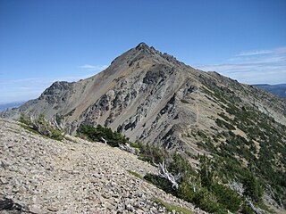
Mount Aix is a 7,766-foot (2,367 m) mountain summit in Yakima County of Washington state.

