Sayerwood South, New Jersey

Last updated
Sayerwood South, New Jersey
Unincorporated community
Location map of Middlesex County, New Jersey.svg
Red pog.svg
Sayerwood South, New Jersey
Location of Sayerwood South in Middlesex County Inset: Location of county within the state of New Jersey
USA New Jersey location map.svg
Red pog.svg
Sayerwood South, New Jersey
Sayerwood South, New Jersey (New Jersey)
Usa edcp location map.svg
Red pog.svg
Sayerwood South, New Jersey
Sayerwood South, New Jersey (the US)
Coordinates: 40°23′50″N74°19′29″W / 40.39722°N 74.32472°W / 40.39722; -74.32472 Coordinates: 40°23′50″N74°19′29″W / 40.39722°N 74.32472°W / 40.39722; -74.32472
Country Flag of the United States.svg  United States
State Flag of New Jersey.svg  New Jersey
County Middlesex
Township Old Bridge
Elevation [1] 82 ft (25 m)
GNIS feature ID 883194 [1]

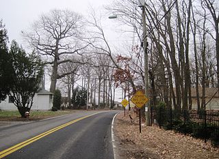
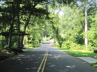
Sayerwood South or Sayrewood South is an unincorporated community located within Old Bridge Township in Middlesex County, New Jersey, United States. [2]
Old Bridge Township, New Jersey Township in New Jersey, United States

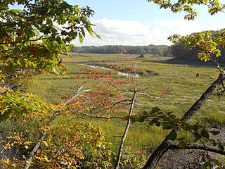
Old Bridge Township is a township in Middlesex County, New Jersey, United States. As of the 2010 United States Census, the township had a total population of 65,375, reflecting an increase of 4,919 (+8.1%) from the 60,456 counted in the 2000 Census, which had in turn increased by 3,981 (+7.0%) from the 56,475 counted in the 1990 Census. As of the 2010 Census, the township was the state's 18th largest municipality, after being the state's 21st most-populous municipality in 2000. Old Bridge is a bedroom suburb of New York City located across the Raritan Bay from Staten Island, and it is about 25 miles (40 km) from Manhattan, and about 30 miles (48 km) south of Newark.

Middlesex County, New Jersey county in New Jersey, United States of America

Middlesex County is a county located in central New Jersey, United States. As of the 2017 Census estimate, the county's population was 842,798, making it the state's second-most populous county, an increase of 4.1% from the 2010 United States Census, when its population was enumerated at 809,858, making it the second-most populous county in the state. Middlesex is part of the New York metropolitan area, and its county seat is New Brunswick. The center of population of the state of New Jersey is located in Middlesex County, in East Brunswick Township, just east of the New Jersey Turnpike. The 2000 Census showed that the county ranked 63rd in the United States among the highest-income counties by median household. The Bureau of Economic Analysis ranked the county as having the 143rd-highest per capita income of all 3,113 counties in the United States as of 2009. Middlesex County holds the nickname, "The Greatest County in the Land".

New Jersey State of the United States of America

New Jersey is a state in the Mid-Atlantic region of the Northeastern United States. It is a peninsula, bordered on the north and east by the state of New York, particularly along the extent of the length of New York City on its western edge; on the east, southeast, and south by the Atlantic Ocean; on the west by the Delaware River and Pennsylvania; and on the southwest by the Delaware Bay and Delaware. New Jersey is the fourth-smallest state by area but the 11th-most populous, with 9 million residents as of 2017, and the most densely populated of the 50 U.S. states; its biggest city is Newark. New Jersey lies completely within the combined statistical areas of New York City and Philadelphia and was the second-wealthiest U.S. state by median household income as of 2017.

Related Research Articles

Locust, New Jersey Unincorporated community in New Jersey, United States

Locust is an unincorporated community located within Middletown Township in Monmouth County, New Jersey, United States. It is situated along the north banks of the Navesink River and Claypit Creek. The area consists of mostly medium-to-large sized houses throughout the hilly terrain of this part of the township. The Oceanic Bridge connects Locust with Rumson to the south.

Emleys Hill, New Jersey Unincorporated community in New Jersey, United States

Emleys Hill is an unincorporated community located within Upper Freehold Township in Monmouth County, New Jersey, United States. The settlement is located at the intersection of Emleys Hill Road and Burlington Path Road.

East Spotswood, New Jersey Unincorporated community in New Jersey, United States

East Spotswood, also known as the settlement of Old Bridge, is an unincorporated community located within East Brunswick, New Jersey and Old Bridge townships in Middlesex County, New Jersey, United States. The area is made up of homes, businesses, and wetlands for the South River. The area is located at the junction of New Jersey Route 18, County Route 527, the western end of CR 516, and the Bordentown and South Amboy Turnpike. The still-active Jamesburg Branch of the former Camden & Amboy Railroad also runs through the community.

Mechanicsville, Middlesex County, New Jersey Unincorporated community in New Jersey, United States

Mechanicsville is an unincorporated community located within South Amboy in Middlesex County, New Jersey, United States.

Newton Heights, New Jersey Unincorporated community in New Jersey, United States

Newton Heights is an unincorporated community located along the border of East Brunswick Township and South River Borough in Middlesex County, New Jersey, United States.

Riverview Manor, New Jersey Unincorporated community in New Jersey, United States

Riverview Manor is an unincorporated community located within Piscataway Township in Middlesex County, New Jersey, United States.

Samptown, New Jersey Unincorporated community in New Jersey, United States

Samptown is an unincorporated community located within South Plainfield in Middlesex County, New Jersey, United States.

Sand Hills, Edison and Woodbridge, New Jersey Unincorporated community in New Jersey, United States

Sand Hills is an unincorporated community located along the border of Edison and Woodbridge townships in Middlesex County, New Jersey, United States.

Sand Hills, South Brunswick, New Jersey Unincorporated community in New Jersey, United States

Sand Hills is an unincorporated community located within South Brunswick Township in Middlesex County, New Jersey, United States. The settlement is named for Sand Hills, a small group of diabase hills which contains Middlesex County's highest point. The settlement is located approximately at the intersection of U.S. Route 1, Sand Hills Road, and Major Road. There is a small cluster of houses and small businesses on Major Road just south of US 1 while more housing developments are found on the north side of the highway. Fast food restaurants, stores, and repair shops line US 1 through the area; this area of US 1 also has large inclines on both sides of the hills to climb from the relatively low and flat areas of the Atlantic coastal plain.

Sayre Woods, New Jersey Unincorporated community in New Jersey, United States

Sayre Woods is a neighborhood located within Sayreville in Middlesex County, New Jersey, United States.

Sayreville Junction, New Jersey Unincorporated community in New Jersey, United States

Sayreville Junction is a neighborhood located within Sayreville in Middlesex County, New Jersey, United States.

Sayreville Station, New Jersey Unincorporated community in New Jersey, United States

Sayreville Station is a neighborhood in Sayreville in Middlesex County, New Jersey, United States.

Shore Road Estates, New Jersey Unincorporated community in New Jersey, United States

Shore Road Estates is an unincorporated community located within Monroe Township in Middlesex County, New Jersey, United States.

Shore View, New Jersey Unincorporated community in New Jersey, United States

Shore View is an unincorporated community located within Woodbridge Township in Middlesex County, New Jersey, United States.

South Brunswick Terrace, New Jersey Unincorporated community in New Jersey, United States

South Brunswick Terrace is an unincorporated community located within South Brunswick Township in Middlesex County, New Jersey, United States.

South Old Bridge, New Jersey Unincorporated community in New Jersey, United States

South Old Bridge is an unincorporated community located within Old Bridge Township in Middlesex County, New Jersey, United States. The community consists of homes and businesses between New Jersey Route 18 and County Route 516 in the western portion of the township. The reason for the odd directional naming is because it is located south of the settlement of Old Bridge while the name of the township of the time was Madison Township.

Washington Heights, New Jersey Unincorporated community in New Jersey, United States

Washington Heights is an unincorporated community located within East Brunswick Township in Middlesex County, New Jersey, United States.

Homes Mills, New Jersey Unincorporated community in New Jersey, United States

Homes Mills or Holmes Mills is an unincorporated community located within Upper Freehold Township in Monmouth County, New Jersey, United States. The settlement is located along Holmes Mill Road [sic] where it crosses the Miry Run. The land around the Miry Run is hilly and forested but on the north side of the stream there are horse farms and housing developments on the south side.

Land of Pines, New Jersey Unincorporated community in New Jersey, United States

Land of Pines is an unincorporated community located within Howell Township in Monmouth County, New Jersey, United States. The area consists of single-family home developments with some businesses located along U.S. Route 9, a divided highway that runs through the center of the community. It is located in the northernmost extents of the Pine Barrens and is just south of Interstate 195.

Low Moor, New Jersey Unincorporated community in New Jersey, United States

Low Moor is an unincorporated community located within Sea Bright in Monmouth County, New Jersey, United States. It is located at the southern end of the borough at the border with Monmouth Beach. The area consists of single-family homes, condominiums, marinas on the Shrewsbury River side of the peninsula, and public beaches on the Atlantic Ocean side. New Jersey Route 36 is the main road that runs north and south through the area. The Sea Bright–Monmouth Beach Seawall is parallel to the road.

References