
Edison is an NJ Transit station located 30.3 miles (48.8 km) southwest of New York City on the Northeast Corridor Line, in Edison, New Jersey. It is at the corner of Central and Plainfield Avenues in the Stelton neighborhood of Edison which is located in the southwestern corner of the Township, and accessible by car via Reed Street. A small privately run convenience store operates in the waiting room of the north/New York City-bound platform. Passengers use a ticket machine as there is no station agent or station office. Elevators and ramps make both the north- and south-bound platforms wheelchair accessible. With the growing population of Edison, ridership has increased over the last 10–15 years, resulting in a shortage of parking spaces on weekdays and heavy traffic during rush hours.

Port-au-peck is an unincorporated community located within Oceanport in Monmouth County, New Jersey, United States.
Locust is an unincorporated community located within Middletown Township in Monmouth County, New Jersey, United States. It is situated along the north banks of the Navesink River and Claypit Creek. The area consists of mostly medium-to-large sized houses throughout the hilly terrain of this part of the township. The Oceanic Bridge connects Locust with Rumson to the south.

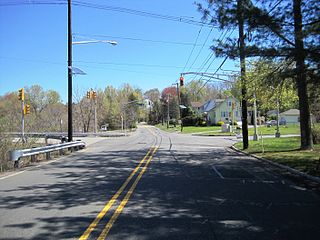
Stelton is an unincorporated community located within Edison Township in Middlesex County, New Jersey, United States.
Bonhamtown is an section of Edison Township in Middlesex County, New Jersey, United States.
Maple Meade is an unincorporated community located within North Brunswick Township in Middlesex County, New Jersey, United States. The area, located near the intersection of Adams Lane and U.S. Route 130, is made up of homes and apartment complexes with businesses lining US 130.
Morgan Heights is a neighborhood located within Sayreville in Middlesex County, New Jersey, United States.
New Dover is an unincorporated community located within Edison Township in Middlesex County, New Jersey, United States. The neighborhood began as colonial village that was part of adjacent Woodbridge Township. Along with Bonhamtown, New Durham and Stelton, it is one of the older historical communities of the township.
New Durham was an unincorporated community and now a neighborhood located within Edison in Middlesex County, New Jersey, United States, south of Dismal Swamp.
Newton Heights is an unincorporated community located along the border of East Brunswick Township and South River Borough in Middlesex County, New Jersey, United States.
Patricks Corner or Patricks Corners is an unincorporated community located along the border of East Brunswick and North Brunswick townships in Middlesex County, New Jersey, United States. Adjacent to Farrington Lake, the East Brunswick side is about half residential homes and half forestland. The North Brunswick side is much denser with more homes in the area.

Branchport is an unincorporated community located within Long Branch in Monmouth County, New Jersey, United States. Centered in the northern part of the city, the area contains mostly single-family homes along grid-like streets though some commercial businesses are located on New Jersey Route 36 which through Branchport is called Joline Avenue. The North Jersey Coast Line passes through the community though the closest stops along the line are the Monmouth Park station in Oceanport and the Long Branch station in the center of the city.
Holland is an unincorporated community located on the border of Holmdel and Middletown townships in Monmouth County, New Jersey, United States. The community is centered on the intersection of County Route 52 and Holland Road. The area making up Holland is hilly and consists of large single-family residences. An AT&T Labs campus is located off Laurel Avenue while Tatum County Park is also located in the area, both of which are on the Middletown side of the border.
Homes Mills or Holmes Mills is an unincorporated community located within Upper Freehold Township in Monmouth County, New Jersey, United States. The settlement is located along Holmes Mill Road [sic] where it crosses the Miry Run. The land around the Miry Run is hilly and forested but on the north side of the stream there are horse farms and housing developments on the south side.
Low Moor is an unincorporated community located within Sea Bright in Monmouth County, New Jersey, United States. It is located at the southern end of the borough at the border with Monmouth Beach. The area consists of single-family homes, condominiums, marinas on the Shrewsbury River side of the peninsula, and public beaches on the Atlantic Ocean side. New Jersey Route 36 is the main road that runs north and south through the area. The Sea Bright–Monmouth Beach Seawall is parallel to the road.

Matthews is an unincorporated community located within Howell Township in Monmouth County, New Jersey, United States. The settlement is located on the western border of the township near Jackson Township, Ocean County and Interstate 195. It is located about the intersection of Hulses Corner Road and Fort Plains Road. The Howell side of the North Branch Metedeconk River is mainly rural with only a few houses located along the main surface roads while the Jackson side of the river is more suburbanized.
North Centerville is an unincorporated community located within Hazlet Township in Monmouth County, New Jersey, United States. Like most of Hazlet, North Centerville is largely suburban. The settlement is located at the intersection of Middle Road and Union Avenue in the center of the township.

North Long Branch is an unincorporated community located within Long Branch in Monmouth County, New Jersey, United States. The community is situated in the northern portion of the city and is physically located between Troutmans Creek and Ocean Boulevard. Centered about the intersection of Joline Avenue and Long Branch Avenue, most of the area is made up of single-family houses except for some schools, apartment complexes, and the city's sewage treatment plant.

Ellisdale is an unincorporated community located along the border of North Hanover Township in Burlington County and Upper Freehold Township in Monmouth County, in New Jersey, United States. The community is centered about the intersection of Province Line Road and Hill Road / Ellisdale-Crosswicks Road. The Crosswicks Creek runs to the north of the settlement and the nearby Ellisdale Fossil Site takes its name from Ellisdale.


