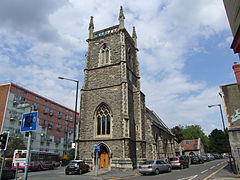
The M32 is a 4.42 miles (7.11 km) long motorway in South Gloucestershire and Bristol, England. It provides a link from the M4, a major motorway linking London and South Wales, to Bristol city centre and is maintained by National Highways, the national roads body.
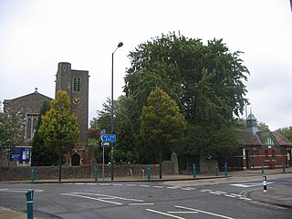
Avonmouth is a port and outer suburb of Bristol, England, facing two rivers: the reinforced north bank of the final stage of the Avon which rises at sources in Wiltshire, Gloucestershire and Somerset; and the eastern shore of the Severn Estuary. Strategically the area has been and remains an important part of the region's maritime economy particularly for larger vessels for the unloading and exporting of heavier goods as well as in industry including warehousing, light industry, electrical power and sanitation. The area contains a junction of and is connected to the south by the M5 motorway and other roads, railway tracks and paths to the north, south-east and east.
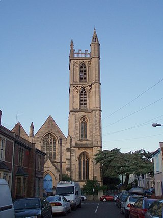
St. Werburgh's is an area in north-east central Bristol, England. It is surrounded by the M32 motorway.

Bristol City Centre is the commercial, cultural and business centre of Bristol, England. It is the area north of the New Cut of the River Avon, bounded by Clifton Wood and Clifton to the north-west, Kingsdown and Cotham to the north, and St Pauls, Lawrence Hill and St Phillip's Marsh to the east. The Bristol Royal Infirmary, Bristol Royal Hospital for Children, the BBC, the main campus of the University of Bristol, the Crown and Magistrate's Courts, Temple Meads railway station, Bristol bus station, the Park Street, Broadmead and Cabot Circus shopping areas together with numerous music venues, theatres and restaurants are located in this area. The area consists of the council wards of Central, Hotwells & Harbourside, and part of Lawrence Hill.
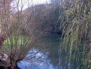
The Frome, historically the Froom, is a river that rises in Dodington Park, South Gloucestershire and flows southwesterly through Bristol to join the river Avon. It is approximately 20 miles (32 km) long, and the mean flow at Frenchay is 60 cubic feet per second (1.7 m3/s). The name Frome is shared with several other rivers in South West England and means 'fair, fine, brisk'. The river is known locally in east Bristol as the Danny.
St Pauls is an inner suburb of Bristol, England, situated just northeast of the city centre and west of the M32. It is bounded by the A38, the B4051, the A4032 and the A4044, although the River Frome was traditionally the eastern boundary before A4032 was constructed. St Pauls was laid out in the early 18th century as one of Bristol's first suburbs.

Stapleton is an area in the northeastern suburbs of the city of Bristol, England. The name is colloquially used today to describe the ribbon village along Bell Hill and Park Road in the Frome Valley. It borders Eastville to the South and Begbrook and Frenchay to the North. It comprises an eclectic mix of housing mainly from the Victorian, Edwardian, inter-war and late 20th century periods.
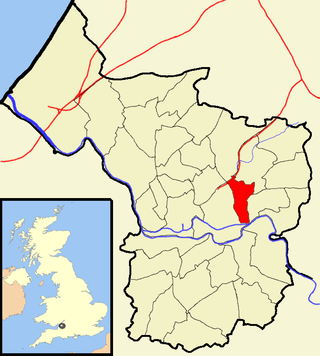
Easton is an inner city area of the city of Bristol in the United Kingdom. Informally the area is considered to stretch east of Bristol city centre and the M32 motorway, centred on Lawrence Hill. Its southern and eastern borders are less defined, merging into St Philip's Marsh and Eastville. The area includes the Lawrence Hill and Barton Hill estates.

Ashley is one of thirty-five council wards in the city of Bristol in the United Kingdom. The ward contains the areas of Baptist Mills, Montpelier, St Andrew's, St Paul's and St Werburgh's. The Ward has over 16,000 residents and is served by one community magazine and resident-led organisational body called 'Vocalise'.

Stapleton Road railway station is on the Severn Beach Line and Cross Country Route, serving the inner-city district of Easton in Bristol, England. It is 1.6 miles (2.6 km) from Bristol Temple Meads. Its three letter station code is SRD. The station has two platforms, four running lines and minimal facilities. It is managed by Great Western Railway, the seventh company to be responsible for the station, and the third franchise since privatisation in 1997. They provide all train services at the station, the standard service being two trains per hour along the Severn Beach Line and an hourly service between Bristol Temple Meads and Filton Abbey Wood.

Eastville is the name of both a council ward in the city of Bristol in the United Kingdom and a suburb of the city that lies within that ward. The Eastville ward covers the areas of Eastville, Crofts End, Stapleton and part of Fishponds. Notable places within the ward include Bristol Metropolitan Academy and Colston's School, and the Bristol and Bath Railway Path also passes through the ward.

Bristol, the largest city in South West England, has an eclectic combination of architectural styles, ranging from the medieval to 20th century brutalism and beyond. During the mid-19th century, Bristol Byzantine, an architectural style unique to the city, was developed, and several examples have survived.

The English city of Bristol has a number of parks and public open spaces.
The city of Bristol, England, is divided into many areas, which often overlap or have non-fixed borders. These include Parliamentary constituencies, council wards and unofficial neighbourhoods. There are no civil parishes in Bristol.
Bristol is a city in south west England, near the Bristol Channel coast, approximately 106 miles (170 km) west of London. Several factors have influenced the development of its transport network. It is a major centre of employment, retail, culture and higher education, has many historic areas, and has a history of maritime industry. The city has a population of 450,000, with a metropolitan area of 650,000, and lies at the centre of the former County of Avon, which includes many dormitory towns, and has a population of one million.
Baptist Mills an area of the city of Bristol, England. The name derives from the former mills which stood in that area.

Cabot Circus is a covered shopping centre in Bristol, England. It is adjacent to Broadmead, a shopping district in Bristol city centre. The Cabot Circus development area contains shops, offices, a cinema, hotel and 250 apartments. It covers a total of 139,350 m2 (1,500,000 sq ft) floor space, of which 92,900 m2 (1,000,000 sq ft) is retail outlets and leisure facilities. It opened in September 2008, after a ten-year planning and building project costing £500 million.

Stapleton Road is a major thoroughfare in the English city of Bristol, running through the districts of Lawrence Hill and Easton. It is known for being very culturally diverse with many esoteric shops. However since the mid 20th century it has gained a reputation for having a high crime rate.

Road building was central to planning policy for much of the 20th century in Bristol, England. The planned road network evolved over time but at its core was a network of concentric ring roads and high-capacity radial roads.
