
The River Parrett flows through the counties of Dorset and Somerset in South West England, from its source in the Thorney Mills springs in the hills around Chedington in Dorset. Flowing northwest through Somerset and the Somerset Levels to its mouth at Burnham-on-Sea, into the Bridgwater Bay nature reserve on the Bristol Channel, the Parrett and its tributaries drain an area of 660 square miles (1,700 km2) – about 50 per cent of Somerset's land area, with a population of 300,000.

The Somerset Levels are a coastal plain and wetland area of Somerset, England, running south from the Mendips to the Blackdown Hills.

The River Huntspill is an artificial river, in the Somerset Levels, in the Sedgemoor district of Somerset, England. It was built in 1940 to supply process water to ROF Bridgwater, and has resulted in reduced flooding of the lower Brue Valley. Huntspill Sluice at the river's western end, also known as West Huntspill Sluice, separates it from the River Parrett.
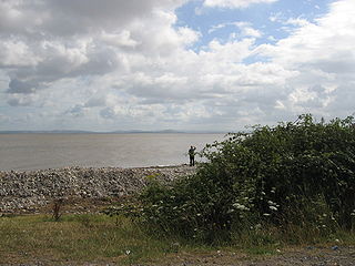
Bridgwater Bay is on the Bristol Channel, 5 kilometres (3.1 mi) north of Bridgwater in Somerset, England at the mouth of the River Parrett and the end of the River Parrett Trail. It stretches from Minehead at the southwestern end of the bay to Brean Down in the north. The area consists of large areas of mudflats, saltmarsh, sandflats and shingle ridges, some of which are vegetated. It has been designated as a Site of Special Scientific Interest (SSSI) covering an area of 3,574.1 hectares since 1989, and is designated as a wetland of international importance under the Ramsar Convention. The risks to wildlife are highlighted in the local Oil Spill Contingency Plan.

A salt marsh, saltmarsh or salting, also known as a coastal salt marsh or a tidal marsh, is a coastal ecosystem in the upper coastal intertidal zone between land and open saltwater or brackish water that is regularly flooded by the tides. It is dominated by dense stands of salt-tolerant plants such as herbs, grasses, or low shrubs. These plants are terrestrial in origin and are essential to the stability of the salt marsh in trapping and binding sediments. Salt marshes play a large role in the aquatic food web and the delivery of nutrients to coastal waters. They also support terrestrial animals and provide coastal protection.

Ian Richard Peregrine Liddell-Grainger is a British Conservative Party politician and former property developer. He was MP for Bridgwater from 2001 until 2010, and since then has been MP for Bridgwater and West Somerset. He is a great-great-great-grandson of Queen Victoria through his mother.

Mudflats or mud flats, also known as tidal flats or, in Ireland, slob or slobs, are coastal wetlands that form in intertidal areas where sediments have been deposited by tides or rivers. A global analysis published in 2019 suggested that tidal flat ecosystems are as extensive globally as mangroves, covering at least 127,921 km2 (49,391 sq mi) of the Earth's surface. They are found in sheltered areas such as bays, bayous, lagoons, and estuaries; they are also seen in freshwater lakes and salty lakes alike, wherein many rivers and creeks end. Mudflats may be viewed geologically as exposed layers of bay mud, resulting from deposition of estuarine silts, clays and aquatic animal detritus. Most of the sediment within a mudflat is within the intertidal zone, and thus the flat is submerged and exposed approximately twice daily.

Bracklesham Bay is a 200.6-hectare (496-acre) biological and geological Site of Special Scientific Interest in West Sussex. It is a Geological Conservation Review site.

Stogursey is the name of a small village and civil parish in the Quantock Hills in Somerset, England. It is situated 3 miles (4.8 km) from Nether Stowey, and 8 miles (12.9 km) west of Bridgwater. The village is situated near the Bristol Channel, which bounds the parish on the north.

The River Brue originates in the parish of Brewham in Somerset, England, and reaches the sea some 50 kilometres (31 mi) west at Burnham-on-Sea. It originally took a different route from Glastonbury to the sea, but this was changed by Glastonbury Abbey in the twelfth century. The river provides an important drainage route for water from a low-lying area which is prone to flooding which man has tried to manage through rhynes, canals, artificial rivers and sluices for centuries.

Steart, historically also called Stert, is a small village in Somerset, England. It lies in an isolated position on the Steart Peninsula on the Bristol Channel coast, about 6 miles (10 km) north of Bridgwater.

Combwich is a village in the parish of Otterhampton within the Sedgemoor district of Somerset, between Bridgwater and the Steart Peninsula.

Stockland Bristol is a village and civil parish in the Sedgemoor district of Somerset, between Bridgwater and the Steart Peninsula.
Otterhampton is a village and civil parish in the Sedgemoor district of Somerset, England, between Bridgwater and the Steart Peninsula. The civil parish includes the larger village of Combwich and the small village of Steart.

The River Parrett Trail is a long-distance footpath that can be used for walking, jogging, or running, following the route of the River Parrett in Somerset, England. The trail, which is 50 miles (80 km) long, runs from Chedington in Dorset to the mouth of the river in Bridgwater Bay where it joins the West Somerset Coast Path.

The county of Somerset is in South West England, bordered by the Bristol Channel and the counties of Bristol and Gloucestershire to the north, and Wiltshire to the east, Dorset to the south, and Devon to the west. The climate, influenced by its proximity to the Atlantic Ocean and the prevailing westerly winds, tends to be mild, damp and windy.

Ham Wall is an English wetland National Nature Reserve (NNR) 4 kilometres (2.5 mi) west of Glastonbury on the Somerset Levels. It is managed by the Royal Society for the Protection of Birds (RSPB). Since the last Ice Age, decomposing plants in the marshes of the Brue valley in Somerset have accumulated as deep layers of peat that were commercially exploited on a large scale in the twentieth century. Consumer demand eventually declined, and in 1994 the landowners, Fisons, gave their old workings to what is now Natural England, who passed the management of the 260 hectares Ham Wall section to the RSPB.

Baldoyle Bay is a sea inlet on the east coast of Fingal in Ireland, in the historic County Dublin. It is situated between Portmarnock, at its head, and Baldoyle. It contains two small estuaries, those of the Sluice River and the Mayne River, and is sometimes called Baldoyle Estuary. The inlet is an important natural feature with protected status. It was once the site of a Viking longphort and later the fishing village of Baldoyle developed near its outlet to the sea.

From December 2013 onwards the Somerset Levels suffered severe flooding as part of the wider 2013–2014 Atlantic winter storms in Europe and subsequent 2013–2014 United Kingdom winter floods. The Somerset Levels, or the Somerset Levels and Moors as they are less commonly but more correctly known, is a coastal plain and wetland area of central Somerset, in South West England, running south from the Mendip Hills to the Blackdown Hills.
The Kendall-Frost Mission Bay Marsh Reserve is a 20-acre University of California Natural Reserve System reserve on the northern shore of Mission Bay in San Diego County, California. Administered by UC San Diego, the site is owned by the University of California and managed for teaching and research.

