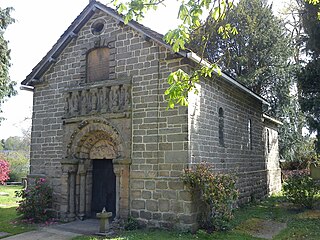
Thornbury is a market town and civil parish in the South Gloucestershire unitary authority area of England, about 12 miles north of Bristol. It had a population of 12,063 at the 2011 Census. This was put at 12,459 in 2019. Thornbury is a Britain in Bloom award-winning town, with its own competition: Thornbury in Bloom. The earliest documentary evidence of a village at "Thornbyrig" dates from the end of the 9th century. Domesday Book noted a manor of "Turneberie" belonging to William the Conqueror's consort, Matilda of Flanders, with 104 residents.

Bollington is a town and civil parish in Cheshire, England, to the east of Prestbury. In the Middle Ages, it was part of the Earl of Chester's manor of Macclesfield and the ancient parish of Prestbury. In 2011, it had a population of 8,310.

Macclesfield is a market town and civil parish in the unitary authority of Cheshire East in Cheshire, England. It is located on the River Bollin in the east of the county, on the edge of the Cheshire Plain, with Macclesfield Forest to its east; it is 16 miles (26 km) south of Manchester and 38 miles (61 km) east of Chester.

Bramhall is a suburban area in the Metropolitan Borough of Stockport, Greater Manchester, England. Historically in Cheshire, it had a population of 17,436 at the 2011 Census.

Meanwood is a suburb and former village in north-west Leeds, West Yorkshire, England.

Marple is a town in the Metropolitan Borough of Stockport, Greater Manchester, England. It is on the River Goyt, 9 miles (14 km) south-east of Manchester, 9 miles (14 km) north of Macclesfield and 4 miles (6 km) south-east of Stockport. In 2011, it had a population of 23,686.

Coolock is a large suburban area, centred on a village, on Dublin city's Northside in Ireland. Coolock is crossed by the Santry River, a prominent feature in the middle of the district, with a linear park and ponds. The Coolock suburban area encompasses parts of three Dublin postal districts: Dublin 5, Dublin 13 and Dublin 17.

Poynton is a town in Cheshire, England, on the easternmost fringe of the Cheshire Plain. It is 11 miles (18 km) south-east of Manchester, 7 miles (11 km) north of Macclesfield and 5 miles (8 km) south of Stockport. Poynton has formed part of the Cheshire East unitary authority since the abolition of the Borough of Macclesfield in 2009.

Northenden is a suburb of Manchester, England, with a population of 14,771 at the 2011 census. It lies on the south side of the River Mersey, 4.2 miles (6.8 km) west of Stockport and 5.2 miles (8.4 km) south of Manchester city centre, bounded by Didsbury to the north, Gatley to the east, and Wythenshawe to the south and west.

Pendlebury is a town in the City of Salford, Greater Manchester, England. The population at the 2011 Census was 13,069. It lies 4.1 miles (6.6 km) northwest of Manchester city centre, 3.4 miles (5.5 km) northwest of Salford, and 5.9 miles (9.5 km) southeast of Bolton.

Oughtibridge is a residential village in the north of Sheffield within the bounds of Bradfield civil parish. The village stands 5 miles (8 km) north-west of the city centre in the valley of the River Don. The population of the village has increased significantly in recent years due to much private housing development and stood at 3,542 in 2006 over an area of 355 hectares. The population of Oughtibridge increased to 3,584 in 2011.
The London Borough of Bexley owns and maintains over 100 parks and open spaces within its boundaries, with a total of 638 hectares. They include small gardens, river and woodland areas, and large parks with many sporting and other facilities.

Prestbury is a village and civil parish in Cheshire, England, about 1.5 miles (3 km) north of Macclesfield. At the 2001 census, it had a population of 3,324; it increased slightly to 3,471 at the 2011 census. Alongside fellow "Cheshire Golden Triangle" villages, Wilmslow and Alderley Edge, it is one of the more sought-after places in the north. The ecclesiastical parish is almost the same as the former Prestbury local government ward which consisted of the civil parishes of Prestbury, Adlington and Mottram St Andrew.
Kingshurst is a post-war housing estate and civil parish in the Metropolitan Borough of Solihull, in the West Midlands. It lies about 9 miles (14 km) east of Birmingham city centre. The Smith's Wood area of Solihull borders it to the north and east, Fordbridge to the south and the Shard End area of Birmingham to the west.

Bowdon is a suburb and electoral ward in the Metropolitan Borough of Trafford, Greater Manchester, England.

Burnside is a mostly residential area in the town of Rutherglen in South Lanarkshire, Scotland. Including the neighbourhoods of High Burnside and High Crosshill, respectively south and north-west of its main street, it borders Overtoun Park in Rutherglen plus several other residential areas of the town, as well as western parts of neighbouring Cambuslang.
Brandlesholme is a suburb north of Bury in Greater Manchester, England, half-way between Bury town centre and Ramsbottom.
Putnoe is an electoral ward on the northern side of Bedford, England.
Redditch is a town and local government district in north-east Worcestershire, England. The town is divided into separate districts. All street-name signs in Redditch have the street name in white lettering on a blue background and the district name in black lettering on a white background at the bottom of the sign. In the New Town areas the roads are usually named in alphabetical order and house numbering in the cul-de-sac closes is consecutive, starting with number 1 as the first house on the left as you enter, and the highest house number will be on the opposite side of the road as you leave.
Weston Coyney is a suburb of the City of Stoke-on-Trent in Staffordshire. It lies on the south eastern edge of the city and borders the neighbouring Staffordshire Moorlands district.


