WAFLEX is a spreadsheet-based model. It can be used to analyse upstream-downstream interactions, dam management options and water allocation and development options.
WAFLEX is a spreadsheet-based model. It can be used to analyse upstream-downstream interactions, dam management options and water allocation and development options.
WAFLEX is set up as a network, where each cell is river reach, demand node or reservoir. Each cell contains a simple formula to add water flowing into it from adjacent cells, and to subtract any demand connected to that cell. The network is set up twice, in demand mode and in supply mode. [1]
The inputs to WAFLEX are:
The outputs of WAFLEX are:
Code can be readily added to generate the above outputs graphically.
WAFLEX has been applied extensively, especially in southern Africa and South America, including for:

Hydrology is the scientific study of the movement, distribution, and management of water on Earth and other planets, including the water cycle, water resources, and drainage basin sustainability. A practitioner of hydrology is called a hydrologist. Hydrologists are scientists studying earth or environmental science, civil or environmental engineering, and physical geography. Using various analytical methods and scientific techniques, they collect and analyze data to help solve water related problems such as environmental preservation, natural disasters, and water management.

An aquifer is an underground layer of water-bearing, permeable rock, rock fractures, or unconsolidated materials. Groundwater from aquifers can be extracted using a water well. Aquifers vary greatly in their characteristics. The study of water flow in aquifers and the characterization of aquifers is called hydrogeology. Related terms include aquitard, which is a bed of low permeability along an aquifer, and aquiclude, which is a solid, impermeable area underlying or overlying an aquifer, the pressure of which could create a confined aquifer. The classification of aquifers is as follows: Saturated versus unsaturated; aquifers versus aquitards; confined versus unconfined; isotropic versus anisotropic; porous, karst, or fractured; transboundary aquifer.
The Delft University of Technology is the oldest and largest Dutch public technical university, located in Delft, Netherlands. As of 2022 it is ranked by QS World University Rankings among the top 10 engineering and technology universities in the world. In the fields of architecture and civil engineering, it was ranked 2nd in the world, after MIT.
The virtual water trade is the hidden flow of water in food or other commodities that are traded from one place to another. The virtual water trade is the idea that when goods and services are exchanged, so is virtual water. Virtual water trade allows a new, amplified perspective on water problems: In the framewond balancing different perspectives, basic conditions, and interests. Analytically, the concept enables one to distinguish between global, regional, and local levels and their linkages. However, the use of virtual water estimates may offer no guidance for policymakers seeking to ensure that environmental objectives are being met.
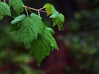
Interception refers to precipitation that does not reach the soil, but is instead intercepted by the leaves, branches of plants and the forest floor. It occurs in the canopy, and in the forest floor or litter layer. Because of evaporation, interception of liquid water generally leads to loss of that precipitation for the drainage basin, except for cases such as fog interception, but increase flood protection dramatically, Alila et al., (2009).
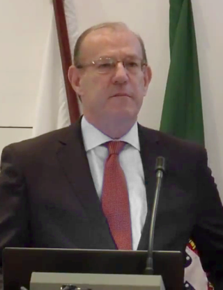
António Pedro Nobre Carmona Rodrigues, grand-nephew of Óscar Carmona, is a university professor and a Portuguese politician. He was mayor of Lisbon, and Minister of Public Works, Transportation and Habitation and the Minister of Cities in the 15th Constitutional Government of Portugal.
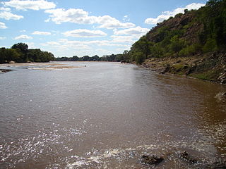
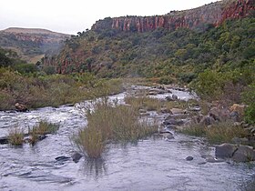
The Mzingwane River, formerly known Umzingwane River as or Umzingwani River is a major left-bank tributary of the Limpopo River in Zimbabwe. It rises near Fort Usher, Matobo District, south of Bulawayo and flows into the Limpopo River near Beitbridge, downstream of the mouth of the Shashe River and upstream of the mouth of the Bubye River.

The Shashe River is a major left-bank tributary of the Limpopo River in Zimbabwe. It rises northwest of Francistown, Botswana and flows into the Limpopo River where Botswana, Zimbabwe and South Africa meet. The confluence is at the site of the Greater Mapungubwe Transfrontier Conservation Area.

The Mwenezi River, originally known as the Nuanetsi River, is a major tributary of the Limpopo River. The Mwenezi River starts up in south central Zimbabwe and flows south-east along what is known as the Mwenezi River Valley that bisects the district into two sectors. The river is found in both Zimbabwe and Mozambique. In Zimbabwe it has been known as the Nuanetsi or Nuanetzi River in the past, a name it retains in Mozambique.

Water conflict is a term describing a conflict between countries, states, or groups over the rights to access water resources. The United Nations recognizes that water disputes result from opposing interests of water users, public or private. A wide range of water conflicts appear throughout history, though rarely are traditional wars waged over water alone. Instead, water has long been a source of tension and one of the causes for conflicts. Water conflicts arise for several reasons, including territorial disputes, a fight for resources, and strategic advantage.

The Thuli River, former name Tuli River, is a major tributary of the Shashe River in Zimbabwe. It rises near Matopo Mission, Matobo District, and flows into the Shashe River near Tuli village.
WEAP is a model-building tool for water resource planning and policy analysis that is distributed at no charge to non-profit, academic, and governmental organizations in developing countries.

The Umchabezi River is a tributary of the Mzingwane River in Beitbridge District and Gwanda District, Zimbabwe. The main dam on the river is Makado Dam, which supplies water for commercial irrigation.
The following outline is provided as an overview of and topical guide to hydrology:
The Surface Energy Balance Algorithm for Land (SEBAL) uses the '''surface''' energy balance to estimate aspects of the hydrological cycle. SEBAL maps evapotranspiration, biomass growth, water deficit and soil moisture. Its main creator is Prof. Dr. W.G.M. Bastiaanssen
John Anthony Allan, sometime cited as Tony Allan, was a British geographer. He was awarded the Stockholm Water Prize in 2008 for his revolutionary virtual water concept. Although being an emeritus of the School of Oriental and African Studies and King's College London of the University of London, he still acted as a teaching Professor at King's College London.

Murugesu Sivapalan is an Australian-American engineer and hydrologist of Sri Lankan Tamil origin and a world leader in the area of catchment hydrology. He is currently the Chester and Helen Siess Endowed Professor of Civil and Environmental Engineering, and professor of Geography & Geographic Information Science, at the University of Illinois, Urbana-Champaign. Sivapalan is widely recognized for his fundamental research on scale issues in hydrological modeling, his leadership of global initiatives aimed at hydrologic predictions in ungauged basins, and for his role in launching the new sub-field of socio-hydrology.
Melesse Temesgen is an Ethiopian agricultural engineer, hydrologist and businessman. He was born on 7 July 1964 in Gojjam, Ethiopia. He is the CEO of Aybar Engineering PLC.
Rashid Mekki Hassan is the Professor and Director at the Centre for Environmental Economics and Policy in Africa (CEEPA) at the University of Pretoria. He specialises in natural resource and environmental economics, agricultural economics, and optimisation and modelling of economic systems.
The Geneva Water Hub is a water research and policy institute headquartered in Geneva, Switzerland. Established by the Swiss Confederation and the University of Geneva it focuses on hydro-diplomacy to prevent and resolve water-related conflicts, conducts water related research, runs education courses and is a think-tank on global water governance and its challenges.