Pratapgarh, also called Belha or Bela Pratapgarh, is a town and municipality in the state of Uttar Pradesh in India. It is the administrative headquarters of Pratapgarh district, part of the Prayagraj division.

Raisen District is a district of Madhya Pradesh state of India. The town of Raisen is the district headquarters. The district is part of Bhopal Division. Sanchi University of Buddhist-Indic Studies is the first international university located at Sanchi Town.

Sheopur District is a district of Madhya Pradesh state in central India. The district is located in the north of the state and forms part of Chambal division. It is situated on the periphery of Rajasthan, which shows in the influence of Rajasthani culture in this district.

Chhatarpur District is a district of Madhya Pradesh state of central India. The town of Chhatarpur is the district headquarters.

Bhadohi district is a district of Uttar Pradesh state in northern India. It is also referred to as Sant Ravidas Nagar. It is the smallest district by area in the state of Uttar Pradesh which was created on June 30, 1994 by dividing western part of the district Varanasi. It is surrounded by Varanasi district on east, Allahabad on west, Jaunpur north and Mirzapur district in south. The state capital Lucknow is distanced at 234 KM from Bhadohi. Its district headquarters is situated in the city of Gyanpur. The district is popularly known for carpet weaving as it is one of largest centres of Carpet Industries in India and therefore it also known as the 'Carpet City of India'. Carpets of Bhadohi have 'Geographical Indication' tag attached to it. Bhadohi has huge geographical significance and position attached to it due to its location between two culturally important and rich heritage cities of Prayagraj and Varanasi.

Guna district is one of the 52 districts of Madhya Pradesh in central India. Its administrative headquarters is Guna. The district has a population of 1,241,519. It has an area of 6390 km², and is bounded on the northeast by Shivpuri District, on the east by Ashoknagar District, on the southeast by Vidisha District, on the southwest by Rajgarh District, on the west and northwest by Jhalawar and Baran districts of Rajasthan state. The Sindh River flows northward along the eastern edge of the district, forming part of the boundary with Ashoknagar District, and the Parvati River flows northwestward through the southern portion of the district, forming part of the boundary with Baran District before flowing into Rajasthan.

Tikamgarh district is one of the 52 districts of Madhya Pradesh state in central India. Tikamgarh town is the district headquarters. The district is part of Sagar Division.

Ujjain district is a district of Madhya Pradesh state in central India. The historic city of Ujjain is the district headquarters. The district has an area of 6,091 km2, and a population of 19,86,864, a 16.12% increase from its 2001 population of 17,10,982.

The Indore District is a district of Madhya Pradesh state in central India. It is believed that the city is named after its Indreshwar Mahadev Temple, Where Indra is the presiding deity. The Gupta inscriptions name Indore as "Indrapura". It is also called the administrative capital. This district forms part of the Indore Division.

Shivpuri District is a district of Madhya Pradesh state of India. The town of Shivpuri is the district headquarters. National Highway 3 (NH-3) runs through the district.

Sehore District is a district of Madhya Pradesh state in central India. The town of Sehore is the district headquarters. The district is part of Bhopal Division.
Karauli District is a district of the state of Rajasthan in western India. It is located in the Braj Bhoomi region. The town of Karauli serves as the administrative headquarters of the district. Karauli district also comes under the Bharatpur Divisional Commissionerate.
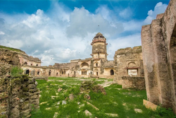
Bhanpura is a town and a nagar panchayat in Mandsaur district, located in the state of Madhya Pradesh, India. Bhanpura was discovered by King Bhanu bhil. It was also ruled by the Chandrawats of Mewar during the times of Rana Sanga's rule. The town is home to a number of historic places such as the Daraki-Chattan region, which is one of the world's oldest rock arts, Chaturbhujnath Nala rock art shelters, and the Hinglajgarh Fort. Bhanpura also has a museum that displays the popular arts of Mandsaur, including art from the Gupta era until the time of Pratiharas and Parmaras.
Mundi is a city and Tehsil in the Khandwa district of Nimar region the Indian state of Madhya Pradesh. It is situated in North Side of East Nimar District.

Rehli is a city and a municipality in Sagar district in the Indian state of Madhya Pradesh. it's also a tehsil headquarter.
Sabalgarh is a municipality in Morena district in the Indian state of Madhya Pradesh.

Gohad Fort is situated at Gohad city in Bhind district of Madhya Pradesh, India. The town is situated at a distance of 45 km from Gwalior. The fort was built in 1505 by Bamraulia Jat ruler Singhandev II of Gohad State.

Singrauli district is one of the districts in the Indian state of Madhya Pradesh.
Alampur is a town and a nagar panchayat in Bhind district in the Indian state of Madhya Pradesh. Alampur is known for its history, for the chhatri of Malhar Rao Holkar which is in Alampur.
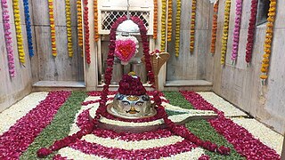
Vankhandeshwar Mahadev Mandir is a Hindu temple dedicated to Hindu deity Shiva located on the banks of Gauri Lake in Bhind, Madhya Pradesh, India.