Banda district is a district of Uttar Pradesh state of India, and Banda is the district headquarters. It is a part of Chitrakoot Division.

Betul district is a district of Madhya Pradesh state in central India. The city of Betul serves as its administrative headquarters. The district is a part of Narmadapuram Division.

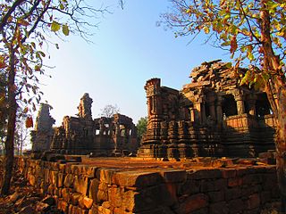
Raisen District is a district of Madhya Pradesh state of India. The town of Raisen is the district headquarters. The district is part of Bhopal Division. Sanchi University of Buddhist-Indic Studies is the first international university located at Sanchi Town.

Sheopur District is a district of Madhya Pradesh state in central India. The district is located in the north of the state and forms part of Chambal division. It is situated on the periphery of Rajasthan, which shows in the influence of Rajasthani culture in this district.

Bhind district is a district in the Chambal division of the Indian state of Madhya Pradesh. The town of Bhind is the district headquarters.Bhind District is situated in Chambal region in the northwest of the state. It is surrounded by Agra, Etawah, Jalaun and Jhansi districts of Uttar Pradesh state to the north and the east, and the Madhya Pradesh districts of Datia to the south, Gwalior to the southwest, and Morena to the west. The geography of the district is characterised by uneven ravines, plain fertile fields and scanty forests. The total area of the district is 4,459 km2 (1,722 sq mi).
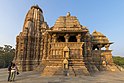
Panna district is a district of the Sagar Division, within the Madhya Pradesh state in central India. The town of Panna is the district headquarters.
Umaria district is a district of Madhya Pradesh. The town of Umaria is the district headquarters. The district is part of Shahdol Division.

Balaghat district is a district of Madhya Pradesh state in Central India.

Dindori District, formerly known as Ramgarh District, is a district of Madhya Pradesh state of central India. The town of Dindori is the district headquarters. The district is part of Jabalpur Division. Total area of the district is 6,128 km2 (2,366 sq mi). It is located on the eastern part of Madhya Pradesh, bordering the state of Chhattisgarh. It is surrounded by Anuppur district to the northeast, Umaria district to the north, Jabalpur district to the west, Mandla district to the southwest and Mungeli and Kabirdham districts of Chhattisgarh to the south.

Katni District, also known as Murwara District, is one of the 55 districts of Madhya Pradesh state in central India. The town of Katni (Murwara) is the District headquarters. The District is part of Jabalpur Division. The District occupies an area of 4949.59 km².

Mandla District is a district of Madhya Pradesh in central India. The town of Mandla is the administrative headquarters of the district. It is part of Jabalpur Division.

Sagar district is a district of Madhya Pradesh state in central India. The town of Sagar serves as its administrative center.

Barwani district is one of the districts of Madhya Pradesh state of India. The administrative headquarters of the district is at Barwani. Barwani district has an area of 5,427 km² and a population 1,385,881. The district lies in the southwestern corner of Madhya Pradesh; the Narmada River forms its northern boundary. The Satpura Range lies to its south. The district is bordered by Maharashtra state to the south, Gujarat state to the west, Dhar District to the north and Khargone District to the east.

Tikamgarh district is one of the 52 districts of Madhya Pradesh state in central India. Tikamgarh town is the district headquarters. The district is part of Sagar Division.

Damoh District is a district of Madhya Pradesh state in central India. The town of Damoh is the district headquarters. The district is part of the Sagar Division.

Lalitpur is one of the 75 districts in the northern Indian state of Uttar Pradesh. Lalitpur district is a part of Jhansi Division. Lalitpur is the main town and administrative headquarters. The district occupies an area of 5,039 km2.

Vidisha District (विदिशा) is in Madhya Pradesh state, in central India. The city of Vidisha is the administrative headquarters of the district.

Shivpuri District is a district of Madhya Pradesh state of India. The town of Shivpuri is the district headquarters. National Highway 3 (NH-3) runs through the district.

Banswara District has an area of 5,037 km2 (1,945 sq mi), which is 1.47% of Rajasthan state, India. The city of Banswara is the district headquarters. It is bounded on the north by Udaipur District, on the northeast by Pratapgarh District, on the east and southeast by Madhya Pradesh state, on the southwest by Gujarat state, and on the west by Dungarpur District.
Satna District is a district of Madhya Pradesh state in central India. The city of Satna is the district headquarters. The district has an area of 7,502 km², and a population of 22,28,935(2011 census), 20.63% of which is urban. The district has a population density of 249 persons per km².