
Darke County is a county in the U.S. state of Ohio. As of the 2010 census, the population was 52,959. Its county seat is Greenville. The county was created in 1809 and later organized in 1817. It is named for William Darke, an officer in the American Revolutionary War. Darke County comprises the Greenville, OH Micropolitan Statistical Area, which is also included in the Dayton-Springfield-Sidney, OH Combined Statistical Area.

Greenville is a city in and the county seat of Darke County, Ohio, United States, located near the western edge of Ohio about 33 miles northwest of Dayton. The population was 13,227 at the 2010 census.

Adams Township is one of the twenty townships of Darke County, Ohio, United States. The 2010 census found 3,441 people in the township, 2,163 of whom lived in the unincorporated portions of the township.
The Benham Mound is a Native American mound in the southwestern part of the U.S. state of Ohio. Located in modern Amberley Village in Hamilton County, the mound is an archaeological site.

Price's Mill, also known as Calliham's (Callaham's) Mill, Stone's Mill, and Park's Mill, is a water-powered gristmill about 2 mi (3 km) east of the town of Parksville on South Carolina Highway 33-138 at Stevens Creek in McCormick County. Its name in the USGS Geographic Names Information System is Prices Mill. It was built in the 1890s and was named to the National Register of Historic Places on November 22, 1972. At this time, it was one of the few remaining water-powered gristmills in South Carolina.

Holy Family Catholic Church is a historic Roman Catholic church in Wayne Township, Darke County, Ohio, United States. Located in the unincorporated community of Frenchtown, it houses an active congregation, and it has been accorded historic site status because of its well-preserved Gothic Revival architecture.
Frenchtown is an unincorporated community in Wayne Township, Darke County, Ohio, United States. The community lies at the intersection of State Route 185 with Burns and Mangen Roads, approximately 2 miles (3.2 km) northwest of the village of Versailles. Its elevation is 1,027 feet (313 m).

St. Louis Catholic Church is a historic Roman Catholic church in North Star, Ohio, United States. Constructed in the early twentieth century, it is one of the newest churches in a heavily Catholic region of far western Ohio, but it has been recognized as a historic site because of its unique architecture.

St. Nicholas Catholic Church is a historic Roman Catholic church in Osgood, Ohio, United States. Built in the first years of the 20th century, it houses one of the newest parishes in a heavily Catholic region of far western Ohio, but it has been recognized as a historic site for its architecture.

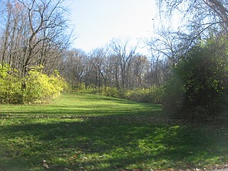
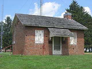
Fort Jefferson was a fortification erected by soldiers of the United States Army in Oct. 1791 during the Northwest Indian War. Built to support a military campaign, it saw several years of active fighting. Today, the fort site is a historic site.

The Benjamin Franklin Coppess House, built in 1882, is a historic Queen Anne and Stick-Eastlake style house located at 209 Washington Street in Greenville, Ohio, United States.

The Donovan Robeson House is a historic house in Greenville, Ohio, United States. Located along Fourth Street west of downtown, the Robeson House has been ranked as the city's most significant Queen Anne mansion.
The Studabaker-Scott House and Beehive School are two historic buildings near the city of Greenville in Darke County, Ohio, United States. Located along State Route 49 south of the city, both are unusually well-preserved remnants of the architecture of the middle third of the nineteenth century.

The Eakin Mill Covered Bridge is a historic covered bridge in Vinton County, Ohio, United States. Located southeast of the county seat of McArthur, this bridge carries Mound Hill Road near the community of Arbaugh.

The Greenville Mausoleum is an imposing Egyptian Revival structure in Greenville, Ohio, United States. Built in 1913, this historic mausoleum is built of concrete covered with courses of limestone, resting on a foundation of granite and covered with a roof of ceramic tiles. Among its most distinctive elements are the marble pillars, topped with capitals of the Doric order, that line the main entrance. The main portion of the interior, built in a basilican style with multiple aisles, contains approximately four hundred concrete and marble crypts, and the building's wings house individual family crypts. It is lit by twelve clerestory windows under the roofline.

The James and Sophia Clemens Farmstead is a historic farm in far western Darke County, Ohio, United States. It is situated at 467 Stingley Road, little more than 1 mile (1.6 km) from the Indiana border, it is among the oldest extant buildings that remain from a small community of free blacks founded before the Civil War.

The Old Enon Road Stone Arch Culvert is a historic limestone bridge in southern Clark County, Ohio, United States. It carries Rocky Point Road over Mud Run, a tributary of the Mad River, just west of its intersection with Old Mill Road. Located approximately 3.5 miles (5.6 km) east of Enon in eastern Mad River Township, it was constructed under the leadership of stonemason Samuel Taylor in 1871. In the past, the region was dotten with stone culverts, which were built in the nineteenth and early twentieth centuries to carry roads over small watercourses. Today, few stone culverts survive in Ohio; the Old Enon Road culvert is both Clark County's only such bridge in daily use and the oldest bridge of any type still open to daily traffic throughout the county.

The Jonathan Sprague House is a historic residence in northwestern Washington County, Ohio, United States. Located atop a bluff above the Muskingum River, it is one of Washington County's most significant houses, due to its age and method of construction.

Gaston's Mill-Lock No. 36, Sandy and Beaver Canal District, is a historic district listed in the National Register of Historic Places. The district is located within Beaver Creek State Park, approximately 1 mile south of Clarkson, Ohio. Gaston's Mill was constructed in 1837 and was powered by Little Beaver Creek. Lock 36 was one of 90 locks on the Sandy and Beaver Canal. Construction of this canal began in 1834 but was not completed until 1848.
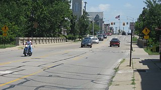
The Broadway Bridge is a historic arch bridge that spans Greenville Creek on the edge of downtown Greenville, a city in the far western part of the U.S. state of Ohio. Constructed in the early twentieth century, it carries one of the city's most important streets and connects the city's northern and southern sections. One of several large concrete bridges designed by a Cleveland engineer, it has been named a historic site.


