Related Research Articles
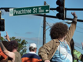
Peachtree Street is one of several major streets running through the city of Atlanta. Beginning at Five Points in downtown Atlanta, it runs North through Midtown; a few blocks after entering into Buckhead, the name changes to Peachtree Road at Deering Road. Much of the city's historic and noteworthy architecture is located along the street, and it is often used for annual parades,, as well as one-time parades celebrating events such as the 100th anniversary of Coca-Cola in 1986 and the Atlanta Braves' 1995 and 2021 World Series victories.

The Battle of Peachtree Creek was fought in Georgia on July 20, 1864, as part of the Atlanta Campaign in the American Civil War. It was the first major attack by Lt. Gen. John Bell Hood since taking command of the Confederate Army of Tennessee. The attack was against Maj. Gen. William T. Sherman's Union army, which was perched on the doorstep of Atlanta. The main armies in the conflict were the Union Army of the Cumberland, commanded by Maj. Gen. George Henry Thomas and two corps of the Confederate Army of Tennessee.
Standing Peachtree was a Muscogee village and the closest Indian settlement to what is now the Buckhead area of Atlanta, Georgia. It was located where Peachtree Creek flows into the Chattahoochee River, in today's Paces neighborhood. It was located in the borderlands of the Cherokee and Muscogee nations. It is referred to in several documents dating as far back as 1762.
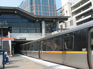
The Atlanta BeltLine is a 22 miles (35 km) open and planned loop of multi-use trail and light rail transit system on a former railway corridor around the core of Atlanta, Georgia. The Atlanta BeltLine is designed to reconnect neighborhoods and communities historically divided and marginalized by infrastructure, improve transportation, add green space, promote redevelopment, create and preserve affordable housing, and showcase arts and culture. The project is in varying stages of development, with several mainline and spur trails complete and others in an unpaved, but hikeable, state. Since the passage of the More MARTA sales tax in 2016, construction of the light rail streetcar system is overseen by MARTA in close partnership with Atlanta BeltLine, Inc.

Peachtree Creek is a major stream in Atlanta. It flows for 7.5 miles (12.1 km) almost due west into the Chattahoochee River just south of Vinings.

Brookhaven is a city in the northeastern suburbs of Atlanta that is located in western DeKalb County, Georgia, United States, directly northeast of Atlanta. On July 31, 2012, Brookhaven was approved in a referendum to become DeKalb County's 11th city. Incorporation officially took place on December 17, 2012, on which date municipal operations commenced. With a population of around 55,366 as of 2021, it is the largest city in DeKalb County. The new city stretches over 12 square miles (31 km2).
Loring Heights is a neighborhood of just over 300 homes located in south Buckhead neighborhood of Atlanta, nestled between Peachtree Street, on the east, Northside Drive on the west, and Atlantic Station to the south. Like most of Buckhead, Loring Heights is part of City Council District 8 and is currently represented by Mary Norwood. The neighborhood provides relatively easy access to I-75/85, GA 400, and I-285.

Brookwood Hills is a historic neighborhood located in intown Atlanta, Georgia, United States, north of Midtown and south-southwest of Buckhead. Home to about 1000 people, it was founded in the early 1920s by Benjamin Franklin Burdett and his son, Arthur. The site of the neighborhood is located where some of the bloodiest battles of the American Civil War took place during the Atlanta Campaign.

Clear Creek is a stream in northeast Atlanta that is a tributary to Peachtree Creek and part of the Chattahoochee River watershed. It has two main branches, one originating east of the high ground along which Boulevard runs and another to the west originating on the northeast side of downtown Atlanta. The easterly branch of Clear Creek begins in several springs and branches in what are now Inman Park and the Old Fourth Ward. Flowing north, the creek was joined by other branches and springs, including Angier Springs near the end of Belgrade Avenue and the so-called Ponce de Leon Springs, which were “discovered” during railroad construction in the 1860s and gave rise to the eponymous park and avenue.

Ponce de Leon Avenue, often simply called Ponce, provides a link between Atlanta, Decatur, Clarkston, and Stone Mountain, Georgia. It was named for Ponce de Leon Springs, in turn from explorer Juan Ponce de León, but is not pronounced as in Spanish. Several grand and historic buildings are located on the avenue.

Collier Hills is a residential neighborhood in Atlanta, Georgia. The area gets its name from the family whose homestead was broadly located in the southwest corner of the intersection of Peachtree St. and Collier Rd. Andrew Jackson Collier, a member of this family and early pioneer of the area, operated an antebellum grist mill off Tanyard Creek, near Collier Rd.
Paces is a neighborhood of Atlanta, US. It is part of the Buckhead district and located in the far northwest corner of the city. Paces is bounded on the northwest by the Chattahoochee River, which is also the Cobb/Fulton county line. Just across the river in Cobb is the unincorporated community of Vinings, which was originally known as Paces after founder Hardy Pace, who operated Pace's Ferry. Cumberland is also located on the other side of the river. It is perhaps Atlanta's most affluent neighborhood, with many houses selling in the US$5–$7 million range, and some for more than $20 million.

Pine Hills is a neighborhood of Atlanta, Georgia and also part of the Buckhead Community, located in north east Atlanta on the eastern part of Buckhead. Many homes in Pine Hills are also located in Brookhaven, GA. It is roughly bounded by Buford Highway to the south, the railway to the north, Lenox Road to the west, and East Roxboro Road to the east. The western and central section of Pine Hills is in Fulton County and a smaller section to the east is in Dekalb County, east of a north-south line that roughly passes through the intersection of East Roxboro Road and West Roxboro Road. The area includes part of the 30324 and 30329 postal zip codes.
Lindridge/Martin Manor is an intown neighborhood of Atlanta, Georgia. It consists mostly of the single-family homes located off Lindbergh Drive in between I-85 and Cheshire Bridge Road. In addition, it includes a small commercial area of three streets west of I-85 bounded by Peachtree Creek, Piedmont Road and the Southern railroad. The neighborhood's boundaries are I-85 on the northwest, Morningside-Lenox Park on the south, and North Druid Hills in unincorporated DeKalb County, Georgia on the east.
Lenox Park is a neighborhood of homes and office buildings located primarily within the city of Brookhaven, Georgia, just east of the northern border of the city of Atlanta.
Lindbergh, officially Lindbergh/Morosgo, is a neighborhood in the Buckhead district of Atlanta, Georgia. Most of the neighborhood consists of multi-use development combining retail, office and residential space.
Peachtree Hills is a neighborhood within the Buckhead district of Atlanta, Georgia. It primarily contains residential buildings, however, commercial buildings are scattered throughout the neighborhood. Peachtree Battle Shopping Center is located within the borders of Peachtree Hills.
Tanyard Creek Park is a 14.5-acre (5.9 ha) park in the Buckhead area of Atlanta. It is located along Tanyard Creek between Collier Road on the north and BeltLine rail corridor to the south. The neighborhood of Collier Hills borders it on the west and Collier Hills North on the east.

Ardmore, sometimes called "Ardmore Park" for the city park of the same name within the neighborhood, is a neighborhood in the extreme south Buckhead area of Atlanta, between Peachtree Road, on the east, railroad tracks and the Atlanta BeltLine on the west, Collier Road to the north and Brookwood to the south. Though distinct from Brookwood and Collier Hills, the neighborhoods are often linked as they share a border and location along Collier Road and Peachtree Street/Road just north of Midtown.
References
- ↑ City of Atlanta, NPU E Map Archived December 14, 2010, at the Wayback Machine
| Topics |  | |
|---|---|---|
| Education | ||
| Government |
| |
| Sports | ||
| Related | ||