Related Research Articles

Dunwoody is a city located in DeKalb County, Georgia, United States. As a northern suburb of Atlanta, Dunwoody is part of the Atlanta metropolitan area. It was incorporated as a city on December 1, 2008 but its area establishment dates back to the early 1830s. As of 2019, the city has a population of 49,356, up from 46,267 in the 2010 census.

Poncey–Highland is an intown neighborhood on the east side of Atlanta, Georgia, located south of Virginia–Highland. It is so named because it is near the intersection of east/west Ponce de Leon Avenue and north/southwest North Highland Avenue. This Atlanta neighborhood was established between 1905 and 1930, and is bordered by Druid Hills and Candler Park across Moreland Avenue to the east, the Old Fourth Ward across the BeltLine Eastside Trail to the west, Inman Park across the eastern branch of Freedom Parkway to the south, and Virginia Highland to the north across Ponce de Leon Avenue. The Little Five Points area sits on the border of Poncey–Highland, Inman Park, and Candler Park.

Ernest W. Barrett Parkway is a major thoroughfare in the northwestern part of the Atlanta metropolitan area, in the north-central part of Cobb County, in the U.S. state of Georgia. It travels from the southeastern edge of Kennesaw to a point north of Marietta, and continues on in both directions under other names. The portion of Barrett Parkway between Interstate 575 (I-575/SR 5) and US 41/SR 3 is designated State Route 5 Connector. The road is named after Ernest W. Barrett, the first chairman of the Cobb County Board of Commissioners in the 1960s, after home rule was enacted under a Georgia State Constitution amendment. The initial portion was constructed through Barrett family land, enabling it to be later sold for major development.

Brookhaven is a city in the northeastern suburbs of Atlanta that is located in western DeKalb County, Georgia, United States, directly northeast of Atlanta. On July 31, 2012, Brookhaven was approved in a referendum to become DeKalb County's 11th city. Incorporation officially took place on December 17, 2012, on which date municipal operations commenced. With a population of around 55,366 as of 2021, it is the largest city in DeKalb County. The new city stretches over 12 square miles (31 km2).

Sylvan Hills is a historic intown neighborhood in southwest Atlanta, Georgia, United States.

Freedom Park is one of the largest city parks in Atlanta, Georgia, United States. The park forms a cross shape with the axes crossing at the Carter Center. The park stretches west-east from Parkway Drive, just west of Boulevard, to the intersection with the north-south BeltLine Eastside Trail, to Candler Park, and north-south from Ponce de Leon Avenue to the Inman Park/Reynoldstown MARTA station.

Capitol View Manor is a small community in Southwest Atlanta that was named for the excellent view of the Georgia State Capitol building. Its boundaries include I-75/85 to the east, the Beltline to the north, Metropolitan Parkway to the west, and Atlanta Technical College to the south.

Ponce de Leon Avenue, often simply called Ponce, provides a link between Atlanta, Decatur, Clarkston, and Stone Mountain, Georgia. It was named for Ponce de Leon Springs, in turn from explorer Juan Ponce de León, but is not pronounced as in Spanish. Several grand and historic buildings are located on the avenue.

Perimeter Mall is a shopping mall in Perimeter Center, Dunwoody, Georgia, a suburb of Atlanta, near the interchange of Interstate 285 and Georgia State Route 400. It is the second-largest shopping mall in the state of Georgia, the largest being the Mall of Georgia in Buford, Georgia. The mall features Macy's, Dillard's, Von Maur, and Nordstrom.

Greenbriar Mall is a shopping mall in the Greenbriar neighborhood of Atlanta, Georgia that opened in 1965. The anchor stores are Beauty Master, Dollar Tree, Greenbriar Furniture, and Citi Trends. There are 2 vacant anchor stores that were once Burlington and Fallas. It was home to the first Chick-fil-A location.

Capitol View is a historic in-town southwest Atlanta neighborhood 2.5 miles from downtown Atlanta, Georgia that was named for its view of the Georgia State Capitol building. Its boundaries include Metropolitan Parkway to the east, Lee Street to the west, and the Beltline to the north. On the south, the border follows Arden Street, Deckner Avenue, and Perkerson Park.
Riverside is an intown neighborhood located on the Upper Westside of Atlanta. It is so named because it is situated along the Chattahoochee River.
Paces is a neighborhood of Atlanta, US. It is part of the Buckhead district and located in the far northwest corner of the city. Paces is bounded on the northwest by the Chattahoochee River, which is also the Cobb/Fulton county line. Just across the river in Cobb is the unincorporated community of Vinings, which was originally known as Paces after founder Hardy Pace, who operated Pace's Ferry. Cumberland is also located on the other side of the river. It is perhaps Atlanta's most affluent neighborhood, with many houses selling in the US$5–$7 million range, and some for more than $20 million.

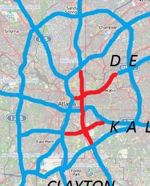
There have been multiple freeway revolts in Atlanta, Georgia. The longest and most famous examples of Interstate opposition were against I-485 and the Stone Mountain Freeway through Intown Atlanta, lasting over 30 years, from the early 1960s until the final construction of Freedom Parkway on a small portion of the contested routes in 1994.

Lindbergh, officially Lindbergh/Morosgo, is a neighborhood in the Buckhead district of Atlanta, Georgia. Most of the neighborhood consists of multi-use development combining retail, office and residential space.
Carey Park is a neighborhood on the Upper Westside of Atlanta with a population of 1,739.

Crossroads Shopping Center, better known by its name in its heyday, Stewart-Lakewood Center, is an open-air shopping center on Metropolitan Parkway at Langford Parkway in the Sylvan Hills neighborhood of southern Atlanta. It was built in 1962 by the same company and in the same style as Ansley Mall near Midtown Atlanta. It was considered a major regional retail center.

Krog Street Market is a 9-acre (3.6 ha) mixed-use development in Atlanta, located along the BeltLine trail at Edgewood Avenue in Inman Park which opened in Summer 2014. The complex is centered on a 12,000-square-foot (1,100 m2), west coast-style market and restaurants, and also includes up to 300 apartments. The marketplace has been planned to have four or five restaurants and merchants such as florists, cheesemakers, butchers, and bakers under one roof. It is to incorporate two existing parcels on either side of Krog Street: The Stove Works on the west side and the former Tyler Perry Studios at 99 Krog Street, on the east side. The conversion to Krog Street Market is to cost $70 million. The Stove Works is to remain unaltered. Illustrations in the plans show the existing bridge over Krog Street renovated as a pedestrian bridge and incorporated as part of the complex.

Ansley Mall is an open-air shopping mall in the Piedmont Heights neighborhood of Atlanta at 1544 Piedmont Avenue at the intersection of Monroe Drive near the Atlanta BeltLine trail.
Dixie Hills is a historic neighborhood of northwest Atlanta with a population of 1,756 (2010).
References
- ↑ "City of Atlanta NPU R Map" (PDF). Archived from the original (PDF) on 2010-11-29. Retrieved 2012-01-13.
- ↑ "U.S. Census 2000". Archived from the original on 2020-02-12. Retrieved 2012-01-13.
- ↑ City-data.com, "Greenbriar, Atlanta"
- ↑ ""Tyler Perry's Studio Opening Draws A-List Stars, Angry Protesters", WSB-TV, October 5, 2008". Archived from the original on May 4, 2012. Retrieved January 13, 2012.
