Related Research Articles

Buckhead is the uptown commercial and residential district of the city of Atlanta, Georgia, comprising approximately the northernmost fifth of the city. Buckhead is the third largest business district within the Atlanta city limits, behind Downtown and Midtown, and a major commercial and financial center of the Southeast.
The city of Atlanta, Georgia is made up of 243 neighborhoods officially defined by the city. These neighborhoods are a mix of traditional neighborhoods, subdivisions, or groups of subdivisions. The neighborhoods are grouped by the city planning department into 25 neighborhood planning units (NPUs). These NPUs are "citizen advisory councils that make recommendations to the Mayor and City Council on zoning, land use, and other planning issues". There are a variety of other widely recognized named areas within the city. Some are officially designated, while others are more informal.

Buckhead Village is a neighborhood of Atlanta, Georgia, one of 42 neighborhoods in the larger Buckhead district and the community's historic business section. The Village as defined by the city as the area between Piedmont Road, Peachtree Road, and Pharr Road.
From its incorporation in 1847, the municipal boundaries of Atlanta, Georgia, United States, were extended repeatedly from a small area around its railroad station to today's city covering 131.7 square miles (341 km2).

This is a list of official neighborhoods in Louisville, Kentucky. Like many older American cities, Louisville has well-defined neighborhoods, many with well over a century of history as a neighborhood.
Loring Heights is a neighborhood of just over 300 homes located in south Buckhead neighborhood of Atlanta, nestled between Peachtree Street, on the east, Northside Drive on the west, and Atlantic Station to the south. Like most of Buckhead, Loring Heights is part of City Council District 8 and is currently represented by Mary Norwood. The neighborhood provides relatively easy access to I-75/85, GA 400, and I-285.

Historic Brookhaven is a historic neighborhood, part of which lies in Atlanta's Buckhead Community, part of which lies in Sandy Springs, Georgia, and part of which lies in city of Brookhaven, Georgia, to which it lends its name. Capital City Club country club is at the center of the neighborhood, and it is surrounded by valuable homes, many of which were designed by a number of well-known Atlanta architects of the pre-war period. The neighborhood boundaries are well defined, and it stretches from Peachtree Dunwoody Road to the west, Windsor Parkway to the north, Mabry Drive to the east, and Peachtree Road to the south.
Hunter Hills is a neighborhood located west of downtown Atlanta, Georgia, United States. Its motto, "One Community, One Family", has been its cornerstone since 2001. The neighborhood is encompassed in the 30314 zip code. Hunter Hills shares borders with Mozley Park, Dixie Hills and West Lake neighborhoods. The neighborhood rests just inside Atlanta's perimeter highway I-285, and U.S. Route 78. The schools that serve the neighborhood are Stanton Elementary, Carter G. Woodson Elementary School, Ron Clark Academy, Herndon Elementary and Washington High School, and the Atlanta Job Corps. City of Refuge, a community-based 501(c)(3) non-profit, was established on the 1300 block of Joseph E. Boone Blvd. in 2003 and helps to bring transformation to individuals and families through services including housing, health and wellness, vocational training, and youth development.
Paces is a neighborhood of Atlanta, US. It is part of the Buckhead district and located in the far northwest corner of the city. Paces is bounded on the northwest by the Chattahoochee River, which is also the Cobb/Fulton county line. Just across the river in Cobb is the unincorporated community of Vinings, which was originally known as Paces after founder Hardy Pace, who operated Pace's Ferry. Cumberland is also located on the other side of the river. It is perhaps Atlanta's most affluent neighborhood, with many houses selling in the US$5–$7 million range, and some for more than $20 million.

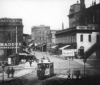
Streetcars originally operated in Atlanta downtown and into the surrounding areas from 1871 until the final line's closure in 1949.
Lindridge/Martin Manor is an intown neighborhood of Atlanta, Georgia. It consists mostly of the single-family homes located off Lindbergh Drive in between I-85 and Cheshire Bridge Road. In addition, it includes a small commercial area of three streets west of I-85 bounded by Peachtree Creek, Piedmont Road and the Southern railroad. The neighborhood's boundaries are I-85 on the northwest, Morningside-Lenox Park on the south, and North Druid Hills in unincorporated DeKalb County, Georgia on the east.

Lindbergh, officially Lindbergh/Morosgo, is a neighborhood in the Buckhead district of Atlanta, Georgia. Most of the neighborhood consists of multi-use development combining retail, office and residential space.
Brookwood is a neighborhood at the southernmost tip of the Buckhead Community of Atlanta. It should not be confused with Brookwood Hills, a neighborhood and historic district east of Brookwood across Peachtree Road.
North Buckhead is a neighborhood in the Buckhead district, at the northern edge of the city of Atlanta, Georgia, and is one of Atlanta's most affluent neighborhoods.

Peachtree Park is a neighborhood in the Buckhead Community of Atlanta, Georgia.
Buckhead Forest is a neighborhood of 165 homes in the Buckhead district of Atlanta, Georgia.
Midwest Cascade is an Affluent predominantly African American neighborhood. neighborhood of Atlanta at the city's far west edge. Together with the tiny neighborhood of Regency Trace it forms NPU Q, the city's fastest growing NPU from 2000 to 2010.
Tuxedo Park is a neighborhood of Atlanta in the Buckhead area of the city. The area is National Register of Historic Places NRHP-listed.
Argonne Forest is an officially defined neighborhood of Atlanta in the Buckhead area of the city. Its population at the 2010 census was 590. The neighborhood is named after the Argonne Forest in northeastern France, where the American military was heavily involved in the 1918 Meuse-Argonne offensive of World War I.
References
- ↑ "Atlanta, Georgia - City Code of Ordinances". Part III, Chapter 3, Article B, Neighborhood Planning. Retrieved 7 September 2011.[ permanent dead link ]
- ↑ "City of Atlanta, Neighborhood Planning Units". Office of Planning Website. Retrieved 7 September 2011.
- ↑ "NPU Directory and NPU Meeting Information". City of Atlanta. 2021-07-02. Retrieved 2024-01-24.
