List of Minnesota state forests

Last updated

Minnesota State Forests are State forests located within the U.S. State of Minnesota. The 59 state forests were established by the Minnesota Legislature in order to conserve and manage the forest resources, including: Timber management, Wildlife management, Water resources management, and Public recreation. Acreage of Minnesota's State Forests is over 4,200,000 acres (17,000 km2). [1]

Contents

Minnesota's state forests are generally managed by the Minnesota Department of Natural Resources, Division of Forestry - headquartered in Saint Paul, Minnesota. Some forest land is managed entirely or in-part by the counties in which they are located in, or by the United States Forest Service in cases where state forests are located within the boundaries of either Chippewa National Forest or Superior National Forest. [2]

The following is a list of state forests in Minnesota:

List of Minnesota state forests

NameCounty or countiesAreaNotes
Badoura Cass, Hubbard 4,520 acres (18.3 km2)Established 1963, sections of forest also managed by Cass and Hubbard counties.
Battleground Cass 17,969 acres (72.72 km2)Established in 1963, lies entirely within the boundaries of the Chippewa National Forest, additionally, and a portion of the forest falls within the borders of the Leech Lake Indian Reservation.
Bear Island Lake, St. Louis 157,814 acres (638.65 km2)Established in 1963. Access to the 2,362-acre (956 ha) Bear Island Lake, 5,628-acre (2,278 ha) Birch Lake, as well as canoe and boat access to multiple smaller lakes within the forest. The Taconite State Trail runs through the forest, although it can only be accessed through the nearby Bear Head Lake State Park and Soudan Underground Mine State Park.
Beltrami Island Beltrami, Lake of the Woods, Roseau 703,336 acres (2,846.30 km2)Established in 1933, named for Italian Explorer Giacomo Beltrami.
Big Fork Itasca, Koochiching 127,929 acres (517.71 km2)Established in 1963, the "Lost 40" and the largest red pine in the state of Minnesota are located within the forest.
Birch Lakes Stearns 710 acres (2.9 km2)Established in 1959, The forest is located in a transitory ecotone between the temperate deciduous forest to the northeast and the tallgrass prairie to the southwest.
Blackduck Beltrami, Itasca 125,529 acres (508.00 km2)Established in 1935.
Bowstring Cass, Itasca 526,569 acres (2,130.95 km2)Established in 1963. The 56,470 acres (22,850 ha) Lake Winnibigoshish is located entirely within the forest.
Buena Vista Beltrami 104,073 acres (421.17 km2)Established in 1935.
Burntside Lake, St. Louis 74,815 acres (302.77 km2)Established in 1905, home to Burntside Lake, portions of the forest are within the Boundary Waters Canoe Area Wilderness and Superior National Forest.
Centennial Cass 3,394 acres (13.74 km2)
Chengwatana Chisago, Pine 29,039 acres (117.52 km2)Established in 1953. The name is derived from the Ojibwe: Zhingwaadena, meaning white-pine town, after the nearby ghost town and township. Eastern White Pine was historically the dominant tree species in the surrounding forest prior to intensive logging at the end of the nineteenth century.
Cloquet Valley St. Louis 327,098 acres (1,323.72 km2)
Crow Wing Crow Wing 31,307 acres (126.69 km2)Established in 1935.
D.A.R. (Daughters of the American Revolution) Pine 643 acres (2.60 km2)Established in 1943.
Emily Crow Wing 639 acres (2.59 km2)Established in 1963.
Finland Cook, Lake 311,970 acres (1,262.5 km2)Established in 1933, Minnesota DNR manages approximately 1/3, while the remaining management is by U.S. Forest Service and Cook & Lake counties. Most of the forest is within the Superior National Forest.
Fond du Lac Carlton, Saint Louis 64,505 acres (261.04 km2)Established in 1933, parts of the forest are within the Fond du Lac Indian Reservation.
Foot Hills Cass, Hubbard 46,896 acres (189.78 km2)Established in 1931, hundreds of small lakes and potholes in the forest, formed during the Wisconsin glaciation, make boating, swimming, canoeing, and kayaking popular recreation activities.
General C. C. Andrews Pine 7,770 acres (31.4 km2)The forest is named in honor of Major General Christopher Columbus Andrews, a Civil War veteran, and an early Minnesota State Forestry Commissioner and proponent for scientific forestry and forest management.
George Washington Itasca, Koochiching, and St. Louis 320,534 acres (1,297.16 km2)Established in 1931.
Golden Anniversary Itasca 6,811 acres (27.56 km2)The forest was established in 1961 in celebration of the "golden anniversary" (50 years) of the Minnesota Department of Natural Resources's Division of Forestry.
Grand Portage Cook 99,200 acres (401 km2)Established in 1933, in extreme northeastern Minnesota. The forest is named after the Grand Portage, a historic trade route between the Great Lakes and the Northwest.
Hill River Aitkin 124,204 acres (502.64 km2)Established in 1963.
Huntersville Wadena 33,963 acres (137.44 km2)Established in 1963.
Insula Lake 609 acres (2.46 km2)Established in 1963, managed by United States Forest Service.
Jeanette St. Louis 11,521 acres (46.62 km2)Established in 1963, managed by United States Forest Service.
Kabetogama Koochiching, St. Louis 619,287 acres (2,506.17 km2)Established in 1933. Adjacent to Voyageurs National Park, and located on Lake Vermilion.
Koochiching Itasca, Koochiching and St. Louis 567,985 acres (2,298.55 km2)Established in 1943.
Lake Isabella Lake 638 acres (2.58 km2)Established in 1963.
Lake of the Woods Beltrami, Koochiching, Lake of the Woods, and Roseau 142,331 acres (575.99 km2)Established in 1990.
Land O'Lakes Aitkin, Cass, and Crow Wing 51,498 acres (208.41 km2)Established in 1933.
Lost River Roseau 54,915 acres (222.23 km2)Established in 1963.
Lyons Wadena 14,789 acres (59.85 km2)Established in 1963.
Mississippi Headwaters Beltrami, Clearwater, and Hubbard 45,290 acres (183.3 km2)Established in 1935, The forest is named after its location immediately downstream (north) of Lake Itasca, the headwaters of the Mississippi River.
Nemadji Carlton, Pine 92,924 acres (376.05 km2)Established in 1935.
Northwest Angle Lake of the Woods 144,412 acres (584.41 km2)Established in 1935. The name of the forest is derived from its location near the Northwest Angle, the northernmost point of the contiguous United States. The forest borders the Canadian provinces of Manitoba and Ontario.
Pat Bayle Cook 180,403 acres (730.07 km2)Established in 1963, located within the Superior National Forest. Eagle Mountain, the highest natural point in Minnesota, at 2,301 feet (701 m), is located within the forest.
Paul Bunyan Cass, Hubbard 150,113 acres (607.49 km2)Established in 1935. The Paul Bunyan State Trail, the Heartland State Trail, and the North Country National Scenic Trail all pass through the forest.
Pillsbury Cass 25,612 acres (103.65 km2)Established in 1900. Named for Governor John S. Pillsbury, who served from 1876-1882. Located on the western shore of Gull Lake.
Pine Island Beltrami, Itasca, Koochiching County, Minnesota, and Lake of the Woods 878,040 acres (3,553.3 km2)Established in 1933. Largest State Forest, although boundary of Richard J. Dorer Memorial Hardwood is larger only about 45,000 acres of RJDMH State Forest are state owned.
Red Lake Beltrami, Koochiching 84,105 acres (340.36 km2)Established in 1963.
Remer Cass, Itasca 12,850 acres (52.0 km2)
Richard J. Dorer Memorial Hardwood Dakota, Fillmore, Goodhue, Houston, Olmsted, Wabasha, and Winona 1,016,204 acres (4,112.43 km2)Established in 1961. Located in Minnesota's Driftless Area. Only 45,000 acres (180 km2) of the land is state owned, with the remainder owned by private individuals and community groups, governed by easements.
Rum River Kanabec, Mille Lacs, and Morrison 40,605 acres (164.32 km2)
Sand Dunes Sherburne 11,040 acres (44.7 km2)
Savanna Aitkin, Carlton, Itasca, St. Louis 238,954 acres (967.01 km2) Savanna Portage State Park is located within the forest.
Smokey Bear Koochiching 12,276 acres (49.68 km2)
Snake River Aitkin, Kanabec 9,635 acres (38.99 km2)
Solana Aitkin, Pine 68,141 acres (275.76 km2)
St. Croix Pine 42,153 acres (170.59 km2)
Sturgeon River Itasca, St. Louis 170,587 acres (690.34 km2)
Two Inlets Becker, Hubbard 28,051 acres (113.52 km2)
Waukenabo Aitkin 15,688 acres (63.49 km2)
Wealthwood Aitkin 15,042 acres (60.87 km2)
Welsh Lake Cass, Hubbard 19,797 acres (80.12 km2)
White Earth Becker, Clearwater, and Mahnomen 155,390 acres (628.8 km2)
Whiteface River St. Louis 4,468 acres (18.08 km2)

See also

Related Research Articles

<span class="mw-page-title-main">Trout Lake Township, Itasca County, Minnesota</span> Township in Minnesota, United States

Trout Lake Township is located in north central Minnesota in Itasca County, United States. It is bordered by the City of Coleraine to the west and north, City of Bovey on the north, an unorganized township on the east, and Blackberry Township to the south. Town government was adopted on March 6, 1894. The population was 1,056 at the 2020 census.

The Indiana Department of Natural Resources (DNR) is the agency of the U.S. state of Indiana. There are many divisions within the DNR and each has a specific role. The DNR is not only responsible for maintaining resource areas but also manages Indiana's fish and wildlife, reclaims coal mine ground, manages forested areas, aids in the management of wildlife on private lands, enforces Indiana's conservation laws, and many other duties not named here. According to the department's website, their mission is "to protect, enhance, preserve, and wisely use natural, cultural, and recreational resources for the benefit of Indiana's citizens through professional leadership, management, and education".

<span class="mw-page-title-main">Lake Vermilion</span> Lake in the state of Minnesota, United States

Lake Vermilion is a shallow freshwater lake in northeastern Minnesota, United States. The Ojibwe originally called the lake Onamanii-zaaga'iganiing, which means “the evening sun tinting the water a reddish color”. French fur traders translated this to the Latin word Vermilion, which is a red pigment. Lake Vermilion is located between the towns of Tower on the east and Cook on the west, in the heart of Minnesota's Arrowhead Region at Vermilion Iron Range. The area was mined from the late 19th century until the 1960s, and the Soudan Mine operated just south of the lake.

<span class="mw-page-title-main">Nerstrand-Big Woods State Park</span> State park in Minnesota, United States

Nerstrand-Big Woods State Park is a state park of Minnesota, US, northeast of Faribault just outside the small town of Nerstrand. The park derives its name from the Big Woods, a large, contiguous forested area covering much of southeast Minnesota prior to the 1840s, when European settlers began to establish farms in the territory, and from Nedstrand in Tysvær, Norway, of which Nerstrand is a namesake. The park and its forest were an outlying 'woods' typical of and similar to the Big Woods proper, which were historically found on the more recent glacier deposits located west of the Cannon River 10 miles (16 km) to the west. Aside from a small waterfall, the outstanding natural feature of the park is the forest itself.

<span class="mw-page-title-main">Minnesota Department of Natural Resources</span> State government agency in Minnesota, United States

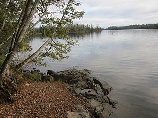
The Minnesota Department of Natural Resources, or Minnesota DNR, is the agency of the U.S. state of Minnesota charged with conserving and managing the state's natural resources. The agency maintains areas such as state parks, state forests, recreational trails, and recreation areas as well as managing minerals, wildlife, and forestry throughout the state. The agency is divided into six divisions - Ecological & Water Resources, Enforcement, Fish & Wildlife, Forestry, Lands & Minerals, and Parks & Trails.

<span class="mw-page-title-main">Wisconsin Department of Natural Resources</span> Government agency of Wisconsin, US

The Wisconsin Department of Natural Resources (WDNR) is a government agency of the U.S. state of Wisconsin charged with conserving and managing Wisconsin's natural resources. The Wisconsin Natural Resources Board has the authority to set policy for the WDNR. The WDNR is led by the Secretary, who is appointed by the Governor of Wisconsin. The WDNR develops regulations and guidance in accordance with laws passed by the Wisconsin Legislature. It administers wildlife, fish, forests, endangered resources, air, water, waste, and other issues related to natural resources. The central office of the WDNR is located in downtown Madison, near the state capitol.

<span class="mw-page-title-main">Natural history of Minnesota</span>

The natural history of Minnesota covers many plant and animal species in the U.S. state of Minnesota. The continental climate and location of Minnesota at the physiographic intersection of the Laurentian and the Interior Plains influences its plant and animal life. Three of North America's biomes converge in Minnesota: prairie grasslands in the southwestern and western parts of the state, the eastern temperate deciduous forests in the east-central and the southeast, and the coniferous forest in the north-central and northeast.

<span class="mw-page-title-main">Geography of Wisconsin</span> Physical features of the state in the Midwestern United States

Wisconsin, a state in the Midwestern United States, has a vast and diverse geography famous for its landforms created by glaciers during the Wisconsin glaciation 17,000 years ago. The state can be generally divided into five geographic regions—Lake Superior Lowland, Northern Highland, Central Plain, Eastern Ridges & Lowlands, and Western Upland. The southwestern part of the state, which was not covered by glaciers during the most recent ice age, is known as the Driftless Area. The Wisconsin glaciation formed the Wisconsin Dells, Devil's Lake, and the Baraboo Range. A number of areas are protected in the state, including Devil's Lake State Park, the Apostle Islands National Lakeshore, and the Chequamegon–Nicolet National Forest.

The Little Isabella River is a 33.17 mi (53.38 km) stream in Superior National Forest, a United States National Forest in the U.S. state of Minnesota. The stream runs through Stony River Township, which is part of Lake County. The Little Isabella River Campground, which is operated by the United States Forest Service, is about 5 miles (8.0 km) north of Isabella, Minnesota, an unincorporated community. The Minnesota Department of Natural Resources has designated it as a trout stream and it is populated with Brook trout.

The Battleground State Forest is a state forest located near Gould Township in Cass County, Minnesota. It is managed by the Minnesota Department of Natural Resources. It lies entirely within the boundaries of the Chippewa National Forest, additionally, and a portion of the forest falls within the borders of the Leech Lake Indian Reservation.

The Blackduck State Forest is a state forest near the town of Blackduck, located in Beltrami and Itasca counties in Minnesota. It is adjacent to the Buena Vista State Forest and the federally managed Chippewa National Forest. It is managed primarily by the Minnesota Department of Natural Resources and the counties.

The Bowstring State Forest is a state forest located in Itasca and Cass Counties in Minnesota. It is located entirely within the boundaries of the federally managed Chippewa National Forest, and is managed by the Minnesota Department of Natural Resources.

The Buena Vista State Forest is a state forest located in Beltrami County, Minnesota. The Minnesota Department of Natural Resources manages 18,693 acres (7,565 ha) of state lands, with the majority of the forest split between private and other public ownership. The eastern half of the forest falls within the Chippewa National Forest, where Federal lands are managed by the United States Forest Service.

The General C. C. Andrew State Forest is a state forest located in Pine County, Minnesota. The forest is named in honor of major general Christopher Columbus Andrews, a Civil War veteran, and an early Minnesota state Forestry Commissioner and proponent for scientific forestry and forest management. The Minnesota Department of Natural Resources manages the majority of the forest.

The Insula Lake State Forest is a state forest located in Lake County, Minnesota. The forest is entirely within the limits of the Boundary Waters Canoe Area Wilderness of the Superior National Forest, and as such falls under the jurisdiction and management of the United States Forest Service.

The Jeanette State Forest is a state forest located in St. Louis County, Minnesota. The forest is within the limits of the Superior National Forest's Boundary Waters Canoe Area Wilderness, and thus falls under the federal jurisdiction and management of the United States Forest Service.

The Lake Isabella State Forest is a state forest located in Lake County, Minnesota. The forest is located completely within the Superior National Forest and the Boundary Waters Canoe Area Wilderness, and is thus subject to the management of the United States Forest Service. At 638 acres (258 ha), it one of the smallest forests in the Minnesota state system.

The Nemadji State Forest is a state forest located primarily in Pine County, Minnesota. A small portion of the forest extends into neighboring Carlton County. The eastern perimeter of the forest borders the state of Wisconsin. It is managed by the Minnesota Department of Natural Resources. Gray wolves, white-tailed deer, and eagles are present in the forest.

The Paul Bunyan State Forest is a state forest located in Hubbard and Cass counties in Minnesota. The forest borders the Chippewa National Forest and the Welsh Lake State Forest to the east, and the Mississippi Headwaters State Forest to the northwest. The forest is managed by the Minnesota Department of Natural Resources and the land department for Hubbard County.

<span class="mw-page-title-main">Crescent Lake (Minnesota)</span> Lake in the state of Minnesota, United States

Crescent Lake is a lake located in Tofte Township and Lutsen Township, Cook County, Minnesota.

References

  1. "Division of Forestry - Minnesota DNR - MN Department of Natural Resources". Dnr.state.mn.us. 2018-09-24. Retrieved 2019-01-29.
  2. "State Forests - Minnesota DNR - MN Department of Natural Resources". Dnr.state.mn.us. 2018-09-24. Retrieved 2019-01-29.