Three Rivers Park District

Last updated

Crow-Hassan Park Reserve has miles of trails leading through woods and restored native prairie. Crow-Hassan Park Reserve 030527.jpg
Crow-Hassan Park Reserve has miles of trails leading through woods and restored native prairie.

Three Rivers Park District is a special park district serving the suburban areas of the Twin Cities including suburban Hennepin, Carver, Dakota, Scott, and Ramsey counties. Three Rivers's mission is "To promote environmental stewardship through recreation and education in a natural resources-based park system." Three Rivers operates twenty parks and ten regional trails, with at least two more regional trails planned. Nearly seven million people visit Three Rivers facilities each year. It has over 27,000 acres (11,000 ha) of parks and trails.

Contents

History

A park system in Hennepin County outside of Minneapolis was proposed as early as 1901, but it was not until 1955 that the Minnesota Legislature passed the legislation that cleared the way to establish the park system in 1957. It was then known as the Hennepin County Park Reserve District. In its first decade, the Park District purchased nearly 21,000 acres (8,500 ha) of property, mostly farmland in Hennepin County's fast-growing suburban areas. In 1967, the Park District began efforts to restore wetland, prairie, woodland, and wildlife habitat to their natural state before 19th-century settlement. The district's policy is now that at least 80% of the land in a park reserve must be maintained or restored to its natural state, with only 20% of the land or less developed for recreation. Not all the parks in the system are park reserves; some of the smaller or more-developed parks are "regional parks".

Beginning in the 1970s, the district's focus shifted from land acquisition to development. The building of recreational facilities including park buildings, beaches, boat launches, paved trails for hiking and biking, and cross-country ski trails began in earnest.

In 2005 the park system was renamed Three Rivers Park District to better reflect the areas it serves. Each of the Park District's facilities has watersheds that flow into three rivers: the Mississippi, Minnesota and Crow. These rivers have historically been and continue to be significant in the lives of the region's residents.

The park system's current chair is John Gunyou.

Parks

Most Three Rivers Park District parks are open from 5 a.m. through 10 p.m.

One of the cabins at the Baker Near-Wilderness Settlement BakerParkReserve1.jpg
One of the cabins at the Baker Near-Wilderness Settlement

Baker Park Reserve

Baker Park Reserve, with an area of 3,313 acres (1,341 ha), is located in Medina, Minnesota. Its highlights include the Baker Near-Wilderness Settlement retreat, available for use by families and groups, and Baker National Golf Course. It has eight miles (13 km) of paved biking/hiking trails. There is a mountain biking trail available by special-use permit in the winter.

Bryant Lake Regional Park

Bryant Lake Regional Park is located in Eden Prairie, Minnesota and has an area of 170 acres (69 ha). It features a swimming beach on Bryant Lake, a disc golf course, and a mix of paved and unpaved trails.

Carver Park Reserve

With an area of 3,719 acres (1,505 ha), Carver Park Reserve is the second-largest park reserve in the system. Located near Victoria, Minnesota, in Carver County, it features the Lowry Nature Center with interpretive programs, nine miles (14 km) of paved biking/hiking trails, 22 miles (35 km) of unpaved hiking trails, and nine miles (14 km) of horse trails. It is also connected to the Southwest LRT Trail's northern branch. The Grimm Farm Historic Site serves as a museum within the reserve.

Cleary Lake Regional Park

Cleary Lake Regional Park is located near Prior Lake, in Scott County. Its 1,186 acres (480 ha) contain a nine-hole golf course, an off-leash pet exercise area, and four miles (6.4 km) of paved biking/hiking trails.

Mississippi Gateway Regional Park

Coon Rapids Dam in June 2004 Coon Rapids River Dam - Coon Rapids, Minnesota.jpg
Coon Rapids Dam in June 2004

Mississippi Gateway Regional Park, formerly Coon Rapids Dam Regional Park, [1] is located in Brooklyn Park, Minnesota and Coon Rapids, Minnesota. The dam, for which the park was named, was built by Northern States Power Company in 1913 for electrical power generation. Power generation was discontinued in 1966, so the dam is now used for recreation. Anoka County operates a park on its side of the dam. There is a pedestrian and bicycle walkway across the Dam. It also connects to the Elm Creek Regional Trail, which stretches six miles (9.7 km) across Brooklyn Park and Maple Grove to meet up with Elm Creek Park Reserve. This park and the Coon Rapids Dam East, a walk across the dam, are sites for the National Parks Passport Program for the Mississippi National River and Recreation Area. The park has a staffed visitor's center with restrooms. There are picnic shelters along the pedestrian trail. Various wildlife can be seen throughout the year.

Crow-Hassan Park Reserve

Located in Rogers, Minnesota, Crow-Hassan Park Reserve has an area of 2,597 acres (1,051 ha), including 600 acres (240 ha) of tallgrass prairie. The park features 18 miles (29 km) of unpaved hiking trails, 11 miles (18 km) of horse trails, and an off-leash dog area. [2]

Eagle Lake Regional Park

Eagle Lake Regional Park is located in Plymouth, Minnesota and Maple Grove, Minnesota and features a nine-hole golf course with a lighted driving range.

Elm Creek Park Reserve

Elm Creek Park Reserve, at 5,315 acres (2,151 ha), is the largest park reserve in the system and occupies portions of Maple Grove, Champlin and Dayton. It features 19 miles (31 km) of paved biking/hiking trails, 21 miles (34 km) of horse trails, and a 13-mile (21 km) mountain bike trail. It also has a championship level disc golf course and a popular chlorinated swimming pond and a creative play area. Elm Creek also has a large fully fenced off-leash dog area.

A regional trail system connects Elm Creek Park Reserve to Fish Lake Regional Park and Mississippi Gateway Regional Park. In the winter, portions of the 11 miles (18 km) cross-country ski trail system are served by snowmaking. They also offer a snowtubing hill and a small downhill ski/snowboard area featuring a small terrain park. The Eastman Nature Center provides interpretive programs. This park also has more bike trails than all other parks in the park district, at 29.1 miles (46.8 km).

Fish Lake Regional Park

Fish Lake Regional Park is located in Maple Grove and offers boat access to Fish Lake, as well as a swimming beach and four-season pavilion. Also, there is a fully fenced, off-leash dog area.

Clifton E. French Regional Park

Located on Medicine Lake in Plymouth, Clifton E. French Regional Park (referred to locally as French Park) contains a popular creative play area and a large Nature Exploration Area, where patrons do not have to stay on paths and may do activities that are forbidden elsewhere in the park, such as digging or building forts. It also includes boat access to Medicine Lake. In the winter, it has six miles (9.7 km) of cross-country ski trails. The park is connected to Medicine Lake Regional Trail.

Gale Woods

Gale Woods, located on the shores of Whaletale Lake in Minnetrista, is a working farm featuring interpretive programs where visitors can learn about agriculture and land stewardship. The farm is home to the Gale Woods Folk School, which offers classes in cooking and the fiber arts. The park also includes a barn-style pavilion overlooking the lake.

Glen Lake Golf and Practice Center

Glen Lake Golf and Practice Center is located on the boundary of Minnetonka and Eden Prairie. It features a popular nine-hole golf course, along with a driving range and practice areas. It is built on the site of the former Glen Lake Sanatorium.

The Landing

The Landing – Minnesota River Heritage Park, formerly Historic Murphy's Landing, in Shakopee, is a regional park featuring a number of restored buildings from the 19th century. Buildings from the 1840s to the 1880s illustrate what life was like for some of Minnesota's earliest settlers along the Minnesota River. The site is open to the public daily for walking, biking and self-guided activities. Special programs take visitors inside the buildings. School groups tours are also available along with summer camps, and seasonal program offerings.

Hyland Lake Park Reserve

Play equipment in Hyland Lake Park Reserve Hyland Creative Play.jpg
Play equipment in Hyland Lake Park Reserve

Hyland Lake Park Reserve, located in Bloomington, features the Hyland Hills Ski Area, a downhill ski area with two terrain parks. The park is home to a massive creative play area that is a favorite of local residents. The ski area is popular for lessons and for its proximity to the metro area. On Hyland Lake at the playground there is a chalet with a concessions stand and tables and chairs. During the winter the chalet has cross country ski rentals. The rest of the park reserve's 1,000 acres (400 ha) contain nine miles (14 km) of paved biking/hiking trails and other unpaved hiking trails. In addition, the park features an 18-hole championship-level disc golf course playing along the ski slopes. The visitor's center offers boat and kayak rentals for use on Hyland Lake. In the winter, seven miles (11 km) of cross-country ski trails are offered, and some trails are lit for evening use. Hyland Lake Park Reserve also hosts Richardson Nature Center. The center offers live animal displays, interpretive nature programs and winter snowshoe rentals. The creative play in Hyland Lake Park Reserve features a wide variety of slides and other playground equipment. This playground is called "Chutes & Ladders" by Minnesotans because just the like the popular games its massive playground is mostly ladders leading to chutes "slides".

Lake Minnetonka Regional Park

Located in Minnetrista, Lake Minnetonka Regional Park is a relatively new park in the Three Rivers system. It offers a chlorinated sand-bottom swimming pond and a creative play area. It also provides boat access to Lake Minnetonka.

Lake Rebecca Park Reserve

Lake Rebecca Park Reserve, in Greenfield and Independence, is a large park reserve with 2,577 acres (1,043 ha). It offers seven miles (11 km) of biking/hiking trails, 13 miles (21 km) of unpaved hiking trails, and a 14-mile (23 km) mountain bike trail. It also has a non-motorized lake for canoeing, rowing, and fishing. In the winter, there are 10 miles (16 km) of cross-country ski trails.

Murphy-Hanrehan Park Reserve

Murphy-Hanrehan Park Reserve, in Burnsville, Lakeville, Savage, and Credit River Township, features a hilly cross-country ski trail system and a hilly 10-mile (16 km) singletrack mountain bike trail, maintained by Minnesota Off-Road Cyclists. The mountain bike trail is probably one of the most challenging trails in the Twin Cities due to its long climbs and rapid descents. The trail also includes natural and man-made obstacles such as rocks, wooden bridges, logs and stairsteps. The park reserve, at 2,786 acres (1,127 ha), also includes 14 miles (23 km) of horse trails, as well as bird watching. It is the only known nesting site of the hooded warbler in Minnesota. Also includes a hiking trail that is 3.1 miles (5.0 km) at the longest and 2.3 miles (3.7 km) at the shortest

Noerenberg Memorial Gardens

Noerenberg Memorial Gardens, located in Orono, is considered one of Minnesota's finest formal public gardens. It was donated to the park reserve by the estate of Frederick Noerenberg, founder of the Grain Belt brewery. The gardens are open May through October for tours, programs, informal viewing, and weddings.

North Mississippi Regional Park NMRPSign.jpg
North Mississippi Regional Park

North Mississippi Regional Park

North Mississippi Regional Park is located on the west bank of the Mississippi River on the border of Minneapolis and Brooklyn Center. It has a scenic view of the river and surrounding woods, along with a paved biking/hiking trail that connects to the Minneapolis trail system and to the Anoka County Park trails that go north to the Coon Rapids Dam.

Silverwood Park

Silverwood is the park district's newest acquisition. Located on the northwest shore of Silver Lake in St. Anthony, it was formerly the site of the Salvation Army Silver Lake Camp. Silverwood serves as a regional center devoted to connecting the community with the natural world and artistic creation. Through a gallery space, an amphitheater, art circles, and classrooms, artists engage and inspire the community with exhibitions, creations, teaching and performance. The park also features a coffee shop specializing in local, natural, organic, and sustainable foods. Picnicking, hiking trails and fishing are also available.

Trails

Cedar Lake LRT Regional Trail

Cedar Lake LRT Regional Trail runs from downtown Minneapolis to Hopkins along former railroad lines. It connects to other trails including Luce Line Regional Trail, North Cedar Lake Regional Trail, and Minnesota River Bluffs LRT Regional Trail. It is part of the Southwest LRT Trail

Dakota Rail Regional Trail

The Dakota Rail Regional Trail follows the former Dakota Rail Corridor along the north side of Lake Minnetonka. The trail runs 13.5 miles (21.7 km) from Wayzata southwest to St. Bonifacius.

Lake Independence Regional Trail

The Lake Independence Regional Trail is a paved trail which runs from Crow-Hassan Park Reserve in Corcoran through Baker Park Reserve to the Luce Line State Trail in Orono.

Lake Minnetonka LRT Regional Trail

Lake Minnetonka LRT Regional Trail is a limestone trail which runs from Hopkins to Victoria, where it connects to Carver Park Reserve. It is part of the Southwest LRT Trail.

Luce Line Regional Trail

Luce Line Regional Trail is a paved trail which runs nine miles (14 km) from Theodore Wirth Park in Golden Valley to Plymouth, where it becomes the Luce Line State Trail. In Plymouth Luce Line Regional Trail connects with Medicine Lake Regional Trail.

Medicine Lake Regional Trail

Medicine Lake Regional Trail is a paved trail which runs from Elm Creek Park Reserve in Maple Grove to Luce Line Regional Trail on the south end of Medicine Lake. In between, the trail runs through Fish Lake Regional Park and Clifton E. French Regional Park. A short branch of the trail extends east of French Park into the surrounding neighborhood, ending at a city park.

Minnesota River Bluffs LRT Regional Trail

Minnesota River Bluffs LRT Regional Trail is a limestone trail which runs from Hopkins to Chanhassen along the former Minneapolis and St. Louis Railway line. In Hopkins the trail connects to Cedar Lake LRT Regional Trail and North Cedar Lake Regional Trail. It is part of the Southwest LRT Trail.

Nine Mile Creek Regional Trail

Nine Mile Creek Regional Trail is a paved trail which runs from the Cedar Lake LRT Regional Trail in Hopkins to the Nokomis-MN River Trail in Bloomington.

North Cedar Lake Regional Trail

North Cedar Lake Regional Trail is a paved trail which runs from Minneapolis to Hopkins, where it connects to Cedar Lake LRT Regional Trail and Minnesota River Bluffs LRT Regional Trail. North Cedar Lake Regional Trail forms part of the Cedar Lake Loop, along with Cedar Lake Regional Trail, Cedar Lake LRT Trail, Midtown Greenway, and the Kenilworth Trail.

Rush Creek Regional Trail

Rush Creek Regional Trail is a paved six-mile (9.7 km) trail which connects Elm Creek Park Reserve and Mississippi Gateway Regional Park. It also connects to Shingle Creek Regional Trail, although three rivers is planning on extending the trail to Crow Hassen regional park

Shingle Creek Regional Trail

Shingle Creek Regional Trail is a paved trail that runs from Rush Creek Regional Trail in Brooklyn Center down into Brooklyn Park, where it connects to local trails.

Planned Trails

Bassett Creek Regional Trail

Basset Creek Regional Trail is a paved trail that connects Clifton E. French Regional Park to Theodore Wirth Park. [3]

Crystal Lake Regional Trail

Crystal Lake Regional Trail is a 8.6-mile paved trail from the Minneapolis Grand Rounds at Victory Memorial Parkway to Elm Creek Park Reserve. It largely runs parallel to the Bottineau Boulevard. It was constructed in several phases as Bottineau Boulevard itself was reconstructed. [4]

See also

Related Research Articles

<span class="mw-page-title-main">Huron–Clinton Metroparks</span> A regional park system around Detroit, Michigan

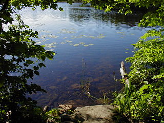
The Huron–Clinton Metroparks system is a regional park system in Metro Detroit in the U.S. state of Michigan. The park system includes 13 parks totaling more than 24,000 acres (97 km2) arranged along the Huron River and Clinton River forming a partial ring around the metro area. Plans are in development to finish the ring by building hike/bike trails to connect all the parks as a green belt. The parks draw about 7.5 million visitors a year, down from a peak of 10 million in 2009. The park system is primarily tax-funded with a $50 million annual budget. The system provides employment for 200 full-time and part-time employees year-round and 1,000 additional summer workers. The rivers are prime fishing and canoeing streams with Delhi Metropark including a short rapids, which while runnable, is the only point other than dams on either stream normally portaged.

<span class="mw-page-title-main">Cedar Lake Trail</span> Shared-use path in Minneapolis

Cedar Lake Trail is a 4.3-mile (6.9 km), shared-use path in the U.S. state of Minnesota, from downtown Minneapolis to the neighboring suburb of St. Louis Park. The trail begins at its eastern trailhead in downtown Minneapolis (44°59′11″N93°16′01″W) and continues west to Minnesota State Highway 100 in St. Louis Park (44°57′43″N93°20′36″W). At the trail's west end, a paved path continues for another 4.2 miles (6.8 km) through St. Louis Park to Hopkins under the former name of Hutchinson Spur Trail, but known as North Cedar Lake Regional Trail since 2009. In 2019, large portions of the Cedar Lake Trail were closed due to construction of the Southwest LRT extension with expected reopening in 2021 or 2022.

<span class="mw-page-title-main">Midtown Greenway</span> Shared-use path in Minneapolis, USA

The Midtown Greenway is a 5.7-mile (9.2 km) rail trail in Minneapolis, Minnesota that follows the path of an abandoned route of the Milwaukee Road railway. It is considered under segregated cycle facilities.

<span class="mw-page-title-main">Fort Snelling State Park</span> State park in Minnesota, United States

Fort Snelling State Park is a state park of the U.S. state of Minnesota, at the confluence of the Mississippi and Minnesota rivers. For many centuries, the area of the modern park has been of importance to the Mdewakanton Dakota people who consider it the center of the Earth. The state park, which opened in 1962, is named for the historic Fort Snelling, which dates from 1820. The fort structure is maintained and operated by the Minnesota Historical Society. The bulk of the state park preserves the bottomland forest, rivers, and backwater lakes below the river bluffs. Both the state and historic fort structure are part of the Mississippi National River and Recreation Area, a National Park Service site.

<span class="mw-page-title-main">Minneopa State Park</span> United States historic place

Minneopa State Park is a state park in the U.S. state of Minnesota. It was established in 1905 to preserve Minneopa Falls, a large waterfall for southern Minnesota, and was expanded in the 1960s to include the lower reaches of Minneopa Creek and a large tract of prairie. Minneopa is Minnesota's third oldest state park, after Itasca and Interstate. Two park resources are listed on the National Register of Historic Places: the 1862 Seppman Mill and a district of seven Rustic Style structures built by the Works Progress Administration in the late 1930s. The park is located almost entirely on the south side of the Minnesota River, three miles (4.8 km) west of Mankato. In 2015 the state reintroduced American bison to the park in a 330-acre (130 ha) fenced enclosure, through which visitors can drive in their vehicles.

<span class="mw-page-title-main">Lebanon Hills Regional Park</span>

Lebanon Hills Regional Park is a park in Eagan and Apple Valley, Minnesota. The 1,869-acre (7.56 km2) park, the largest in Dakota County, contains forests, grasslands, marshes, and wetlands. Winter activities include skiing, snowshoeing, ice skating, ice fishing, hiking, and winter mountain biking. Summer activities include mountain biking, canoeing, kayaking, swimming, camping, horseback riding, and hiking.

<span class="mw-page-title-main">Sakatah Lake State Park</span> State park in Minnesota

Sakatah Lake State Park is an 842-acre (341 ha) state park of Minnesota, USA, on a natural widening of the Cannon River near the town of Waterville. The Dakota native to the area called it "Sakatah" which means "singing hills". To honor this native heritage, some of the trails in the park have been given Dakota names. The Sakatah Singing Hills State Trail, which connects Faribault and Mankato, runs through this park.

<span class="mw-page-title-main">Lake Bemidji State Park</span> United States historic place

Lake Bemidji State Park is a state park of Minnesota, United States, on the north shore of 6,765-acre (27.38 km2) Lake Bemidji. The northern half of the park preserves a spruce-tamarack bog. A district of National Park Service rustic structures built by the Civilian Conservation Corps and National Youth Administration in the 1930s is on the National Register of Historic Places. The park is located 5 miles (8.0 km) north of the city of Bemidji.

<span class="mw-page-title-main">Minnesota Valley National Wildlife Refuge</span> United States protected natural area near Minneapolis

The Minnesota Valley National Wildlife Refuge is a 14,000-acre (5,666 ha) National Wildlife Refuge in eastern and central Minnesota. Located just south of the city of Minneapolis, it is one of fourteen Regional Priority Urban Wildlife Refuges in the nation. Many parts of the Refuge are near large establishments of the Twin Cities; the Bloomington Education and Visitor Center and two trailheads are located just blocks from the Mall of America, the Wilkie Unit is just east of Valleyfair and the Louisville Swamp Unit is just south of Minnesota Renaissance Festival.

<span class="mw-page-title-main">Prompton State Park</span> State park in Wayne County, Pennsylvania

Prompton State Park is a Pennsylvania state park on 2,000 acres (809 ha) in Clinton and Dyberry Townships, Wayne County, Pennsylvania in the United States. This park, which was established in 1962, is officially listed by the Pennsylvania Department of Conservation and Natural Resources as being undeveloped. This means that it is officially a state park but the PA-DCNR is not currently managing the park. However, the lands of the park are open to visitors. Friends of Prompton State Park, a grassroots organization is working to take over management of the park in much the same way that Salt Springs State Park in Susquehanna County is managed by The Friends of Salt Springs Park. Northeast Sports Ltd. of Honesdale sponsors several outdoor sports events that are held at the park. Prompton State Park is 4.2 miles (6.8 km) west of Honesdale on Pennsylvania Route 170.

<span class="mw-page-title-main">Tryon Creek State Natural Area</span> Park and natural area in Portland, Oregon, U.S.

The Tryon Creek State Natural Area is a state park located primarily in Portland, in the U.S. state of Oregon. It is the only Oregon state park within a major metropolitan area. The 645-acre (261 ha) park lies between Boones Ferry Road and Terwilliger Boulevard in southwest Portland in Multnomah County and northern Lake Oswego in Clackamas County and is bisected from north to south by Tryon Creek. To the north, the park abuts the Lewis & Clark Law School campus.

<span class="mw-page-title-main">Southwest LRT Trail</span> Shared-use path in Minneapolis

Southwest LRT Trail is a system of shared-use paths for bicycles and pedestrian paths that extends through several western suburbs of Minneapolis, Minnesota. They are operated by the Three Rivers Park District. Two former rail corridors originally built by the Minneapolis and St. Louis Railway were acquired and converted to trails in anticipation of the Southwest Corridor light rail project. The two former railway corridors are now divided into three distinct trails.

<span class="mw-page-title-main">George Wyth Memorial State Park</span> State park in Black Hawk County, Iowa

The George Wyth Memorial State Park is a state park in Black Hawk County, Iowa, United States. The park was dedicated in 1940 as "Josh Higgins Parkway", named for a popular radio character of the day. In 1956, it was renamed George Wyth Memorial State Park after a well-known Cedar Falls businessman and conservationist.

<span class="mw-page-title-main">Kenilworth Trail</span> Shared-use path in Minneapolis

The Kenilworth Trail is a paved bicycle trail in Minneapolis, Minnesota, United States. It runs nearly 1.5 miles (2.4 km) and acts as a connector between the Cedar Lake Trail in the north and the Midtown Greenway in the south. Like the Cedar Lake Trail, most of the route is composed of a triple-divided cycleway/pedway with a pair of one-way paths for bicycles and another path for pedestrians. On some maps, a southern segment of the Kenilworth Trail is called the Burnham Trail. The trail corridor has been considered the most highly trafficked in the Minneapolis park system.

<span class="mw-page-title-main">Parks and Greenways in Huntsville</span>

An extensive collection of parks and greenways exists in Huntsville, Alabama for the public's recreational use.

Lynn Headwaters Regional Park is an area of North Vancouver, British Columbia, and is the largest of twenty-two regional parks in Metro Vancouver. At 9,216.5 acres (3,729.8 ha), the park boasts a variety of trails for hikers, including easy, intermediate, and challenging. The trails are colour-coded and range from 3 kilometres (1.9 mi) to 21.4 kilometres (13.3 mi). Bikes and dogs are allowed on select trails.

<span class="mw-page-title-main">Minnesota Valley State Trail</span> Multi-use recreation pathway along the Minnesota River

Minnesota Valley State Trail is a 27-mile, multi-use trail in the Minneapolis-Saint Paul metropolitan area that runs parallel to the Minnesota River from the cities of Belle Plaine to Shakopee. A 10-mile segment of the trail from Chaska to Shakopee is paved. Allowable trail uses include hiking, biking, horseback riding, cross-country skiing, and snowmobiling. First established in 1969, and never fully completed, the trail is undergoing a 13.5 mile extension in 2019 and 2020.

<span class="mw-page-title-main">Trails in Minneapolis</span>

Minneapolis is often considered one of the top biking and walking cities in the United States due to its vast network of trails and dedicated pedestrian areas. In 2020, Walk Score rated Minneapolis as 13th highest among cities over 200,000 people. Some bicycling ratings list Minneapolis at the top of all United States cities, while others list Minneapolis in the top ten. There are over 80 miles (130 km) of paved, protected pathways in Minneapolis for use as transportation and recreation. The city's Grand Rounds National Scenic Byway parkway system accounts for the vast majority of the city's shared-use paths at approximately 50 miles (80 km) of dedicated biking and walking areas. By 2008, other city, county, and park board areas accounted for approximately 30 miles (48 km) of additional trails, for a city-wide total of approximately 80 miles (130 km) of protected pathways. The network of shared biking and walking paths continued to grow into the late 2010s with the additions of the Hiawatha LRT Trail gap remediation, Min Hi Line pilot projects, and Samatar Crossing. The city also features several natural-surface hiking trails, mountain-biking paths, groomed cross-country ski trails in winter, and other pedestrian walkways.

<span class="mw-page-title-main">Luce Line Trail</span> Shared-use path in Minnesota

Luce Line Trail is a 74.9-mile (120.5 km), shared-use path in Minnesota, United States, that stretches from Cosmos to Minneapolis. The trail system was built after 1995 when the Luce Line Railroad was abandoned west of Interstate 494. The previous line extended 104 miles (167 km) to Gluek. The multi-use trail has varying surface features, though it is primarily made up of crushed limestone or aggregate base, and the section from Cosmos to Cedar Mills is undeveloped, as are the sections from just west of Hutchinson to Winsted and east of Plymouth. The trail is maintained by the Minnesota Department of Natural Resources west of Vicksburg Lane, where it is named Luce Line State Trail. East of Vicksburg Lane, it is maintained by the Three Rivers Park District and named Luce Line Regional Trail.

<span class="mw-page-title-main">Mississippi Gorge Regional Park</span> Urban park in Minnesota, United States

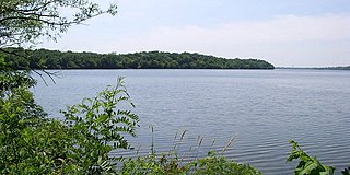
Mississippi Gorge Regional Park is a regional park along the east and west bluffs of the Mississippi River in the cities of Minneapolis and Saint Paul in the U.S. state of Minnesota. The two-city park area is between Mississippi river miles 848 and 852, from just south of Northern Pacific Bridge Number 9 to just north of Minnehaha Regional Park, and lies within the Mississippi National River and Recreation Area. The park area protects scenic and natural areas of the Mississippi River gorge, the only true gorge along the entire length of the 2,320-mile (3,730 km) river.

References

  1. "Mississippi Gateway Redevelopment | Three Rivers Park District". www.threeriversparks.org. Retrieved October 17, 2022.
  2. "Crow-Hassan Prairie: 50 Years in the Making". Three Rivers Park District. Retrieved October 9, 2020.
  3. "Bassett Creek Regional Trail". Three Rivers Park District. July 8, 2021.
  4. "Crystal Lake Regional Trail | Three Rivers Park District". www.threeriversparks.org. Retrieved September 7, 2022.