List of state routes in West Virginia

Last updated

WV-2.svgWV-20.svgWV-259.svg
Sample highway shields
Highway names
Interstates Interstate XX (I-XX)
US Highways U.S. Route XX (US XX)
State West Virginia Route XX (WV XX)
County RoutesCounty Route XX (CR XX)
System links

State highways in the U.S. state of West Virginia are owned and maintained by the West Virginia Division of Highways.

Contents

History

State routes

NumberLength (mi)Length (km)Southern or western terminusNorthern or eastern terminusFormedRemovedNotes
WV-1 (1922).svg WV 1 01922-01-01192201927-01-011927
WV-2.svg WV 2 230.6371.1 US 60 in Huntington US 30 in Chester 01922-01-011922current
WV-3 (1922).svg WV 3 01922-01-01192201927-01-011927
WV-3.svg WV 3 186.0299.3 WV 10 in West Hamlin WV 311 in Sweet Springs 01931-01-011931current
WV-4 (1922).svg WV 4 01922-01-01192201927-01-011927
WV-4.svg WV 4 96.6155.5 US 119 in Clendenin WV 20 in Rock Cave 01937-01-011937current
WV-5 (1922).svg WV 5 01922-01-01192201937-01-011937
WV-5.svg WV 5 71.6115.2 WV 14 in Elizabeth US 19/WV 4 in Heaters 01938-01-011938current
WV-6 (1922).svg WV 6 01922-01-01192201928-01-011928
WV-6.svg WV 6 0.60.97 WV 61 in Montgomery US 60 in Smithers 01956-01-011956currentUnsigned route
WV-7.svg WV 7 102.5165.0 SR 536 at the Ohio state line, west end of New Martinsville Bridge in New Martinsville MD 39 at the Maryland state line east of Corinth 01922-01-011922current
WV-8 (1922).svg WV 8 01922-01-01192201932-01-011932
WV-8.svg WV 8 8.313.4 WV 2 in New Cumberland US 30 east of Chester 01968-01-011968current
WV-9.svg WV 9 74.0119.1 MD 51 at Maryland state line in Paw Paw SR 9 at Virginia state line state line near Keyes Gap 01922-01-011922current
WV-10.svg WV 10 148.5239.0 US 19 in Kegley US 60 in Huntington 01922-01-011922current
WV-11 (1922).svg WV 11 01922-01-01192201931-01-011931
WV-12 (1922).svg WV 12 01922-01-01192201940-01-011940Became part of WV 16 to match Virginia (which had renumbered its side from SR 27 to SR 16)
WV-12.svg WV 12 48.678.2 Peterstown Alta 01941-01-011941current
WV-13 (1922).svg WV 13 Charleston Yawkey 01922-01-01192201946-01-011946Became part of WV 14; now WV 214
WV-14.svg WV 14 59.095.0 Spencer Williamstown 01922-01-011922current
WV-15.svg WV 15 64.1103.2North of Sutton Valley Head 01922-01-011922current
WV-16.svg WV 16 252.9407.0 Virginia state line St. Marys 01922-01-011922current
WV-17.svg WV 17 01922-01-01192201970-01-011970
WV-17.svg WV 17 30.448.9 Stollings Madison 01976-01-011976current
WV-18.svg WV 18 57.492.4 Troy Sistersville 01922-01-011922current
WV-19 (1922).svg WV 19 01922-01-01192201931-01-011931
WV-20 (1922).svg WV 20 256.2412.301922-01-01192201931-01-011931
WV-20.svg WV 20 256.2412.3 US 52 in Bluewell WV 7 east of New Martinsville 01931-01-011931currentExtended in 1941 to include the 1922 route
WV-21 (1922).svg WV 21 01922-01-01192201931-01-011931
WV-22 (1922).svg WV 22 01922-01-01192201931-01-011931
WV-23 (1922).svg WV 23 01922-01-01192201940-01-011940Renumbered WV 259 and WV 55 to match Virginia
WV-23.svg WV 23 27.043.5 Tyler Salem 01940-01-011940current
WV-24 (1922).svg WV 24 01922-01-01192201935-01-011935
WV-24.svg WV 24 Silver Lake Eglon 01935-01-011935current
WV-25 (1922).svg WV 25 01922-01-01192201927-01-011927
WV-25 (1922).svg WV 25 01931-01-01193101935-01-011935
WV-25.svg WV 25 South of Poca Charleston 01935-01-011935current
WV-26.svg WV 26 41.366.5 US 50 in Fellowsville PA 281 at the Pennsylvania state line northeast of Glade Farms 01922-01-011922current
WV-27.svg WV 27 WV 2 in Wellsburg PA 844 at Pennsylvania state line 5.6 miles (9.0 km) east of Wellsburg01922-01-011922current
WV-28.svg WV 28 150.8242.7 Huntersville Maryland state line01922-01-011922current
WV-29 (1922).svg WV 29 01922-01-01192201927-01-011927
WV-29.svg WV 29 Baker South of Paw Paw 01928-01-011928current
WV-30 (1922).svg WV 30 01922-01-01192201927-01-011927
WV-31 (1922).svg WV 31 01922-01-01192201927-01-011927
WV-31.svg WV 31 Williamstown Harrisville 01934-01-011934current
WV-32 (1922).svg WV 32 01922-01-01192201927-01-011927
WV-32.svg WV 32 Harman Thomas 01931-01-011931current
WV-33 (1922).svg WV 33 01922-01-01192201937-01-011937
WV-34.svg WV 34 East of Hamlin Kenna 01922-01-011922current
WV-35 (1922).svg WV 35 01922-01-01192201938-01-011938
WV-36.svg WV 36 West of Maysel Spencer 01922-01-011922current
WV-37.svg WV 37 Kentucky Ranger 01922-01-011922current
WV-38 (1922).svg WV 38 01922-01-01192201931-01-011931
WV-38 (1922).svg WV 38 01931-01-01193101940-01-011940Renumbered WV 522 to match Virginia; later US 522
WV-38.svg WV 38 US 250 near Philippi WV 72 near St. George 01957-01-011957current
WV-39.svg WV 39 US 60/WV 16 in Gauley Bridge SR 39 at the Virginia state line at Rimel 01922-01-011922current
WV-40 (1922).svg WV 40 01922-01-01192201931-01-011931
WV-41.svg WV 41 64.8104.3 Beckley Calvin 01922-01-011922current
WV-42.svg WV 42 West of Petersburg Maryland state line01922-01-011922current
WV-43 (1922).svg WV 43 01922-01-01192201940-01-011940Became part of WV 39 to match Virginia (which had renumbered its side from SR 501 to SR 39); the original plan was to renumber this road as WV 501, but West Virginia could not do that
WV-43.svg WV 43 US 19 at Muddlety WV 20 at Craigsville 01941-01-01194101980-01-011980
WV-43.svg WV 43 I-68 at Cheat Lake PA 43 at Pennsylvania state line 1.5 miles (2.4 km) north of Cheat Lake02011-01-012011current
WV-44 (1922).svg WV 44 01922-01-01192201931-01-011931
WV-44 (1922).svg WV 44 01931-01-01193101941-01-011941
WV-44.svg WV 44 01956-01-01195601977-01-011977
WV-44.svg WV 44 Mountain View Logan 01977-01-011977current
WV-45 (1922).svg WV 45 01922-01-01192201932-01-011932
WV-45.svg WV 45 Virginia state line Shepherdstown 01932-01-011932current
WV-46.svg WV 46 Elk Garden
Maryland state line
Maryland state line
Fort Ashby
01922-01-011922current
WV-47 (1922).svg WV 47 01922-01-01192201928-01-011928
WV-47.svg WV 47 Parkersburg Linn 01928-01-011928current
WV-48.svg WV 48 01922-01-01192201977-01-011977
WV-49 (1922).svg WV 49 01922-01-01192201931-01-011931
WV-49.svg WV 49 Kentucky state lineEast of Williamson 01935-01-011935current
WV-50 (1922).svg WV 50 01922-01-01192201927-01-011927
WV-51 (1922).svg WV 51 01922-01-01192201931-01-011931
WV-51 (1922).svg WV 51 01931-01-01193101931-01-011931Appeared alongside the current one
WV-51.svg WV 51 18.229.3East of Glengary Charles Town 01932-01-011932current
WV-52 (1922).svg WV 52 01922-01-01192201927-01-011927
WV-53 (1922).svg WV 53 01922-01-01192201931-01-011931
WV-53.svg WV 53 East of Elizabeth West of Macfarlan 01931-01-011931current
WV-54 (1922).svg WV 54 01922-01-01192201931-01-011931
WV-54 (1922).svg WV 54 01931-01-01193101946-01-011946
WV-54.svg WV 54 Mullens Sophia 01957-01-011957current
WV-55 (1922).svg WV 55 01922-01-01192201927-01-011927
WV-55 (1922).svg WV 55 01928-01-01192801931-01-011931
WV-55 (1922).svg WV 55 01933-01-01193301940-01-011940Renumbered WV 23 in a numbering swap so that new WV 55 matched Virginia
WV-55.svg WV 55 Muddlety Virginia state line01940-01-011940current
WV-56 (1922).svg WV 56 01922-01-01192201935-01-011935
WV-56.svg WV 56 01937-01-01193701977-01-011977
WV-57.svg WV 57 East of Clarksburg South of Philippi 01922-01-011922current
WV-58 (1922).svg WV 58 01922-01-01192201928-01-011928
WV-58 (1922).svg WV 58 01928-01-01192801940-01-011940Renumbered WV 259 to match Virginia (which had renumbered its side from SR 275)
WV-58.svg WV 58 Stonewood Bridgeport 01957-01-011957current
WV-59 (1922).svg WV 59 01922-01-01192201926-01-011926
WV-59.svg WV 59 01929-01-01192902018-01-012018
WV-60 (1922).svg WV 60 01922-01-01192201926-01-011926
WV-60 (1922).svg WV 60 01928-01-01192801931-01-011931
WV-61.svg WV 61 Piney View Charleston 01922-01-011922current
WV-62.svg WV 62 Charleston Ripley 01922-01-011922current
WV-63 (1922).svg WV 63 01922-01-01192201931-01-011931
WV-63.svg WV 63 Alderson Caldwell 01933-01-011933current
WV-64 (1922).svg WV 64 01922-01-01192201932-01-011932
WV-64 (1948).svg WV 64 01938-01-01193801961-01-011961
WV-65 (1922).svg WV 65 01922-01-01192201931-01-011931
WV-65.svg WV 65 Matewan Naugatuck 01933-01-011933current
WV-66 (1922).svg WV 66 01922-01-01192201931-01-011931
WV-66.svg WV 66 01932-01-01193201970-01-011970
WV-66.svg WV 66 East of Slatyfork South of Green Bank 01990-01-011990current
WV-67 (1922).svg WV 67 01922-01-01192201931-01-011931
WV-67.svg WV 67 WV 2 along the edge of Wellsburg PA 331 at Pennsylvania state line southeast of Bethany 01933-01-011933current
WV-68 (1922).svg WV 68 01922-01-01192201931-01-011931
WV-68 (1922).svg WV 68 01932-01-01193201948-01-011948
WV-68.svg WV 68 01961-01-01196101978-01-011978
WV-68.svg WV 68 Ravenswood East of Parkersburg 01978-01-011978current
WV-69 (1922).svg WV 69 01923-01-01192301933-01-011933
WV-69.svg WV 69 US 250 in Hundred PA 18 at Pennsylvania state line in Burton 01961-01-011961currentRenumbered from WV 70
WV-70 (1948).svg WV 70 US 250 in Hundred PA 18 at Pennsylvania state line in Burton 01923-01-01192301961-01-011961Renumbered as WV 69
WV-71 (1922).svg WV 71 01923-01-01192301931-01-011931
WV-71.svg WV 71 Bluewell Matoaka 01935-01-011935current
WV-72.svg WV 72 North of Dryfork Kingwood 01923-01-011923current
WV-73.svg WV 73 US 50 in Bridgeport WV 26 in Bruceton Mills 01924-01-01192401977-01-011977
WV-73.svg WV 73 US 119 in Verdunville WV 10 in Logan 01996-01-011996current
WV-74.svg WV 74 Coxs Mills Josephs Mills 01924-01-011924current
WV-75.svg WV 75 Kenova Lavalette 01924-01-011924current
WV-76 (1922).svg WV 76 01924-01-01192401931-01-011931
WV-76.svg WV 76 East of Bridgeport North of Philippi 01961-01-011961current
WV-77 (1948).svg WV 77 01924-01-01192401961-01-011961
WV-78 (1922).svg WV 78 01925-01-01192501932-01-011932
WV-78 (1948).svg WV 78 01957-01-01195701965-01-011965
WV-79 (1922).svg WV 79 01925-01-01192501927-01-011927
WV-79 (1948).svg WV 79 01933-01-01193301961-01-011961
WV-80 (1922).svg WV 80 01925-01-01192501927-01-011927
WV-80.svg WV 80 Bradshaw Huff Junction 01941-01-011941current
WV-81 (1922).svg WV 81 01925-01-01192501940-01-011940Renumbered WV 311 to match Virginia
WV-81 (1948).svg WV 81 01960-01-01196001961-01-011961
WV-82 (1922).svg WV 82 01928-01-01192801947-01-011947
WV-82.svg WV 82 01947-01-01194701983-01-011983
WV-82.svg WV 82 Birch River Cowen 01990-01-011990current
WV-83.svg WV 83 Virginia state line Yukon 01928-01-011928current
WV-84.svg WV 84 Frost Virginia state line01928-01-011928current
WV-85 (1922).svg WV 85 01928-01-01192801931-01-011931
WV-85 (1922).svg WV 85 01935-01-01193501947-01-011947
WV-85 (1948).svg WV 85 01947-01-01194701959-01-011959
WV-85.svg WV 85 Oceana Danville 01961-01-011961current
WV-86 (1922).svg WV 86 01928-01-01192801931-01-011931
WV-86.svg WV 86 US 250/WV 2 in Glen Dale WV 88 in Sherrard 01957-01-011957current
WV-87 (1922).svg WV 87 01928-01-01192801931-01-011931
WV-87 (1922).svg WV 87 01933-01-01193301937-01-011937
WV-87.svg WV 87 West of Mount Alto West of Ripley 01937-01-011937current
WV-88.svg WV 88 US 250 in Limestone WV 27 east of Wellsburg 01928-01-011928current
WV-89.svg WV 89 01928-01-01192801993-01-011993
WV-90.svg WV 90 Thomas Gormania 01930-01-011930current
WV-91.svg WV 91 01930-01-01193001985-01-011985 [1]
WV-92.svg WV 92 White Sulphur Springs Reedsville 01930-01-011930current
WV-93 (1922).svg WV 93 01930-01-01193001931-01-011931
WV-93.svg WV 93 37.860.8 Davis West of New Creek 01957-01-011957current
WV-94 (1922).svg WV 94 01930-01-01193001941-01-011941
WV-94 (1948).svg WV 94 01941-01-01194101956-01-011956
WV-94.svg WV 94 01968-01-01196801980-01-011980
WV-94.svg WV 94 Racine Marmet 01982-01-011982current
WV-95.svg WV 95 Parkersburg Parkersburg01961-01-011961current
WV-97.svg WV 97 Hanover Mabscott 01971-01-011971current
WV-98.svg WV 98 Clarksburg Nutter Fort 01978-01-011978current
WV-99.svg WV 99 North of Kopperston Glen Daniel 01967-01-011967current
WV-100.svg WV 100 US 19 in Westover US 19 northwest of Maidsville 01957-01-011957current
WV-101.svg WV 101 Huntington Huntington01993-01-011993current
WV-102.svg WV 102 Virginia state lineVirginia state line01959-01-011959current
WV-103.svg WV 103 Black Wolf Welch 01978-01-011978current
WV-104.svg WV 104 Princeton Princeton01978-01-011978current
WV-105.svg WV 105 WV 2 in Weirton US 22 in Weirton01978-01-011978current
WV-106.svg WV 106 Huntington Huntington01980-01-011980current
WV-107.svg WV 107 Hinton Hinton01981-01-011981current
WV-112.svg WV 112 Bluefield Oakvale
WV-114.svg WV 114 Charleston Big Chimney
WV-115.svg WV 115 Charles Town Ranson
WV-120.svg WV 120 Bramwell Virginia state lineproposedProposed upgrade of CR 120 [2]
WV-121.svg WV 121 Slab Fork North of Sophia Future US 121, will be decommissioned when more of US 121 is completed
WV-122.svg WV 122 Forest Hill North of Rock Camp
WV-123.svg WV 123 Virginia state lineWest of Princeton
WV-125.svg WV 125 Hinton Sandstone Partially built New River Parkway, unsigned as of 2016
WV-127.svg WV 127 Forks of Cacapon Virginia state line
WV-129.svg WV 129 Drennen Mount Nebo
WV-131.svg WV 131 Shinnston Bridgeport
WV-150.svg WV 150 West of Mill Point North of Edray
WV-152.svg WV 152 North of Crum Huntington
WV-154.svg WV 154 Crumpler Ghent proposedProposed Shawnee Parkway
WV-161.svg WV 161 Bishop Elkhorn
WV-180.svg WV 180 North of Middlebourne South of New Martinsville
WV-193.svg WV 193 Barboursville Lesage
WV-208.svg WV 208 WV 2 WV 8 near US 30 proposedProposed upgrade of the relatively new CR 208 [2]
WV-210.svg WV 210 2.94.7 Beckley Beckley
WV-211.svg WV 211 Mount Hope Mount Hope
WV-214.svg WV 214 Yawkey Ruth
WV-218.svg WV 218 Worthington Pennsylvania state line
WV-230.svg WV 230 Halltown Shepherdstown
WV-251.svg WV 251 Wheeling Wheeling
WV-252.svg WV 252 Wheeling WheelingRoute may no longer exist as Aetnaville Bridge is closed.
WV-259.svg WV 259 Virginia state lineVirginia state line
WV-270.svg WV 270 West Milford Lost Creek Formerly CR 27
WV-273.svg WV 273 Pleasant Valley Fairmont Route fully opened on December 22, 2010 [3]
WV-279.svg WV 279 Clarksburg Bridgeport
WV-290.svg WV 290 01976-01-01197601981-01-011981
WV-305.svg WV 305 Lester Surveyor
WV-307.svg WV 307 Beaver Daniels
WV-310.svg WV 310 Fairmont Grafton
WV-311.svg WV 311 Virginia state line
Virginia
Virginia
east of White Sulphur Springs
WV-331.svg WV 331 Mount Alto Cottageville
WV-338.svg WV 338 Ravenswood Ohio state lineBefore 2003: former designation for the Ravenswood Bridge, replaced by US 33
WV-479.svg WV 479 Rivesville I-79 proposedProposed Rivesville/I-79 Connector
WV-480.svg WV 480 Kearneysville Maryland state line
WV-501.svg WV 501 Tyler Mountain Tyler Heights
WV-507.svg WV 507 01978-01-01197801980-01-011980Signed until 2001; listed as "LSR (Legislative Secondary Route) 507" in 2015 log
WV-522 (1922).svg WV 522 01941-01-01194101944-01-011944Temporary designation while the upgrade to US 522 was being completed
WV-527.svg WV 527 Huntington Huntington
WV-598.svg WV 598 Virginia state line Bluefield
WV-601.svg WV 601 Ruth South Charleston
WV-612.svg WV 612 8.4013.52 Mossy Oak Hill
WV-618.svg WV 618 Parkersburg Parkersburg
WV-622.svg WV 622 17.4528.08 Institute Pocatalico
WV-635.svg WV 635 3.715.97 Virginia state line Jolo
WV-705.svg WV 705 3.55.6 US 19 in Morgantown US 119 in Morgantown
WV-707.svg WV 707 WV 279 in McAlpin WV 131 in McAlpinproposedProposed upgrade of CR 707 (FBI Center Road)
WV-807.svg WV 807 0.350.56 Ohio state line St. Marys
WV-817.svg WV 817 26.1242.04 St. Albans Fraziers Bottom 02008-01-012008current
WV-857.svg WV 857 US 119 near Morgantown PA 857 at the Pennsylvania state lineproposedProposed upgrade of CR 857; East Morgantown Bypass [2]
WV-869.svg WV 869 0.941.51North of Fraziers Bottom South of Buffalo
WV-891.svg WV 891 2.293.69 US 250 north of Cameron PA 21 at Pennsylvania state line northeast of Cameron
WV-892.svg WV 892 9.9516.01 Eli West of Parkersburg
WV-901.svg WV 901 5.659.09 Hedgesville Falling Waters
WV-956.svg WV 956 4.186.73 Maryland state lineNorth of Fort Ashby
WV-971.svg WV 971 10.2316.46 Baileysville Oceana
WV-972.svg WV 972 2.193.5201978-01-01197802017-01-012017
  •       Former
  •       Proposed and unbuilt

Special routes

NumberLength (mi)Length (km)Southern or western terminusNorthern or eastern terminusFormedRemovedNotes
Alt plate.svg
WV-10.svg WV 10 Alt.
WV 10 in Melissa US 60 west of Barboursville
Alt plate.svg
WV-27.svg WV 27 Alt.
6.09.7 WV 2 in Follansbee Pennsylvania state line 5.5 miles (8.9 km) east of Follansbee
Alt plate.svg
WV-34.svg WV 34 Alt.
Hurricane US 60 in Hurricane
Alt plate.svg
WV-45.svg WV 45 Alt.
West of Shepherdstown Southwest of Shepherdstown

See also

Related Research Articles

<span class="mw-page-title-main">Interstate 81</span> Interstate Highway through Appalachian Mountains

Interstate 81 (I-81) is a north–south Interstate Highway in the eastern part of the United States. Its southern terminus is at I-40 in Dandridge, Tennessee; its northern terminus is on Wellesley Island, New York at the Canadian border, where the Thousand Islands Bridge connects it to Highway 137 and ultimately to Highway 401, the main Ontario freeway connecting Detroit via Toronto to Montreal. The major metropolitan areas along the route of I-81 include the Tri-Cities of Tennessee; Roanoke in Virginia; Harrisburg and the Wyoming Valley in Pennsylvania; and Syracuse in New York.

<span class="mw-page-title-main">Interstate 68</span> Interstate in West Virginia and Maryland

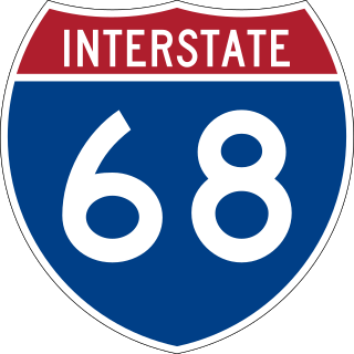
Interstate 68 (I-68) is a 112.9-mile (181.7 km) Interstate Highway in the US states of West Virginia and Maryland, connecting I-79 in Morgantown, West Virginia, east to I-70 in Hancock, Maryland. I-68 is also Corridor E of the Appalachian Development Highway System. From 1965 until the freeway's construction was completed in 1991, it was designated as U.S. Route 48 (US 48). In Maryland, the highway is known as the National Freeway, an homage to the historic National Road, which I-68 parallels between Keysers Ridge and Hancock. The freeway mainly spans rural areas and crosses numerous mountain ridges along its route. A road cut at Sideling Hill exposed geological features of the mountain and has become a tourist attraction.

<span class="mw-page-title-main">New River Gorge Bridge</span> Bridge in West Virginia, U.S.

The New River Gorge Bridge is a steel arch bridge 3,030 feet (924 m) long over the New River Gorge near Fayetteville, West Virginia, in the Appalachian Mountains of the eastern United States. With an arch 1,700 feet (518 m) long, the New River Gorge Bridge was the world's longest single-span arch bridge for 26 years; it is now the fifth longest; the longest outside of China. Part of U.S. Route 19, its construction marked the completion of Corridor L of the Appalachian Development Highway System. An average of 16,200 motor vehicles cross the bridge each day.

<span class="mw-page-title-main">U.S. Route 35</span> Highway in the United States

U.S. Route 35 (US 35) is a United States Highway that runs southeast-northwest for approximately 412 miles (663 km) from the western suburbs of Charleston, West Virginia to northern Indiana. Although the highway is physically southeast-northwest, it is nominally north–south. The highway's southern terminus is in Teays Valley, West Virginia, near Scott Depot, at Interstate 64 (I-64). Its northern terminus is near Michigan City, Indiana, at US 20. The West Virginia portion of the highway is mostly expressway, becoming a freeway shortly before it crosses the Ohio River into Ohio. The Ohio portion has been upgraded to a four-lane highway/freeway between the West Virginia state line and Trotwood, west of Dayton.

<span class="mw-page-title-main">U.S. Route 119</span> Highway in the United States

U.S. Route 119 (US 119) is a spur of US 19. It is a north–south route that was an original United States highway of 1926. It is Corridor G of the Appalachian Development Highway System (ADHS) east of US 23 and KY 80 in Kentucky to Interstate 64 at Charleston, West Virginia.

<span class="mw-page-title-main">U.S. Route 340</span> US Numbered Highway in Virginia, West Virginia and Maryland, United States

U.S. Route 340 is a spur route of US 40, and runs from Greenville, Virginia, to Frederick, Maryland. In Virginia, it runs north–south, parallel and east of US 11, from US 11 north of Greenville via Waynesboro, Grottoes, Elkton, Luray, Front Royal, and Berryville to the West Virginia state line. A short separate piece crosses northern Loudoun County on its way from West Virginia to Maryland.

<span class="mw-page-title-main">U.S. Route 121</span>

U.S. Route 121 (US 121) is a proposed U.S. highway designated as the Coalfields Expressway, a four-lane highway stretching from Beckley, West Virginia, to Pound, Virginia, approximately 108 miles (174 km) in length. It is designed to connect Interstate 64 (I-64) and I-77 in West Virginia near Beckley to US 23 in Wise County, Virginia, at Pound. While US 121 will not connect directly to US 21, it will intersect at the latter road's original alignment, now a part of I-77.

<span class="mw-page-title-main">U.S. Route 48</span> Highway in the United States

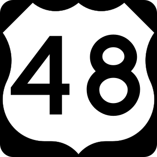
U.S. Route 48 (US 48), also known as the incomplete Corridor H of the Appalachian Development Highway System, extends from Interstate 79 (I-79) in Weston, West Virginia, eastward across the crest of the Allegheny Mountains to I-81 in Strasburg, Virginia. It is planned to extend 157 miles (253 km) from northwestern Virginia to central West Virginia.

In the United States, Corridor D is part of the Appalachian Development Highway System. In Ohio, it follows State Route 32 from the eastern Cincinnati suburbs until a point west of Albany, where it becomes concurrent with U.S. Route 50. After crossing into West Virginia, it follows U.S. Route 50 until the Interstate 79 interchange in Clarksburg.

<span class="mw-page-title-main">West Virginia Route 972</span>

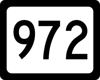
West Virginia Route 972 was a short north–south state highway in Mineral County, West Virginia. It was decommissioned in July 2017, becoming an extension of WV 93. The route connected U.S. Route 220 to U.S. Route 50 in the New Creek Valley. New Creek, West Virginia, the only populated place on the route, is located midway between US 50 and US 220. Route 972 was the highest numbered road in the state of West Virginia. Prior to 1972, WV 972 was part of US 220. In 1972, US 220 was moved to its present alignment east of New Creek.

<span class="mw-page-title-main">West Virginia Route 480</span> Highway in West Virginia, United States

West Virginia Route 480 is a 5.64-mile-long (9.08 km) state highway in the U.S. state of West Virginia. Known for most of its length as Kearneysville Pike, the highway extends from WV 115 in Kearneysville north to the Maryland state line at the Potomac River in Shepherdstown, from where the highway continues as Maryland Route 34. The route is one of the main north–south highways of northern Jefferson County and passes through the campus of Shepherd University. WV 480 was originally established in the early 1920s as West Virginia Route 48. The highway was paved in the mid-1920s, which included a different routing through Shepherdstown. WV 48's present routing through the town was established in the late 1930s when the first James Rumsey Bridge was completed; that bridge was replaced with the current bridge in the mid-2000s. WV 48 was renumbered to WV 480 in the mid-1970s after U.S. Route 48 was established in West Virginia and Maryland.

<span class="mw-page-title-main">West Run Expressway</span>

The West Run Expressway is a proposed four-lane expressway that would bypass Morgantown, West Virginia, to the northeast, connecting Interstate 68 (I-68) east of the city at milepost 7 to I-79 north of the city. The western terminus would be somewhere between exit 155 and the West Virginia Welcome Center at milepost 160 along I-79. It would relieve congestion along U.S. Highway 119 (USS 119) and West Virginia Route 705 (WV 705), the latter of which might be relieved with the 705 Connector.

<span class="mw-page-title-main">Interstate 470 (Ohio–West Virginia)</span> Highway in Ohio and West Virginia

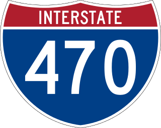
Interstate 470 (I-470) is a 10.63-mile-long (17.11 km) auxiliary Interstate Highway of I-70 that bypasses the city of Wheeling, West Virginia, United States. I-470 is one of 13 auxiliary Interstate Highways in Ohio and the only auxiliary Interstate Highway in West Virginia. The western terminus of I-470 is an interchange with I-70 in Richland Township, Ohio. Traveling southeast through rural Belmont County, I-470 approaches the Vietnam Veterans Memorial Bridge, which spans the Ohio River. After crossing the river into Ohio County, West Virginia, the highway continues east toward the Wheeling communities of Bethlehem and Elm Grove and its eastern terminus at I-70 near Elm Grove. The portion of the highway in West Virginia is named the USS West Virginia Memorial Highway by proclamation of then-Governor Cecil H. Underwood on the 59th anniversary of the attack on Pearl Harbor.

The Mon–Fayette Expressway is a partially-completed tolled freeway that is planned to eventually link Interstate 68 near Morgantown, West Virginia with Interstate 376 near Monroeville, Pennsylvania. The ultimate goal of the highway is to provide a high speed north–south connection between Morgantown and the eastern side of Pittsburgh while revitalizing economically distressed Monongahela River Valley towns in Fayette and Washington counties, serving as an alternative to Interstate 79 to the west, as well as relieving the PA 51 alignment from Pittsburgh to Uniontown.

<span class="mw-page-title-main">Parkersburg Bridge (CSX)</span> Bridge in Parkersburg, West Virginia

The Parkersburg Bridge crosses the Ohio River between Parkersburg, West Virginia, and Belpre, Ohio. Designed by Jacob Linville, the bridge has 46 spans: 25 deck plate girder, 14 deck truss, 6 through truss, and 1 through plate girder. 50,000 cubic yards (38,000 m3) of stone were used for the 53 piers. The bridge was constructed from May 1869 to January 1871 by the Baltimore and Ohio Railroad. At the time of its completion, the bridge was reportedly the longest in the world at 7,140 feet (2,180 m).

<span class="mw-page-title-main">Interstate 77 in West Virginia</span> Section of Interstate Highway in West Virginia, United States

Interstate 77 (I-77) in the US state of West Virginia is a major north–south Interstate Highway. It extends for 187.21 miles (301.29 km) between Bluefield at the Virginia state line and Williamstown at the Ohio state line.

<span class="mw-page-title-main">Interstate 64 in West Virginia</span> Highway in West Virginia

Interstate 64 (I-64) is an Interstate Highway in the US state of West Virginia. It travels east–west through the state for 189 miles (304 km) passing by the major towns and cities of Huntington, Charleston, Beckley, and Lewisburg.

<span class="mw-page-title-main">Interstate 81 in West Virginia</span> Section of the Interstate in West Virginia

Interstate 81 (I-81) in the US state of West Virginia crosses the Eastern Panhandle region, linking Virginia to Maryland. The Interstate Highway, completed in 1966, spans 26 miles (42 km) through Berkeley County, paralleling U.S. Route 11 (US 11) for its entire length. I-81 enters the state near Ridgeway, travels northeast, bypassing the city of Martinsburg, and leaves the state at the Potomac River, which serves as the state line. The first solicitations for the construction of I-81 were published in 1959, with the first six miles (9.7 km) of freeway being opened in 1963, and the full length was completed by 1966. On average, between 45,000 and 60,000 vehicles use the freeway through the panhandle per day.

<span class="mw-page-title-main">Interstate 70 in West Virginia</span> Highway in West Virginia

Interstate 70 (I-70) is a portion of the Interstate Highway System that runs from near Cove Fort, Utah, at a junction with I-15 to Baltimore, Maryland. It crosses the Northern Panhandle of West Virginia through Ohio County and the city of Wheeling. This segment is the shortest of all states through which I-70 passes, crossing West Virginia for only 14.45 miles (23.26 km). The Fort Henry Bridge carries I-70 from Wheeling Island across the Ohio River and into downtown Wheeling before the freeway enters the Wheeling Tunnel. I-470, a southerly bypass of Wheeling and the lone auxiliary Interstate Highway in West Virginia, is intersected near Elm Grove. Before crossing into Pennsylvania, I-70 passes The Highlands, a major shopping center in the panhandle, and the Bear Rocks Lake Wildlife Management Area. On average, between 27,000 and 53,000 vehicles use the freeway every day.

<span class="mw-page-title-main">Route 102 (Virginia–West Virginia)</span>

Virginia State Route 102 and West Virginia Route 102 are adjoining state highways in the U.S. states of Virginia and West Virginia. The two state highways together run 11.4 miles (18.3 km) from Center Street in Pocahontas, Virginia east to the Virginia – West Virginia state line between the twin cities of Bluefield, Virginia and Bluefield, West Virginia. Most of Route 102 consists of three sections in Virginia maintained by the Virginia Department of Transportation (VDOT); the two intervening sections in West Virginia are maintained by the West Virginia Division of Highways. In addition to connecting Pocahontas with the two Bluefields, the state highway passes through Nemours, West Virginia and Falls Mills, Virginia and provides access to Bluefield College.

References

  1. "WV Highways Annex" . Retrieved July 4, 2018.[ self-published source ]
  2. 1 2 3 Cramer, Cindy (September 1, 2015). "Traffic Engineering Directive 220-2" (PDF). West Virginia Division of Highways Traffic Engineering Division. Retrieved July 29, 2018.
  3. Panuska, Mallory (December 22, 2010). "Gateway Connector Opens Today". Times West Virginian . Fairmont, WV. Retrieved December 22, 2010.