Northfork, West Virginia

Last updated

Northfork, West Virginia
Northfork, West Virginia.jpg
Looking north on Coal Heritage Road in Northfork
Nickname: 
Northfork Blue Demons
McDowell County West Virginia Incorporated and Unincorporated areas Northfork Highlighted.svg
Location of Northfork in McDowell County, West Virginia.
USA West Virginia location map.svg
Red pog.svg
Northfork, West Virginia
Usa edcp location map.svg
Red pog.svg
Northfork, West Virginia
Coordinates: 37°25′0″N81°25′54″W / 37.41667°N 81.43167°W / 37.41667; -81.43167
Country United States
State West Virginia
County McDowell
Government
   Mayor Carol Sizemore
   Council Members Mike Capparelli, Latonia Foster, Bernie Shupe, Curtis Spencer, Robert White Town Recorder: Gary L. Dove[ citation needed ]
Area
[1]
  Total0.96 sq mi (2.50 km2)
  Land0.96 sq mi (2.50 km2)
  Water0.00 sq mi (0.00 km2)
Elevation
1,686 ft (514 m)
Population
 (2020) [2]
  Total231
  Density348.55/sq mi (134.64/km2)
Time zone UTC-5 (Eastern (EST))
  Summer (DST) UTC-4 (EDT)
ZIP code
24868
Area code 304
FIPS code 54-59428 [3]
GNIS feature ID1544237 [4]
Website local.wv.gov/northfork/Pages/default.aspx

Northfork is a town in McDowell County, West Virginia, United States, located on U.S. Route 52 between Welch and Bluefield.

Contents

The population was 231 at the 2020 census. Northfork was incorporated in 1901, so named because of its location on the north fork of the Elkhorn Creek at its junction with the south fork. It was consolidated with the town of Clark on March 26, 1948.

Geography

According to the United States Census Bureau, the town has a total area of 0.96 square miles (2.49 km2), all land. [5] The town is on the Norfolk Southern Railway (former Norfolk and Western) network.

Demographics

Historical population
CensusPop.Note
1910 425
1920 421−0.9%
1930 49417.3%
1940 387−21.7%
1950 994156.8%
1960 798−19.7%
1970 737−7.6%
1980 1,10549.9%
1990 656−40.6%
2000 519−20.9%
2010 429−17.3%
2020 231−46.2%
U.S. Decennial Census [6]
Northfork in 1946. Photo by Russell Lee. North Fork is about four miles from Gilliam Mine. North Fork, McDowell County, West Virginia. - NARA - 540807.jpg
Northfork in 1946. Photo by Russell Lee.

2020 census

Northfork town, West Virginia – Racial and ethnic composition
Note: the U.S. census treats Hispanic/Latino as an ethnic category. This table excludes Latinos from the racial categories and assigns them to a separate category. Hispanics/Latinos may be of any race.
Race / Ethnicity (NH = Non-Hispanic)Pop 2000 [7] Pop 2010 [8] Pop 2020 [9] % 2000% 2010% 2020
White alone (NH)2291817744.12%42.19%33.33%
Black or African American alone (NH)27824414053.56%56.88%60.61%
Native American or Alaska Native alone (NH)1100.19%0.23%0.00%
Asian alone (NH)0000.00%0.00%0.00%
Pacific Islander alone (NH)0000.00%0.00%0.00%
Some Other Race alone (NH)0000.00%0.00%0.00%
Mixed Race or Multi-Racial (NH)92121.73%0.47%5.19%
Hispanic or Latino (any race)2120.39%0.23%0.87%
Total519429231100.00%100.00%100.00%

2010 census

At the 2010 census there were 429 people, 173 households, and 108 families living in the town. The population density was 446.9 inhabitants per square mile (172.5/km2). There were 242 housing units at an average density of 252.1 per square mile (97.3/km2). The racial makeup of the town was 42.2% White, 57.1% African American, 0.2% Native American, and 0.5% from two or more races. Hispanic or Latino of any race were 0.2%. [2]

Of the 173 households 26.0% had children under the age of 18 living with them, 33.5% were married couples living together, 21.4% had a female householder with no husband present, 7.5% had a male householder with no wife present, and 37.6% were non-families. 36.4% of households were one person and 16.8% were one person aged 65 or older. The average household size was 2.48 and the average family size was 3.24.

The median age in the town was 46.3 years. 23.1% of residents were under the age of 18; 5.2% were between the ages of 18 and 24; 20.6% were from 25 to 44; 33.6% were from 45 to 64; and 17.7% were 65 or older. The gender makeup of the town was 47.6% male and 52.4% female.

2000 census

At the 2000 census there were 519 people, 229 households, and 130 families living in the town. The population density was 535.8 inhabitants per square mile (206.9/km2). There were 298 housing units at an average density of 307.7 per square mile (118.8/km2). The racial makeup of the town was 44.12% White, 53.95% African American, 0.19% Native American, and 1.73% from two or more races. Hispanic or Latino of any race were 0.39%. [3]

Of the 229 households 21.8% had children under the age of 18 living with them, 29.3% were married couples living together, 24.9% had a female householder with no husband present, and 42.8% were non-families. 38.9% of households were one person and 20.1% were one person aged 65 or older. The average household size was 2.24 and the average family size was 3.03.

The age distribution was 22.5% under the age of 18, 8.1% from 18 to 24, 22.0% from 25 to 44, 23.3% from 45 to 64, and 24.1% 65 or older. The median age was 43 years. For every 100 females, there were 79.0 males. For every 100 females age 18 and over, there were 69.6 males.

The median household income was $16,544 and the median family income was $19,236. Males had a median income of $27,917 versus $20,781 for females. The per capita income for the town was $10,001. About 31.3% of families and 34.4% of the population were below the poverty line, including 52.6% of those under age 18 and 20.9% of those age 65 or over.

Notable people

Related Research Articles

<span class="mw-page-title-main">Randolph County, Alabama</span> County in Alabama, United States

Randolph County is a county on the central eastern border of the U.S. state of Alabama. As of the 2020 census, the population was 21,967. Its county seat is Wedowee. Its name is in honor of John Randolph, a member of the United States Senate from Virginia. Randolph County was a prohibition or dry county until 2012, when the citizens of Randolph County voted to repeal prohibition.

<span class="mw-page-title-main">Mosses, Alabama</span> Town in Alabama, United States

Mosses is a town in Lowndes County, Alabama, United States. At the 2010 census the population was 1,029, down from 1,101 in 2000. It is part of the Montgomery Metropolitan Statistical Area. It incorporated in 1979.

<span class="mw-page-title-main">Pine Hill, Alabama</span> Town in Alabama, United States

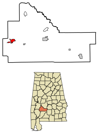
Pine Hill is a town in Wilcox County, Alabama, United States. It incorporated in 1895. Per the 2020 census, the population was 758.

<span class="mw-page-title-main">Schneider, Indiana</span> Town in Indiana, United States

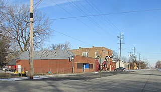
Schneider is a town in West Creek Township, Lake County, Indiana, United States. The population was 277 at the 2010 census. It is the smallest incorporated town in Lake County by population. It sits in the Kankakee River Valley.

<span class="mw-page-title-main">Ozawkie, Kansas</span> City in Kansas, United States

Ozawkie is a city in Jefferson County, Kansas, United States. As of the 2020 census, the population of the city was 638. Located adjacent to Perry Lake, Ozawkie formerly existed in a different location but was relocated without the aid of government funding prior to the reservoir's construction.

<span class="mw-page-title-main">Atwood, Kansas</span> City in Rawlins County, Kansas

Atwood is a city in and the county seat of Rawlins County, Kansas, United States. As of the 2020 census, the population of the city was 1,290.

<span class="mw-page-title-main">Island Falls, Maine</span> Town in the state of Maine, United States

Island Falls is a town in Aroostook County, Maine, United States. The population was 758 at the 2020 census. The primary village of Island Falls in the town is situated at a falls in the West Branch Mattawamkeag River.

<span class="mw-page-title-main">Burnham, Maine</span> Town in the state of Maine, United States

Burnham is a town in Waldo County, Maine, United States. The population was 1,096 at the 2020 census.

<span class="mw-page-title-main">Thorndike, Maine</span> Town in the state of Maine, United States

Thorndike is a town in Waldo County, Maine, United States. The town was named after Israel Thorndike, a landowner. The population was 774 at the 2020 census.

<span class="mw-page-title-main">Lake Shore, Minnesota</span> City in Minnesota, United States

Lake Shore is a city in Cass County, Minnesota, United States. The population was 1,056 at the 2020 census. It is part of the Brainerd Micropolitan Statistical Area.

<span class="mw-page-title-main">Sledge, Mississippi</span> Town in Mississippi, United States

Sledge is a town located in Quitman County, Mississippi, United States. As of the 2020 census, the town had a total population of 368.

<span class="mw-page-title-main">Black Jack, Missouri</span> City in Missouri, United States

Black Jack is a second-ring suburb of St. Louis, located in northern St. Louis County, Missouri, United States. The population was 6,929 at the 2010 census.

<span class="mw-page-title-main">Clarkson Valley, Missouri</span> City in Missouri, United States

Clarkson Valley is a city in St. Louis County, Missouri, United States. The population was 2,609 at the 2020 census.

<span class="mw-page-title-main">Pratt, West Virginia</span> Town in West Virginia, United States

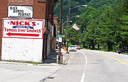
Pratt is a town in Kanawha County, West Virginia, United States, along the Kanawha River. The population was 482 at the 2020 census.

<span class="mw-page-title-main">Bramwell, West Virginia</span> Town in West Virginia, United States

Bramwell is a town in Mercer County, West Virginia, United States, along the Bluestone River. The population was 277 at the 2020 census. It is part of the Bluefield, WV-VA micropolitan area which has a population of 107,578.

<span class="mw-page-title-main">Newburg, West Virginia</span> Town in West Virginia, United States

Newburg is a town in western Preston County, West Virginia, United States. The population was 275 at the 2020 census. It is part of the Morgantown metropolitan area.

<span class="mw-page-title-main">Mill Creek, West Virginia</span> Town in West Virginia, United States

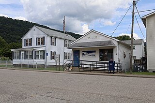
Mill Creek is a town in Randolph County, West Virginia, United States, along the Tygart Valley River. The population was 563 at the 2020 census.

<span class="mw-page-title-main">Lincoln, Forest County, Wisconsin</span> Town in Wisconsin, United States

Lincoln is a town in Forest County, Wisconsin, United States. The population was 955 at the 2010 census. The ghost town of Keith was located within Lincoln.

<span class="mw-page-title-main">Geuda Springs, Kansas</span> City in Cowley and Sumner County, Kansas

Geuda Springs is a city in Cowley and Sumner counties in the U.S. state of Kansas. As of the 2020 census, the population of the city was 158.

<span class="mw-page-title-main">St. Albans, Maine</span> Town in the state of Maine, United States

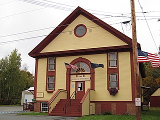
St. Albans is a town in Somerset County, Maine, United States. The population was 2,045 at the 2020 census.

References

  1. "2019 U.S. Gazetteer Files". United States Census Bureau. Retrieved August 7, 2020.
  2. 1 2 "U.S. Census website". United States Census Bureau . Retrieved January 24, 2013.
  3. 1 2 "U.S. Census website". United States Census Bureau . Retrieved January 31, 2008.
  4. "US Board on Geographic Names". United States Geological Survey. October 25, 2007. Retrieved January 31, 2008.
  5. "US Gazetteer files 2010". United States Census Bureau. Archived from the original on July 2, 2012. Retrieved January 24, 2013.
  6. "Census of Population and Housing". Census.gov. Retrieved June 4, 2015.
  7. "P004 Hispanic or Latino, and Not Hispanic or Latino by Race – 2000: DEC Summary File 1 – Northfork town, West Virginia". United States Census Bureau .
  8. "P2 HISPANIC OR LATINO, AND NOT HISPANIC OR LATINO BY RACE – 2010: DEC Redistricting Data (PL 94-171) – Northfork town, West Virginia". United States Census Bureau .
  9. "P2 Hispanic or Latino, and Not Hispanic or Latino by Race – 2020: DEC Redistricting Data (PL 94-171) – Northfork town, West Virginia". United States Census Bureau .