
Columbus is the capital and most populous city of the U.S. state of Ohio. With a 2020 census population of 905,748, it is the 14th-most populous city in the U.S., the second-most populous city in the Midwest after Chicago, and the third-most populous U.S. state capital. Columbus is the county seat of Franklin County; it also extends into Delaware and Fairfield counties. It is the core city of the Columbus metropolitan area, which encompasses 10 counties in central Ohio. It had a population of 2,138,926 in 2020, making it the largest metropolitan entirely in Ohio and 32nd-largest city in the U.S.

Mount Vernon is a neighborhood of Baltimore, Maryland, located immediately north of the city's downtown district. Designated a city Cultural District, it is one of the oldest neighborhoods originally home to the city's wealthiest and most fashionable families. The name derives from Mount Vernon, the home of George Washington, given the original Washington Monument, a massive pillar commenced in 1815 to commemorate the first president of the United States, is the defining feature of the neighborhood.

Victorian Village is a neighborhood in Columbus, Ohio, United States, north and near west of downtown. It is an established neighborhood built when a streetcar line first ran along Neil Avenue around 1900 with a fair number of established trees for an urban setting. To preserve, protect and enhance the unique architectural and historical features, the Victorian Village Historic District was established in 1973. Columbus Monthly named this neighborhood the top place to live for Arts and Entertainment, with fun right around the corner in the Short North as its neighborhood hangout.

Columbus Union Station was an intercity train station in Downtown Columbus, Ohio, near The Short North neighborhood. The station and its predecessors served railroad passengers in Columbus from 1851 until April 28, 1977.

Italian Village is a neighborhood in Columbus, Ohio, that contains an array of residential, commercial, and industrial buildings. It is a designated historic district, known for its historical and cultural preservation. The building types and architecture reflect Italian influence. With its parks and preserved historic homes, Italian Village has the highest home value appreciation in Columbus.
The Near East Side is a neighborhood located near downtown Columbus, Ohio, made up of several neighborhoods: Mount Vernon, King-Lincoln Bronzeville, Eastgate, Franklin Park, Nelson Park, Olde Towne East, and Woodland Park.

Downtown Columbus is the central business district of Columbus, Ohio. Downtown is centered on the intersection of Broad and High Streets, and encompasses all of the area inside the Inner Belt. Downtown is home to most of the tallest buildings in Columbus.
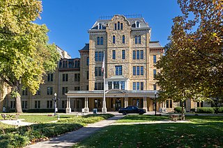
Columbus, the state capital and Ohio's largest city, has numerous neighborhoods within its city limits. Neighborhood names and boundaries are not officially defined. They may vary or change from time to time due to demographic and economic variables.

The city of Columbus is located in central Ohio at the confluence of the Scioto and Olentangy rivers. The region is dominated by a humid continental climate, characterized by hot, muggy summers and cold, dry winters.

Hollins–Roundhouse Historic District is a national historic district in Baltimore, Maryland, United States. It is a primarily residential area characterized by 19th century rowhouses. The neighborhood is historically significant due to its association with the development of rail transportation in Maryland. Additional historical significance comes from the neighborhood's association with ethnic immigration to Baltimore. During the 1840s and 1850s the area was a center of settlement for Baltimore's German and Irish communities, many of whom immigrated to the United States to work in the rail industry. Later, from the 1880s to the 1920s, the neighborhood became established as the center of Baltimore's Lithuanian immigrant community. Because of the large Lithuanian population in the area north of Hollins Street, the area became known as Little Lithuania. A few remnants of the neighborhood's Lithuanian heritage still remain, such as Lithuanian Hall located on Hollins Street.

Public transit has taken numerous forms in Columbus, the largest city and capital of Ohio. Transit has variously used passenger trains, horsecars, streetcars, interurbans, trolley coaches, and buses. Current service is through the Central Ohio Transit Authority's bus system, numerous intercity bus companies, and through bikeshare, rideshare, and electric scooter services.
Columbus Public Health is the health department of Columbus, Ohio. The department is accredited by the Public Health Accreditation Board. The department dates to 1833, when the city's mayor appointed five citizens to help with its cholera outbreak. It became a permanent body to activate whenever health emergencies arose.

The Jefferson Avenue Historic District is a historic district in Downtown Columbus, Ohio. The site was listed on the National Register of Historic Places in 1982 and the Columbus Register of Historic Properties in 1983. The site includes approximately 12 buildings regarded for their history and architecture. It is one of few remaining residential neighborhoods downtown. It includes the Thurber House, formerly home to cartoonist and author James Thurber, and the headquarters building of the Columbus Landmarks Foundation. The boundaries of the district vary slightly between the two registers the district was entered in.

The Old Beechwold Historic District is a neighborhood and historic district in Clintonville, Columbus, Ohio. The site was listed on the Columbus Register of Historic Properties in 1985 and the National Register of Historic Places in 1987. The district is significant for its architecture, landscape architecture, and community planning. The houses are of the early 20th century, using stone, brick, and stucco.

High Street is a major thoroughfare in Central Ohio, predominantly in Franklin County and Columbus. It stretches from the northern border of Columbus in Delaware County south to the southern boundary of Franklin County just past Columbus's municipal boundaries. The street is considered one of Columbus's two main roads, along with Broad Street.

The Charles S. Barrett Building is a historic building in the Merion Village neighborhood of Columbus, Ohio. It was listed on the Columbus Register of Historic Properties in 2006 and the National Register of Historic Places in 2015. The building was completed in 1900 as the home of the city's South High School, part of the Columbus Public School District. It has since been converted into apartments, rented out as The Barrett.
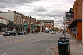
The North Columbus Commercial Historic District is a historic district in the Old North Columbus neighborhood of Columbus, Ohio. It was listed on the National Register of Historic Places in 2010. The district is centered on High Street, one of the city's two main thoroughfares. The district has 25 buildings, all of which contribute to the district, and built from c. 1880 to 1960. Architectural styles range from Italianate to Tudor Revival and Neoclassical, with some Craftsman elements and one Modernist building.

The Near Northside Historic District is a historic district in Columbus, Ohio. The large district encompasses portions of the University District, Harrison West, and nearly all of Victorian Village.

The Peruna Drug Manufacturing Company Building was a historic building in Downtown Columbus, Ohio. It was built c. 1902 and was listed on the National Register of Historic Places in March 1973. The building was demolished in November 1973.

Southwood Elementary School is a public elementary school in Columbus, Ohio, part of Columbus City Schools. The school building, located in the city's Merion Village neighborhood, was completed in 1894 and was designed by David Riebel. It was added to the Columbus Register of Historic Properties in 2002.


