The Assembly of the Republic of Kosovo was originally established by the United Nations Interim Administration Mission in Kosovo in 2001 to provide 'provisional, democratic self-government'.

Nové Zámky District is a district in the Nitra Region of western Slovakia. Until 1918, the area of the district was split between several county of Kingdom of Hungary: the largest area in the north formed part of Nitra; an area in the south between Dvory nad Žitavou and Strekov formed part of Komárno; an area in the north-east around Veľké Lovce formed part of Tekov; a sizable area in the east formed part of Esztergom (Ostrihom); and a small area around Salka formed part of Hont County.

The Argentière Glacier is a glacier in the French Alps. It is one of the larger glaciers found within the Mont Blanc massif, and is situated above the village of Argentière. It lies perpendicular to the Chamonix valley and falls within the Auvergne-Rhône-Alpes region.

Palaruvi Falls is a waterfall located in Kollam district in the Indian state of Kerala. It is the 32nd highest waterfall in India.
Janków is a village in the administrative district of Gmina Domaniów, within Oława County, Lower Silesian Voivodeship, in south-western Poland. Prior to 1945 it was in Germany.
Sardauna Memorial Stadium is a multi-use stadium in Gusau, Zamfara State, Nigeria. It is currently used mostly for football matches and is the home stadium of Zamfara United F.C. of the Nigerian Premier League. The stadium has a capacity of 5,000 people.
Archis is a town in the Tavush Province of Armenia.

Stawiszynek is a village in the administrative district of Gmina Świnice Warckie, within Łęczyca County, Łódź Voivodeship, in central Poland. It lies approximately 4 kilometres (2 mi) east of Świnice Warckie, 17 km (11 mi) west of Łęczyca, and 45 km (28 mi) north-west of the regional capital Łódź.

Güllücə is a village in the Agdam Rayon of Azerbaijan.
Babaylı is a village in the Zangilan Rayon of Azerbaijan.
Antonin is a village in the administrative district of Gmina Krzykosy, within Środa Wielkopolska County, Greater Poland Voivodeship, in west-central Poland.
Nowy Głomsk is a village in the administrative district of Gmina Zakrzewo, within Złotów County, Greater Poland Voivodeship, in west-central Poland. It lies approximately 4 kilometres (2 mi) north of Zakrzewo, 13 km (8 mi) north-east of Złotów, and 118 km (73 mi) north of the regional capital Poznań.
Starowice is a village in the administrative district of Gmina Otmuchów, within Nysa County, Opole Voivodeship, in south-western Poland, close to the Czech border. It lies approximately 5 kilometres (3 mi) north of Otmuchów, 13 km (8 mi) west of Nysa, and 58 km (36 mi) west of the regional capital Opole.
Stara Brda is a settlement in the administrative district of Gmina Koczała, within Człuchów County, Pomeranian Voivodeship, in northern Poland. It lies approximately 11 kilometres (7 mi) north-east of Koczała, 37 km (23 mi) north of Człuchów, and 104 km (65 mi) south-west of the regional capital Gdańsk.

The Hollandia Hut is a mountain hut of the Swiss Alpine Club, located east of Blatten in the canton of Valais. The hut lies at a height of 3,240 metres above sea level, just above the Lötschenlücke, the glacier pass connecting the Lötschental from the Aletsch Glacier. All accesses to the hut involve glacier crossing.
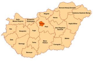
Szentpéterúr is a village in Zala County, Hungary.
Pizzo di Rodes is a mountain of Lombardy, Italy. It has an elevation of 2,829 metres above sea level.
Vahelmisrahu is an island belonging to the country of Estonia.

Tava or Plita, is an island in the Bay of Baku, Azerbaijan.

Xili Lake station is a Metro station of Shenzhen Metro Line 7. It opened on 28 October 2016.