Pördefölde

Last updated

Pördefölde
Village
CountryFlag of Hungary.svg  Hungary
Region Western Transdanubia
County Zala County
Time zone CET (UTC+1)
  Summer (DST) CEST (UTC+2)

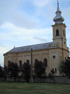
Pördefölde is a village in Zala County, Hungary. [1]

Zala County Counties of Hungary in Western Transdanubia

Zala is an administrative county in south-western Hungary. It is named after the Zala River. It shares borders with Croatia and Slovenia and the Hungarian counties Vas, Veszprém and Somogy. The capital of Zala county is Zalaegerszeg. Its area is 3,784 square kilometres (1,461 sq mi). Lake Balaton lies partly in the county.

Counties of Hungary counties of Hungary since 1950

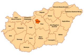
Hungary is subdivided administratively into 19 counties and the capital city (főváros) Budapest. The counties are further subdivided into 174 districts. The capital Budapest is subdivided into 23 districts.

Hungary Country in Central Europe

Hungary is a country in Central Europe. Spanning 93,030 square kilometres (35,920 sq mi) in the Carpathian Basin, it borders Slovakia to the north, Ukraine to the northeast, Austria to the northwest, Romania to the east, Serbia to the south, Croatia to the southwest, and Slovenia to the west. With about 10 million inhabitants, Hungary is a medium-sized member state of the European Union. The official language is Hungarian, which is the most widely spoken Uralic language in the world, and among the few non-Indo-European languages to be widely spoken in Europe. Hungary's capital and largest city is Budapest; other major urban areas include Debrecen, Szeged, Miskolc, Pécs and Győr.

Related Research Articles

Csengőd Place in Bács-Kiskun, Hungary

Csengőd is a village in Bács-Kiskun county, in the Southern Great Plain region of Hungary.

Páhi Place in Bács-Kiskun, Hungary

Páhi is a village in Bács-Kiskun county, in the Southern Great Plain region of southern Hungary.

Petelea Commune in Mureș County, Romania

Petelea is a commune in Mureș County, Romania that is composed of two villages: Habic and Petelea. It has a population of 2977: 48.3% Roma, 48.2% Romanians and 2.5% Hungarians.

Sárfimizdó Place in Western Transdanubia, Hungary

Sárfimizdó is a village in Vas county, Hungary.

Szőce Place in Western Transdanubia, Hungary

Szőce is a village in Vas county, Hungary.

Rădești, Alba Commune in Alba County, Romania

Rădești is a commune located in Alba County, Romania. It has a population of 1,398. It is composed of four villages: Leorinț, Meșcreac, Rădești and Șoimuș (Magyarsolymos).

Ciumeghiu Commune in Bihor County, Romania

Ciumeghiu is a commune in Bihor County, northwestern Romania with a population of 4,297 people (2011). It is composed of three villages: Boiu (Mezőbaj), Ciumeghiu and Ghiorac (Erdőgyarak).

Börzönce is a village in Zala County, Hungary.

Csonkahegyhát is a village in Zala County, Hungary.

Hagyárosbörönd is a village in Zala County, Hungary.

Kávás is a village in Zala County, Hungary.

Kerkaszentkirály is a village in Zala County, Hungary.

Kerkateskánd is a village in Zala County, Hungary.

Márokföld is a village in Zala County, Hungary.

Páka is a village in Zala County, Hungary.

Pórszombat is a village in Zala County, Hungary.

Szentliszló is a village in Zala County, Hungary.

Zalaszentbalázs is a village in Zala County, Hungary.

Zalaszentgyörgy is a village in Zala County, Hungary.

Zalaszentmihály is a village in Zala County, Hungary.

References

Coordinates: 46°35′N16°43′E / 46.583°N 16.717°E / 46.583; 16.717

Geographic coordinate system Coordinate system

A geographic coordinate system is a coordinate system that enables every location on Earth to be specified by a set of numbers, letters or symbols. The coordinates are often chosen such that one of the numbers represents a vertical position and two or three of the numbers represent a horizontal position; alternatively, a geographic position may be expressed in a combined three-dimensional Cartesian vector. A common choice of coordinates is latitude, longitude and elevation. To specify a location on a plane requires a map projection.