It is proposed that this article be deleted because of the following concern:
If you can address this concern by improving, copyediting, sourcing, renaming, or merging the page, please edit this page and do so. You may remove this message if you improve the article or otherwise object to deletion for any reason. Although not required, you are encouraged to explain why you object to the deletion, either in your edit summary or on the talk page. If this template is removed, do not replace it . ContentsThe article may be deleted if this message remains in place for seven days, i.e., after 15:29, 17 December 2018 (UTC). Nominator: Please consider notifying the author/project: {{subst:proposed deletion notify |2009 Guerrero earthquake|concern=Insignificant event with no encyclopedic value}} ~~~~ |
 | |
| UTC time | 2009-04-27 16:46:28 |
|---|---|
| ISC event | 12704953 |
| USGS-ANSS | ComCat |
| Local date | 27 April 2009 |
| Local time | 09:46:28 |
| Magnitude | 5.8 Mw |
| Depth | 35 kilometres (22 mi) |
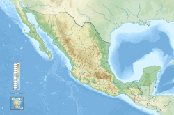
| Epicenter | 17°04′N99°23′W / 17.07°N 99.39°W Coordinates: 17°04′N99°23′W / 17.07°N 99.39°W |
| Areas affected | Mexico |
| Max. intensity | V (Moderate) |
| Casualties | 2 |
The 2009 Guerrero earthquake struck southeast of Chilpancingo, Guerrero with a moment magnitude of 5.8 on 27 April. [1] The earthquake was at a depth of 30 miles and was felt in other parts of the Mexico's central region, including Mexico City and the states of Hidalgo, Morelos, Puebla and Veracruz. Two women died of heart attacks in the municipality of Acapulco, Guerrero, where four homes also collapsed. [2] [3]

Chilpancingo de los Bravo is the capital and second-largest city of the state of Guerrero, Mexico. In 2010 it had a population of 187,251 people. The municipality has an area of 2,338.4 km2 (902.9 sq mi) in the south-central part of the state, situated in the Sierra Madre del Sur, on the bank of the Huacapa River. The city is on Mexican Federal Highway 95 which connects Acapulco to Mexico City. It is served by Chilpancingo National Airport, which is one of the five airports in the state.

Guerrero, officially the Free and Sovereign State of Guerrero, is one of the 31 states which, with the Federal District, comprise the 32 Federal Entities of Mexico. It is divided in 81 municipalities and its capital city is Chilpancingo and its largest city is Acapulco.
The moment magnitude scale is a measure of n earthquake's magnitude based on its seismic moment, expressed in terms of the familiar magnitudes of the original "Richter" magnitude scale.
