22nd parallel south

Last updated
World location map (equirectangular 180).svg
22°
22nd parallel south
The 22nd parallel south forms part of Botswana's border with Namibia. 22nd meridian Botswana.png
The 22nd parallel south forms part of Botswana's border with Namibia.
The 22nd parallel south forms part of Bolivia's border with Argentina. 22nd meridian Bolivia.png
The 22nd parallel south forms part of Bolivia's border with Argentina.

The 22nd parallel south is a circle of latitude that is 22 degrees south of the Earth's equatorial plane. It crosses the Atlantic Ocean, Africa, the Indian Ocean, Australasia, the Pacific Ocean and South America.

Contents

A section of the border between Namibia and Botswana, and two sections of the border between Bolivia and Argentina are defined by the parallel.

Around the world

Starting at the Prime Meridian and heading eastwards, the parallel 22° south passes through:

Co-ordinatesCountry, territory or oceanNotes
22°00′S00°00′E / 22.000°S 0.000°E / -22.000; 0.000 (Prime Meridian) Atlantic Ocean
22°00′S14°10′E / 22.000°S 14.167°E / -22.000; 14.167 (Namibia) Flag of Namibia.svg  Namibia
22°00′S20°00′E / 22.000°S 20.000°E / -22.000; 20.000 (Namibia / Botswana border) Flag of Namibia.svg  Namibia / Flag of Botswana.svg  Botswana border
22°00′S21°00′E / 22.000°S 21.000°E / -22.000; 21.000 (Botswana) Flag of Botswana.svg  Botswana
22°00′S29°02′E / 22.000°S 29.033°E / -22.000; 29.033 (Zimbabwe) Flag of Zimbabwe.svg  Zimbabwe
22°00′S31°44′E / 22.000°S 31.733°E / -22.000; 31.733 (Mozambique) Flag of Mozambique.svg  Mozambique
22°00′S35°19′E / 22.000°S 35.317°E / -22.000; 35.317 (Indian Ocean) Indian Ocean Mozambique Channel
22°00′S43°16′E / 22.000°S 43.267°E / -22.000; 43.267 (Madagascar) Flag of Madagascar.svg  Madagascar
22°00′S48°05′E / 22.000°S 48.083°E / -22.000; 48.083 (Indian Ocean) Indian Ocean
22°00′S113°56′E / 22.000°S 113.933°E / -22.000; 113.933 (Australia) Flag of Australia (converted).svg  Australia Western Australia - North West Cape peninsula
22°00′S114°08′E / 22.000°S 114.133°E / -22.000; 114.133 (Exmouth Gulf) Indian Ocean Exmouth Gulf
22°00′S114°30′E / 22.000°S 114.500°E / -22.000; 114.500 (Australia) Flag of Australia (converted).svg  Australia Western Australia
Northern Territory
Queensland
22°00′S149°29′E / 22.000°S 149.483°E / -22.000; 149.483 (Coral Sea) Pacific Ocean Coral Sea
Passing through Flag of Australia (converted).svg  Australia's Coral Sea Islands Territory
22°00′S166°01′E / 22.000°S 166.017°E / -22.000; 166.017 (New Caledonia) Flags of New Caledonia.svg  New Caledonia
22°00′S166°45′E / 22.000°S 166.750°E / -22.000; 166.750 (Pacific Ocean) Pacific Ocean Passing just south of Mangaia, Flag of the Cook Islands.svg  Cook Islands
Passing just south of Îles Maria, Flag of French Polynesia.svg  French Polynesia
Passing between the atolls of Moruroa and Fangataufa, Flag of French Polynesia.svg  French Polynesia
22°00′S136°12′W / 22.000°S 136.200°W / -22.000; -136.200 (French Polynesia) Flag of French Polynesia.svg  French Polynesia Atoll of Maria Est
22°00′S136°10′W / 22.000°S 136.167°W / -22.000; -136.167 (Pacific Ocean) Pacific Ocean
22°00′S70°11′W / 22.000°S 70.183°W / -22.000; -70.183 (Chile) Flag of Chile.svg  Chile
22°00′S68°03′W / 22.000°S 68.050°W / -22.000; -68.050 (Bolivia) Bandera de Bolivia (Estado).svg  Bolivia
22°00′S66°17′W / 22.000°S 66.283°W / -22.000; -66.283 (Argentina) Flag of Argentina.svg  Argentina
22°00′S65°52′W / 22.000°S 65.867°W / -22.000; -65.867 (Bolivia) Bandera de Bolivia (Estado).svg  Bolivia
22°00′S63°56′W / 22.000°S 63.933°W / -22.000; -63.933 (Bolivia / Argentina border) Bandera de Bolivia (Estado).svg  Bolivia / Flag of Argentina.svg  Argentina border
22°00′S63°43′W / 22.000°S 63.717°W / -22.000; -63.717 (Bolivia) Bandera de Bolivia (Estado).svg  Bolivia For 4.5 km - the border diverts south of the parallel around the town of Yacuíba
22°00′S63°40′W / 22.000°S 63.667°W / -22.000; -63.667 (Bolivia / Argentina border) Bandera de Bolivia (Estado).svg  Bolivia / Flag of Argentina.svg  Argentina border
22°00′S62°48′W / 22.000°S 62.800°W / -22.000; -62.800 (Bolivia) Bandera de Bolivia (Estado).svg  Bolivia
22°00′S62°34′W / 22.000°S 62.567°W / -22.000; -62.567 (Paraguay) Flag of Paraguay.svg  Paraguay
22°00′S57°58′W / 22.000°S 57.967°W / -22.000; -57.967 (Brazil) Flag of Brazil.svg  Brazil Mato Grosso do Sul
São Paulo
Minas Gerais
Rio de Janeiro
22°00′S40°59′W / 22.000°S 40.983°W / -22.000; -40.983 (Atlantic Ocean) Atlantic Ocean

See also

Related Research Articles

<span class="mw-page-title-main">45th parallel south</span> Circle of latitude

The 45th parallel south is a circle of latitude that is 45° south of the Earth's equator.

The 17th parallel north is a circle of latitude that is 17 degrees north of the Earth's equatorial plane. It crosses Africa, Asia, the Indian Ocean, the Pacific Ocean, Central America, the Caribbean and the Atlantic Ocean.

The 40th parallel north is a circle of latitude that is 40 degrees north of the Earth's equatorial plane. It crosses Europe, the Mediterranean Sea, Asia, the Pacific Ocean, North America, and the Atlantic Ocean.

The 30th parallel north is a circle of latitude that is 30 degrees north of the Earth's equatorial plane. It stands one-third of the way between the equator and the North Pole and crosses Africa, Asia, the Pacific Ocean, North America and the Atlantic Ocean. The parallel is used in some contexts to delineate Europe or what is associated with the continent of Europe as a southernmost limit, e.g. to qualify for membership of the European Broadcasting Union.

<span class="mw-page-title-main">110th meridian west</span> Line of longitude

The meridian 110° west of Greenwich is a line of longitude that extends from the North Pole across the Arctic Ocean, North America, the Pacific Ocean, the Southern Ocean, and Antarctica to the South Pole.

The 35th parallel north is a circle of latitude that is 35 degrees north of the Earth's equatorial plane. It crosses Africa, the Mediterranean Sea, Asia, the Pacific Ocean, North America and the Atlantic Ocean.

<span class="mw-page-title-main">141st meridian east</span> Line of longitude

The 141st meridian east of Greenwich is a line of longitude that extends from the North Pole across the Arctic Ocean, Asia, the Pacific Ocean, Australasia, the Indian Ocean, the Southern Ocean, and Antarctica to the South Pole.

The 26th parallel south latitude is a circle of latitude that is 26 degrees south of Earth's equatorial plane. It crosses the Atlantic Ocean, Africa, the Indian Ocean, Australia, the Pacific Ocean and South America.

<span class="mw-page-title-main">10th parallel north</span> Circle of Latitude

The 10th parallel north is a circle of latitude that is 10 degrees north of the Earth's equatorial plane. It crosses Africa, the Indian Ocean, the Indian Subcontinent, Southeast Asia, the Pacific Ocean, Central America, South America and the Atlantic Ocean.

<span class="mw-page-title-main">20th parallel north</span> Circle of latitude

The 20th parallel north is a circle of latitude that is 20 degrees north of the Earth's equatorial plane. It crosses Africa, Asia, the Indian Ocean, the Pacific Ocean, North America, the Caribbean and the Atlantic Ocean.

The 10th parallel south is a circle of latitude that is 10 degrees south of the Earth's equatorial plane. It crosses the Atlantic Ocean, Africa, the Indian Ocean, Australasia, the Pacific Ocean and South America.

<span class="mw-page-title-main">25th parallel north</span> Circle of latitude

The 25th parallel north is a circle of latitude that is 25 degrees north of the Earth's equatorial plane. It crosses Africa, Asia, the Indian Ocean, the Pacific Ocean, North America and the Atlantic Ocean.

<span class="mw-page-title-main">29th parallel south</span> Circle of latitude

The 29th parallel south is a circle of latitude that is 29 degrees south of the Earth's equatorial plane. It crosses the Atlantic Ocean, Africa, the Indian Ocean, Australasia, the Pacific Ocean and South America.

<span class="mw-page-title-main">13th parallel south</span>

The 13th parallel south is a circle of latitude that is 13 degrees south of the Earth's equatorial plane. It crosses the Atlantic Ocean, Africa, the Indian Ocean, Australasia, the Pacific Ocean and South America.

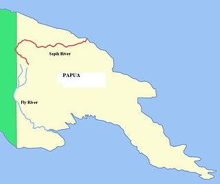
The 8th parallel south is a circle of latitude that is 8 degrees south of the Earth's equatorial plane. It crosses the Atlantic Ocean, Africa, the Indian Ocean, Southeast Asia, Australasia, the Pacific Ocean and South America.

<span class="mw-page-title-main">1st parallel south</span> Circle of latitude

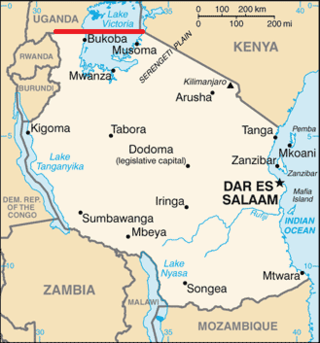
The 1st parallel south is a circle of latitude that is 1 degree south of the Earth's equatorial plane. It crosses the Atlantic Ocean, Africa, the Indian Ocean, Southeast Asia, Australasia, the Pacific Ocean and South America.

The meridian 20° west of Greenwich is a line of longitude that extends from the North Pole across the Arctic Ocean, Greenland, Iceland, the Atlantic Ocean, the Southern Ocean, and Antarctica to the South Pole. The 20th meridian west forms a great circle with the 160th meridian east.

The 8th parallel north is a circle of latitude that is 8 degrees north of the Earth's equatorial plane. It crosses Africa, the Indian Ocean, South Asia, Southeast Asia, the Pacific Ocean, Central America, South America and the Atlantic Ocean.

The 16th parallel south is a circle of latitude that is 16 degrees south of the Earth's equatorial plane. It crosses the Atlantic Ocean, Africa, the Indian Ocean, Australasia, the Pacific Ocean and South America.

The 38th parallel north is a circle of latitude that is 38 degrees north of the Earth's equatorial plane. It crosses Europe, the Mediterranean Sea, Asia, the Pacific Ocean, North America, and the Atlantic Ocean. The 38th parallel north formed the border between North and South Korea prior to the Korean War.

References