Aarbergen

Last updated
Aarbergen
Wappen Aarbergen.png
Location of Aarbergen within Rheingau-Taunus-Kreis district
Aarbergen in RUD.svgHohenstein
Germany adm location map.svg
Red pog.svg
Aarbergen
Hesse location map.svg
Red pog.svg
Aarbergen
Coordinates: 50°15′N8°4′E / 50.250°N 8.067°E / 50.250; 8.067 Coordinates: 50°15′N8°4′E / 50.250°N 8.067°E / 50.250; 8.067
Country Germany
State Hesse
Admin. region Darmstadt
District Rheingau-Taunus-Kreis
Subdivisions6 districts
Government
   Mayor (201925) Matthias Rudolf [1]
Area
  Total33.94 km2 (13.10 sq mi)
Elevation
230 m (750 ft)
Population
 (2020-12-31) [2]
  Total6,337
  Density190/km2 (480/sq mi)
Time zone UTC+01:00 (CET)
  Summer (DST) UTC+02:00 (CEST)
Postal codes
65326
Dialling codes 06120
Vehicle registration RÜD
Website www.aarbergen.de

Aarbergen is a municipality in the Rheingau-Taunus-Kreis in the Regierungsbezirk of Darmstadt in Hesse, Germany.

Contents

Geography

Location

Aarbergen lies on the river Aar south of Limburg an der Lahn and between the Taunus ridge and the river Lahn in the Western Hintertaunus ("Farther Taunus").

The community is found in the low mountain landscape in the western Hintertaunus, which is part of the Rhenish Massif (Rhenish Slate Mountains). The heights are characterized by a pronounced peak-and-trough surface relief, parts of which show formations from deep in the ground (kaolin). The surface relief had valleys carved deeply into it in the Quaternary by the Aar and its tributaries. Underground, the rock is formed mainly out of the Rhenish Slate Mountains’ Lower Devonian shale, metamorphic sandstone and quartzite. On top are found, often several metres deep, great layers of periglacial deposits much of which contains carbonate-free to weakly carbonate loess loam. Oligocene shingle (Vallendar facies) overlies the older surface near Kettenbach and Hausen über Aar.

Well known in professional circles are the occurrences of soil erosion (gullies and similar channels) in broad parts of the community which began in historical times. The landscape in the community's municipal area is characterized by the middle Aar valley with its side valleys. The greater part of the municipal area is wooded. The main land use in open areas is field crops. In the valleys is meadowland, sometimes with scenically valuable meadow orchards (Streuobstwiesen). The Aubach, the Aar's biggest tributary, empties into that river within community limits, as does the Bettenbach.

Neighbouring communities

Aarbergen borders in the north on the communities of Mudershausen, Schiesheim, Burgschwalbach and Kaltenholzhausen (all in the Rhein-Lahn-Kreis in Rhineland-Palatinate) and Hünfelden (Limburg-Weilburg), in the east on the community of Hünstetten, in the south on the community of Heidenrod (all in the Rheingau-Taunus-Kreis) and in the west on the communities of Reckenroth, Eisighofen, Dörsdorf and Berghausen (all in the Rhein-Lahn-Kreis).

Constituent communities

Aarbergen's Ortsteile are Hausen über Aar, Rückershausen, Kettenbach, Michelbach, Daisbach and Panrod.

History

The constituent community of Rückershausen had its first documentary mention in 879. Until 1326, the village belonged to the domain held by Count Gebhard of the Niederlohngau. Thereafter, first a share of the village and later the whole passed to Nassau. In 1532, Rückershausen was granted market rights.

Hausen über Aar likewise had its first documentary mention in 879, when it belonged to the Niederlohngau and found its way into the ownership of St. Severus's Monastery in Kettenbach, which in the same year was moved to Gemünden in the Westerwald. Later, Hausen über Aar had two lords and as of 1806 belonged to the Duchy of Nassau.

With the consecration of St. Severus's Monastery in 845, the village of Kettenbach was founded by Gebhard, Count of the Lahngau and had its first documentary mention. Some time about 1000, the County of Diez grew out of the Niederlahngau. Over the centuries, Kettenbach had various owners and ended up in 1771 wholly in Nassau's hands.

Politics

Community council

The municipal election held on 26 March 2006 yielded the following results:

Parties and voter communities%
2006
Seats
2006
%
2001
Seats
2001
CDU Christian Democratic Union of Germany 41.81334.911
SPD Social Democratic Party of Germany 41.21345.014
GREENS Bündnis 90/Die Grünen 7.925.92
BLBürgerliste Aarbergen9.0314.24
Total100.031100.031
Voter turnout in %58.171.7

Mayors

Past mayoral contests yielded the following results:

YearCandidatesParty%
Result
2007Udo ScheligaCDU50.5
Hartmut BoppSPD49.5
Voter turnout in %69.7
2001(1)Hartmut BoppSPD50.9
Rolf-Dieter FinklerCDU49.1
Voter turnout in %71.1
YearCandidatesParty%
Result
2001Hartmut BoppSPD38.9
Monika BaumgartlBL22.3
Rolf-Dieter FinklerCDU38.8
Voter turnout in %65.6
1995Wolf SchraderSPD74.2
Rolf-Dieter FinklerCDU25.8
Voter turnout in %77.9

(1) Runoff

At the last election on 11 March 2007, Udo Scheligo (CDU) edged in with 50.5% of the vote over the incumbent mayor Hartmut Bopp (SPD), who garnered 49.5% of the vote. Other parties nominated no candidates, and also, no independent candidates stood. Voter turnout was 69.7%.

Culture and sightseeing

Buildings

Kettenbach

  • Evangelical church from 1752. The Baroque organ, called the Schölerorgel from 1763 is under monumental protection; its last major overhaul was in 1969–1970.

Michelbach

  • Fortress church at the graveyard, about 800 years old (mediaeval quire tower, rib vaulting, eight-sided cupola, round quire arch). Today, Aarbergen's oldest building is used as a mortuary chapel.
  • Evangelical church from the late Gründerzeit (1908)
  • 450-year-old lime tree under conservation protection at the graveyard (Apostellinde)
  • Rahnstätter Hof (former estate), well with restored walls with a plaque on which a summarized history can be read, below the glider field (first mentioned in 1194–98, in 1870 the estate was made public at dissolution)

Rückershausen

  • Evangelical church built about 1326, converted in the 18th century, organ from 1755
  • Antonius-Sprudel, known since 1779, carbonic acid sparkling sour mineral water (Säuerling), drinking and healing water (gout, diabetes, gastritis and enteritis, kidney flushing, metabolic disorders)

Hausen über Aar

  • Picturesque bridge on the Aar built out of broken stone and with cast iron balustrade from 1866.
  • War memorial under monumental protection from 1926 with names of the fallen from both world wars.

Panrod

Daisbach

  • Catholic church built 1690-1709 (endowed by the Baron of Galen, hereditary treasurer). The church is used equally by both Catholic and Evangelical Christians.

Michelbach, Kettenbach, Hausen über Aar, Rückershausen

  • Through the community runs the Aartalbahn (railway), which opened in 1894 and is now under monumental protection. It is Hesse's longest building monument and is said to be an outstanding example of an elaborately designed German secondary railway line. In the warmer half of the year there are Draisine trips on these tracks run by the interstate Aarbeitskreis Aartalbahn (“Aar Valley Railway Working Group”, with the first word humorously misspelt – there is usually only one A).

Regular events

Culinary specialities

Famous people

Honorary citizens

Sons and daughters of the town

Education

Related Research Articles

<span class="mw-page-title-main">Taunus</span> Mountain range in Germany

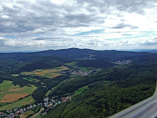
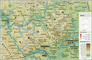
The Taunus is a mountain range in Hesse, Germany, located north of Frankfurt. The tallest peak in the range is Großer Feldberg at 878 m; other notable peaks are Kleiner Feldberg and Altkönig.

Rheingau-Taunus is a Kreis (district) in the west of Hesse, Germany. Rheingau-Taunus-Kreis is part of the Darmstadt region; its main administrative seat is Bad Schwalbach. Outposted sections of the local administration are located in Idstein and Rüdesheim am Rhein.

<span class="mw-page-title-main">Lahn</span> Right tributary of Rhine river in Germany

The Lahn is a 245.6-kilometre-long (152.6 mi), right tributary of the Rhine in Germany. Its course passes through the federal states of North Rhine-Westphalia (23.0 km), Hesse (165.6 km), and Rhineland-Palatinate (57.0 km).

<span class="mw-page-title-main">Idstein</span> Town in Hesse, Germany

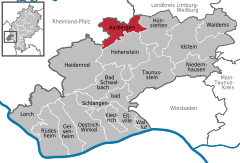
Idstein is a town of about 25,000 inhabitants in the Rheingau-Taunus-Kreis in the Regierungsbezirk of Darmstadt in Hesse, Germany. Because of its well preserved historical Altstadt it is part of the Deutsche Fachwerkstraße, connecting towns with fine fachwerk buildings and houses. In 2002, the town hosted the 42nd Hessentag state festival.

<span class="mw-page-title-main">Diez, Germany</span> Town in Rhineland-Palatinate, Germany

Diez an der Lahn is a town in Germany's Rhein-Lahn district in Rhineland-Palatinate, on the borders of Hesse. Diez is the administrative seat of the municipality of Diez.

<span class="mw-page-title-main">Niedernhausen</span> Municipality in Hesse, Germany

Niedernhausen im Taunus is a municipality in the Rheingau-Taunus-Kreis in the Regierungsbezirk of Darmstadt in Hesse, Germany, with almost 15,000 inhabitants.

<span class="mw-page-title-main">Eltville</span> Town in Hesse, Germany

Eltville am Rhein is a town in the Rheingau-Taunus-Kreis in the Regierungsbezirk of Darmstadt in Hesse, Germany. It lies on the German Timber-Frame Road.

<span class="mw-page-title-main">Selters (Taunus)</span> Municipality in Hesse, Germany

Selters (Taunus) is a municipality with 8,000 inhabitants north of Bad Camberg in Limburg-Weilburg district in Hesse, Germany.

<span class="mw-page-title-main">Taunusstein</span> Town in Hesse, Germany

Taunusstein is the biggest town in the Rheingau-Taunus-Kreis in the Regierungsbezirk of Darmstadt in Hessen, Germany. It has 30,068 inhabitants (2020).

<span class="mw-page-title-main">Hünfelden</span> Municipality in Hesse, Germany

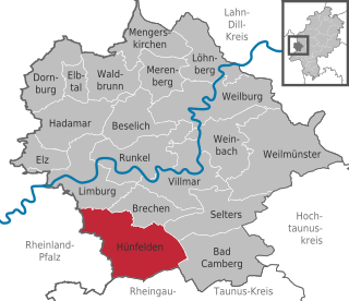
Hünfelden is a municipality in Limburg-Weilburg district in Hesse, Germany. Hünfelden lies on the Hühnerstraße, an historic part of Bundesstraße 417.

<span class="mw-page-title-main">Siegbach</span> Municipality in Hesse, Germany

Siegbach is a municipality in the Lahn-Dill-Kreis in Hesse, Germany.

<span class="mw-page-title-main">Löhnberg</span> Municipality in Hesse, Germany

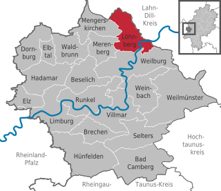
Löhnberg is a municipality north of Weilburg in Limburg-Weilburg district in Hesse, Germany.

<span class="mw-page-title-main">Heidenrod</span> Municipality in Hesse, Germany

Heidenrod is a municipality in the Rheingau-Taunus-Kreis in the Regierungsbezirk of Darmstadt in Hesse, Germany. Seat of municipal administration is to be found in the most populated municipal district, in Laufenselden.

<span class="mw-page-title-main">Hohenstein, Hesse</span> Municipality in Hesse, Germany

Hohenstein is a municipality in the Rheingau-Taunus-Kreis in the Regierungsbezirk of Darmstadt in Hesse, Germany.

<span class="mw-page-title-main">Hünstetten</span> Municipality in Hesse, Germany

Hünstetten is a community in the Rheingau-Taunus-Kreis in the Regierungsbezirk of Darmstadt in Hesse, Germany.

<span class="mw-page-title-main">Cramberg</span> Municipality in Rhineland-Palatinate, Germany

Cramberg is a municipality in the Nassau Nature Park in the district of Rhein-Lahn, in Rhineland-Palatinate, in western Germany. It belongs to the Verbandsgemeinde of Diez.

<span class="mw-page-title-main">Aar (Lahn)</span> River in Germany

The Aar is a 50-kilometre-long (31 mi) river in western Germany, left tributary of the Lahn. It rises in the Taunus mountains, near Taunusstein. It flows generally north through the towns Taunusstein, Bad Schwalbach, Aarbergen and Hahnstätten. It flows into the Lahn in Diez.

<span class="mw-page-title-main">Aar Valley Railway</span>

The Aar Valley Railway is a 53.7 km long line between Wiesbaden, the capital of the German state of Hesse, and Diez in Rhineland-Palatinate. From 1985 to 2007, the southern end was operated as a heritage railway with historic trains. The Hessian part of the line is heritage-listed. Currently, two bridges are unusable and several sets of points are defective and need to be repaired. Its northern end is operated with draisines.

<span class="mw-page-title-main">Limburg Basin</span>

The Limburg Basin is one of the two large intramontane lowland areas within the Rhenish Massif in Germany, the other being the Middle Rhine Basin. It forms the central part of the natural region of the Gießen-Koblenz Lahn Valley between the Weilburg Lahn Valley Region and the Lower Lahn Valley on both sides of the Lahn around the town of Limburg.

References

  1. "Ergebnisse der letzten Direktwahl aller hessischen Landkreise und Gemeinden" (XLS) (in German). Hessisches Statistisches Landesamt. 5 September 2022.
  2. "Bevölkerung in Hessen am 31.12.2020 nach Gemeinden". Hessisches Statistisches Landesamt (in German). June 2021.