
The regions of Niger are subdivided into 63 departments. Before the devolution program on 1999–2005, these departments were styled arrondissements. Confusingly, the next level up (regions) had, before 2002-2005 been styled departments. Prior to a revision in 2011, there had been 36 departments. Until 2010, arrondissements remained a proposed subdivision of departments, though none were used. The decentralisation process, begun in the 1995-1999 period replaced appointed Prefects at Departmental or Arrondissement level with elected councils, first elected in 1999. These were the first local elections held in the history of Niger. Officials elected at commune level are then selected as representatives at Departmental, regional, and National level councils and administration. The Ministry of Decentralisation was created to oversee this task, and to create a national consultative council of local officials.
The Mbochi are a Bantu ethnic group in Central Africa. Their language originates from the regions of the African Great Lakes where they began, after a long migration from the east to the centre, over the years, until 1850. This central African ethnic group as a population is concentrated in the northern region of the Republic of the Congo. The current Congolese president, Denis Sassou-Nguesso, as well as many senior government officials, belong to this group. Mbochi is the traditional language spoken in the northern regions of la Cuvette also in the region of the Plateaux.

Plateaux is a department of the Republic of the Congo in the central part of the country. It borders the departments of Cuvette, Cuvette Ouest, Lékoumou and Pool, and internationally, the Democratic Republic of the Congo on the east and Gabon on the west. The regional capital is Djambala. Principal cities and towns include Gamboma and Lekana.
Gabriel Oba-Apounou is a Congolese politician. During the single-party rule of the Congolese Labour Party (PCT), he was First Secretary of the Congolese Socialist Youth Union; he also served in the government of Congo-Brazzaville as Minister of Youth from 1979 to 1985, Minister of Agriculture from 1985 to 1989, and as Minister of State for Youth and Rural Development from 1989 to 1991. Later, he was First Vice-President of the National Assembly from 2002 to 2007, and he has been a member of the Senate since 2008.
The Departments of the Republic of the Congo are divided into 86 districts and 6 communes; which are further subdivided into urban communities and rural communities ; which are further subdivided into quarters or neighborhoods (quartiers) and villages. Note the departments of Brazzaville and Pointe-Noire are made of 1 commune each, then divided in urban districts (arrondissements).
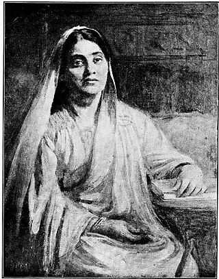
Abala, Lady Bose was an Indian social worker and feminist. She was known for her efforts in women's education and her contribution towards helping widows.
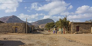
Abala is a town in north-eastern Abala The administrative center of Kilbet Rasu, Afar Region, this town has a latitude and longitude of 13°22′N39°45′E with an elevation of 1465 meters.

Henri Ossébi is a Congolese sociologist and politician who served in the government of Congo-Brazzaville as Minister of Energy from 2011 to 2016. Previously he was Minister of Higher Education from 2002 to 2009 and Minister of Scientific Research from 2009 to 2011.
Abala, Niger is a village and rural commune in Niger.
Ibinda is a language of Cabinda, Angola. Ibinda can also refer to:
Abala is one of the woredas in the Afar Region of Ethiopia. Part of the Administrative Zone 2, Abala is located at the base of the eastern escarpment of the Ethiopian highlands, and bordered on the south by Megale, on the west by the Tigray Region, on the north by Berhale, on the northeast by Afdera, and on the east by Erebti. The major town in Abala is Abala.

The Republic of the Congo faces a number of ongoing health challenges.
Abala is a 1973 Indian Malayalam film, directed by Thoppil Bhasi. The film stars Madhu, Jayabharathi, KPAC Lalitha and Adoor Bhasi in the lead roles. The film has musical score by V. Dakshinamoorthy.

Abalá Municipality is a municipality in the Mexican state of Yucatán containing (301.45 km2) of land and located roughly 50 km south of the city of Mérida.
Abala-Ibeme or Abala is a village in Obingwa local government area in Abia State, Nigeria.

Trijama is a 1956 Indian Bengali-language romantic drama film directed by Agradoot, based on Subodh Ghosh's novel of the same name. This film was released under the banner of Sunrise Films. Music direction of the film was made by Nachiketa Ghosh. Film starring Uttam Kumar and Suchitra Sen in lead role. It's critically acclaimed but become semi hit at the box office. But in 1960s when the film was re released it's become huge blockbuster hit at the box office.

Abala Abaya is a district in Wolayita Zone of South Ethiopia Regional State. The district is composed of 16 kebele administrations, of which 13 are rural and 3 are urban. It is situated between 6°38′ N latitude and 37 ° 42′ E longitude and located at a distance of 419 km south from Addis Ababa. The district was established in 2019 from the surrounding districts. Abala Abaya is bordered on the south by Lake Abaya, on the west by the Humbo district, on the north by the Sodo Zuria district, on the east by Hobicha district. The administrative center of this district is Paracho Town.
Hobicha is woredas in Wolaita Zone of South Ethiopia Regional State. The woreda was established in 2019 from the surrounding woredas. And those surrounding woredas formed border to the Hobicha woreda. Hobicha is bordered on the south by Bilate River and Lake Abaya, on the west by the Abala Abaya woreda, on the north by the Damot Weyde woreda, on the east by Diguna Fango woreda and Bilate River. The administrative center of this woreda is Bada Town.
Faracho or Abala Faracho is a town in Wolayita Zone, South Ethiopia Regional State, Ethiopia. The town is an administrative center of Abala Abaya district of Wolayita Zone, Ethiopia. Faracho is located about 349 km (217 mi) away from Addis Ababa to the south and also 30 km (19 mi) away from Sodo to the South, the capital of Wolaita Zone. The amenities in the town are, 24 hours electricity, pure public water, banks, schools, postal service, telecommunications services and others. Faracho lies between 6°55'0" N and 37°39'0" E. The town is located at an elevation of 1,378 meters (4,521 ft) above sea level.

