The Mid-Atlantic Ridge is a mid-ocean ridge located along the floor of the Atlantic Ocean, and part of the longest mountain range in the world. In the North Atlantic, the ridge separates the North American from the Eurasian Plate and the African Plate, north and south of the Azores Triple Junction. In the South Atlantic, it separates the African and South American plates. The ridge extends from a junction with the Gakkel Ridge northeast of Greenland southward to the Bouvet Triple Junction in the South Atlantic. Although the Mid-Atlantic Ridge is mostly an underwater feature, portions of it have enough elevation to extend above sea level, for example in Iceland. The ridge has an average spreading rate of about 2.5 centimetres (1 in) per year.

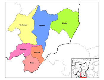
Pool is a department of the Republic of the Congo in the southeastern part of the country. It borders the departments of Bouenza, Lékoumou, and Plateaux. Internationally, it borders the Democratic Republic of the Congo. It also surrounds the commune district of the national capital, Brazzaville.

The Djado Plateau lies in the Sahara, in northeastern Niger. It is known for its cave art, but is now largely uninhabited, with abandoned towns and forts still standing and visible. As of 2012, the commune of Djado had a total population of 876 people.
Nuevo Celilac is a municipality in the Honduran department of Santa Bárbara.
Likasi is a city in Haut-Katanga Province, in the south-east of the Democratic Republic of Congo.

The Departments of the Republic of the Congo are divided into 86 districts and 6 communes; which are further subdivided into urban communities and rural communities ; which are further subdivided into quarters or neighborhoods (quartiers) and villages. Note the departments of Brazzaville and Pointe-Noire are made of 1 commune each, then divided in urban districts (arrondissements).
The Northumberland Islands are a scattered island chain off the eastern coast of Queensland, Australia.

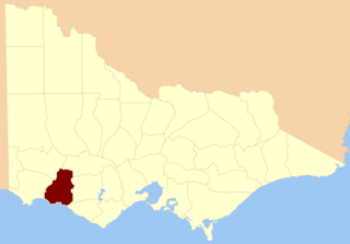
The County of Villiers is one of the 37 counties of Victoria which are part of the cadastral divisions of Australia, used for land titles. It includes the area to the north of Warrnambool, and to the west of the Hopkins River. The county was proclaimed in 1849.

Rubavu District is one of the seven districts (akarere) in Western Province, Rwanda, with a total surface area of 388.4 km2. Its capital is Gisenyi, a large beach resort and border city. The Rubavu Urban area, which includes Gisenyi, Rugerero and other nearby localities, had a 2012 population of 149,209, the second most populous urban area in Rwanda.
Karuba is a village in Nord-Kivu, Democratic Republic of the Congo. In September and October 2007, it was the scene of fighting between the forces of rebel general Laurent Nkunda and the army of the Democratic Republic of the Congo. The Congolese army claimed to be in control of Karuba as of October 10, 2007.

Mouyondzi is a district in the Bouenza Region of southern Republic of the Congo. The capital lies at Mouyondzi.

Kelle is a district in the Cuvette-Ouest Region of western Republic of the Congo. The capital lies at Kelle.

Mvouti is a district in the Kouilou Region of far south-western Republic of the Congo. The capital lies at Mvouti.

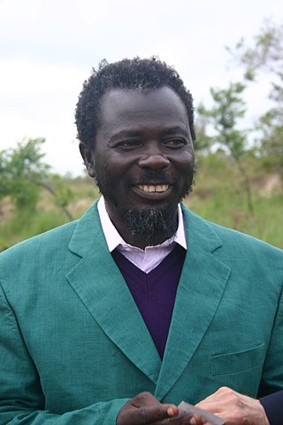
Frédéric Bintsamou also known as Pastor Ntumi, is a Protestant clergyman and was the leader of the "semi-religious" rebel group The Ninjas which led a civil war in Congo-Brazzaville.
N'kosso is a small village situated in Mouyondzi District, some 250 km from the town called Nkayi in the Bouenza region of Republic of Congo.
Agudos do Sul is a municipality in the state of Paraná in the Southern Region of Brazil.
Diaka, Burkina Faso is a town in the Thion Department of Gnagna Province in eastern Burkina Faso. The town has a population of 2,479.

Congo Canyon is a submarine canyon found at the end of the Congo River in Africa. It is one of the largest submarine canyons in the world.


