
Bouenza is a department of the Republic of the Congo in the southern part of the country. It borders the departments of Lékoumou, Niari, and Pool, and internationally, the Democratic Republic of the Congo. The regional capital is Madingou. Towns and cities include Loudima, Mouyondzi, Loutété and Nkayi.

Caxambu is a Brazilian municipality in Minas Gerais. Its population in 2021 was estimated at 21,566.
The Possession Islands are a group of small islands and rocks extending over an area of about 7 nautical miles, lying in the western part of the Ross Sea, lying 5 nautical miles south-east of Cape McCormick, in Victoria Land, Antarctica. The Possession Islands were named by Captain James Clark Ross, Royal Navy, in commemoration of the planting of the British flag here on January 12, 1841.
Borchgrevink Glacier is a large glacier in the Victory Mountains, Victoria Land, Antarctica. It drains south between Malta Plateau and Daniell Peninsula, and thence projects into Glacier Strait, Ross Sea, as a floating glacier tongue.
The Departments of the Republic of the Congo are divided into 86 districts and 6 communes; which are further subdivided into urban communities and rural communities ; which are further subdivided into quarters or neighborhoods (quartiers) and villages. Note the departments of Brazzaville and Pointe-Noire are made of 1 commune each, then divided in urban districts (arrondissements).
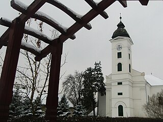
Dunavecse is a town and municipality in Bács-Kiskun County in southern Hungary.

Rutsiro is a district (akarere) in Western Province, Rwanda. Its headquarter is located in Gihango sector.
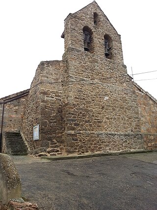
Santibáñez de Tera is a municipality located in the province of Zamora, Castile and León, Spain. According to the 2004 census (INE), the municipality has a population of 605 inhabitants.
Karuba is a village in Nord-Kivu, Democratic Republic of the Congo. In September and October 2007, it was the scene of fighting between the forces of rebel general Laurent Nkunda and the army of the Democratic Republic of the Congo. The Congolese army claimed to be in control of Karuba as of October 10, 2007.

Mayama is a district in the Pool Department of south-eastern Republic of the Congo. The capital lies at Mayama.
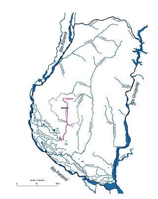
The Nogoya River is a river of Argentina. It is a tributary of the Paraná River, which it joins in a region of wetlands and complex distributaries.
Verdejante is a city in the state of Pernambuco, Brazil. The population in 2020, according with IBGE was 9,553 inhabitants and the total area is 476.03 km2.
N'kosso is a small village situated in Mouyondzi District, some 250 km from the town called Nkayi in the Bouenza region of Republic of Congo.

Okahandja Constituency is an electoral constituency in the Otjozondjupa Region of Namibia. It had 18,155 inhabitants in 2004 and 18,109 registered voters in 2020. The constituency consists of the town of Okahandja and the surrounding rural area.
Kuala Pegang is a small town in Baling District, Kedah, Malaysia.
Sõreste is a village in Kanepi Parish, Põlva County in southeastern Estonia.
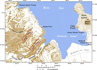
Mackay Glacier is a large glacier in Victoria Land, descending eastward from the Antarctic Plateau, between the Convoy Range and Clare Range, into the southern part of Granite Harbour. It was discovered by the South magnetic pole party of the British Antarctic Expedition, 1907–09, and named for Alistair Mackay, a member of the party. The glacier's tongue is called Mackay Glacier Tongue. First mapped by the British Antarctic Expedition, 1910–13 and named for Alistair F. Mackay, a member of the party. Its mouth is south of the Evans Piedmont Glacier and the Mawson Glacier. It is north of the Wilson Piedmont Glacier and the Ferrar Glacier.
Mouyondzi Airport was an airstrip 5 kilometres (3.1 mi) east of the town of Mouyondzi, in the Bouenza Department of the Republic of the Congo. The land is now under cultivation.
The 2018 Coupe du Congo is the 34th edition of the Coupe du Congo, the knockout football competition of the Republic of the Congo.


