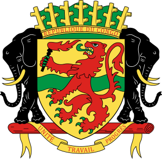
Bouenza is a department of the Republic of the Congo in the southern part of the country. It borders the departments of Lékoumou, Niari, and Pool, and internationally, the Democratic Republic of the Congo. The regional capital is Madingou. Towns and cities include Loudima, Mouyondzi, Loutété and Nkayi.
Kayes is a small town in the Bouenza Department of the Republic of the Congo. It is located about 2 km north of Nkayi, the country’s fourth largest city. Kayes is also the name of a district, of which the town of Kayes is the capital.

The Departments of the Republic of the Congo are divided into 86 districts and 6 communes; which are further subdivided into urban communities and rural communities ; which are further subdivided into quarters or neighborhoods (quartiers) and villages. Note the departments of Brazzaville and Pointe-Noire are made of 1 commune each, then divided in urban districts (arrondissements).

Cajueiro is a municipality located in the western of the Brazilian state of Alagoas. Its population is 21,331 (2020) and its area is 124 km². Its name comes from the Portuguese for the cashew tree — in the 19th century, a village began to form around such a tree, near the banks of the Paraíba river.

Arapuá is a Brazilian municipality located in the northwest of the state of Minas Gerais. Its population as of 2020 was 2,835 people living in a total area of 172 km². The city belongs to the mesoregion of Triângulo Mineiro e Alto Paranaiba and to the microregion of Patos de Minas. It became a municipality in 1962.

Jacobo Hunter District is one of the 29 districts of the Arequipa Province in Peru.
Sciots Camp is a small unincorporated community in El Dorado County, California. It is located on the South Fork of the American River 4 miles (6.4 km) south of Pyramid Peak, at an elevation of 5659 feet. The ZIP code is 95610. The community is inside area code 530. Sciots Camp is a USFS Recreation Residences community.
Railway stations in the Republic of the Congo (Congo) include:

Juvenília is a municipality in the north of the state of Minas Gerais in Brazil. As of 2020 the population was 5,715 in an area of 1,065 km².
Mirzəhəsənli is a village in the Zangilan Rayon of Azerbaijan.
Bəzirxana is a village in the Kalbajar District of Azerbaijan.

Armira Glacier is a 1.6 nautical miles long glacier on Smith Island in the South Shetland Islands, Antarctica draining the southeast slopes of Imeon Range southeast of Slaveykov Peak and east of Neofit Peak. It is situated southwest of Dragoman Glacier and northeast of Gramada Glacier, and flows southeastward into Yarebitsa Cove on Osmar Strait. Bulgarian early mapping in 2009. The glacier is named after Armira River in southeastern Bulgaria.

Congo, officially the Republic of the Congo or Congo Republic, also known as Congo-Brazzaville is a country located on the western coast of Central Africa to the west of the Congo River. It is bordered to the west by Gabon, to the northwest by Cameroon, to the northeast by the Central African Republic, to the southeast by the Democratic Republic of the Congo, to the south by the Angolan exclave of Cabinda, and to the southwest by the Atlantic Ocean.

La Clota is a neighborhood in the Horta-Guinardó district of Barcelona, Catalonia (Spain).

The Republic of the Congo includes 16 communes, some divided in urban boroughs (arrondissements) and in quarters.
Madlangempisi is an inkhundla of Eswatini, located in the Hhohho District. Its population as per the 2007 census was 16,972.

Vila Jardim is a neighbourhood (bairro) in the city of Porto Alegre, the state capital of Rio Grande do Sul, in Brazil. It was created by Law 2022 from December 7, 1959.

The Republic of the Congo faces a number of ongoing health challenges.
Siegfried Glacier is a glacier flowing east-southeast into Lazarev Bay, south of Mirnyy Peak on Rothschild Island. It was named by the UK Antarctic Place-names Committee in association with the Wagner Ice Piedmont after Siegfried, the third part of the four-part festival play Der Ring des Nibelungen (1826) by Wagner.
The ROCA vulnerability is a cryptographic weakness that allows the private key of a key pair to be recovered from the public key in keys generated by devices with the vulnerability. "ROCA" is an acronym for "Return of Coppersmith's attack". The vulnerability has been given the identifier CVE-2017-15361.


