Abbey Hill

Last updated

Abbey Hill
Location map United Kingdom Milton Keynes.png
Red pog.svg
Abbey Hill
Buckinghamshire UK location map.svg
Red pog.svg
Abbey Hill
Location within Buckinghamshire
Population4,215  [1] [a]
OS grid reference SP818389
Civil parish
  • Abbey Hill
District
Unitary authority
Ceremonial county
Region
Country England
Sovereign state United Kingdom
Post town MILTON KEYNES
Postcode district MK8, MK11 3
Dialling code 01908
Police Thames Valley
Fire Buckinghamshire
Ambulance South Central
UK Parliament
List of places
UK
England
Buckinghamshire

52°02′35″N0°48′29″W / 52.043°N 0.808°W / 52.043; -0.808

Contents

Abbey Hill

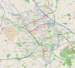
Abbey Hill is a civil parish that covers the Two Mile Ash, Kiln Farm, and Wymbush districts of Milton Keynes in Buckinghamshire, England. [2] As the first tier of Local Government, the parish council is responsible for the people, living and working in this area of Milton Keynes.

The Parish was formed in 2008 as part of a revision of parishes of the Borough of Milton Keynes:[ citation needed ] the districts were previously part of a parish called Bradwell Abbey. It is bounded by Millers Way (H2), the A5, Watling Street (V4), and Dansteed Way (H4). [3]
Districts of the parish

Two Mile Ash

This residential district contains a primary school, a local centre and part of the eponymous Abbey Hill golf course.

Kiln Farm

This is an employment district of light industry and low-intensity warehousing and distribution. It also contains the remainder of the Abbey Hill golf course.

Wymbush

This is another employment district of light industry and low-intensity warehousing and distribution.

Electoral ward (Borough)

The Parish falls within the Bradwell Ward of the Borough of Milton Keynes.

Related Research Articles

<span class="mw-page-title-main">London Borough of Barking and Dagenham</span> London borough in United Kingdom

The London Borough of Barking and Dagenham is a London borough in East London. The borough was created in 1965 as the London Borough of Barking; the name was changed in 1980. It is an Outer London borough and the south is within the London Riverside section of the Thames Gateway; an area designated as a national priority for urban regeneration. At the 2011 census it had a population of 187,000. The borough's three main towns are Barking, Chadwell Heath and Dagenham. The local authority is the Barking and Dagenham London Borough Council. Barking and Dagenham was one of six London boroughs to host the 2012 Summer Olympics.

<span class="mw-page-title-main">London Borough of Merton</span> London borough in United Kingdom

The London Borough of Merton is a London borough in London, England. The borough was formed under the London Government Act 1963 in 1965 by the merger of the Municipal Borough of Mitcham, the Municipal Borough of Wimbledon and the Merton and Morden Urban District, all formerly within Surrey.

<span class="mw-page-title-main">Milton Keynes</span> City in Buckinghamshire, England

Milton Keynes is a city in Buckinghamshire, England, about 50 miles (80 km) north-west of London. At the 2021 Census, the population of its urban area was 264,349. The River Great Ouse forms the northern boundary of the urban area; a tributary, the River Ouzel, meanders through its linear parks and balancing lakes. Approximately 25% of the urban area is parkland or woodland and includes two Sites of Special Scientific Interest (SSSIs).

<span class="mw-page-title-main">City of Milton Keynes</span> Unitary authority area in England

The City of Milton Keynes is a borough with city status, in Buckinghamshire, England. It is the northernmost district of the South East England Region. The borough abuts Bedfordshire, Northamptonshire and the remainder of Buckinghamshire. The borough is administered by Milton Keynes City Council, a unitary authority.

<span class="mw-page-title-main">Bradwell, Milton Keynes</span> Civil parish in Milton Keynes, England

Bradwell is an ancient village and modern district in Milton Keynes, Buckinghamshire, England, situated approximately 1 mile (1.6 km) north-west of Central Milton Keynes. It has also given its name to a modern civil parish that is part of the City of Milton Keynes. The village was adjacent to Bradwell Abbey, a Benedictine priory, founded in 1155 and dissolved in about 1540, but the abbey and its immediate environs were always a separate ecclesiastical parish.

<span class="mw-page-title-main">Stantonbury</span> Civil parish in Milton Keynes, England

Stantonbury is a district and civil parish of Milton Keynes, Buckinghamshire, England, situated roughly 2 miles (3.2 km) north of Central Milton Keynes. The toponym Stanton is derived from an Old English term for "stone-built farmstead" and the bury element from the French family Barri who held it in 1235. The original Stantonbury is a deserted medieval village now known as Stanton Low; the Stantonbury name has been reused for the modern district at the heart of the civil parish.

Worth is either a civil parish in the Mid Sussex District of West Sussex, or a distinct but historically related village in Crawley.

<span class="mw-page-title-main">Newport Pagnell Rural District</span>

Newport Pagnell was a rural district in the administrative county of Buckinghamshire, England, from 1894 to 1974, covering an area in the north-east of the county.

<span class="mw-page-title-main">New Bradwell</span> Civil parish in Milton Keynes, England

New Bradwell is (mainly) an Edwardian era village, modern district and civil parish in north-west Milton Keynes, Buckinghamshire, England, about 2 miles (3.2 km) north-west of Central Milton Keynes. Together with Wolverton, it was built primarily to house the workers on the Wolverton railway works.

<span class="mw-page-title-main">West Bletchley</span> Civil parish in Milton Keynes, England

West Bletchley is a district and civil parish that covers the western part of Bletchley, a constituent town of Milton Keynes in Buckinghamshire, England. The parish consists of that part of Bletchley which is south of Standing Way/H8 (A421), west of the West Coast Main Line, and north of Water Eaton Brook..

<span class="mw-page-title-main">Bradwell Abbey</span> Historic site in Milton Keynes, England

Bradwell Abbey or Bradwell Priory is a scheduled monument, urban studies site, district and former civil parish in Milton Keynes, Buckinghamshire, England. The site was once the location of a Benedictine priory, founded in 1155.

Kents Hill, Monkston and Brinklow is a civil parish that covers the Kents Hill, Brinklow, Monkston, Monkston Park and Kingston neighborhoods of Milton Keynes in Buckinghamshire, England. As the first tier of Local Government, the Parish Council is responsible for the people, living and working in this area of Milton Keynes.

<span class="mw-page-title-main">Milton Keynes North (UK Parliament constituency)</span> Parliamentary constituency in the United Kingdom, 2010 onwards

Milton Keynes North is a constituency represented in the House of Commons of the UK Parliament since the 2024 general election by Chris Curtis for the Labour Party.

<span class="mw-page-title-main">History of Milton Keynes</span> History of the city in England

This history of Milton Keynes details its development from the earliest human settlements, through the plans for a 'new city' for 250,000 people in northern Southeast England, its subsequent urban design and development, to the present day. Milton Keynes, founded in 1967, is the largest settlement and only city in Buckinghamshire. At the 2021 census, the population of its urban area was estimated to have exceeded 256,000.

<span class="mw-page-title-main">Milton Keynes City Council</span> Unitary authority in England

Milton Keynes City Council is the local authority for the City of Milton Keynes, a local government district in Buckinghamshire, England. The council was established in 1974 as Milton Keynes Borough Council. Since 1997 it has been a unitary authority, being a district council which also performs the functions of a county council; it is independent of Buckinghamshire Council, the unitary authority which administers the rest of the county.

<span class="mw-page-title-main">Two Mile Ash</span> Human settlement in England

Two Mile Ash is a district of north-west Milton Keynes in Buckinghamshire, England, two miles south of Stony Stratford, just off Watling Street. The district was named after the Two Mile Ash toll gate on Watling Street. It is one of the larger districts, but a large part of its area is taken up by Abbey Hill, an 18-hole golf course. Consequently, many of the streets here are named after famous golf courses. The district was one of the first to be built in the (mainly) private housing period of the development of Milton Keynes. It is in Abbey Hill civil parish.

Milton Keynes City Council is the local authority and unitary authority for the City of Milton Keynes, a borough in Buckinghamshire, England.

<span class="mw-page-title-main">Loughton and Great Holm</span> Civil parish in Milton Keynes, England

Loughton and Great Holm is a civil parish in the City of Milton Keynes, Buckinghamshire, England. It includes the districts of Loughton, Great Holm, the National Bowl and Elfield Park, West Rooksley, Loughton Lodge, and Knowlhill. It is bordered by H4 Dansteed Way to the north, V4 Watling Street to the west, a tiny stretch of H8 Standing Way to the south, and the West Coast Main Line to the east. Originally named Loughton, it was renamed to Loughton and Great Holm in 2013

<span class="mw-page-title-main">Whitehouse, Milton Keynes</span> Civil parish in Milton Keynes, England

Whitehouse is a neighbourhood and civil parish that covers a large new development area on the western flank of Milton Keynes, Buckinghamshire, England. As the first tier of Local Government, its community council is responsible for the people, living and working in this area of Milton Keynes. In 2021 the parish had a population of 3341.

References

  1. According to parish boundary recorded in the 2011 Census, [1] this parish included Bradwell Abbey, whereas the Milton Keynes Council table dated 2014 places it in Bradwell CP. However, as there are only three small dwellings on the Abbey site, the difference is not significant.
  1. 1 2 UK Census (2011). "Local Area Report – Abbey Hill (E04012175)". Nomis. Office for National Statistics . Retrieved 21 January 2019.
  2. AREA-PARISH-WARD table Archived 21 January 2019 at the Wayback Machine   Milton Keynes Council, June 2014
  3. "Abbey Hill". ONS. Retrieved 2 March 2018.