Aborlan | |
---|---|
Municipality of Aborlan | |
![]() Palm plantation in Sagpangan, in Aborlan municipality | |
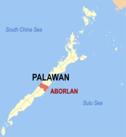
![]() Map of Palawan with Aborlan highlighted | |
Location within the Philippines | |
Coordinates: 9°26′19″N118°32′53″E / 9.438639°N 118.548136°E | |
Country | Philippines |
Region | Mimaropa |
Province | Palawan |
District | 3rd district |
Founded | June 28, 1949 |
Barangays | 19 (see Barangays) |
Government | |
• Type | Sangguniang Bayan |
• Mayor | Lito O. Tito |
• Vice Mayor | Marvin C. Madeja |
• Representative | Gil A. Acosta Jr. |
• Municipal Council | Members |
• Electorate | 28,433 voters (2025) |
Area | |
• Total | 807.33 km2 (311.71 sq mi) |
Elevation | 210 m (690 ft) |
Highest elevation | 64 m (210 ft) |
Lowest elevation | 0 m (0 ft) |
Population (2024 census) [4] | |
• Total | 39,972 |
• Density | 50/km2 (130/sq mi) |
• Households | 9,715 |
Economy | |
• Income class | 1st municipal income class |
• Poverty incidence | 15.44 |
• Revenue | ₱ 446.1 million (2022) |
• Assets | ₱ 1,119 million (2022) |
• Expenditure | ₱ 260.1 million (2022) |
• Liabilities | ₱ 228.9 million (2022) |
Service provider | |
• Electricity | Palawan Electric Cooperative (PALECO) |
Time zone | UTC+8 (PST) |
ZIP code | 5302 |
PSGC | |
IDD : area code | +63 (0)48 |
Native languages | Aborlan Tagbanwa Palawano Tagalog |
Aborlan, officially the Municipality of Aborlan (Tagalog : Bayan ng Aborlan), is a municipality in the province of Palawan , Philippines. According to the 2020 census, it has a population of 38,736 people. [6]
Aborlan is the province's only town with an agricultural college, now called Western Philippines University. It was founded in 1910. [7]
Many stories tell about how the town got its present name: [8]
During ancient times, there was a legendary supernatural chief called Biarongbarongan, who lived in the other side of the Iraan River at the present site of the Agricultural High School. He had two sons, namely Baybayaren and Palaysegen. At one time, Biarongbarongan went for a tournament in a foreign land and was defeated. Because of this, he was defeated, and his head was pierced at the plaza. His fierceful son Palaysegen rode an enormous ship with hundreds of followers to avenge his father's death. When he was exhausted in his battle, he alighted in a tree and only his sword and shield continued to fight until he was victorious and went home to Aborlan. One afternoon, an ordinary man and woman happened to meet at the sinful persons, thus he and his family together with his kinds left Aborlan for another virgin land. [9]
Aborlan was made a town in 1910 and became a municipal district. This municipal district was initially made as a reservation where no Christians were allowed to settle except teachers. Eventually, the Tagbanuas were given the opportunity to govern themselves in 1916 through a plebiscite, voting their mayor and vice-mayors for the first time. [9]
By 1933, the Aborlan River flooded the whole town and some people were carried away by the flood. [9]
On May 12, 1942, Japanese forces came to Aborlan, leading to the evacuation of many civilians throughout the hinterlands. They quartered themselves in the Central School building. The Japanese forces garrisoned in this town were not cruel, and as soon as the people learned of this, they returned back to the town. During this period, guerrilla forces became active in southern Palawan and made attacks on public schools in Aborlan. [9]
By late 1944, as soon as the Japanese learned of the American landing at Leyte, the Philippine Constabulary in Aborlan abandoned their posts and joined the guerrillas at Brooke's Point. However, the guerrillas were suspicious of the PC defectors and made them war prisoners, only releasing them 6 months after incarceration. [9]
Formerly a municipal district, Aborlan became a municipality on June 28, 1949, by virtue of Executive Order No. 232. [7] [10] In 1951, the municipality lost the barrios of Berong and Alfonso XII when those were transferred to the newly created town of Quezon. [11] By this point, the majority of the inhabitants were still non-Christian. [9]
It lies in a vast plain between the Sulu Sea and the mountains, 68 kilometres (42 mi) south of Puerto Princesa City.
Aborlan is politically subdivided into 19 barangays. Each barangay consists of puroks and some have sitios.
Climate data for Aborlan, Palawan | |||||||||||||
---|---|---|---|---|---|---|---|---|---|---|---|---|---|
Month | Jan | Feb | Mar | Apr | May | Jun | Jul | Aug | Sep | Oct | Nov | Dec | Year |
Mean daily maximum °C (°F) | 29 (84) | 30 (86) | 31 (88) | 31 (88) | 30 (86) | 30 (86) | 29 (84) | 29 (84) | 30 (86) | 29 (84) | 29 (84) | 29 (84) | 30 (85) |
Mean daily minimum °C (°F) | 23 (73) | 23 (73) | 24 (75) | 25 (77) | 26 (79) | 26 (79) | 25 (77) | 25 (77) | 25 (77) | 25 (77) | 25 (77) | 24 (75) | 25 (76) |
Average precipitation mm (inches) | 73 (2.9) | 68 (2.7) | 96 (3.8) | 104 (4.1) | 193 (7.6) | 246 (9.7) | 225 (8.9) | 199 (7.8) | 213 (8.4) | 250 (9.8) | 226 (8.9) | 143 (5.6) | 2,036 (80.2) |
Average rainy days | 15.4 | 13.7 | 17.8 | 19.4 | 27.0 | 28.5 | 29.1 | 27.8 | 28.3 | 28.5 | 25.6 | 21.8 | 282.9 |
Source: Meteoblue [12] |
|
| |||||||||||||||||||||||||||||||||||||||||||||||||||
Source: Philippine Statistics Authority [13] [14] [15] [16] [17] |
In the 2020 census, the population of Aborlan was 38,736 people, [18] with a density of 48 inhabitants per square kilometre or 120 inhabitants per square mile.
Poverty incidence of Aborlan
10 20 30 40 50 60 2000 54.93 2003 53.77 2006 37.30 2009 23.37 2012 22.35 2015 21.56 2018 13.33 2021 15.44 Source: Philippine Statistics Authority [19] [20] [21] [22] [23] [24] [25] [26] |
The town celebrates the Rakudan Festival (Palawano for 'gathering in an agreed place') annually every June. It features the lechon or roast pig which references the theory of the town's name origin coming from the phrase "a boar land". [27]