Araceli, Palawan Last updated January 05, 2026 Municipality in Palawan, Philippines
Municipality in Mimaropa, Philippines
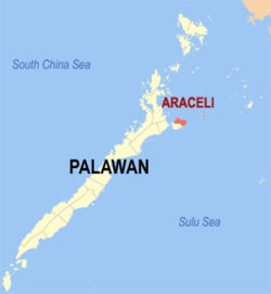
Araceli , officially the Municipality of Araceli (Tagalog : Bayan ng Araceli municipality in the province of Palawan , Philippines . According to the 2024 census , it has a population of 14,554 people. [ 5]
The municipality covers roughly the northern half of Dumaran Island . Cuyono is the principal language of the area.
Etymology The town's Catholic parish is Nuestra Señora de Araceli , a Spanish term that can be translated to "Our Lady of Altar of the Sky" (from ara , meaning altar; and celi , meaning sky).
History Araceli was formerly known as Dumaran until it was renamed on June 15, 1954. [ 6] [ 7] In 1961, barrios Dumaran, Bacao, Bohol, Calasag, and San Juan were excised from Araceli to form part of the new municipality of Dumaran, effective upon the election of its new municipal officials later that year. [ 8]
Geography Barangays Araceli is politically subdivided into 15 barangays . Each barangay consists of puroks and some have sitios .
Balogo Calandagan (formerly Tudela [ 9] ) Dagman Dalayawon Lumacad Madoldolon Mauringuen Omulan Osmeña Poblacion (Centro) San Jose De Oro Santo Niño Taloto Tiemad Tinintinan Climate Climate data for Araceli, Palawan Month Jan Feb Mar Apr May Jun Jul Aug Sep Oct Nov Dec Year Mean daily maximum °C (°F) 29 30 30 31 31 30 29 30 29 29 29 29 30 Mean daily minimum °C (°F) 23 23 23 24 25 25 25 24 24 24 24 24 24 Average precipitation mm (inches) 45 34 62 64 127 159 172 147 167 182 172 88 1,419 Average rainy days 12.1 9.4 13.0 14.3 22.7 26.9 28.0 26.4 27.0 27.0 22.7 17.8 247.3 Source: Meteoblue [ 10]
Demographics Population census of Araceli
Year ±% p.a. 1903 2,146 — 1960 4,955 +1.48% 1970 4,444 −1.08% 1975 5,552 +4.57% 1980 6,030 +1.66% 1990 8,708 +3.74% 1995 10,556 +3.67%
Year ±% p.a. 2000 10,894 +0.68% 2007 13,233 +2.72% 2010 14,113 +2.37% 2015 14,909 +1.05% 2020 14,434 −0.68% 2024 14,554 +0.20%
Source: Philippine Statistics Authority [ 11] [ 12] [ 13] [ 14] [ 15]
In the 2024 census, the population of Araceli was 14,554 people, [ 16] with a density of 71 inhabitants per square kilometer or 180 inhabitants per square mile .
Education The Araceli Schools District Office governs all educational institutions within the municipality. It oversees the management and operations of all private and public, from primary to secondary schools. [ 25]
Primary and elementary schools Araceli Central School Araceli North Central School Baing Elementary School Balogo Elementary School Bolocot Elementary School Calandagan Elementary School Dagman Elementary School Dalayawan Elementary School Lumacad Elementary School Maducang Elementary School Madoldolon Elementary School Mauriguen Elementary School Osmeña Elementary School San Felipe Elementary School San Jose De Oro Elementary School Sto Niño Elementary School Taloto Elementary School Tinintinan Elementary School Secondary schools Araceli National High School Araceli Plainview National High School Araceli Western National High School Calandagan National High School References ↑ Municipality of Araceli | (DILG) ↑ "2015 Census of Population, Report No. 3 – Population, Land Area, and Population Density" (PDF) . Philippine Statistics Authority . Quezon City, Philippines. August 2016. ISSN 0117-1453 . Archived (PDF) from the original on May 25, 2021. Retrieved July 16, 2021 . ↑ "2024 Census of Population (POPCEN) Population Counts Declared Official by the President" . Philippine Statistics Authority. 17 July 2025. Retrieved 18 July 2025 . ↑ "PSA Releases the 2021 City and Municipal Level Poverty Estimates" . Philippine Statistics Authority. 2 April 2024. Retrieved 28 April 2024 . ↑ "2024 Census of Population (POPCEN) Population Counts Declared Official by the President" . Philippine Statistics Authority. 17 July 2025. Retrieved 18 July 2025 . ↑ Republic Act No. 1111 (June 15, 1954), An Act Changing the Name of the Municipality of Dumaran, Province of Palawan, to Araceli , retrieved October 3, 2023 ↑ "Araceli" (PDF) . Provincial Government of Palawan. Archived from the original (PDF) on 4 March 2012. Retrieved 15 November 2012 . ↑ Republic Act No. 3418 (June 18, 1961), An Act Creating the Municipality of Dumaran in the Province of Palawan , retrieved October 3, 2023 ↑ "An Act Changing the Name of Barrio Tudela, Municipality of Araceli, Province of Palawan, to Calandagan" . LawPH.com. Retrieved 2011-04-12 . ↑ "Araceli: Average Temperatures and Rainfall" . Meteoblue. Retrieved 17 November 2019 . ↑ "2024 Census of Population (POPCEN) Population Counts Declared Official by the President" . Philippine Statistics Authority. 17 July 2025. Retrieved 18 July 2025 . ↑ Census of Population (2015). "Region IV-B (Mimaropa)" . Total Population by Province, City, Municipality and Barangay . Philippine Statistics Authority . Retrieved 20 June 2016 . ↑ Census of Population and Housing (2010). "Region IV-B (Mimaropa)" (PDF) . Total Population by Province, City, Municipality and Barangay . National Statistics Office . Retrieved 29 June 2016 . ↑ Censuses of Population (1903–2007). "Region IV-B (Mimaropa)" . Table 1. Population Enumerated in Various Censuses by Province/Highly Urbanized City: 1903 to 2007 National Statistics Office . ↑ "Province of" . Municipality Population Data . Local Water Utilities Administration Research Division. Retrieved 17 December 2016 . ↑ "2024 Census of Population (POPCEN) Population Counts Declared Official by the President" . Philippine Statistics Authority. 17 July 2025. Retrieved 18 July 2025 . ↑ "Poverty incidence (PI):" . Philippine Statistics Authority. Retrieved December 28, 2020 . ↑ "Estimation of Local Poverty in the Philippines" (PDF) . Philippine Statistics Authority. 29 November 2005. ↑ "2003 City and Municipal Level Poverty Estimates" (PDF) . Philippine Statistics Authority. 23 March 2009. ↑ "City and Municipal Level Poverty Estimates; 2006 and 2009" (PDF) . Philippine Statistics Authority. 3 August 2012. ↑ "2012 Municipal and City Level Poverty Estimates" (PDF) . Philippine Statistics Authority. 31 May 2016. ↑ "Municipal and City Level Small Area Poverty Estimates; 2009, 2012 and 2015" . Philippine Statistics Authority. 10 July 2019. ↑ "PSA Releases the 2018 Municipal and City Level Poverty Estimates" . Philippine Statistics Authority. 15 December 2021. Retrieved 22 January 2022 . ↑ "PSA Releases the 2021 City and Municipal Level Poverty Estimates" . Philippine Statistics Authority. 2 April 2024. Retrieved 28 April 2024 . ↑ "Masterlist of Schools" (PDF) . Department of Education . January 15, 2021. Retrieved October 23, 2025 . External links
Places adjacent to Araceli, Palawan
This page is based on this
Wikipedia article Text is available under the
CC BY-SA 4.0 license; additional terms may apply.
Images, videos and audio are available under their respective licenses.