Abu Shukheidim

Last updated
Abu Shukheidim
Arabic transcription(s)
   Arabic ابو شخيدم
Antenna6726 d25.jpg
Northern part of Abu Shukheidim
Palestine location map wide.png
Red pog.svg
Abu Shukheidim
Location of Abu Shukheidim within Palestine
Coordinates: 31°57′53″N35°10′25″E / 31.96472°N 35.17361°E / 31.96472; 35.17361
Palestine grid 166/152
State State of Palestine
Governorate Ramallah and al-Bireh
Government
  Type Municipality
  Head of MunicipalityAbdullah Ladadwa
Area
  Total15,500  dunams (15.5 km2 or 6.0 sq mi)
Population
 (2017) [1]
  Total2,438
  Density160/km2 (410/sq mi)
Name meaningThe father of Shukheidim [2]

Abu Shukheidim was a Palestinian village in the Ramallah and al-Bireh Governorate.

Contents

In 2005 it merged with the village of Al-Mazra'a al-Qibliya to form the town of Al-Zaitounah.

History

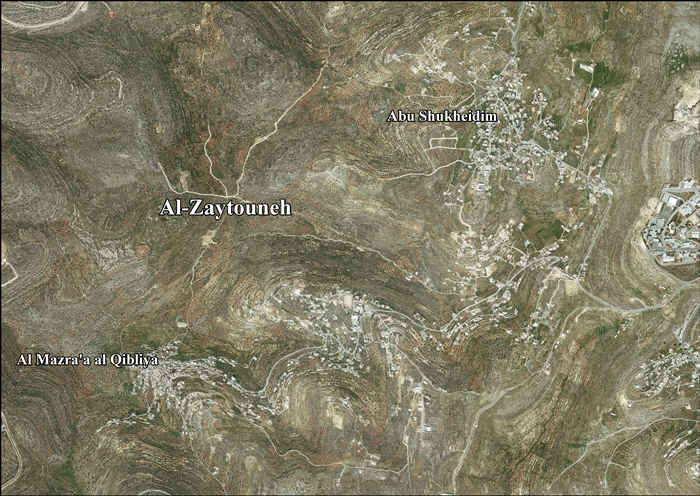
Abu Shukheidim does not appear in records from the 16th century. By the 19th century, it was a small village. The village, founded when the area was under Ottoman rule, likely grew into a permanent settlement as a result of the local Qays–Yaman war. [3]

Pottery sherds from the Hellenistic/Roman, Byzantine, Crusader/Ayyubid and the Mamluk eras have been found here. [4]

Ottoman era

Sherds from the early Ottoman era has also been found here. The historical core of the village is predominantly uninhabited. [4]

In 1838, it was noted as a Muslim village, Abu Shukheidim, in the Bani Harith district, north of Jerusalem. [5] [6]

In 1863 Victor Guérin found it consisting of a dozen houses. A birket (artificial pond) was lined on the inside with good cement, but needed repairs. Near the birket were several very old buildings. The villagers were compelled to stock up on water at a well located at the bottom of the mountain whose village occupies the summit. [7]

An Ottoman village list of about 1870 showed that Abu Schechedim had 14 houses and a population of 76, though the population count included men, only. [8] [9]

In 1882, the PEF's Survey of Western Palestine described Abu Shukheidim as a village resembling Abu Qash, and supplied by the same well. [10]

In 1896 the population of 'Abu schechedim was estimated to be about 204 persons. [11]

British Mandate era

In the 1922 census of Palestine, conducted by the British Mandate authorities, the population of Abu Iskhajdam was 139 Muslims, [12] increasing in the 1931 census to 201 Muslims, in 47 houses. [13]

In 1945 statistics Abu Shukheidim had a population of 250 Muslims, [14] and a total land area of 1,430 dunams. [15] Of this, 781 dunams were for plantations and irrigable land, 178 were for cereals, [16] while 23 dunams were built-up areas. [17]

Jordanian era

In the wake of the 1948 Arab–Israeli War, and after the 1949 Armistice Agreements, Abu Shukheidim came under Jordanian rule.

The Jordanian census of 1961 found 1,358 inhabitants. [18]

Post-1967

Since the Six-Day War in 1967, Abu Shukheidim has been under Israeli occupation.

After the 1995 accords, 54.2% of Al-Zaitounah land was defined as Area B, while the remaining 45.8% was defined as Area C. Israel has confiscated 308 dunams of land from Al-Zaitounah in order to construct two Israeli settlements, Talmon and Nahl'iel. [19]

Population

Abu Shukheidim's population in 1922 was estimated at 139 people, and in 1945, 150 people. [20] After an influx of refugees in 1967, the number reached about 5,069 people; in 1987 it became 773 people, and in 1996 the number reached 1,025.[ citation needed ] The population was 2,438 in 2017. [1]

Most of the village's residents have roots in Deir Dibwan, although the original settlers came from Hebron. There's an old ruin nearby sharing the same name, and a family with the same name in Hebron. [3]

Related Research Articles

<span class="mw-page-title-main">Rafat, Jerusalem</span> Municipality type D in Jerusalem, State of Palestine

Rafat is a Palestinian town, located approximately 4 km (2.5 mi) southwest of the city of Ramallah in the central West Bank in the northern Jerusalem Governorate. According to the Palestinian Central Bureau of Statistics, it had a population of 2,941 in 2017. Its total land area consists of 3,773 dunams.

<span class="mw-page-title-main">Husan</span> Municipality type C in Bethlehem, State of Palestine

Husan is a Palestinian town located 9 km (5.6 mi) west of Bethlehem, in the Bethlehem Governorate. According to the Palestinian Central Bureau of Statistics, Husan had a population of 7,048 in 2017.

<span class="mw-page-title-main">Ein Yabrud</span> Municipality type C in Ramallah and al-Bireh, State of Palestine

Ein Yabrud is a Palestinian town in the Ramallah and al-Bireh Governorate in the central West Bank. It is located approximately 7 km northeast of the city of Ramallah and its elevation is 800 m. According to the Palestinian Central Bureau of Statistics (PCBS) the town had a population of 2,515 in 2017.

<span class="mw-page-title-main">Surif</span> Municipality type A in Hebron, State of Palestine

Surif is a Palestinian City in the Hebron Governorate located 25 km northwest of the city of Hebron. According to the Palestinian Central Bureau of Statistics census, Surif had a population of 17,287 in 2017. The population is entirely Muslim.

Kafr Ein is a Palestinian village in the Ramallah and al-Bireh Governorate, located northwest of Ramallah in the central West Bank. According to the Palestinian Central Bureau of Statistics (PCBS), Kafr Ein had a population of 1,958 inhabitants in 2017. Most of the village's population comes from the Barghouti, Rifa' and Rafati clans.

<span class="mw-page-title-main">Abwein</span> Village in the West Bank, State of Palestine

Abwein is a Palestinian village in the Ramallah and al-Bireh Governorate of the State of Palestine, located about 37 kilometers north of Ramallah, in the northern West Bank. According to the Palestinian Central Bureau of Statistics, Abwein's population was 3,496 in 2017.

<span class="mw-page-title-main">Kharbatha al-Misbah</span> Municipality type D in Ramallah and al-Bireh, State of Palestine

Kharbatha al-Misbah is a Palestinian town in the central West Bank, located 12.5 kilometers (7.8 mi) west of Ramallah in the Ramallah and al-Bireh Governorate. According to the Palestinian Central Bureau of Statistics, the town had a population of 6,366 in 2017. It has a total land area of 4,431 dunams, of which 644 are built-up areas and the remainder agricultural lands and forests.

<span class="mw-page-title-main">Abu Qash</span> Municipality type C in Ramallah and al-Bireh, State of Palestine

Abu Qash is a Palestinian village located in the Ramallah and al-Bireh Governorate in the northern West Bank, located north of Ramallah and south of the Birzeit University. According to the 2017 census conducted by the Palestinian Central Bureau of Statistics, it had a population of 2,237.

<span class="mw-page-title-main">Beit Sira</span> Municipality type D in Ramallah and al-Bireh, State of Palestine

Beit Sira is a Palestinian village in the central West Bank, located 22 kilometers west of Ramallah and is a part of the Ramallah and al-Bireh Governorate. The village is situated along the Green Line. During the 1948 Arab-Israeli War, around 4,000 dunams of its land became a part of the "No-Man's Land" strip between the north-central West Bank and Israel. Currently Beit Sira's jurisdiction is 3,120 dunams, of which 441 dunams are built-up areas and the remainder is open spaces for future construction or agricultural land.

<span class="mw-page-title-main">Saffa, Ramallah</span> Town in the West Bank, State of Palestine

Saffa is a Palestinian town in the Ramallah and al-Bireh Governorate, located west of Ramallah in the northern West Bank. According to the Palestinian Central Bureau of Statistics (PCBS), the town had a population of 4,374 inhabitants in 2017.

<span class="mw-page-title-main">Burqa, Ramallah</span> Municipality type C in Ramallah and al-Bireh, Palestine

Burqa is a town in the Ramallah and al-Bireh Governorate, located east of Ramallah in the northern West Bank, Palestine. According to the Palestinian Central Bureau of Statistics (PCBS), the town had a population of 2,047 inhabitants in the 2017 census.

<span class="mw-page-title-main">Jammala</span> Municipality type C in Ramallah and al-Bireh, State of Palestine

Jammala is a Palestinian town in the Ramallah and al-Bireh Governorate, located 18 kilometers Northwest of Ramallah in the northern West Bank. According to the Palestinian Central Bureau of Statistics (PCBS), the town had a population of 1,664 inhabitants in 2017.

<span class="mw-page-title-main">Surda</span> Municipality type C in Ramallah and al-Bireh, State of Palestine

Surda is a Palestinian town in the Ramallah and al-Bireh Governorate, located northeast of Ramallah in the northern West Bank. According to the Palestinian Central Bureau of Statistics (PCBS), the town had a population of 1,308 inhabitants in 2017.

<span class="mw-page-title-main">Beit Duqqu</span> Municipality type D in Jerusalem

Beit Duqqu is a Palestinian village in the Jerusalem Governorate, located northwest of Jerusalem in the central West Bank. According to the Palestinian Central Bureau of Statistics, the town had a population of 1,754 in 2017.

<span class="mw-page-title-main">Beit 'Anan</span> Municipality type C in Jerusalem, State of Palestine

Beit 'Anan is a Palestinian village in the Quds Governorate, located northwest of Jerusalem. In 2017, it had a population of 4,210. Some residents of Beit 'Anan hold Israeli identity cards, while others hold Palestinian identity cards.

<span class="mw-page-title-main">Ein Siniya</span> Local Development Committee in Ramallah and al-Bireh, State of Palestine

Ein Siniya is a small Palestinian village in the Ramallah and al-Bireh Governorate, 10 kilometers (6.2 mi) north of Ramallah, and approximately 1km northeast from Jifna. It lies in a valley surrounded with olive and fig-terraces.

<span class="mw-page-title-main">Barqusya</span> Place in Hebron, Mandatory Palestine

Barqusya was a Palestinian Arab village in the Hebron Subdistrict, depopulated in the 1948 Palestine War. It was located 31 km northwest of Hebron.

<span class="mw-page-title-main">Al-Mazra'a al-Qibliya</span> Municipality type C in Ramallah and al-Bireh, State of Palestine

Al-Mazra'a al-Qibliya is a Palestinian village in the Ramallah and al-Bireh Governorate. The village had a population of 5,180 in 2017.

<span class="mw-page-title-main">Umm Safa</span> Municipality type D in Ramallah and al-Bireh, State of Palestine

Umm Safa/Kafr Ishwa or Um Al-Safa is a Palestinian village in the Ramallah and al-Bireh Governorate.

Jibiya is a Palestinian village in the Ramallah and al-Bireh Governorate. It was founded after the 16th century. It is mentioned in text from 1697.

References

  1. 1 2 Preliminary Results of the Population, Housing and Establishments Census, 2017 (PDF). Palestinian Central Bureau of Statistics (PCBS) (Report). State of Palestine. February 2018. pp. 64–82. Retrieved 2023-10-24.
  2. Palmer, 1881, p. 221
  3. 1 2 Grossman, D. (1986). "Oscillations in the Rural Settlement of Samaria and Judaea in the Ottoman Period". in Shomron studies. Dar, S., Safrai, S., (eds). Tel Aviv: Hakibbutz Hameuchad Publishing House. p. 359
  4. 1 2 Finkelstein et al, 1997, p. 406
  5. Robinson and Smith, 1841, vol 3, 2nd appendix, p. 124
  6. Robinson and Smith, 1841, vol 2, p. 133
  7. Guérin, 1869, p. 35
  8. Socin, 1879, p. 142 It was also noted to be in the Beni Harit district
  9. Hartmann, 1883, p. 126, also noted 14 houses
  10. Conder and Kitchener, 1882, SWP II, p. 293
  11. Schick, 1896, p. 124
  12. Barron, 1922, Table VII, Sub-district of Ramalllah, p. 16
  13. Mills, 1932, p.47
  14. Government of Palestine, Department of Statistics, 1945, p. 26
  15. Government of Palestine, Department of Statistics. Village Statistics, April, 1945. Quoted in Hadawi, 1970, p. 64.
  16. Government of Palestine, Department of Statistics. Village Statistics, April, 1945. Quoted in Hadawi, 1970, p. 111
  17. Government of Palestine, Department of Statistics. Village Statistics, April, 1945. Quoted in Hadawi, 1970, p. 161
  18. Government of Jordan, 1964, p. 24
  19. AL-Zaytouneh Town Profile, ARIJ, p. 18
  20. book: كتاب بلادنا فلسطين، صفحة Our Country is Palestine, page 330

Bibliography