
Southern California is a geographic and cultural region that generally comprises the southern portion of the U.S. state of California. It includes the Los Angeles metropolitan area, the second most populous urban agglomeration in the United States. The region generally contains ten of California's 58 counties: Imperial, Kern, Los Angeles, Orange, Riverside, San Bernardino, San Diego, Santa Barbara, San Luis Obispo and Ventura counties.

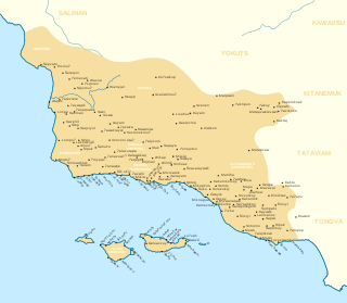
Santa Barbara County, officially the County of Santa Barbara, is located in Southern California. As of the 2020 census, the population was 448,229. The county seat is Santa Barbara, and the largest city is Santa Maria.
The Chumash are a Native American people of the central and southern coastal regions of California, in portions of what is now San Luis Obispo, Santa Barbara, Ventura and Los Angeles counties, extending from Morro Bay in the north to Malibu in the south. Their territory included three of the Channel Islands: Santa Cruz, Santa Rosa, and San Miguel; the smaller island of Anacapa was likely inhabited seasonally due to the lack of a consistent water source.

Santa Barbara is a coastal city in Santa Barbara County, California, of which it is also the county seat. Situated on a south-facing section of coastline, the longest such section on the West Coast of the United States, the city lies between the steeply rising Santa Ynez Mountains and the Pacific Ocean. Santa Barbara's climate is often described as Mediterranean, and the city has been dubbed "The American Riviera". According to the 2020 U.S. Census, the city's population was 88,665.

The Governor Edmund G. Brown California Aqueduct is a system of canals, tunnels, and pipelines that conveys water collected from the Sierra Nevada Mountains and valleys of Northern and Central California to Southern California. Named after California Governor Edmund Gerald "Pat" Brown Sr., the over 400-mile (640 km) aqueduct is the principal feature of the California State Water Project.

The Conejo Valley is a region spanning both southeastern Ventura County and northwestern Los Angeles County in Southern California, United States. It is located in the northwestern part of the Greater Los Angeles Area.
Newbury Park is a populated place and town in Ventura County, California, United States. Most of it lies within the western Thousand Oaks city limits, while unincorporated areas include Casa Conejo and Ventu Park. The town is located in Southern California around 8 miles from the Pacific Ocean and has a mild year-round climate, scenic mountains, and environmental preservation. About 28,000 residents of Thousand Oaks reside in Newbury Park.

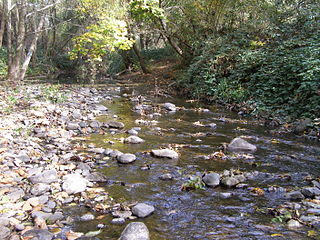
The Santa Ynez River is one of the largest rivers on the Central Coast of California. It is 92 miles (148 km) long, flowing from east to west through the Santa Ynez Valley, reaching the Pacific Ocean at Surf, near Vandenberg Space Force Base and the city of Lompoc.

Pozo is an unincorporated community along the former Butterfield Overland Mail stagecoach route, in San Luis Obispo County, California. The closest communities appearing on road maps are California Valley and Santa Margarita. A USGS-provided set of coordinates for the town are on the Santa Margarita Lake 7.5-minute quadrangle.

The Cuyama River is a 118-mile-long (190 km) river in southern San Luis Obispo County, northern Santa Barbara County, and northern Ventura County, in the U.S. state of California. It joins the Sisquoc River forming the Santa Maria River. The river's name comes from an Indian village named for the Chumash word kuyam, meaning "clam" or "freshwater mollusk".

The Santa Rosa Plateau is an upland plateau and southeastern extension of the Santa Ana Mountains in Riverside County, southern California. It is bounded by the rapidly urbanizing Inland Empire cities of Murrieta and Temecula to the northeast and southeast, respectively.
Santa Rosa Creek is a 22-mile-long (35 km) stream in Sonoma County, California, which rises on Hood Mountain and discharges to the Laguna de Santa Rosa by way of the Santa Rosa Flood Control Channel. This article covers both the creek and the channel.
Santa Ynez Fault is a left-reverse fault in Santa Barbara County of California. Its length is at least 130 km., running through Santa Ynez and north of nearby Santa Barbara. The Santa Ynez Mountains were uplifted within the last 5 million years, mostly along this fault, which marks the north slope of the range.

Santa Susana is a former railroad town located mostly within the City of Simi Valley. A small portion of the community, outside the Simi Valley city limits to the south of the Ventura County Metrolink rail line, is an unincorporated area and census-designated place (CDP). The community is in the eastern part of the Simi Valley.

Salsipuedes Creek is a 9.9 miles (15.9 km) long stream, flowing north to join the Santa Ynez River just southeast of Lompoc in Santa Barbara County, California. Salsipuedes Creek, along with its major tributary, El Jaro Creek, is the largest tributary to the lower Santa Ynez River, shortly before the river reaches the Pacific Ocean.
Rincon Creek is a creek that marks the boundary between Santa Barbara and Ventura County, California. The Santa Barbara County - Ventura County Line follows Rincon Creek from near its source in the Santa Ynez Mountains near Divide Peak, at 34°28′36″N119°26′29″W, down to its mouth on the Pacific Ocean, just east of the extremity of Rincon Point.
Abadi Creek is a stream located in the U.S. state of California. It is located in Santa Barbara County.

Conejo Mountain is a 1,814-foot-high mountain (553 m) in Ventura County, California near Camarillo on the eastern boundary of the Oxnard Plain. At the western edge of the Conejo Valley, it is adjacent to the Santa Monica Mountains. Crossing what was once a formidable barrier for travelers, U.S. Route 101 passes through the area on the steep Conejo Grade.
The Matilija Wilderness is a 29,207-acre (11,820 ha) wilderness area in Ventura and Santa Barbara Counties, Southern California. It is managed by the U.S. Forest Service, being situated within the Ojai Ranger District of the Los Padres National Forest. It is located adjacent to the Dick Smith Wilderness to the northwest and the Sespe Wilderness to the northeast, although it is much smaller than either one. The Matilija Wilderness was established in 1992 in part to protect California condor habitat.
The Lompoc earthquake of 1927 occurred at 5:49 a.m. Pacific Standard Time (PST), on November 4 with an epicenter off the coast of Lompoc, Santa Barbara County in Southern California. It is one of the largest earthquakes to have occurred off the coast of California, measuring a surface-wave magnitude of 7.3. The earthquake may have originated along the Hosgri Fault, an entirely offshore structure. Shaking from the earthquake and an unusually large tsunami caused some damage to communities near the earthquake. Due to its location and the area being sparsely populated at the time, there were no human fatalities reported. It is the only California-generated tsunami recorded in Hawaii.


