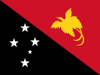
Papua New Guinea, officially the Independent State of Papua New Guinea, is a country in Oceania that comprises the eastern half of the island of New Guinea and its offshore islands in Melanesia. It shares its only land border with Indonesia to the west and its other close neighbors are Australia to the south and the Solomon Islands to the east. Its capital, located on its southern coast, is Port Moresby. The country is the world's third largest island country, with an area of 462,840 km2 (178,700 sq mi).

Melanesia is a subregion of Oceania in the southwestern Pacific Ocean. It extends from New Guinea in the west to the Fiji Islands in the east, and includes the Arafura Sea.

Bougainville, officially the Autonomous Region of Bougainville, is an autonomous region in Papua New Guinea. The largest island is Bougainville Island, while the region also includes Buka Island and a number of outlying islands and atolls. The current capital is Buka, situated on Buka Island.

Pacific Islanders, Pasifika, Pasefika, Pacificans, or rarely Pacificers are the peoples of the Pacific Islands. As an ethnic/racial term, it is used to describe the original peoples—inhabitants and diasporas—of any of the three major subregions of Oceania or any other island located in the Pacific Ocean.

Bougainville Island is the main island of the Autonomous Region of Bougainville, which is part of Papua New Guinea. Its land area is 9,300 km2 (3,600 sq mi). The population of the whole province, including nearby islets such as the Carterets, is approximately 300,000. The highest point is Mount Balbi, on the main island, at 2,715 m (8,907 ft).

The Bismarck Archipelago is a group of islands off the northeastern coast of New Guinea in the western Pacific Ocean and is part of the Islands Region of Papua New Guinea. Its area is about 50,000 square kilometres (19,000 sq mi).

The Torres Strait, also known as Zenadh Kes, is a strait between Australia and the Melanesian island of New Guinea. It is 150 km (93 mi) wide at its narrowest extent. To the south is Cape York Peninsula, the northernmost extremity of the Australian mainland. To the north is the Western Province of Papua New Guinea. It is named after the Spanish navigator Luís Vaz de Torres, who sailed through the strait in 1606.

The Papuan languages are the non-Austronesian languages spoken on the western Pacific island of New Guinea, as well as neighbouring islands in Indonesia, Solomon Islands, and East Timor. It is a strictly geographical grouping, and does not imply a genetic relationship.
The East Papuan languages is a defunct proposal for a family of Papuan languages spoken on the islands to the east of New Guinea, including New Britain, New Ireland, Bougainville, Solomon Islands, and the Santa Cruz Islands. There is no evidence that these languages are related to each other, and the Santa Cruz languages are no longer recognized as Papuan.

UTC+10:00 is an identifier for a time offset from UTC of +10:00. This time is used in:

UTC+11:00 is an identifier for a time offset from UTC of +11:00. This time is used in:

The states and territories are the second level of government of Australia. The states are administrative divisions that are self-governing polities that are partly sovereign, having ceded some sovereign rights to the federal government. They have their own constitutions, legislatures, executive governments, judiciaries and law enforcement agencies that administer and deliver public policies and programs. Territories can be autonomous and administer local policies and programs much like the states in practice, but are still legally subordinate to the federal government.

Talbot Islands are a group of Torres Strait Islands in Queensland, Australia. They lie between the Australian mainland and the island of New Guinea and a few kilometres west of Saibai Island, Torres Strait, only 4 km from the Papua New Guinea mainland at the mouth of the Mai Kussa River.

The Nukumanu Islands, formerly the Tasman Islands, is an atoll of Papua New Guinea, located in the south-western Pacific Ocean, 4 degrees south of the Equator.
Yule Island is a small island in Central Province, Papua New Guinea. It is located 160 km NW from Port Moresby, on the south coast of Papua New Guinea.

Acraea is a genus of brush-footed butterflies of the subfamily Heliconiinae. It seems to be highly paraphyletic and has long been used as a "wastebin taxon" to unite about 220 species of anatomically conservative Acraeini. Some phylogenetic studies show that the genus Acraea is monophyletic if Bematistes and Neotropical Actinote are included. Most species assembled here are restricted to the Afrotropical realm, but some are found in India, Southeast Asia, and Australia.

The Australian New Guinea Administrative Unit (ANGAU) was a civil administration of Territory of Papua and the Mandated Territory of New Guinea formed on 21 March 1942 during World War II. The civil administration of both Papua and the Mandated Territory of New Guinea were replaced by an Australian Army military government and came under the control of ANGAU from February 1942 until the end of World War II.

The continent of Australia, sometimes known in technical contexts by the names Sahul, Australia-New Guinea, Australinea, Oceania, or Meganesia to distinguish it from the country of Australia, is located within the Southern and Eastern hemispheres. The continent includes mainland Australia, Tasmania, the island of New Guinea, the Aru Islands, the Ashmore and Cartier Islands, most of the Coral Sea Islands, and some other nearby islands. Situated in the geographical region of Oceania, Australia is the smallest of the seven traditional continents.

New Guinea is the world's second-largest island, with an area of 785,753 km2 (303,381 sq mi). Located in Melanesia in the southwestern Pacific Ocean, the island is separated from Australia by the 150-kilometre wide Torres Strait, though both landmasses lie on the same continental shelf, and were united during episodes of low sea level in the Pleistocene glaciations as the combined landmass of Sahul. Numerous smaller islands are located to the west and east. The island's name was given by Spanish explorer Yñigo Ortiz de Retez during his maritime expedition of 1545 due to the resemblance of the indigenous peoples of the island to those in the African region of Guinea.

The Solomon Islands (archipelago) is an island group in the western South Pacific Ocean, north-east of Australia. The archipelago is in the Melanesian subregion and bioregion of Oceania and forms the eastern boundary of the Solomon Sea. The many islands of the archipelago are distributed across the sovereign states of Papua New Guinea and Solomon Islands. The largest island in the archipelago is Bougainville Island, which is a part of the Autonomous Region of Bougainville along with Buka Island, the Nukumanu Islands, and a number of smaller nearby islands. Much of the remainder falls within the territory of Solomon Islands and include the atolls of Ontong Java, Sikaiana, the raised coral atolls of Bellona and Rennell, and the volcanic islands of Choiseul, Guadalcanal, Makira, Malaita, New Georgia, the Nggelas, Santa Isabel, and the Shortlands. The Santa Cruz Islands are not a part of the archipelago.


