Agricola, Mississippi | |
|---|---|
 Agricola  Agricola | |
| Coordinates: 30°48′28″N88°31′12″W / 30.80778°N 88.52000°W | |
| Country | United States |
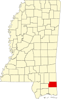
| State | Mississippi |
| County | George |
| Area | |
• Total | 1.50 sq mi (3.89 km2) |
| • Land | 1.49 sq mi (3.87 km2) |
| • Water | 0.0039 sq mi (0.01 km2) |
| Elevation | 230 ft (70 m) |
| Population (2020) | |
• Total | 346 |
| • Density | 231.3/sq mi (89.29/km2) |
| Time zone | UTC-6 (Central (CST)) |
| • Summer (DST) | UTC-5 (CDT) |
| Area codes | 601 & 769 |
| FIPS code | 28-00460 |
| GNIS feature ID | 666164 [2] |
Agricola is a census-designated place and unincorporated community in George County, Mississippi. Per the 2020 Census, the population was 346. [3]
Contents
Agricola is home to Agricola Elementary School (AES). [4] Agricola was a station on the Pascagoula Northern Railroad. [5]
A post office operated under the name Agricola from 1909 to 1964. [6]