Aguacate, Aguadilla, Puerto Rico

Last updated
Aguacate
Barrio
Aguacate, Aguadilla, Puerto Rico locator map.png
Caribbean location map.svg
Red pog.svg
Aguacate
Location of Puerto Rico
Coordinates: 18°29′59″N67°06′41″W / 18.499731°N 67.111453°W / 18.499731; -67.111453 [1]
Commonwealth Flag of Puerto Rico.svg  Puerto Rico
Municipality Bandera de Aguadilla, Puerto Rico.svg Aguadilla
Area
[1]
  Total1.65 sq mi (4.3 km2)
  Land1.48 sq mi (3.8 km2)
  Water0.17 sq mi (0.4 km2)
Elevation
203 ft (62 m)
Population
 (2010)
  Total1,525
  Density1,030.4/sq mi (397.8/km2)
 Source: 2010 Census
Time zone UTC−4 (AST)
ZIP Code
00603

Aguacate is a barrio in the municipality of Aguadilla, Puerto Rico. Its population in 2010 was 1,525. [2] [3] [4]

Contents

History

Aguacate was in Spain's gazetteers [5] until Puerto Rico was ceded by Spain in the aftermath of the Spanish–American War under the terms of the Treaty of Paris of 1898 and became an unincorporated territory of the United States. In 1899, the United States Department of War conducted a census of Puerto Rico finding that the combined population of Aguacate barrio and Arenales was 991. [6]

Historical population
CensusPop.Note
1910 440
1920 4665.9%
1930 62433.9%
1940 97656.4%
1950 1,27830.9%
1960 696−45.5%
1970 7274.5%
1980 7310.6%
1990 1,14957.2%
2000 1,53133.2%
2010 1,525−0.4%
U.S. Decennial Census
1900 (N/A) [7] 1910-1930 [8]
1930-1950 [9] 1980-2000 [10] 2010 [11]

Features

Aguacate has an elevation of 203 feet. [12]

Sectors

Barrios (which are, in contemporary times, roughly comparable to minor civil divisions) [13] in turn are further subdivided into smaller local populated place areas/units called sectores (sectors in English). The types of sectores may vary, from normally sector to urbanización to reparto to barriada to residencial, among others. [14] [15] [16] [17]

The following sectors are in Aguacate barrio: [18]

Reparto Los Robles, Reparto Roldán, Sector Calero, Sector Villa Min, Urbanización Nuevo San Antonio, Urbanización Quintas de San José, Urbanización Ramón Marín, Urbanización Villa Aurelia, Urbanización Villa del Paraíso, Urbanización Villa Jiménez, Urbanización Villa Montaña, Urbanización Villa Sotomayor, Urbanización Villas del Mar, and Villa Olga.

See also

Related Research Articles

<span class="mw-page-title-main">Santa Rosa, Guaynabo, Puerto Rico</span> Barrio of Puerto Rico

Santa Rosa is a barrio in the municipality of Guaynabo, Puerto Rico. Its population in 2010 was 16,904.

<span class="mw-page-title-main">Palmas, Cataño, Puerto Rico</span> Barrio of Puerto Rico

Palmas is a barrio in the municipality of Cataño, Puerto Rico. Its population in 2010 was 23,857.

<span class="mw-page-title-main">Borinquen, Aguadilla, Puerto Rico</span> Barrio of Puerto Rico

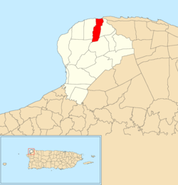
Borinquen is a barrio in the municipality of Aguadilla, Puerto Rico. Its population in 2010 was 7,415.

<span class="mw-page-title-main">Guanajibo, Hormigueros, Puerto Rico</span> Barrio of Puerto Rico

Guanajibo is a barrio in the municipality of Hormigueros, Puerto Rico. Its population in 2010 was 5,959.

<span class="mw-page-title-main">Mamey, Patillas, Puerto Rico</span> Barrio of Puerto Rico

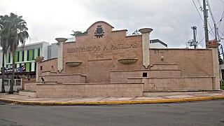
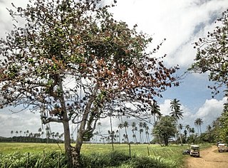
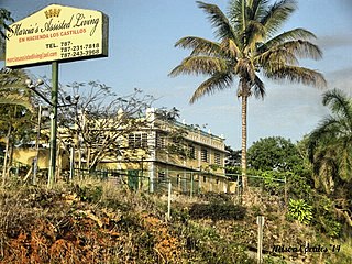
Mamey is a barrio in the municipality of Patillas, Puerto Rico. Its population in 2010 was 1,380.

<span class="mw-page-title-main">Llanos, Aibonito, Puerto Rico</span> Barrio of Puerto Rico

Llanos is a barrio in the municipality of Aibonito, Puerto Rico. Its population in 2010 was 6,840.

<span class="mw-page-title-main">Ortíz, Toa Alta, Puerto Rico</span> Barrio of Puerto Rico

Ortíz is a large barrio in the municipality of Toa Alta, Puerto Rico. Its population in 2010 was 26,580.

<span class="mw-page-title-main">Quebrada Cruz</span> Barrio of Toa Alta, Puerto Rico

Quebrada Cruz is a barrio in the municipality of Toa Alta, Puerto Rico. Its population in 2010 was 5,343 living in over 30 sectors.

<span class="mw-page-title-main">Caimital Alto, Aguadilla, Puerto Rico</span> Barrio of Puerto Rico

Caimital Alto is a barrio in the municipality of Aguadilla, Puerto Rico. Its population in 2010 was 3,989.

<span class="mw-page-title-main">Caimital Bajo, Aguadilla, Puerto Rico</span> Barrio of Puerto Rico

Caimital Bajo is a barrio in the municipality of Aguadilla, Puerto Rico. Its population in 2010 was 4,487. In Caimatal Bajo barrio is part of the Aguadilla urban zone.

<span class="mw-page-title-main">Camaceyes, Aguadilla, Puerto Rico</span> Barrio of Puerto Rico

Camaceyes is a barrio in the municipality of Aguadilla, Puerto Rico. Its population in 2010 was 12,547. In Camaceyes barrio is part of the Aguadilla urban zone.

<span class="mw-page-title-main">Ceiba Alta, Aguadilla, Puerto Rico</span> Barrio of Puerto Rico

Ceiba Alta is a rural barrio in the municipality of Aguadilla, Puerto Rico. Its population in 2010 was 667.

<span class="mw-page-title-main">Ceiba Baja, Aguadilla, Puerto Rico</span> Barrio of Puerto Rico

Ceiba Baja is a rural barrio in the municipality of Aguadilla, Puerto Rico. Its population in 2010 was 2,356.

<span class="mw-page-title-main">Corrales, Aguadilla, Puerto Rico</span> Barrio of Puerto Rico

Corrales is a rural barrio in the municipality of Aguadilla, Puerto Rico. Its population in 2010 was 7,659. In Corrales barrio is Cabán, a comunidad.

<span class="mw-page-title-main">Maleza Baja, Aguadilla, Puerto Rico</span> Barrio of Puerto Rico

Maleza Baja is a rural barrio in the municipality of Aguadilla, Puerto Rico. Its population in 2010 was 1,887.

<span class="mw-page-title-main">Montaña, Aguadilla, Puerto Rico</span> Barrio of Puerto Rico

Montaña is a rural barrio in the municipality of Aguadilla, Puerto Rico. Its population in 2010 was 4,068. In Montaña barrio is the San Antonio community.

<span class="mw-page-title-main">Guerrero, Aguadilla, Puerto Rico</span> Barrio of Puerto Rico

Guerrero is a rural barrio in the municipality of Aguadilla, Puerto Rico. Its population in 2010 was 3,406. In Guerrero barrio is Rafael Hernández, a comunidad.

<span class="mw-page-title-main">Arenales, Aguadilla, Puerto Rico</span> Barrio of Puerto Rico

Arenales is a rural barrio in the municipality of Aguadilla, Puerto Rico. Its population in 2010 was 1,983.

<span class="mw-page-title-main">Aguacate, Yabucoa, Puerto Rico</span> Barrio of Puerto Rico

Aguacate is a barrio in the municipality of Yabucoa, Puerto Rico. Its population in 2010 was 2,828.

<span class="mw-page-title-main">Canóvanas, Canóvanas, Puerto Rico</span> Barrio of Puerto Rico

Canóvanas is a barrio in the municipality of Canóvanas, Puerto Rico. Its population in 2010 was 22,420.

References

  1. 1 2 "US Gazetteer 2019". US Census. US Government.
  2. Picó, Rafael; Buitrago de Santiago, Zayda; Berrios, Hector H. Nueva geografía de Puerto Rico: física, económica, y social, por Rafael Picó. Con la colaboración de Zayda Buitrago de Santiago y Héctor H. Berrios. San Juan Editorial Universitaria, Universidad de Puerto Rico,1969.
  3. Gwillim Law (20 May 2015). Administrative Subdivisions of Countries: A Comprehensive World Reference, 1900 through 1998. McFarland. p. 300. ISBN   978-1-4766-0447-3 . Retrieved 25 December 2018.
  4. Puerto Rico: 2010 Population and Housing Unit Counts.pdf (PDF). U.S. Dept. of Commerce, Economics and Statistics Administration, U.S. Census Bureau. 2010.
  5. "Anuario del comercio, de la industria, de la magistratura y de la administración. 1881". Biblioteca Nacional de España (in Spanish). p. 1614. Retrieved 4 April 2023.
  6. Joseph Prentiss Sanger; Henry Gannett; Walter Francis Willcox (1900). Informe sobre el censo de Puerto Rico, 1899, United States War Dept. Porto Rico Census Office (in Spanish). Imprenta del gobierno. p.  160.
  7. "Report of the Census of Porto Rico 1899". War Department Office Director Census of Porto Rico. Archived from the original on July 16, 2017. Retrieved September 21, 2017.
  8. "Table 3-Population of Municipalities: 1930 1920 and 1910" (PDF). United States Census Bureau. Archived (PDF) from the original on August 17, 2017. Retrieved September 21, 2017.
  9. "Table 4-Area and Population of Municipalities Urban and Rural: 1930 to 1950" (PDF). United States Census Bureau. Archived (PDF) from the original on August 30, 2015. Retrieved September 21, 2014.
  10. "Table 2 Population and Housing Units: 1960 to 2000" (PDF). United States Census Bureau. Archived (PDF) from the original on July 24, 2017. Retrieved September 21, 2017.
  11. Puerto Rico: 2010 Population and Housing Unit Counts.pdf (PDF). U.S. Dept. of Commerce Economics and Statistics Administration U.S. Census Bureau. 2010. Archived (PDF) from the original on 2017-02-20. Retrieved 2019-08-02.
  12. U.S. Geological Survey Geographic Names Information System: Aguacate barrio
  13. "US Census Barrio-Pueblo definition". factfinder.com. US Census. Archived from the original on 13 May 2017. Retrieved 5 January 2019.
  14. Mari Mut, José A. (28 August 2013). "Los pueblos de Puerto Rico y las iglesias de sus plazas" (in Spanish). Retrieved 19 June 2020 via archive.org.
  15. "Agencia: Oficina del Coordinador General para el Financiamiento Socioeconómico y la Autogestión (Proposed 2016 Budget)". Puerto Rico Budgets (in Spanish). Retrieved 28 June 2019.
  16. Rivera Quintero, Marcia (2014), El vuelo de la esperanza : Proyecto de las Comunidades Especiales Puerto Rico, 1997-2004 (Primera edición ed.), San Juan, Puerto Rico Fundación Sila M. Calderón, ISBN   978-0-9820806-1-0
  17. "Leyes del 2001". Lex Juris Puerto Rico (in Spanish). Retrieved 24 June 2019.
  18. "PRECINTO ELECTORAL AGUADILLA 035" (PDF). Comisión Estatal de Elecciones (in Spanish). PR Government. 30 January 2019. Retrieved 21 June 2020.