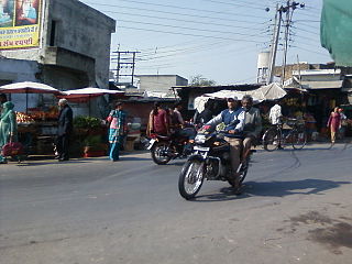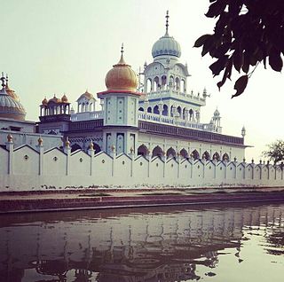
Khaira is a village in Ludhiana district in the Indian state of Punjab.
Jalwehra, commonly known as Jalerha, is a village in Hoshiarpur, Punjab. Its population in 2011 census was 616 of which 310 are males while 306 are females. Average Sex Ratio of Jalwehra village is 987 which is higher than Punjab state average of 895. Child Sex Ratio for the Jalwehra as per census is 1000, higher than Punjab average of 846. Jalwehra village has higher literacy rate compared to Punjab. In 2011, literacy rate of Jalwehra village was 82.22% compared to 75.84% of Punjab. In Jalwehra Male literacy stands at 89.86% while female literacy rate was 74.47%.

Moga is a city in the Indian state of Punjab. Moga was named after Moga Singh Gill, a prominent person of the Gill community.

Gardhiwala is a town and a municipal council in Hoshiarpur district in the state of Punjab, India.

Samrala is a city and a municipal council in Ludhiana district in the Indian state of Punjab. It is about 35 km east of the district headquarters Ludhiana, on the highway to Chandigarh. Samrala is a Class III Municipality. It is also known for the oldest tehsil situated in this city. It is also believed that the name Samrala came from the name of two brothers Sama and Rala.

Urmar Tanda is a town and municipal council in Hoshiarpur district, Punjab, India.

Kartarpur is a town near the city of Jalandhar and is located in the Doaba region of the state. It was founded by the fifth Guru of Sikhs, Sri Guru Arjan Dev Ji.

Rajiana is a village of Malwa region in District Moga, Punjab. The village is divided into pattis like Wigha patti, Narang ki patti, Haveli patti, Joga Patti, Ghoga Patti, Wazir patti, etc. The people of the village belongs to various religions, most of them are Jatt Sikhs of Brar clan. The village has three panchayats; Rajiana, Rajiana Patti Vigha and Rajiana Khurd. There are three water works and 3 water filters in the village supplying pure water to the villagers. Streets of the village are made from concrete. There are one co-operative bank, two petrol pumps, many schools, govt. hospital, govt. veterinary hospital, multiplex, playground, mobile towers and other all facilities.

Singriwala is a village in Hoshiarpur district, in Punjab, India.

Abadan is a village located in Jalandhar West community development block of Jalandhar - I tehsil, Jalandhar district, Punjab state, India.

Dhak Pandori is a village in Kapurthala district in North India, in the central part of the Punjab. Dhak Pandori is a small village located in Phagwara Tehsil of Kapurthala district, Punjab with total 441 families residing. The Dhak Pandori village has population of 2439 of which 1297 are males while 1142 are females as per Population Census 2011.

Boothgarh is a medium-size village located in Khanna Tehsil of Ludhiana district in Punjab, India with a total of 254 families residing. The Boothgarh village has a population of 1190 of which 616 are males while 574 are females as per Population Census 2011.

Chak Sahbu is a small village in Jalandhar District of Punjab State, India. The village is administrated by Sarpanch who is elected representative of village. It is located 49 km towards East from Jalandhar, 14 km from Phillaur and 119 km from Chandigarh. The nearest census town and marketplace is located 1 km in Apra, Punjab. The nearest train station is situated 13.9 km away in Phillaur, nearest domestic airport is at Ludhiana and the nearest international airport is 143 km away in Amritsar.

Borawal is a town in Budhlada tehsil of Mansa district of Punjab, India. According to the census of 2011, Borawal has a population of 3950. Famous places of borawal are village pond ,three gurdwaras,C-pet camp.There are welfare clubs such as umeed social welfare club ,saheed udam singh welfare club.

Sowaddi Kalan or Swaddi Khas is a village in Ludhiana district in the Indian state of Punjab. It is one of the most educated villages in the area. Swaddi Kalan is a large village in Jagraon of Ludhiana district with a total of 954 families and 4,804 residents in 2011.

Nagar is a village in the Phillaur tehsil of Jalandhar District of the Indian state of Punjab. It is located on Phillaur-Nawanshahr Road, 6.7 kilometres (4.2 mi) from the head postal office in Phillaur, 7 kilometres (4.3 mi) from Apra, 50 kilometres (31 mi) from Jalandhar, and 117 kilometres (73 mi) from the state capital of Chandigarh. The village is administered by the Sarpanch, an elected representative.

Allowal is a medium size village in Phillaur tehsil of Jalandhar District of Punjab State, India. It is located 5 km away from postal head office Phillaur, 14.8 km from Goraya, 48 km from Jalandhar and 111 km from state capital Chandigarh. The village is administrated by a sarpanch who is an elected representative of village as per Panchayati raj (India).

Ramgarh is a medium size village in Phillaur tehsil of Jalandhar District of Punjab State, India. It is located 1 km away from postal head office Phillaur, 16 km from Ludhiana, 45 km from district headquarter Jalandhar and 118 km from state capital Chandigarh. The village is administrated by a sarpanch who is an elected representative of village as per Panchayati raj (India).
Dandoh is a village in the Hoshiarpur tehsil, Hoshiarpur district of Punjab, India. It is one of 415 villages in Hoshiarpur. the closest railway station to Dandoh is Hoshiarpur railway station. The village is situated about 134.5 km from Chandigarh, the state capital.

Chandpur Rurki is a village in Shaheed Bhagat Singh Nagar district of Punjab State, India. It is located 5.1 kilometres (3.2 mi) away postal head office Saroa, 27.4 kilometres (17.0 mi) from Banga, 31 kilometres (19 mi) from district headquarter Shaheed Bhagat Singh Nagar and 95.6 kilometres (59.4 mi) from state capital Chandigarh. The village is administrated by Sarpanch an elected representative of the village. Notable alumni<brigadier kuldeep singh chandpuri>


