
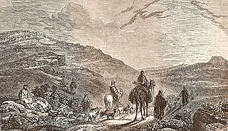
Bethlehem is a city in the West Bank, Palestine, located about 10 kilometres (6.2 mi) south of Jerusalem. It is the capital of the Bethlehem Governorate, and has a population of approximately 25,000 people. The city's economy is largely tourist-driven; international tourism peaks around and during Christmas, when Christians embark on a pilgrimage to the Church of the Nativity, revered as the location of the Nativity of Jesus. At the northern entrance of the city is Rachel's Tomb, the burial place of biblical matriarch Rachel. Movement around the city is limited due to the Israeli West Bank barrier.

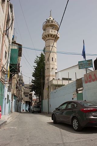
Beit Jala is a Palestinian Christian town in the Bethlehem Governorate of Palestine, in the West Bank. Beit Jala is located 10 km (6.2 mi)10 km south of Jerusalem, on the western side of the Hebron road, opposite Bethlehem, at 825 meters (2,707 ft) altitude. In 2017, Beit Jala had 13,484 inhabitants according to the Palestinian Central Bureau of Statistics. About 80% of the population were Christians and about 20% Muslims.
Beit Hanoun or Beit Hanun is a city on the northeast edge of the Gaza Strip. According to the Palestinian Central Bureau of Statistics, the town had a population of 52,237 in 2017. It is administered by the Hamas administration. It is located by the Hanoun stream, just 6 kilometers (3.7 mi) away from the Israeli town of Sderot.
Beit Lahia or Beit Lahiya is a city in the Gaza Strip north of Jabalia, near Beit Hanoun and the 1949 Armistice Line with Israel. According to the Palestinian Central Bureau of Statistics, the city had a population of 89,838 in 2017. The political party Hamas is still administering the city, together with the entire Gaza Strip, after winning the 2005 municipal elections.

Beit Sahour or Beit Sahur is a Palestinian town east of Bethlehem, in the Bethlehem Governorate of the State of Palestine. The city is under the administration of the Palestinian National Authority. The population was of 13,281 in 2017, consisting of approximately 80% Christians and 20% Muslims.

Har Gilo is an Israeli settlement in the West Bank, organized as a community settlement, located about 2 kilometers west of the Palestinian city of Bethlehem and 5 kilometers south of Jerusalem, in the northern Judean hills.

The Quds Governorate, also Jerusalem Governorate, is one of the 16 Governorates of Palestine and located in the central part of the West Bank. The current Governor, appointed by the Palestinian National Authority, is Adnan Ghaith since 2018, who succeeded to Adnan al-Husayni, appointed in 2008. The Governorate has two sub-districts: Jerusalem J1, which includes the localities within the territory controlled by the Israeli Jerusalem municipality, and Jerusalem J2, which includes the remaining parts of the Jerusalem Governorate. The district capital of the Governorate is East Jerusalem (al-Quds).

The Bethlehem Governorate is one of 16 Governorates of Palestine. It covers an area of the West Bank, south of Jerusalem. Its principal city and district capital is Bethlehem. According to the Palestinian Central Bureau of Statistics, its population was estimated to 199,463 in 2012.

Al-Khader is a Palestinian town in the Bethlehem Governorate of the State of Palestine, in the south-central West Bank. It is located 5 kilometers (3.1 mi) west of Bethlehem. According to the Palestinian Central Bureau of Statistics, the town had a population of 11,960 in 2017. The area around al-Khader is marked by vineyards, and olive and fig trees.
Teqoa is a Palestinian town in the Bethlehem Governorate, located 12 km (7.5 mi) southeast of Bethlehem in the West Bank. The town is built adjacent to the biblical site of Tekoa (Thecoe), now Khirbet Tuqu’, from which it takes its name. Today's town includes three other localities: Khirbet Ad Deir, Al Halkoom, and Khirbet Teqoa. According to the Palestinian Central Bureau of Statistics (PCBS), Teqoa had a population of 8,767 in 2017.

Beit Ummar is a Palestinian town located eleven kilometers northwest of Hebron in the Hebron Governorate of the State of Palestine. According to the Palestinian Central Bureau of Statistics, in 2017, the town had a population of 16,977 inhabitants. Over 4,800 residents of the town are under the age of 18. Since the Second Intifada, unemployment ranges between 60 and 80 percent due mostly to the inability of residents to work in Israel and a depression in the Palestinian economy. A part of the city straddles Road 60 and due to this, several propositions of house demolition have occurred.

Beit Fajjar is a Palestinian town located eight kilometers south of Bethlehem in the Bethlehem Governorate, in the central West Bank. According to the Palestinian Central Bureau of Statistics, the town had a population of over 13,520 in 2017.
'Azza also known as Beit Jibrin Camp is a Palestinian refugee camp in the Bethlehem Governorate located within the city of Bethlehem. It is the smallest of the 59 refugee camps in the West Bank and the other Arab countries. It was established in 1950 in an area of 20 dunams and receives services from UNRWA workers based in nearby Aida camp, but inside the camp, there are no medical or educational services, so it was merged with the Aida camp to receive services.
Khirbet al-Deir, or Khirbet ed-Deir, is a Palestinian village located 10 kilometres (6.2 mi) southwest of Bethlehem, and 15 kilometres (9.3 mi) northwest of Hebron. The town is in the Hebron Governorate of central West Bank. According to the 2017 Palestinian Central Bureau of Statistics (PCBS) Census, the village had a population of 358 people.
Beit Ta'mir is a Palestinian village located six kilometers southeast of Bethlehem.The town is in the Bethlehem Governorate central West Bank. According to the Palestinian Central Bureau of Statistics, the village had a population of 1,596 in 2017. The village is named after the 'Arab al-Ta'mira Bedouin tribe of the Bethlehem area, and along with Tuqu' and Za'atara forms the 'Arab al-Ta'mira village cluster.

Umm Salamuna is a Palestinian village located twelve kilometers South-west of Bethlehem. The village is in the Bethlehem Governorate in the southern West Bank. According to the Palestinian Central Bureau of Statistics, the village had a population of 1,188 in 2017. The primary healthcare is obtained in Beit Fajjar where the Ministry of Heath have classified the care facilities as level 3.
Marah Rabah is a Palestinian village located twelve kilometers south of Bethlehem. The village is in the Bethlehem Governorate central West Bank. According to the Palestinian Central Bureau of Statistics, the town had a population of over 1,729 in 2017. The primary healthcare is obtained in Tuqu', where the Ministry of Health denotes the healthcare facilities as level 2.
Al-Qubeiba is a Palestinian town in the Jerusalem Governorate of Palestine, located 2 kilometers northwest of Jerusalem in the central West Bank. According to the Palestinian Central Bureau of Statistics in 2017, the village had a population of 3,876. Al-Qubeiba lies at an altitude of 783m to 795m above sea-level. It is located in a conflict area near the border with Israel between Ramallah and Jerusalem. The settlement of Giv'on HaHadashah lies 5 km southeast of al-Qubeiba. It is surrounded by the town of Biddu (east), Beit 'Anan (northwest), Qatanna (southwest), and Kharayib Umm al-Lahim (west). Unlike the surrounding region, al-Qubeiba has large areas covered with pine and olive trees.

Doha is the one of the eight municipalities of Qatar. It is the most populous municipality with a population of 956,457, and is the municipality of Qatar's capital city, Doha.

