Al-Masara | |
---|---|
Arabic transcription(s) | |
• Arabic | المعصرة |
• Latin | Al-Ma'sara (official) |
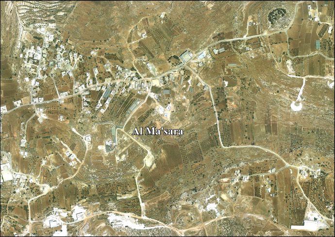
Coordinates: 31°39′17″N35°10′48″E / 31.65472°N 35.18000°E | |
State | State of Palestine |
Governorate | Bethlehem |
Founded | 1930 |
Government | |
• Type | Local Development Committee |
• Head of Municipality | Mahmoud Alaeddin |
Area | |
• Total | 973 dunams (1.0 km2 or 0.4 sq mi) |
Population (2017) [1] | |
• Total | 1,085 |
• Density | 1,100/km2 (2,800/sq mi) |
Name meaning | "the press" |
Al-Masara (Arabic : المعصرة, pronounced al-Ma'sara; translation: "the press") is a Palestinian village in the central West Bank, 6.2 km southwest of Bethlehem, part of the Bethlehem Governorate. It is surrounded by a number of smaller Palestinian villages, including Khallet al-Haddad to the east. [2] The population was 1,085 in the 2017 census by the Palestinian Central Bureau of Statistics (PCBS). [1]
Its name, which translates as "the press", derives from the Byzantine Empire-era olive press still located in al-Ma'sara. [2] In 1883 the PEF's Survey of Western Palestine (SWP) noted "heaps of stones and cisterns" at Khurbet Marsia. [3]
The modern town was founded in 1930 by members of the Arab al-Zawahra and at-Ta'mirah tribes. [2]
After the Six-Day War in 1967, Al-Masara has been under Israeli occupation.
A seven-member local development committee was established by the Palestinian National Authority (PNA) to administer the village, most which is located in Area B giving the PNA jurisdiction over al-Ma'sara's civil affairs. [2] The head of the committee is Mahmoud Alaeddin. [4]
There is one mosque, al-Ma'sara Mosque, and a primary and secondary school in the village. [2]
Agriculture accounts for 70% of al-Ma'sara's economic activity, while the civil sector makes up 16%. The total land area is 973 dunams, of which 42 dunams are designated built-up. Most of the remainder is arable land, 505 dunams of which are cultivated. [2]
Ash-Shuyukh or al-Shuyukh is a Palestinian town in the Hebron Governorate of the State of Palestine, located 6 km northeast of the city of Hebron. According to the Palestinian Central Bureau of Statistics, Ash-Shuyukh had a population of 12,052 in 2017.
Jab'a is a Palestinian village in the central West Bank, located 17 kilometers north of Hebron and 15 kilometers southwest of Bethlehem. Located three kilometers east of the Green Line, it is located in the Seam Zone, surrounded by the Israeli settlements in the Gush Etzion Regional Council and the Israeli West Bank barrier.
Kharbatha al-Misbah is a Palestinian town in the central West Bank, located 12.5 kilometers (7.8 mi) west of Ramallah in the Ramallah and al-Bireh Governorate. According to the Palestinian Central Bureau of Statistics, the town had a population of 6,366 in 2017. It has a total land area of 4,431 dunams, of which 644 are built-up areas and the remainder agricultural lands and forests.
Beit Sira is a Palestinian village in the central West Bank, located 22 kilometers west of Ramallah and is a part of the Ramallah and al-Bireh Governorate. The village is situated along the Green Line. During the 1948 Arab-Israeli War, around 4,000 dunams of its land became a part of the "No-Man's Land" strip between the north-central West Bank and Israel. Currently Beit Sira's jurisdiction is 3,120 dunams, of which 441 dunams are built-up areas and the remainder is open spaces for future construction or agricultural land.
Khirbet Abu Falah is a Palestinian village in the Ramallah and al-Bireh Governorate, located 26 kilometers (16 mi) north of Ramallah in the central West Bank. According to the Palestinian Central Bureau of Statistics (PCBS), the village had a population of 4,394 in the 2017 census.
Khirbet al-Deir, or Khirbet ed-Deir, is a Palestinian village located 10 kilometres (6.2 mi) southwest of Bethlehem, and 15 kilometres (9.3 mi) northwest of Hebron. The town is in the Hebron Governorate of central West Bank. According to the 2017 Palestinian Central Bureau of Statistics (PCBS) Census, the village had a population of 358 people.
Beit Ta'mir is a Palestinian village located six kilometers southeast of Bethlehem.The town is in the Bethlehem Governorate central West Bank. According to the Palestinian Central Bureau of Statistics, the village had a population of 1,596 in 2017. The village is named after the 'Arab al-Ta'mira Bedouin tribe of the Bethlehem area, and along with Za'atara, Hindaza, Tuqu', Khirbet al-Deir, Nuaman, Ubeidiya and al-Asakra forms the 'Arab al-Ta'mira village cluster.
Shuyukh al-Arrub is a Palestinian village located eleven kilometers north-east of Hebron. The village is in the Hebron Governorate Southern West Bank. According to the Palestinian Central Bureau of Statistics, the village had a population of 1,958 inhabitants in 2017. The primary health care facilities for the village are designated by the Ministry of Health as level 2.
Hadab al-Fawwar is a Palestinian village located seven kilometers southwest of Hebron. The village is in the Hebron Governorate Southern West Bank. According to the Palestinian Central Bureau of Statistics, the village had a population of 2,354 in 2017. The primary health care facilities for the village are designated by the Ministry of Health as level 2. It is adjacent to the Palestinian refugee camp of Fawwar.
Qalqas or Qilqis is a Palestinian village located four kilometers south of Hebron and adjacent to Beit Hagai. The village is in the Hebron Governorate Southern West Bank. According to the Palestinian Central Bureau of Statistics, the village had a population of 1,709 in 2017. The primary health care facilities for the village are designated by the Ministry of Health as level 1.
Umm Salamuna is a Palestinian village located twelve kilometers south-west of Bethlehem. The village is in the Bethlehem Governorate in the southern West Bank. According to the Palestinian Central Bureau of Statistics, the village had a population of 1,188 in 2017. The primary healthcare is obtained in Beit Fajjar, where the Ministry of Health has classified the care facilities as level 3.
Karma is a Palestinian village located nineteen kilometers south-west of Hebron. The village is in the Hebron Governorate Southern West Bank. The village had a population of 1,781 in 2017.
Al-Kum is a Palestinian village in the southern West Bank, part of the Hebron Governorate and located 13 kilometers west of Hebron. Its municipal borders stretch from the border with Israel in the west to boundaries of the city of Dura in the east. It had a population of 1,464 in the 2017 census by the Palestinian Central Bureau of Statistics.
Burham is a Palestinian village in the Ramallah and al-Bireh Governorate located twelve kilometers north of Ramallah. The largest nearby town is Bir Zeit located to the southeast. The average elevation of Burham is 680 meters above sea level. The village was established during the Byzantine Empire rule over Palestine.
Ein Siniya is a small Palestinian village in the Ramallah and al-Bireh Governorate, 10 kilometers (6.2 mi) north of Ramallah, and approximately 1km northeast from Jifna. It lies in a valley surrounded with olive and fig-terraces.
Deir Razih is a Palestinian village in the southern West Bank located 11 kilometers (6.8 mi) southwest of Hebron, in the Hebron Governorate. It relies mainly on nearby Dura for basic services. Its total land area is made of 540 dunams, including its built-up area. The village had a population of 294 residents in 2017.
Al-Maniya is a Palestinian village in the Bethlehem Governorate in the central West Bank, 8.6 km southeast of Bethlehem and just south of Tuqu'. It incorporates the nearby hamlet of Wadi Muhammad within its jurisdiction. Most of the village, including much of its built-up area, is in Area C, giving the Israeli military full control over the village. It had a population of 1,346 in the 2017 census by the Palestinian Central Bureau of Statistics.
Rabud is a Palestinian village in the southern West Bank, in the Hebron Governorate of the State of Palestine. The village was the site of an ancient Canaanite city. The village had a population of 2,816 in 2017.
Salhab is a small Palestinian village in the Tubas Governorate in the northeastern West Bank, located four kilometers north of Tubas. According to the Palestinian Central Bureau of Statistics (PCBS) census, it had a population of 45 living in five households in 2007 and a population of 25 in 2017. As of 2007, its mayor was Fawze Sawafta.
Khirbet Beit Zakariyyah is a small Palestinian village southwest of Bethlehem in the West Bank, perched on a hill that rises about 995 metres (3,264 ft) above sea level. Administratively, it is associated with the village of Artas under the Bethlehem Governorate. It is also located in between the Israeli settlements of Alon Shevut and Rosh Tzurim, both of which were built on land confiscated from the village. The village had a population of 142 in 2017.