Al-Khader was founded in the late 18th or early 19th century.[4] Its main landmarks are Solomon's Pools, the Murad Fortress (a Turkish Ottoman castle built by Suleiman the Magnificent in 1617 to defend Solomon’s Pools, that today houses a Museum for Palestinian Culture and Heritage), the Monastery and Church of St. George, and Al-Hamadiyya Mosque.[5]
Name and St George tradition
Al-Khader, in Arabic literally "The Green One", is the modern name of the village, which was called "Casale S. Georgii" during the Crusader era.[6] It is named after Saint George – who in Arab culture is associated with the Muslim figure of al-Khadr, "the green one". According to local tradition, Saint George was imprisoned at the location the current Monastery and Church of St. George stand. Chains displayed inside the church are said to be the ones that held him while he was imprisoned, and are said to have healing power.[7]
During the Crusader era, the village was called Casale S. Georgii.[6]
Mamluk period
Around 1421/1422 CE the Church of St. George was mentioned by Western traveler John Poloner as situated on a hill near Bethlehem.[12][13]
Ottoman period
Al-Khader was founded as a subsidiary village of al-Walaja, emerging due to the Qays–Yaman war in the late 18th or early 19th century, during Ottoman rule.[4] It was part of the political-administrative sheikdom and nahiyah ("subdistrict") of Bani Hasan, which was ruled by the Absiyeh family of al-Walaja. In 1838 it was recorded as a Muslim village by the English scholars Edward Robinson and Eli Smith, part of the Bani Hasan District, west of Jerusalem.[14][15] In 1863 Victor Guérin found the village "reduced to two hundred inhabitants, almost all Muslims." He further noted remains of constructions, with rather large stones, which he thought were dated from an era prior to the Arab conquest.[16]
Albert Socin notes that an official Ottoman village list from about 1870 documented el-chadr with a population of 122 in a total of 43 houses, though that population count only included men. It was further noted that the small Greek monastery served as a mental asylum.[17][18] In 1882, the PEF's Survey of Western Palestine described al-Khader as a moderate-sized village with a "Greek church and convent." It was surrounded by vineyards and olive groves and "rock-cut tombs" were situated to the north of the village.[13] It had a mixed population of Muslims and Greek Orthodox Christians, according to the Survey of Western Palestine.[13] In 1896 the population of al-Khader was estimated to be about 210 people.[19]
British Mandate
In the British Mandate 1922 census of Palestine, al-Khader had a population of 697; 694 Muslims and 3 Christians.[20] By the 1931 census of Palestine, the population was 914, mostly Muslim with three Christian inhabitants.[21]
In the 1945 statistics the town had 1,130 Muslim inhabitants[22] and a total land area of 20,100 dunams. It was a part of the Jerusalem District.[23] Of the land, 5,700 dunams were irrigated or used for plantations, 5,889 dunams were for cereals,[24] while 96 dunams were built-up (urban) land.[25]
The Orthodox Christian Church owns several hundreds of dunams made up of vineyards, olive groves and field crops. The lands were entrusted to them since the Rashidun era during the caliphate of Umar who presided over the conquest of Palestine in the 630s. Most of the land is leased to Muslim farmers.[26]
In 1961, the population of al-Khader was 1,798.[27]
Post-1967
Since the Six-Day War in 1967, al-Khader has been under Israeli occupation. The population in the 1967 census conducted by the Israeli authorities was 2,051.[28]
In 1997, the PCBS recorded a population of 6,802 of which 3,606 were males and 3,196 were females.[30] Unlike many Palestinian towns in the area, refugees and their descendants do not have a substantial population in al-Khader. In 1997, 5.2% of the town's inhabitants were recorded as refugees.[31] In the 2007 PCBS census, al-Khader had a population of 9,774.[32]
Since the construction of the Israeli West Bank barrier around al-Khader, several thousand dunams of farmland have been separated from the village, with the inhabitants unable to access them without a permit. In 2006, 50 villagers protested the barrier by filling bags with grapes and selling them along Route 60. Israeli soldiers and police attempted to quell protesters resulting in the injuries and detainment of two residents.[33]
In April 2015 villagers blocked work by settlers to create a bypass road for access to an illegal outpost, which, if completed, would alienate a further 400 dunams of village land.[34]
Geography and land
Funeral in Al-Khader, February, 2001
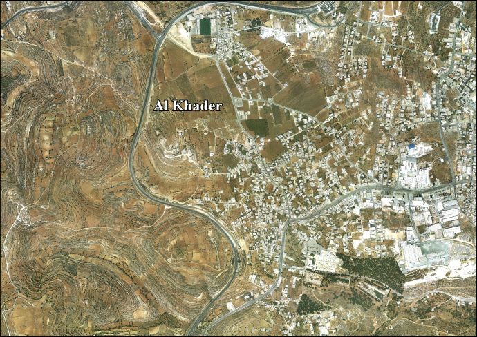
The older part of al-Khader is situated on a saddle-shaped hill facing a steep ridge to the south and open areas to the north, in the central highlands of the West Bank.[13] Nearby localities include the Dheisheh Refugee Camp adjacent to the east, the village of Artas further to the east, Beit Jala to the northeast, al-Walaja and the Israeli settlement of Har Gilo to the north, Battir and Husan to the northwest, Nahalin and the Israeli settlements of Beitar Illit to the west, Neve Daniel to the southeast, and Elazar to the south.
Next to Solomon's Pools stands the town's Convention Palace, amidst restored historic ruins that include the Murad Fortress, a Turkish Ottoman castle built by Suleiman the Magnificent in 1617 to defend Solomon’s Pools. The fortress also houses the Murad Castle Museum for Palestinian Culture and Heritage.[5][37]
Cultural festivals
An outside view of Al-Khader Stadium
Al-Khader is also well known in the area for its peaches, grapes and apples. It hosts its annual Grape Festival every September. The festival was initiated by the al-Khader municipality to promote the town's primary agricultural product, grapes. Other exhibitions held at the festival include one on embroidery and knitting, a local heritage exhibition of mills, grinders, and harvest tools, and an exhibition of home-made grape products such as dibs (molasses made from grapes).[38]Al-Khader Stadium, which holds up to 6,000 people, is located in the town.
Government
Al-Khader is governed by a municipal council of thirteen members including the mayor. In the 2005 municipal elections, the Hamas-affiliated Reform list won the most seats (five), while the Fatah-affiliated Falasteen al-Ghad list won four seats. Two independent lists — Al-Aqsa and Abnaa al-Balad — each won two seats.[39]
1 2 Grossman, D. (1986). "Oscillations in the Rural Settlement of Samaria and Judaea in the Ottoman Period". in Shomron studies. Dar, S., Safrai, S., (eds). Tel Aviv: Hakibbutz Hameuchad Publishing House. p. 366
1 2 "Al Khader". Welcome To Palestine. Retrieved 2023-10-05.
1 2 Röhricht, 1893, RRH, pp. 258-260, No 983; cited in Pringle, 1993, pp. 295-296
↑ Government of Palestine, Department of Statistics, 1945, p. 25
↑ Government of Palestine, Department of Statistics. Village Statistics, April, 1945. Quoted in Hadawi, 1970, p. 57Archived 2011-06-04 at the Wayback Machine
↑ Government of Palestine, Department of Statistics. Village Statistics, April, 1945. Quoted in Hadawi, 1970, p. 103Archived 2016-03-03 at the Wayback Machine
↑ Government of Palestine, Department of Statistics. Village Statistics, April, 1945. Quoted in Hadawi, 1970, p. 153Archived 2016-03-03 at the Wayback Machine
This page is based on this Wikipedia article Text is available under the CC BY-SA 4.0 license; additional terms may apply. Images, videos and audio are available under their respective licenses.


