Allenwood | |
|---|---|
 PA 44 southbound entering Allenwood | |
 Allenwood  Allenwood | |
| Coordinates: 41°06′27″N76°53′54″W / 41.10750°N 76.89833°W | |
| Country | United States |
| State | Pennsylvania |
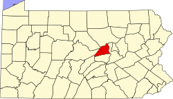
| County | Union |
| Township | Gregg |
| Area | |
• Total | 0.59 sq mi (1.52 km2) |
| • Land | 0.59 sq mi (1.52 km2) |
| • Water | 0 sq mi (0.00 km2) |
| Elevation | 495 ft (151 m) |
| Population | |
• Total | 334 |
| • Density | 568.4/sq mi (219.47/km2) |
| Time zone | UTC-5 (Eastern (EST)) |
| • Summer (DST) | UTC-4 (EDT) |
| Area code | 570 |
| GNIS feature ID | 1168202 [3] |
Allenwood (also called Union Town [3] ) is a census-designated place in Gregg Township, Union County, Pennsylvania, United States. As of the 2020 census, Allenwood had a population of 334. [4]
Contents
Federal Correctional Complex, Allenwood is located in Gregg Township, outside of the CDP boundaries. [5]