Alto Mira, Mindelo

Last updated

For the village on the north of the adjacent island of Santo Antão, see Alto Mira

Alto Mira Settlement in Santo Antão, Cape Verde

Alto Mira is a settlement in the northwestern part of the island of Santo Antão, Cape Verde. It is situated 4 km southeast of Ribeira da Cruz and 18 km northwest of the island capital Porto Novo. Its population was 1,003 at the 2010 census. The Moroços Natural Park lies east of the settlement. The settlement is divided into several localities, including Chã Bonita, Chã Daurinca, Chã de Dragoeiro, Dominguinhas, Faial and Lombo Gorado. The Ribeira Alto Mira flows through the settlement.

Contents

Alto Mira
Neighborhood
Vy mindelo.jpg
Alto Mira (shown at the bottom) and the surrounding area in late 2005
Country Cape Verde
Island São Vicente Island
City Mindelo
Postal code2100
Website www.cmsv.cv

Alto Mira, also as Alto Miramar (Cape Verdean Creole (ALUPEK): Altu Mira, São Vicente Creole: Alt Mira, pre-2000 form: Alt' Mira) is a subdivision located east of the historic center of Mindelo in the island of São Vicente, Cape Verde and are one of the city's six oldest subdivisions, it is the third oldest. The subdivision is Portuguese for a "high panoramic view of the sea" which has a view of Porto Grande Bay to the southwest and northwest opposite to the hill known as Fortinho.

City center of Mindelo Neighborhood in Mindelo, São Vicente Island, Cape Verde

The City center of Mindelo or Morada is the historic center of the Mindelo in the island of São Vicente, Cape Verde. Its population was 1,553 at the 2010 census. It is the place where the island's first settlement was founded in 1793. Many public buildings are situated in the city centre. It lies along the Porto Grande Bay. Adjacent neighbourhoods include Fortinho to the northwest, Alto Miramar to the northeast, Fonte Cônego to the east and Ribeira Bote to the southeast.

São Vicente, Cape Verde island in Cape Verde

São Vicente is one of the Barlavento Islands, the northern group within the Cape Verde archipelago in the Atlantic Ocean, off the west African coast. It is located between the islands of Santo Antão and Santa Luzia, with the Canal de São Vicente separating it from Santo Antão.

Cape Verde Country comprising ten islands off the Northwest coast of Africa

Cape Verde or Cabo Verde, officially the Republic of Cabo Verde, is an island country spanning an archipelago of 10 volcanic islands in the central Atlantic Ocean. It forms part of the Macaronesia ecoregion, along with the Azores, Canary Islands, Madeira, and the Savage Isles. In ancient times these islands were referred to as "the Islands of the Blessed" or the "Fortunate Isles". Located 570 kilometres (350 mi) west of the Cape Verde Peninsula off the coast of Northwest Africa, the islands cover a combined area of slightly over 4,000 square kilometres (1,500 sq mi).

Description

Avenida Baltasar Lopes da Silva, the main street of the city district Av Baltasar Lopes Silva (S Vicente, Cabo Verde).JPG
Avenida Baltasar Lopes da Silva, the main street of the city district

The neighborhood. Bordering neighborhoods include Madeiralzinho to the north bordered south of Rua Dr. Alberto Leite, Fonte de Meio (Madeiral) to the northeast bordered north of Estrada da Cruz, Alto Santo António to the east bordered on the east of Rua Diogo Afonso, Fonte Cônego to the and the city center to the south which is partly bordered on the north of Rua Unidade Africana, Fortinho to the west bordered on Rua Angola and Lajinha to the northwest.

Fortinho Neighborhood in Mindelo, São Vicente Island, Cape Verde

Fortinho or Fortinho/Escola Técnica is a subdivision of the city of Mindelo in the island of São Vicente, Cape Verde. Its population was 92 at the 2010 census. It is situated northwest of the city centre and south of Matiota. It takes its name from the fortress Fortim d'El-Rei.

Former home of Cesaria Evora, one of the greatest Capeverdean singers of all time Cesaria Evora Home.jpg
Former home of Cesária Evora, one of the greatest Capeverdean singers of all time

The lowest point is in the north being 9 meters to the southwest at Rua Unidade Africana and the highest point is 40 meters in the east at Rua José Lopes da Silva (formerly Rua Diogo Afonso) Its length is 530 meters running north to south and its width is around 418 meters running east to west.

History

Alto Mira is the third oldest subdivision of the city, it expanded around the late 19th century when Mindelo's urban sprawl was enlarged and up to the early 20th century, the northeasternmost part was built around up to the mid 20th century. Its buildings consists of colonial neoclassical architecture, parts has modern architecture especially those built where colonial architecture was once featured. Cape Verde's first cinema Eden Park first opened in 1923. [1]

About Alto Mira

Its streets are mixed grid and non-grid within the hills. Its main streets are Rua Baltasar Lopes da Silva, named after the top five Capeverdean writers of all time, Rua 5 de Julho and Rua Angola. Other streets include Rua da Paz, Rua Unidade Africa, Rua Patrice Lumumba, Ruas António Aurélio Gonçalves, another street named after the top five Capeverdean writers of all time, Rua João Cleofas Martins and Rua de Camões, named after one of the greatest Portuguese writers of all time.

Baltasar Lopes da Silva Cape Verdean writer

Baltasar Lopes da Silva was a writer, poet and linguist from Cape Verde, who wrote in both Portuguese and Cape Verdean Creole. With Manuel Lopes and Jorge Barbosa, he was the founder of Claridade. In 1947 he published Chiquinho, considered the greatest Cape Verdean novel and O dialecto crioulo de Cabo Verde which describes different dialects of creoles of Cape Verde. He sometimes wrote under the pseudonym Osvaldo Alcântara.

Eden Park, the first picture house and cinema in Cape Verde Cinema Eden-Park (S Vicente, Cabo Verde).JPG
Eden Park, the first picture house and cinema in Cape Verde

The main square is Praça Amílcar Cabral, also as Praça Nova, located at the southwestern end. Nearby by is the city's art museum, the National Artisan's Centre once served as offices of two radio stations Rádio Clube do Mindelo which aired from 1947 to 1955 and Rádio Barlavento which aired up to 1974 before independence, two banks are in the east, one of them Banco Comercial do Atlântico and a kiosk. A small square to the east is Largo José Lopes named after one of the first Cape Verdean poets and a writer.

Rádio Clube do Mindelo

Rádio Clube do Mindelo was a local radio station in Cape Verde broadcasting in the Portuguese language. A shortwave station (CR4AB), it could be heard 7092kc, and later 4719kc. The station served Mindelo as well as a part of the entire Barlavento island group including Santo Antão, São Vicente and São Nicolau. It was renamed Barlavento Radio in 1955. The station was located in a building near downtown Mindelo that is now the Centro Nacional de Artesanato e Design. It broadcast music, especially traditional Cape Verdean, as well as programs from around the world.

Rádio Barlavento local radio station in Cape Verde broadcast in the Portuguese language

Rádio Barlavento was a radio station in Cape Verde which broadcast in the Portuguese language from 1955 until 1974. It was a shortwave (CR4AC) station broadcasting on 3930 kHz. From 1947 until 1955 it was called Rádio Clube do Mindelo. In 1974 it was seized by members of the Partido Africano da Independência de Guiné-Bissau e Cabo Verde - PAIGC, who sought to "get the station out of hands of those who aligned with colonial power." After this the station became Radio Voz de Sao Vicente. The station served the entire Barlavento island group including Santo Antão, São Vicente, São Nicolau, Sal and Boa Vista. The station was located in a building near downtown Mindelo, which is now the Centro Nacional de Artesanato e Design, and broadcast Cape Verdean traditional music, local programs, and Portuguese and some international programming. Rádio Voz de São Vicente later became an affiliate of RCV, Mindelo's own station would have another separate one and would be named Ràdio Nova.

Hotels exists in the city including Atlântico Porto Grande and Kira's the first is a large building featuring a swimming pool. Also it has a pharmacy and a primary school.

Landmarks and points of interest

Panoramics

Pamoramics in Alto Mira includes Porto Grande Bay and parts of the middle and the western part of the island as well as a small part of he island of Santo Antão. Alto Mira today is not the place for most panoramic views.

Transportation

One transit line run by Transcor include: [2]

Notable people

Related Research Articles

Mindelo Settlement in São Vicente, Cape Verde

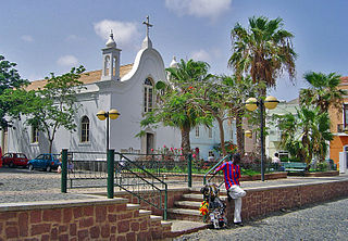
Mindelo is a port city in the northern part of the island of São Vicente in Cape Verde. Mindelo is also the seat of the parish of Nossa Senhora da Luz, and the municipality of São Vicente. The city is home to 93% of the entire island's population. Mindelo is known for its colourful and animated carnival celebrations, with roots in Portuguese traditions.

Tarrafal de São Nicolau, Cape Verde Settlement in São Nicolau, Cape Verde

Tarrafal de São Nicolau is a city in the western part of the island of São Nicolau, Cape Verde. With a population of 3,733, it is the most populous settlement of the island. It is the seat of the Tarrafal de São Nicolau Municipality, and the main port of the island. It is situated on the west coast, 9 km southwest of Ribeira Brava.

Baía das Gatas Settlement in São Vicente, Cape Verde

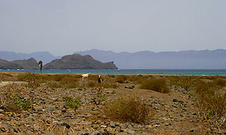
Baía das Gatas is a village in the northeastern part of the island of Sao Vicente, Cape Verde. It is situated on the east coast, 4 km east of Salamansa and 8 km east of the island capital Mindelo. It takes its name from the bay it is situated on, also named Baía das Gatas. The bay was mentioned as "B. des Ghat" in the 1747 map by Jacques-Nicolas Bellin.

São Pedro, Cape Verde Settlement in São Vicente, Cape Verde

São Pedro is a village in the southwestern part of the island of Sao Vicente, Cape Verde. It is situated on the south coast, approximately 10 km southwest of the island capital Mindelo. In 2010 its population was 991. Cesária Évora Airport, the island's international airport is directly north of São Pedro. It was mentioned as a small port as "P. St. Pedro" in the 1747 map by Jacques-Nicolas Bellin. The lighthouse Farol de D. Amélia sits on the Ponta Machado, 3 km west of the village.

Salamansa Settlement in São Vicente, Cape Verde

Salamansa is a village in the northeastern part of the island of Sao Vicente, Cape Verde. It is situated on the north coast, approximately 5 km northeast of the city centre of Mindelo. In 2010 its population was 1,179. Salamansa is a fishing village with a long sandy beach.

Nossa Senhora da Conceição (São Filipe) Civil parish in Fogo, Cape Verde

Nossa Senhora da Conceição is a freguesia of Cape Verde. It covers the southern part of the municipality of São Filipe, on the island of Fogo. The freguesia consists of the following settlements:

Lameirão Settlement in São Vicente, Cape Verde

Lameirão is a village in the northern part of the island of Sao Vicente, Cape Verde. It is situated in the hills east of the island capital Mindelo, approximately 3 km southeast of the city centre and west of Monte Verde.

Ribeira da Vinha Settlement in São Vicente, Cape Verde

Ribeira da Vinha is a village in the central part of the island of Sao Vicente, Cape Verde. It is situated in the plain southwest of the island capital Mindelo, approximately 3 km from the city centre.

Matiota Neighbourhood in Mindelo, São Vicente Island, Cape Verde

Matiota is a subdivision of the city of Mindelo in the island of São Vicente, Cape Verde. It is situated 1.2 km northwest of the city centre, along Porto Grande Bay. Adjacent subdivisions include Chã de Alecrim to the east and Fortinho to the south. It includes the beach Praia da Laginha.

Ribeira Grande, Cape Verde Settlement in Santo Antão, Cape Verde

Ribeira Grande is the largest town of the Ribeira Grande Municipality on the island of Santo Antão, Cape Verde. It has become a city in 2010. In 2010 its population was 2,564. It is situated in the northeastern part of the island, near the outflow of the river Ribeira Grande and its tributary Ribeira da Torre into the Atlantic Ocean. Neighborhoods include Tarrafal, Rua de Agua, Rua d'Horta and Penha de França.

Porto Novo, Cape Verde Settlement in Santo Antão, Cape Verde

Porto Novo is a city in the island of Santo Antão, in Cape Verde. It is the seat of the Porto Novo municipality. At the 2010 census, the town had 9,310 inhabitants, which makes it the most populous settlement of the island.

Ribeira Julião Settlement in São Vicente, Cape Verde

Ribeira Julião is a village in the central part of the island of Sao Vicente, Cape Verde. In 2010 its population was 611. It is situated in the valley of the stream Ribeira de Julião, south of the island capital Mindelo, 3.5 km from the city centre. An adjacent neighbourhood of Mindelo is named Ribeira de Julião.

Ribeira Bote Neighborhood in Mindelo, São Vicente Island, Cape Verde

Ribeira Bote is a subdivision of the city of Mindelo in the island of São Vicente, Cape Verde. Its population was 3,956 at the 2010 census. It borders the city centre to the northwest and Fonte Cónego to the north. The Hospital Velho and the church Nossa Senhora Auxiliadora are located in Ribeira Bote.

Liceu Velho

Liceu Velho is a building in the eastern part of the city centre of Mindelo, Cape Verde. It is situated on Praça Dr. Duarte Silva, between Avenida Fernando Ferreira Fortes and Rua Franz Fanon, east of the Palácio do Povo. Since 2008, it houses the art school M_EIA, officially Instituto Universitário de Arte, Tecnologia e Cultura. It is also one of the locations of the School of Business and Governance (ENG) of the University of Cape Verde.

Chã de Alecrim Neighbourhood in Mindelo, São Vicente Island, Cape Verde

Chã de Alecrim is a subdivision of the city of Mindelo in the island of São Vicente, Cape Verde. Its population was 5,126 at the 2010 census. It is situated 1.5 km north of the city centre. Bordering subdivisions include Matiota/Laginha to the southwest and Fonte Meio/Madeiralzinho to the southeast.

Fonte Cónego Neighborhood in Mindelo, São Vicente Island, Cape Verde

Fonte Cónego is a subdivision of the city of Mindelo in the island of São Vicente, Cape Verde. Its population was 236 at the 2010 census. It is situated directly east of the city centre. Adjacent neighborhoods include Alto Miramar to the northwest, Alto Santo António to the north, Alto Solarine/Forca to the northeast and Ribeira Bote to the south.

Praça Amílcar Cabral

Praça Amílcar Cabral, also popularly known as Praça Nova, is an important square of the city of Mindelo, São Vicente, Cape Verde. It is located in the northern part of the city center of Mindelo. The square is named after Amílcar Cabral, a leader of the independence movement of Cape Verde and Guinea-Bissau. Constructed in 1895, it was named after the colonial administrator Serpa Pinto until Cape Verdean independence in 1975. It was laid out in a new, previously undeveloped part of the town. The square is surrounded by Rua Angola to the north, Rua Argelia to the east, Rua Patrice Lumumba to the south and Rua 5 de Julho to the west.

References

  1. Arenas, Fernando (2011). Lusophone Africa: Beyond Independence. U of Minnesota Press. p. 131. ISBN   978-0-8166-6983-7.
  2. Official website of Transcor

Coordinates: 16°53′19″N24°59′10″W / 16.8885°N 24.9862°W / 16.8885; -24.9862