Amahai

Last updated
Amahai
Village
Seram en.png
Red pog.svg
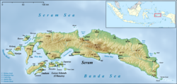
Amahai
Location in Seram Island
Coordinates: 3°20′38″S128°55′56″E / 3.34389°S 128.93222°E / -3.34389; 128.93222
Country Indonesia
Province Maluku
Time zone UTC+8 (WITA)

Amahai is a village on the south coast of the Indonesian island of Seram, to the south of Masohi. [1] Daily speedboats connect Tulehu (Ambon) with Amahai, Seram's main port. [2]

Climate data for Amahai, Seram Maluku Indonesia
MonthJanFebMarAprMayJunJulAugSepOctNovDecYear
Record high °C (°F)35
(95)
35
(95)
35
(95)
33
(91)
32
(90)
30
(86)
30
(86)
30
(86)
31
(88)
32
(90)
34
(93)
35
(95)
35
(95)
Average high °C (°F)31
(88)
31
(88)
31
(88)
30
(86)
28
(82)
27
(81)
27
(81)
27
(81)
28
(82)
29
(84)
31
(88)
31
(88)
29
(84)
Daily mean °C (°F)27
(81)
27
(81)
27
(81)
27
(81)
25
(77)
25
(77)
25
(77)
25
(77)
25
(77)
26
(79)
27
(81)
27
(81)
26
(79)
Average low °C (°F)24
(75)
24
(75)
24
(75)
24
(75)
23
(73)
23
(73)
23
(73)
23
(73)
23
(73)
23
(73)
23
(73)
24
(75)
23
(73)
Record low °C (°F)22
(72)
22
(72)
22
(72)
21
(70)
21
(70)
20
(68)
20
(68)
19
(66)
18
(64)
18
(64)
21
(70)
20
(68)
18
(64)
Average precipitation mm (inches)120
(4.7)
110
(4.3)
130
(5.1)
270
(10.6)
510
(20.1)
630
(24.8)
600
(23.6)
400
(15.7)
240
(9.4)
150
(5.9)
110
(4.3)
130
(5.1)
3,450
(135.8)
Average rainy days665623221812977121
Average relative humidity (%) (daily average)78777982838483828180797881
Mean daily sunshine hours 12.712.612.512.412.312.312.312.412.412.512.612.712.5
Source: [3]

Related Research Articles

<span class="mw-page-title-main">Ambon Island</span> One of the Maluku Islands in Indonesia

Ambon Island is part of the Maluku Islands of Indonesia. The island has an area of 743.37 km2 (287.02 sq mi) and is mountainous, well watered, and fertile. Ambon Island consists of two territories: the city of Ambon to the south and various districts (kecamatan) of the Central Maluku Regency to the north. The main city and seaport is Ambon, which is also the capital of Maluku province, while those districts of Maluku Tengah Regency situated on Ambon Island had a 2020 Census population of 128,069. Ambon has an airport and is home to the Pattimura University and Open University, state universities, and a few private universities, which include Darussalam University and Universitas Kristen Indonesia Maluku (UKIM).

<span class="mw-page-title-main">Seram Island</span> Main island of Maluku Province, Indonesia

Seram is the largest and main island of Maluku province of Indonesia, despite Ambon Island's historical importance. It is located just north of the smaller Ambon Island and a few other adjacent islands, such as Saparua, Haruku, Nusa Laut and the Banda Islands.

<span class="mw-page-title-main">Kelang</span> Island in Maluku, Indonesia

Kelang Island is an island in West Seram Regency, Maluku Province, Indonesia. It is a mountainous island located off the western tip of Seram Island, just east of Manipa. Sole, located on the northeastern side, and Tahalupu are the two principal villages. Tono, the highest point in the island, is an old volcano.

<span class="mw-page-title-main">Nuaulu people</span> Tribe in Indonesia

The Nuaulu, Naulu or Nunuhai are a tribe located in Seram, Maluku, Indonesia.

<span class="mw-page-title-main">Republic of South Maluku</span> Former country

South Maluku, also South Moluccas, officially the Republic of South Maluku, was an unrecognised secessionist republic that claimed the islands of Ambon, Buru, and Seram, which make up the Indonesian province of Maluku.

<span class="mw-page-title-main">Seram Sea</span> One of several small seas in Indonesia

The Seram Sea or Ceram Sea is one of several small seas between the scattered islands of Indonesia. It is a section of the Pacific Ocean with an area of approximately one hundred twenty thousand square kilometres (46,000 sq mi) located between Buru and Seram, which are two of the islands once called the South Moluccas. These islands are the native habitat of plants long coveted for their use as spices, such as nutmeg, cloves, and black peppercorns, and the seas surrounding them were busy shipping routes. The Seram Sea is also the habitat of several species of tropical goby and many other fish. Like many other small Indonesian seas, the Seram Sea is rocky and very tectonically active.

<span class="mw-page-title-main">Wemale people</span> Ethnic group of Seram Island, Indonesia

The Wemale people are an ethnic group of Seram Island, Indonesia. They number over 7,500 and live in 39 villages of the central area of the island. Like the Alune people in the west, the Wemale people originate from a common ancestral group called the Patasiwa.

The Piru Bay languages are a group of twenty Malayo-Polynesian languages, spoken on Ambon Island and around Piru Bay on the island of Seram, Indonesia. None of the languages have more than about twenty thousand speakers, and several are endangered with extinction.

<span class="mw-page-title-main">Manusela National Park</span>

Manusela National Park is located on Seram island, in the Maluku archipelago of Indonesia. It is made up of coastal forest, swamp forest, lowland and montane rainforest ecosystem types. Mount Binaiya at 3,027 meters, is the highest of the park's six mountains. Seram is remarkable for its high degree of localised bird endemism. The park also includes important karst landscapes. On Mount Hatu Saka, near the coast of Saleman-Sawai, it is the Goa Hatusaka, currently the deepest cave of the whole Indonesia.

<span class="mw-page-title-main">Central Maluku Regency</span> Regency in Maluku, Indonesia

Central Maluku Regency is a regency of Maluku Province of Indonesia. The Regency covers an area of 11,595.57 km2, and had a population of 361,698 at the 2010 Census, and 423,094 at the 2020 Census. The official estimate as at mid 2022 was 427,050. The principal town lies at Masohi, on Seram Island. The regency (kebupaten) is composed of the central part of the island of Seram, the Banda Islands, and the Lease Islands, together with those parts of Ambon Island which are outside the City of Ambon.

West Damar, or North Damar, is an Austronesian language of Damar Island, one of the Maluku Islands of Indonesia. In spite of rather low cognacy rates with its neighboring languages, it can be classified as part of the Babar languages based on qualitative evidence.

Amahai Airport is an airport in Amahai, Indonesia.

Luhu is an Austronesian spoken in the west of Seram Island in eastern Indonesia. It is spoken in Luhu village on Hoamoal Peninsula at the western end of Seram, and in Boano and Kelang islands, off the western tip of Seram Island.

<span class="mw-page-title-main">Boano</span> Island in Maluku, Indonesia

Boano Island is an island in West Seram Regency, Maluku Province, Indonesia. It is located off the northern coast of the Hoamoal Peninsula at the western end of Seram Island, across the Boano Strait. The inhabitants speak the Boano, Luhu, as well as Indonesian and Ambonese Malay.

<span class="mw-page-title-main">Manipa</span> Island in Indonesia

Manipa Island is an island in West Seram Regency, Maluku Province, Indonesia. It is located 8 km off the western coast of Kelang at the western end of Seram Island and 25 km off the western coast of Buru. Including adjacent small islands, it covers an area of 159.71 km2. The inhabitants speak the Manipa language, as well as Indonesian and Ambonese Malay.

The Eti River is a river of Seram Island, Maluku province, Indonesia, about 2400 km northeast of the capital Jakarta. It flows into the sea on the southwest side of the island, a few kilometres south of the town of Piru, West Seram Regency.

Bengoi is a village on the northeastern coast of the Indonesian island of Seram. The Bengoi language is spoken by some 350 people in Bengoi and surrounding areas.

Bula is a small town and kecamatan on the northeastern coast of the Indonesian island of Seram. It is the capital of the East Seram Regency. According to the 2010 census, the district had a population of 24,037 people, but it has subsequently been split into three separate districts, with the reduced Bula district having a population of 15,812 at 2014. In the vicinity are the Bula Fields, with notable oil reserves, which were established in 1919. A number of people in the district speak the Masiwang language.

Bemu, also Bemo Perak, is a small town on the southeastern coast of the Indonesian island of Seram, just to the south of Atiahu. It is one of the principal settlements on Teluti Bay.

References

  1. "Seram Island (map)". Indonesiatravelingguide.com. Archived from the original on 24 September 2015. Retrieved 8 June 2015.
  2. "Essential guide to Pulau Seram". Lonely Planet. Archived from the original on 2019-10-07.
  3. "weatherbase - AMAHAI, INDONESIA". weatherbase.