
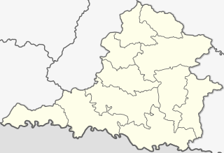
Gandaki zone was one of the fourteen zones of Nepal, located in the Western Development Region. It was named as Sapta Gandaki after the seven tributaries that makes up the Gandaki River. Pokhara served as its regional and zonal headquarter. It was also the birthplace of Bhanubhakta Acharya, first poet of Nepal.

The Gandaki River, also known as the Narayani and Gandak, is one of the major rivers in Nepal and a left-bank tributary of the Ganges in India. Its total catchment area is 46,300 km2 (17,900 sq mi), most of it in Nepal. In the Nepal Himalayas, the Gandaki is notable for its deep canyon. The basin also contains three mountains over 8,000 m (26,000 ft), namely Dhaulagiri, Manaslu and Annapurna Massif. Dhaulagiri is the highest point of the Gandaki basin. In its upper reaches, the river is known as Kali Gandaki as it flows through the Mustang district and the famous Kali Gandaki Gorge in Nepal. When the river reaches the Terai plains of Nepal, it is referred to as the Narayani River. This name change typically occurs near the confluence with the Trishuli River at Devghat in Chitwan. Upon entering India, the river is known as the Gandak River.

Dhaulagiri was one of the fourteen zones which Nepal was divided into for administrative purposes, prior to the September 10, 2015 adoption of a new Constitution, which divided the nation instead into 7 provinces. It is in the Western Development Region of Nepal and its headquarters are Baglung. Famous trekking areas like Mustang, Muktinath, Kali Gandaki valley and Mt Dhaulagiri fall in this zone. Dhorpatan Hunting Reserve, the only hunting reserve in Nepal is spread over Baglung and Myagdi Districts of this zone.

Baglung District, a part of Gandaki Province, is one of the seventy-seven districts of Nepal. The district, with Baglung as its district headquarters, covers an area of 1,784 km2 (689 sq mi) and has a population (2011) of 268,613.

Parbat District (Nepali: पर्वत जिल्ला, is a hilly area of Nepal. It is a part of Gandaki Province and one of the seventy-seven districts of Nepal. The district, with Kusma as its district headquarters, covers an area of 494 km2 and has a population of 157,826. It is the fourth-smallest district of Nepal with 47 village development committees currently.

Baglung is a municipality in Gandaki Province, in western Nepal, 275 km (171 mi) west of Kathmandu. It is the administrative headquarters of Baglung District. Baglung serves as the major center for business, finance, education, service and healthcare for the people of mid-Kali Gandaki valley that encompass Beni, Jaljala, Baglung, Kushma, Kathekhola, Galkot, Phalewas and Jaimuni local bodies. The city is located at the cross-section of Kaligandaki corridor highway and midhill highway that transverse Nepal in north–south and east–west directions respectively.
Waling Municipality, located in the heart of Syangja, is a town and municipality in the western hilly region of [[Nepal]. It was formed on 24 January 1997 by the merging of the then three VDCs namely Waling, Dhanubase and Pekhubaaghkhor. Due to the restructuring of the local government as part of the Federal Government System on 10 March 2017, the municipality's area was expanded to include Majhakot Shiwalaye VDC, Eladi VDC, Jagat Bhanjyang VDC, Chhangchhangdi VDC, Malyangkot VDC, Tindobate VDC, Kalikakot VDC Pelakot VDC ,Thumpokhara VDC(Ward No. 13,14) and Sworek VDC. It is located in the Aadhikhola valley and is bisected by the historic Andhikhola River in Syangja District, Gandaki Province of Nepal. Waling is named the Pink City due to its practice of painting local houses pink. The Government of Nepal has recognized Waling as one of the cities with the potential for future development under the Smart City initiative. Waling received an award for the best municipality of the country and was declared the Clean City of Nepal for The fiscal year 2017.

Jomsom, also known as Dzongsam, is the centre of Gharapjhong rural municipality in Mustang district and a former independent village development committee situated at an altitude of about 2,700 metres (8,900 ft) in Gandaki Province of western Nepal. The soaring peaks of Dhaulagiri and Nilgiri form a backdrop to the town straddling the Kali Gandaki River, which flows right through the centre of Jomsom. Along the banks of the Kali Gandaki, black fossilised stones called shaligram, considered as an iconic symbol and reminder of the god Vishnu in the Hindu culture, can be found. Such stones are believed to be found only in the Kali Gandaki, and are considered holy by Hindus.
Kushma is a small village and the headquarter of Parbat District in Nepal. Kushma municipality was formed by merging thirteen village development committees Pang, Khurkot, Durlung, Shivalaya, Chuwa, Katuwa Chaupari, Pipaltari and Pakuwa on 18 May 2014.
Amarbhumi is a village development committee in Baglung District in the Dhaulagiri Zone of central Nepal. At the time of the 1991 Nepal census it had a population of 2,248 and had 409 houses in the village. It has been reported that the villagers of Amarbhumi VDC in Baglung district have changed their village's name to Mulabari.
Burtibang is a village development committee in Baglung District in the Dhaulagiri Zone of central Nepal. Burtibang is the second-largest commercial city in the district after Baglung.
Khungkhani is a village development committee in Baglung District in the Dhaulagiri Zone of central Nepal. At the time of the 1991 Nepal census it had a population of 1,908 and had 397 houses in the village. Chhantyal, Dalits and Magar are the three ethnic groups living in the VDC.
Narayansthan is a village development committee in Baglung District in the Dhaulagiri Zone of central Nepal.It is located above the bank of Kali gandaki River. Now, it has become one of the major important place in baglung. They have planned to construct the domestic Airport. At the time of the 2011 Nepal census it had a population of 2,876 and had 781 houses in the town. The major castes living in the VDC are Brahman, Chhetry and Newar. There are 2 high schools - Janatadhan Higher School and Ganesh Secondary School and one campus. Krishna Gandaki Campus is at the premises of Janatadhan HSS. Ganesh Secondary School, one of the best schools in the region is known for its quality education movement. Established in 1957 [2014 BS] by Soldier Board (India), Ganesh Secondary School is one of the oldest schools. In 1964 [2021 BS], the Indian Soldier Board stopped its grant. Since there was no school support mechanism developed from the Government of Nepal, the school passed through many ups and downs. After Modern Education Act came in effect in 1971 BS [2028 BS], the school merged with Janatadhan Higher Secondary School. In 1980 [2037 BS], the school was reopened.
Sarkuwa is a village development committee of the Baglung District of the Dhaulagiri Zone, situated in western Nepal. At the 1991 Nepal census it had a population of 2,516 and 495 houses.
Gaikhur is a former village development committee currently located in Palungtar municipality of Gorkha District in the Gandaki Province of northern-central Nepal. At the time of the 1991 Nepal census it had a population of 4,793 and had 948 houses in the town. Mirkot, Palungtar, Khoplang, Dhuwakot were the neighbouring VDCs of Gaikhur. Gaikhur lies on the western side of Gorkha Bazar.
Syaulibang is a village and Village Development Committee in Pyuthan, a Middle Hills district of Rapti Zone, western Nepal.

Dhampus is a village and Village Development Committee in Kaski District in the Gandaki Zone of northern-central Nepal. The village is located 19 km away from the Pokhara Baglung Highways and falls within the trekking route of Mardi Himal Trek. At the 1991 Nepal census, it had a population of 2,753 persons in 547 individual households. The village is gradually turning into a tourist destination. It has the Australian Base Camp with views of the peaks Annapurna, Dhaulagiri and Machhapuchhre.
Katuwa Chaupari is a market center in Kushma Municipality in Gyandi of Parbat District in the Dhawalagiri Zone of central Nepal. The formerly Village Development committee was annexed to form the municipality since 18 May 2014. At the time of the 1991 Nepal census it had a population of 1838 people living in 361 individual households.
Pang, Nepal is a market center in Kushma Municipality in Parbat District in the Dhawalagiri Zone of central Nepal. The former Village Development committee was annexed to form the municipality since 18 May 2014. At the time of the 1991 Nepal census it had a population of 4091 people residing in 791 individual households. Pang is believed to be the birthplace of Goddess Parbati. The world's second longest suspension bridge named as Gandaki Golden Bridge is situated in Pang. It is one of the major historical places of Parbat District.
The Tricity is an area of Nepal that comprises the cities of Baglung, Beni and Kushma as core market centers. The three cities are headquarters of Baglung, Myagdi, and Parbat Districts respectively. Baglung was previously the headquarters of Dhaulagiri zone. The Tricity area is a major center of population and economic activity in West-central Nepal. As three district headquarters and the zonal headquarter are located in the valley there is a large concentration of governmental and nongovernmental offices, banks, educational institutes, cottage industries and healthcare centers. Geographically, 50 km long, region of Kali Gandaki valley stretching from Galeshwor to the north to Phalewas to the south can be considered the Tricity region.


