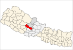
Baglung District, a part of Gandaki Province, is one of the seventy-seven districts of Nepal. The district, with Baglung as its district headquarters, covers an area of 1,784 km2 (689 sq mi) and has a population (2011) of 268,613.

Amarbhumi is a village development committee in Baglung District in the Dhaulagiri Zone of central Nepal. At the time of the 1991 Nepal census it had a population of 2,248 and had 409 houses in the village. It has been reported that the villagers of Amarbhumi VDC in Baglung district have changed their village's name to Mulabari.
Bongadobhan is a village development committee in Baglung District in the Dhaulagiri Zone of central Nepal. At the time of the 1991 Nepal census it had a population of 4,537 and had 904 houses in the town.
Daga Tumdada is a village development committee in Baglung District in the Dhaulagiri Zone of central Nepal. At the time of the 1991 Nepal census it had a population of 4,874 and had 897 houses in the town.
Devisthan is a village development committee in Baglung District in the Dhaulagiri Zone of central Nepal. At the time of the 1991 Nepal census it had a population of 6,151 and had 1247 houses in the town.
Hatiya is a Village Development Committee in Baglung District in the Dhaulagiri Zone of central Nepal. At the time of the 1991 Nepal census it had a population of 6,015 and had 1131 houses in the town.
Hile is a village development committee in Baglung District in the Dhaulagiri Zone of central Nepal. At the time of the 1991 Nepal census it had a population of 2,891 and had 530 houses in the village. The town was founded in 1978.
Hugdishir is a village development committee in Baglung District in the Dhaulagiri Zone of central Nepal. At the time of the 1991 Nepal census it had a population of 4,366 and had 831 houses in the town.
Jaljala is a Village Development Committee in Baglung District in the Dhaulagiri Zone of central Nepal. At the time of the 1991 Nepal census it had a population of 3,637 and had 624 houses in the town.
Khungkhani is a village development committee in Baglung District in the Dhaulagiri Zone of central Nepal. At the time of the 1991 Nepal census it had a population of 1,908 and had 397 houses in the village. Chhantyal, Dalits and Magar are the three ethnic groups living in the VDC.
Khunga is a Village Development Committee in Baglung District in the Dhaulagiri Zone of central Nepal. At the time of the 1991 Nepal census it had a population of 2,926 and had 583 houses in the town.
Lekhani is a Village Development Committee in Baglung District in the Dhaulagiri Zone of central Nepal. At the time of the 1991 Nepal census it had a population of 2,431 and had 507 houses in the village.
Narayansthan is a village development committee in Baglung District in the Dhaulagiri Zone of central Nepal.It is located above the bank of Kali gandaki River. Now, it has become one of the major important place in baglung. They have planned to construct the domestic Airport. At the time of the 2011 Nepal census it had a population of 2,876 and had 781 houses in the town. The major castes living in the VDC are Brahman, Chhetry and Newar. There are 2 high schools - Janatadhan Higher School and Ganesh Secondary School and one campus. Krishna Gandaki Campus is at the premises of Janatadhan HSS. Ganesh Secondary School, one of the best schools in the region is known for its quality education movement. Established in 1957 [2014 BS] by Soldier Board (India), Ganesh Secondary School is one of the oldest schools. In 1964 [2021 BS], the Indian Soldier Board stopped its grant. Since there was no school support mechanism developed from the Government of Nepal, the school passed through many ups and downs. After Modern Education Act came in effect in 1971 BS [2028 BS], the school merged with Janatadhan Higher Secondary School. In 1980 [2037 BS], the school was reopened.
Paiyunthantap is a village development committee in Baglung District in the Dhawalagiri Zone of central Nepal. At the time of the 1991 Nepal census it had a population of 4,027 and had 711 houses in the town.
Bijuwa is a Village of Jaimini Municipality Nepal Former ward no. 1 & 9 of Paiyunthanthap village development committee in Baglung District in the Dhaulagiri Zone of central Nepal. At the time of the 2019 A.D. it had a population of 1101 and had 211 houses in the town.
Salyan is a village development committee in Baglung District in the Dhaulagiri Zone of central Nepal. At the time of the 1991 Nepal census it had a population of 1,935 and had 396 houses in the village.
Sarkuwa is a village development committee of the Baglung District of the Dhaulagiri Zone, situated in western Nepal. At the 1991 Nepal census it had a population of 2,516 and 495 houses.
Bajhketeri is a village and municipality in Gulmi District in the Lumbini Zone of central Nepal. At the time of the 1991 Nepal census it had a population of 2984 persons living in 554 individual households.
Isma Rajasthal is a Village Development Committee in Gulmi District in the Lumbini Zone of central Nepal. At the time of the 1991 Nepal census it had a population of 2974 persons living in 568 individual households. joitikhola rajasthal 1
Bhakunde is a village development committee in Baglung District in the Dhawalagiri Zone of central Nepal. At the time of the 1991 Nepal census it had a population of 3,833 and had 697 houses in the village. At the time of the 2011 Nepal census it had a population of 4,952 among which 2,443 were female and 2,509 were male. There were about 831 houses in the village.